Richfield is a city in Hennepin County, Minnesota. An inner-ring suburb of Minneapolis, Richfield is bordered by Minneapolis to the north, Minneapolis–Saint Paul International Airport and Fort Snelling to the east, Bloomington to the south, and Edina to the west. The population was 36,994 at the 2020 census.
Best Buy, the U.S.’s largest electronics retailer, is headquartered in Richfield.
| Name: | Richfield city |
|---|---|
| LSAD Code: | 25 |
| LSAD Description: | city (suffix) |
| State: | Minnesota |
| County: | Hennepin County |
| Founded: | 1850s |
| Incorporated: | 1908 |
| Elevation: | 840 ft (256 m) |
| Land Area: | 6.78 sq mi (17.55 km²) |
| Water Area: | 0.14 sq mi (0.35 km²) 2.00% |
| Population Density: | 5,457.95/sq mi (2,107.40/km²) |
| ZIP code: | 55423 |
| Area code: | 612 |
| FIPS code: | 2754214 |
| GNISfeature ID: | 0650061 |
| Website: | richfieldmn.gov |
Online Interactive Map
Click on ![]() to view map in "full screen" mode.
to view map in "full screen" mode.
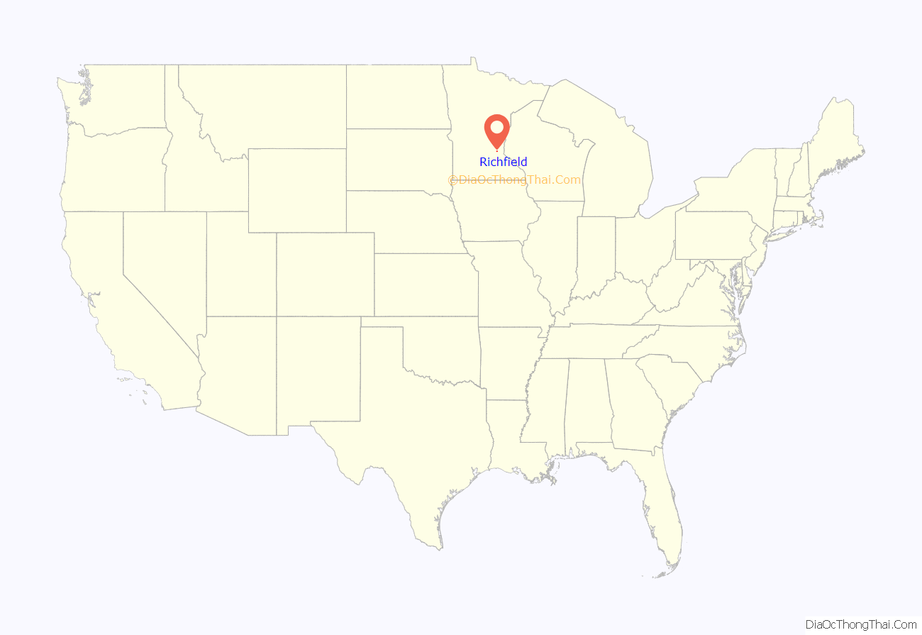
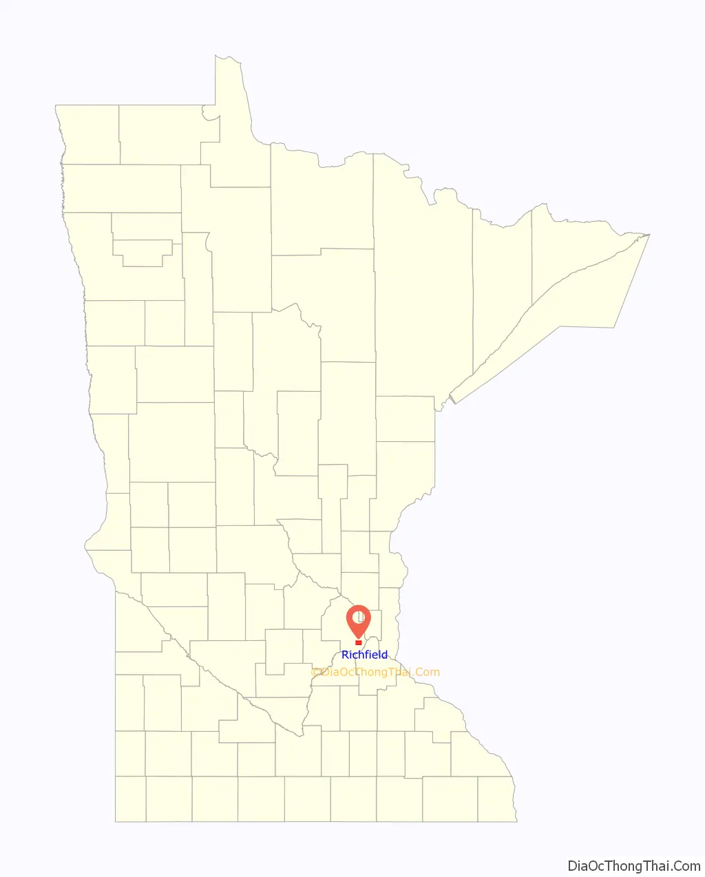
Richfield location map. Where is Richfield city?
History
In the 1820s, some small settlements developed around Fort Snelling. By the late 1830s, the fortress served as a destination for newcomers—lumbermen, missionaries, farmers, traders and travelers—migrating to the borderlands people were now calling “Minisota”. Minnesotan Franklin Steele reached the area in 1837 and worked as a sutler, selling goods to soldiers.
Fort Snelling’s garrison made up the bulk of the area’s population, along with Henry Sibley and Alexander Faribault’s 75-person American Fur Company operation. Other small settlements of traders, farmers, missionaries and refugees began to develop outside the fort, some with permission, some without. These residents built communities on land that became known as Richfield.
Richfield was one of the earliest postwar suburbs in the Twin Cities to be populated by veterans returning from World War II, but its claim to be Minnesota’s oldest suburb date to the land’s connection to Fort Snelling in the 1820s. The term “suburb” is from the Latin suburbium, “the land outside a walled city”. Much of the land that comprised the Township of Richfield and today’s City of Richfield included the Fort Snelling military reservation, which included Camp Coldwater.
Richfield Township is established
One of the first settlers to the area was Riley Bartholomew, a former general in the Ohio Militia. He later became a Richfield justice of the peace and a Minnesota state senator. Bartholomew built a house on Wood Lake’s eastern shore in 1852, and the restored Riley Lucas Bartholomew House is listed on the National Register of Historic Places. Today, the Richfield Historical Society maintains the house and the site.
The Harmony post office, south of the Richland Mill on Lyndale Avenue, opened in 1854. Postmaster James Dunsmoor named the mail center after his hometown in Maine. Richfield farmers looked on the metropolis to its north as their marketing target. They helped supply its restaurants, hotels, grocers and citizens with fresh produce, with enough left over to ship by railroad to other cities.
On May 11, 1858, Congress approved the Territory of Minnesota as the 32nd state to join the union. That day, local citizens met in a schoolhouse at present-day 53rd and Lyndale to form a municipal government. At that meeting, those who previously said they lived in Harmony or Richland Mills chose the name Richfield for their community.
Settlers from Maine made up 35% of U.S.-born adults 18 or older in 1860 Richfield. New York immigrants were 21%. Immigrants from Ireland, numbering 58, represented half of the 119 adults from other nations. Just three of Richfield’s citizens had been born in Minnesota.
Richfield’s fields proved bountiful for the settlers. Early crops included corn, wheat and oats. Wheat immediately became the cash crop, sold in the area’s first major market, St. Paul. Those in southern Hennepin County found it more profitable to haul their wheat crop to St. Paul than to the St. Anthony Falls district. This was before “King Wheat” and Minneapolis’s evolution into a milling center.
Minneapolis became a favorite trading point for market gardeners in 1897 with the building of the modern, covered Second Street Market just two blocks west of Hennepin Avenue and Bridge Square. The market featured a massive platform for gardeners, including Richfield’s sizable contingent, to unload and display produce. The new system freed streets from traffic snarls by allowing each person to unhitch and put up their horses, while their wagon was backed into an assigned space. Wholesale customers could then bring their teams to the platform and negotiate prices when the starting bell sounded.
Boundary changes
Today’s boundaries differ markedly from those the Hennepin County Board of Commissioners set forth on April 10, 1858, when it established the towns of Richfield, Minneapolis, Bloomington and Eden Prairie. Richfield’s boundaries included about 63 square miles. Richfield originally ranged to Minneapolis’s Lake Street on the north, to what is now Highway 169 on the west, to Bloomington on the south, and to Fort Snelling and the Minnesota and Mississippi rivers on the east.
Parts of Richfield were later lost to neighboring towns or villages through annexation. An 1886 partition of Richfield created the village of St. Louis Park, and a division in 1889 produced the village of Edina. Minneapolis absorbed sizeable portions of Richfield through legislative action or annexations in 1867, 1883, 1887 and 1927. The growth of Minneapolis-Saint Paul International Airport during the last half of the 20th century and additions of land to the Fort Snelling compound meant further reductions.
20th century
In 1908, Richfield became a village. From 1908 until 1950, Richfield’s local government consisted of a president, three trustees, and a city clerk. On November 7, 1950, residents voted for a city-manager form of government, meaning the city had a mayor, four council members, and a city manager. This is still Richfield’s form of government. The first mayor was Clarence Christian, who began serving in 1951, but served as president under the old format dating back to 1948. By the late 1940s, the city’s population started increasing rapidly as farmland was sold to developers building homes for veterans returning from World War II. The Richfield Chamber of Commerce was formed in 1955 and has been deeply involved in the community’s development and redevelopment.
Over the years, populations of all nearby communities increased and after World War II, Richfield flourished with commuters to Twin Cities jobs. As of 2019, Richfield has a population of about 35,000, who live within seven square miles of neighborhoods, parks, and shops.
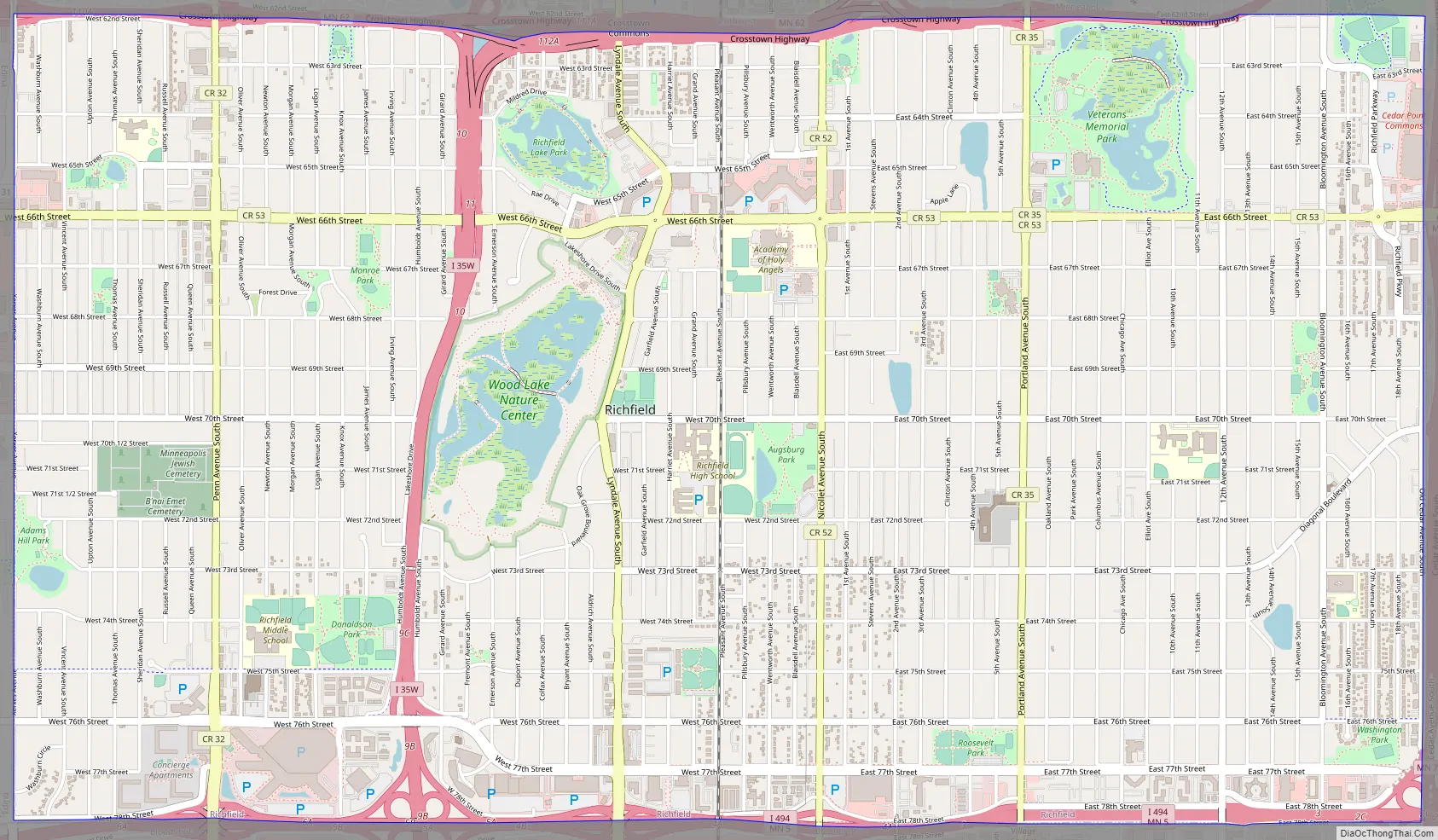
Richfield Road Map
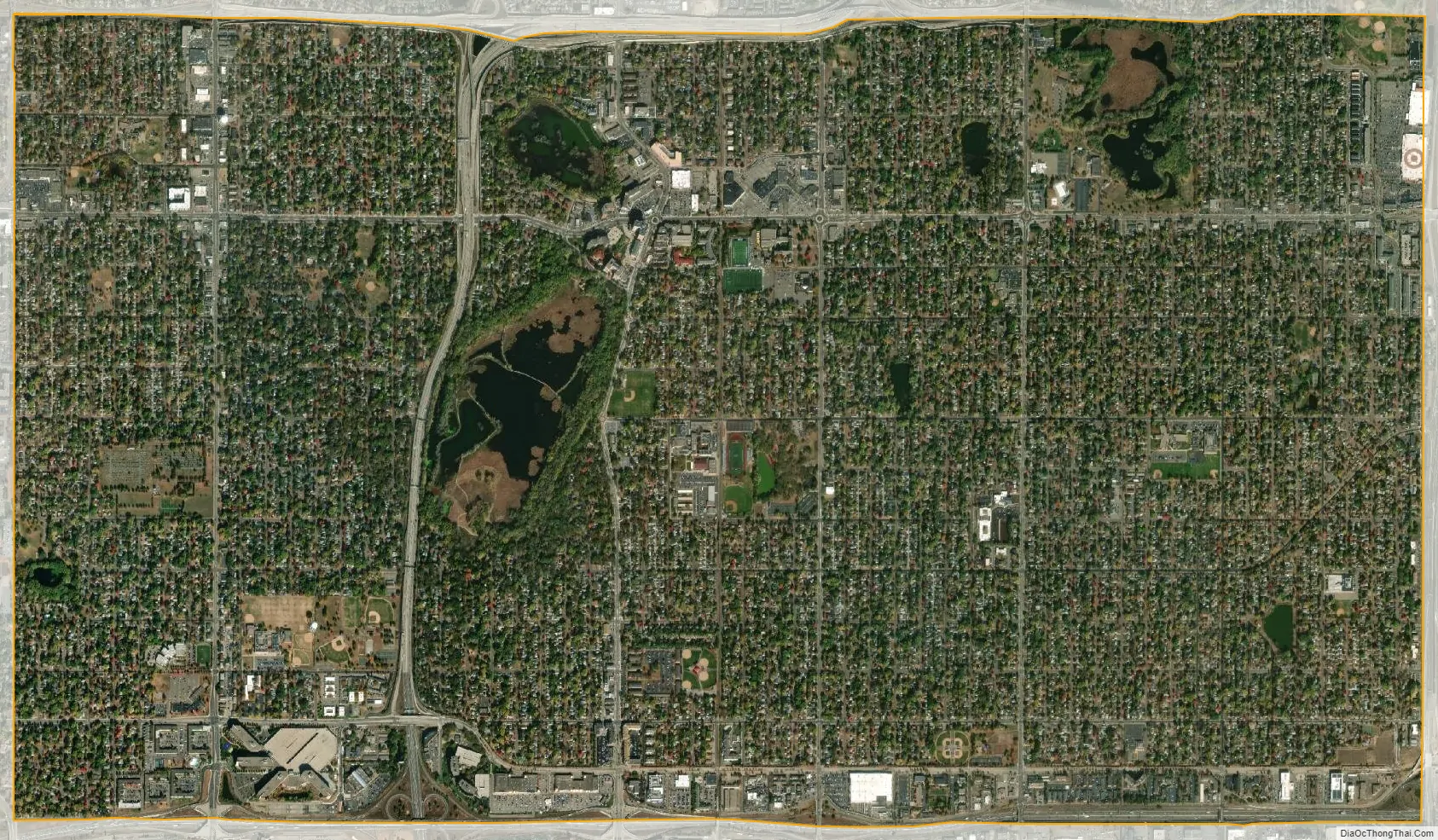
Richfield city Satellite Map
Geography
According to the United States Census Bureau, the city has an area of 7.01 square miles (18.16 km), of which 6.87 square miles (17.79 km) is land and 0.14 square miles (0.36 km) is water.
Interstates 35W and 494 and Minnesota State Highways 62 and 77 are four of the main routes in the city. Other main routes include 66th Street.
The majority of the 10,000 single-family homes were constructed in the 1950s, and the 5,000 apartments date from the 1960s and early 1970s. The Richfield Rediscovered Housing Program has established an environment of change in the community as it encourages home remodeling, expansion, and reconstruction. The program is gradually changing the face of Richfield’s residential neighborhoods, upgrading them from small, post-WWII styles to larger homes.
See also
Map of Minnesota State and its subdivision:- Aitkin
- Anoka
- Becker
- Beltrami
- Benton
- Big Stone
- Blue Earth
- Brown
- Carlton
- Carver
- Cass
- Chippewa
- Chisago
- Clay
- Clearwater
- Cook
- Cottonwood
- Crow Wing
- Dakota
- Dodge
- Douglas
- Faribault
- Fillmore
- Freeborn
- Goodhue
- Grant
- Hennepin
- Houston
- Hubbard
- Isanti
- Itasca
- Jackson
- Kanabec
- Kandiyohi
- Kittson
- Koochiching
- Lac qui Parle
- Lake
- Lake of the Woods
- Lake Superior
- Le Sueur
- Lincoln
- Lyon
- Mahnomen
- Marshall
- Martin
- McLeod
- Meeker
- Mille Lacs
- Morrison
- Mower
- Murray
- Nicollet
- Nobles
- Norman
- Olmsted
- Otter Tail
- Pennington
- Pine
- Pipestone
- Polk
- Pope
- Ramsey
- Red Lake
- Redwood
- Renville
- Rice
- Rock
- Roseau
- Saint Louis
- Scott
- Sherburne
- Sibley
- Stearns
- Steele
- Stevens
- Swift
- Todd
- Traverse
- Wabasha
- Wadena
- Waseca
- Washington
- Watonwan
- Wilkin
- Winona
- Wright
- Yellow Medicine
- Alabama
- Alaska
- Arizona
- Arkansas
- California
- Colorado
- Connecticut
- Delaware
- District of Columbia
- Florida
- Georgia
- Hawaii
- Idaho
- Illinois
- Indiana
- Iowa
- Kansas
- Kentucky
- Louisiana
- Maine
- Maryland
- Massachusetts
- Michigan
- Minnesota
- Mississippi
- Missouri
- Montana
- Nebraska
- Nevada
- New Hampshire
- New Jersey
- New Mexico
- New York
- North Carolina
- North Dakota
- Ohio
- Oklahoma
- Oregon
- Pennsylvania
- Rhode Island
- South Carolina
- South Dakota
- Tennessee
- Texas
- Utah
- Vermont
- Virginia
- Washington
- West Virginia
- Wisconsin
- Wyoming


