Richmond is a city in Stearns County, Minnesota, United States. The population was 1,422 at the 2010 census. Richmond is part of the St. Cloud, Minnesota metropolitan area.
| Name: | Richmond city |
|---|---|
| LSAD Code: | 25 |
| LSAD Description: | city (suffix) |
| State: | Minnesota |
| County: | Stearns County |
| Elevation: | 1,122 ft (342 m) |
| Total Area: | 1.21 sq mi (3.14 km²) |
| Land Area: | 1.19 sq mi (3.09 km²) |
| Water Area: | 0.02 sq mi (0.05 km²) |
| Total Population: | 1,475 |
| Population Density: | 1,237.42/sq mi (477.59/km²) |
| ZIP code: | 56368 |
| Area code: | 320 |
| FIPS code: | 2754268 |
| GNISfeature ID: | 650067 |
| Website: | www.ci.richmond.mn.us |
Online Interactive Map
Click on ![]() to view map in "full screen" mode.
to view map in "full screen" mode.
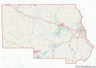
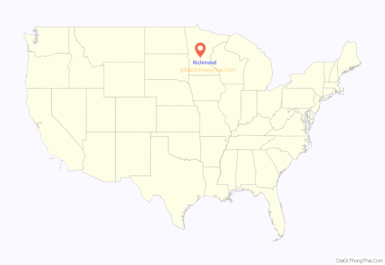
Richmond location map. Where is Richmond city?

History
Richmond was platted in 1856 by Reuben Richardson, a farmer from Sauk Rapids who later served in Minnesota Legislature. The name “Richmond” may come from the surname of an early settler, the surname of Richardson’s wife, or an early surveyor. The original plat was a seven block by seven block square piece of land. Two years later, land owned by G.H. Brauning (also spelled Bruening), on the eastern side of the town, was added to Richmond’s plat. The town was incorporated in 1890, but went by the name Torah, because there was another town in southeastern Minnesota named Richmond. The same year of its incorporation, a Great Northern Railway station was built. The town’s post office and railroad station was named Torah until 1909, when the other Richmond’s post office closed. Following this, the name changed to Richmond, a name that locals identified with.
The pontoon boat was invented in Richmond in the 1950s by Ambrose Weeres, who was involved in the milling business, and Edwin Torborg, a farmer who manufactured feed mixers.
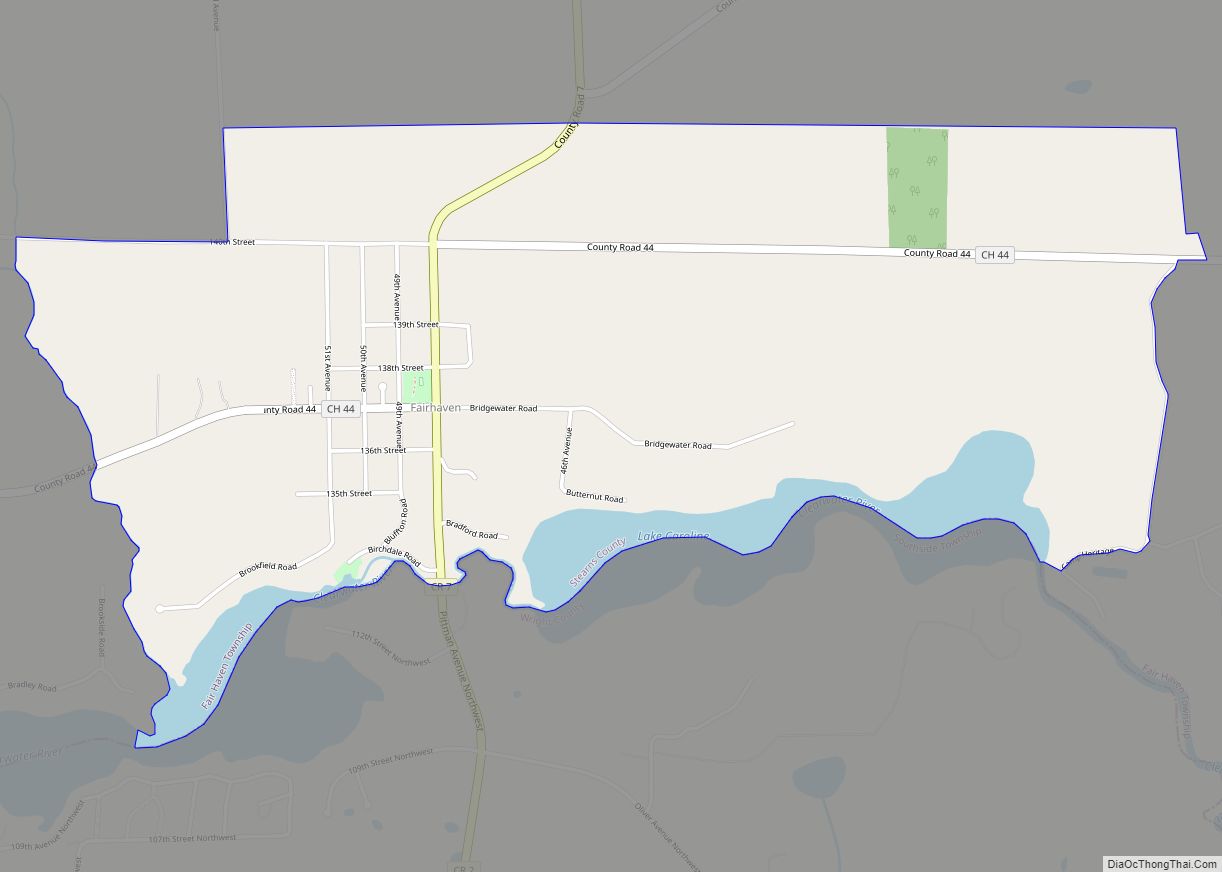
Richmond Road Map

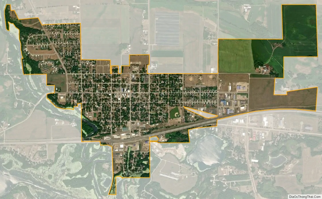
Richmond city Satellite Map
Geography
According to the United States Census Bureau, the city has a total area of 1.05 square miles (2.72 km); 1.03 square miles (2.67 km) is land and 0.02 square miles (0.05 km) is water.
Richmond serves as the northern terminus for State Highway 22, with the route ending when it connects with State Highway 23. Richmond is located about 15 miles west of Interstate 94 following State Highway 23. Glacial Lakes State Trail also runs through Richmond and connects it through different towns all the way to Willmar.
The town’s nickname, “On the Horseshoe Chain of Lakes”, is a nod to a geographical feature of the town. The town is home to a group of over a dozen lakes along the Sauk River, with the largest being Horseshoe Lake, hence the name “Horseshoe Chain of Lakes”.
Richmond is located in an area with many outcrops of granite. The area is known as “Granite Country”, as the material has been mined there for over 100 years and is home to around twenty different quarries.
See also
Map of Minnesota State and its subdivision:- Aitkin
- Anoka
- Becker
- Beltrami
- Benton
- Big Stone
- Blue Earth
- Brown
- Carlton
- Carver
- Cass
- Chippewa
- Chisago
- Clay
- Clearwater
- Cook
- Cottonwood
- Crow Wing
- Dakota
- Dodge
- Douglas
- Faribault
- Fillmore
- Freeborn
- Goodhue
- Grant
- Hennepin
- Houston
- Hubbard
- Isanti
- Itasca
- Jackson
- Kanabec
- Kandiyohi
- Kittson
- Koochiching
- Lac qui Parle
- Lake
- Lake of the Woods
- Lake Superior
- Le Sueur
- Lincoln
- Lyon
- Mahnomen
- Marshall
- Martin
- McLeod
- Meeker
- Mille Lacs
- Morrison
- Mower
- Murray
- Nicollet
- Nobles
- Norman
- Olmsted
- Otter Tail
- Pennington
- Pine
- Pipestone
- Polk
- Pope
- Ramsey
- Red Lake
- Redwood
- Renville
- Rice
- Rock
- Roseau
- Saint Louis
- Scott
- Sherburne
- Sibley
- Stearns
- Steele
- Stevens
- Swift
- Todd
- Traverse
- Wabasha
- Wadena
- Waseca
- Washington
- Watonwan
- Wilkin
- Winona
- Wright
- Yellow Medicine
- Alabama
- Alaska
- Arizona
- Arkansas
- California
- Colorado
- Connecticut
- Delaware
- District of Columbia
- Florida
- Georgia
- Hawaii
- Idaho
- Illinois
- Indiana
- Iowa
- Kansas
- Kentucky
- Louisiana
- Maine
- Maryland
- Massachusetts
- Michigan
- Minnesota
- Mississippi
- Missouri
- Montana
- Nebraska
- Nevada
- New Hampshire
- New Jersey
- New Mexico
- New York
- North Carolina
- North Dakota
- Ohio
- Oklahoma
- Oregon
- Pennsylvania
- Rhode Island
- South Carolina
- South Dakota
- Tennessee
- Texas
- Utah
- Vermont
- Virginia
- Washington
- West Virginia
- Wisconsin
- Wyoming