Wayzata (/waɪˈzɛtə/ wy-ZET-ə) is a city in Hennepin County, Minnesota, United States. A western suburb of the Twin Cities, Wayzata is situated along the northern shore of Lake Minnetonka about 12 miles (19 km) west of Minneapolis. Known for its small-town character and lakeside location, Wayzata is frequented by local boaters, shoppers, and restaurant goers.
The population was 4,434 as of the 2020 census. U.S. Route 12 passes through the city. One of Wayzata’s landmarks is the Wayzata Train Depot, a historic and quaint rail station along the shores of Lake Minnetonka.
| Name: | Wayzata city |
|---|---|
| LSAD Code: | 25 |
| LSAD Description: | city (suffix) |
| State: | Minnesota |
| County: | Hennepin County |
| Founded: | 1854 |
| Incorporated: | 1883 |
| Elevation: | 942 ft (287 m) |
| Land Area: | 3.10 sq mi (8.02 km²) |
| Water Area: | 1.60 sq mi (4.14 km²) |
| Population Density: | 1,431.71/sq mi (552.86/km²) |
| ZIP code: | 55391 |
| Area code: | 952 |
| FIPS code: | 2768818 |
| GNISfeature ID: | 0653868 |
| Website: | wayzata.org |
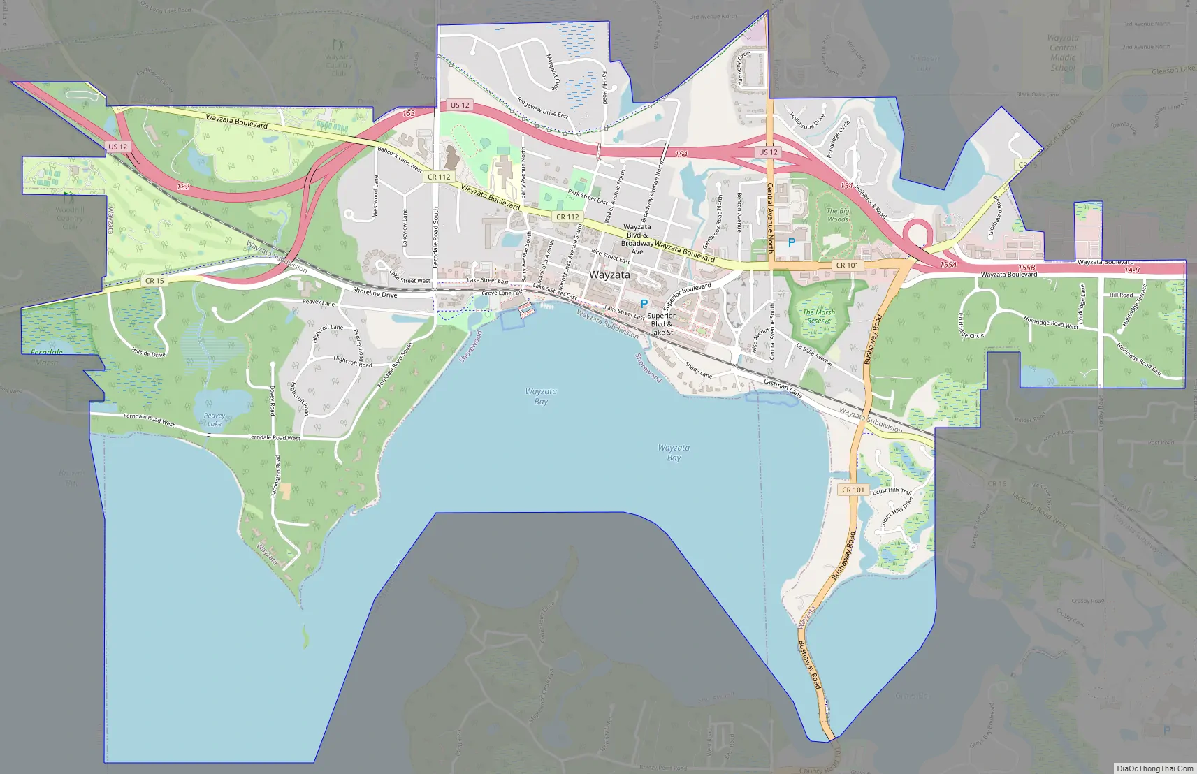
Online Interactive Map
Click on ![]() to view map in "full screen" mode.
to view map in "full screen" mode.
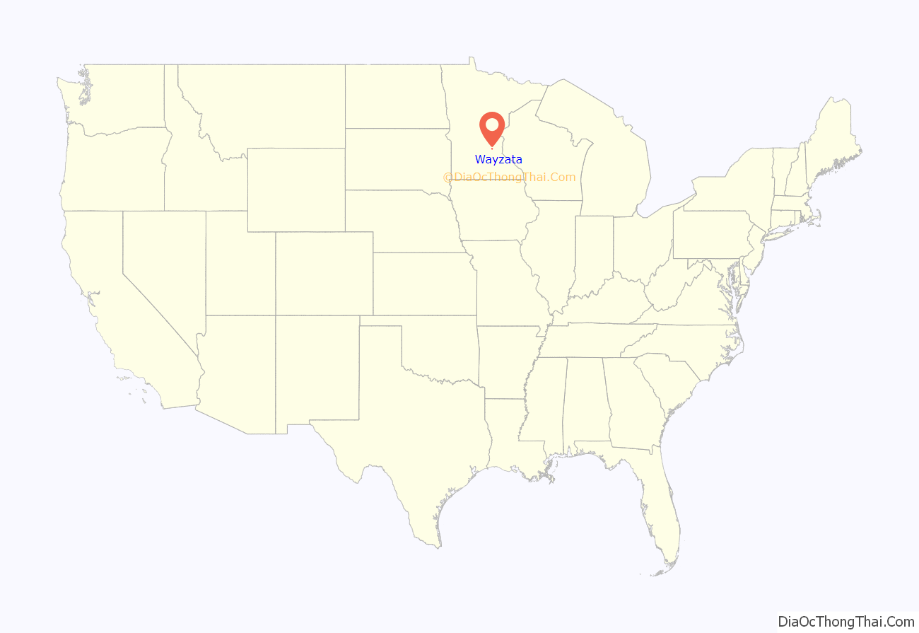
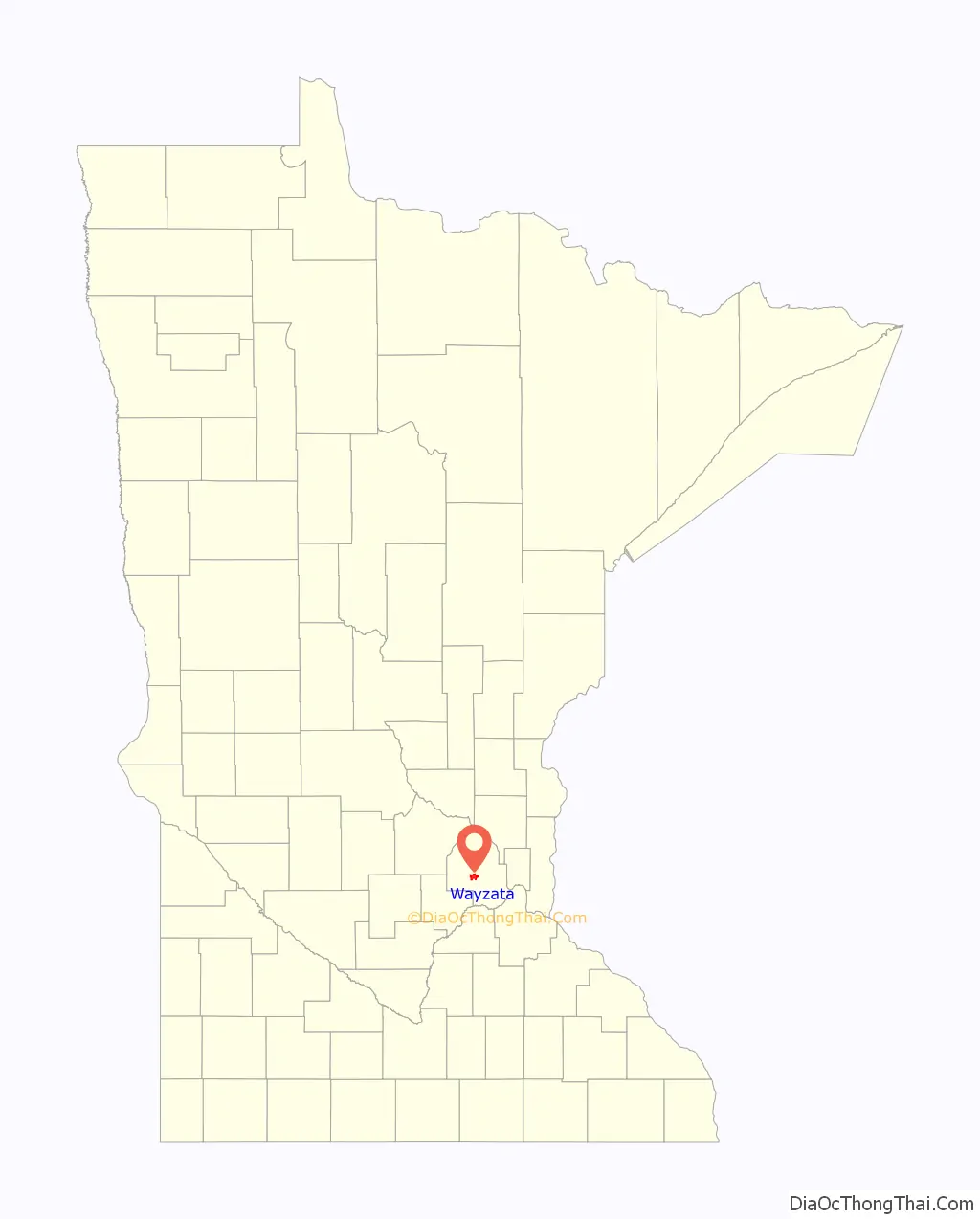
Wayzata location map. Where is Wayzata city?
History
Early history
The name “Wayzata” comes from the Dakota word meaning “north” or “north shore.” The Mdewakanton, a subtribe of the Dakota nation, treasured Lake Minnetonka—the “Big Water”—as a place for hunting, fishing, and harvesting wild rice and maple sap. Spirit Knob, a peninsula in Wayzata Bay, was regarded as a particularly sacred place. The Dakota resided in this area of Minnesota until 1851, when the Treaty of Mendota was signed and land west of the Mississippi was opened for Euro-American settlement. Most Dakota were exiled from Minnesota after 1862.
Oscar E. Garrison originally platted Wayzata in 1854. In 1855, it saw an influx of settlers, who built a sawmill, a hotel, and a blacksmith shop. Most early settlers made their living by clear-cutting the land to grow corn and wheat. In 1857, this flourishing economy was nearly terminated by a grasshopper infestation, but the community rebounded when ginseng was discovered in the remaining hardwood forest. Ginseng root was in great demand as an aphrodisiac in China. During this boom, Wayzata became a collection center for ginseng roots discovered around Lake Minnetonka.
In 1867 the Saint Paul and Pacific Railroad extended its tracks to Wayzata, making it the area’s transportation hub. The railroad was particularly important to local farmers because they now had easy access to markets in Minneapolis, Saint Paul, and beyond. The railroad also made Wayzata the original “gateway” to Lake Minnetonka, which was billed as a place of commanding beauty and good health.
Resort period
In the 1860s and 1870s many small hotels and boarding houses were erected around Wayzata and Lake Minnetonka to accommodate tourists. One early example was the Maurer House-West Hotel, which was built near the corner of Lake Street and Broadway Avenue. Most local hotels and boarding houses were rather primitive until 1879, when the 150-room Hotel Saint Louis was built in Deephaven. The Lake Park Hotel in Tonka Bay, Arlington Hotel in Wayzata, and the massive Hotel Lafayette in Minnetonka Beach soon followed. These large, grandiose hotels primarily catered to wealthy tourists who came from the East and South to spend entire summers on Lake Minnetonka.
Most Lake Minnetonka tourists in the late 1800s arrived in Wayzata by train. Steamboats waited for new arrivals near the foot of Broadway Avenue and took them to destinations across the lake. Some of these steamboats, such as the City of Saint Louis and Belle of Minnetonka, were quite large. The Belle of Minnetonka was 300 feet (91 m) long and could purportedly carry 2,500 passengers.
Wayzata was officially incorporated as a village in 1883. One of the village council’s first orders of business was to reroute the railroad tracks north of town. James J. Hill, who had become chairman of the newly formed Saint Paul, Minneapolis, & Manitoba Railway in 1879, initially ignored the council’s order. When the council took the case to court, Hill reacted by demolishing the train station at the foot of Broadway Avenue and building a new one east of town at a stop called “Holdridge.” He declared that Wayzata residents could “walk a mile for the next twenty years” to catch the train. Hill moved the tracks as well, but rather than rerouting them north of town, he moved them closer to the lake.
Hill was also connected to Wayzata and Lake Minnetonka through the Arlington Hotel, Hotel Lafayette, and Belle of Minnetonka, all owned by the Saint Paul, Minneapolis, & Manitoba Railway. He purchased Wayzata’s Arlington Hotel in 1881 and never reopened it. Due to its impractical size, the Belle of Minnetonka steamboat was laid up by the mid-1880s. The Hotel Lafayette continued to operate until it burned to the ground in 1897. By that time Lake Minnetonka had largely fallen out of favor as a vacation destination for wealthy tourists. A number of factors including new railroad regulations, new vacation spots, and a national economic depression contributed to this decline.
Cottage period
As national tourism to Lake Minnetonka faded in the 1890s, a new era for Wayzata began. Many urban dwellers began to construct summer cottages along Lake Minnetonka’s shores as the Twin Cities grew. While many of these new cottages were modest, some were monumental. Wayzata became home to a large collection of grand country estates along the Ferndale Shore. Notable families who built country estates there include the Bells, Boveys, Crosbys, Peaveys, Pillsburys, and Washburns.
Despite the influx of new summer residences, Wayzata barely grew during this period. That changed in 1905, when the village council voted for a Reconciliation Ordinance to repair relations with Hill and his railway (now known as the “Great Northern”). He responded by building a new train depot near downtown Wayzata. At the depot’s grand opening celebration in 1906, he declared it the “handsomest” on the entire Great Northern line.
Wayzata was also connected to a new form of water transportation in 1906. The Twin City Rapid Transit Company launched six new “Express Boats” on Lake Minnetonka that served as an extension of the Twin City streetcar system. Designed by Royal C. Moore of Wayzata, the boats provided fast, reliable transportation for Lake Minnetonka residents. There were connections to streetcars in Excelsior, Deephaven, and Tonka Bay. In Wayzata, passengers could transfer to Great Northern Railway trains. This convenient service was very popular until about 1920, when local roads began to be improved for automobiles. The service was discontinued in 1926 after several years of declining ridership. Some of the Express Boats were scuttled (purposely sunk) in the lake that year. One, the Minnehaha, was raised from the depths in 1980, restored, and returned to passenger service in 1996.
As the cottage era continued, downtown Wayzata rebounded with residences and small commercial centers at each end of Lake Street. Wayzata State Bank was established in 1909 as the area’s first local financial institution. The bank’s first president was Moore, who owned Moore Boat Works on Wayzata Bay. He eventually sold his boat business to Eugene Ramaley. Motorboating was all the rage by 1920, and Wayzata was at the center of the trend with two nationally famous boat makers, Ramaley and Wise, based there. In 1929 the Ramaley Boat Company merged with Wise Boat Works and Walker Boat Works to form Minnetonka Boat Works. Minnetonka Boat Works eventually became well-known manufacturers and distributors of Tonka-Craft and Chris-Craft power boats.
20th century
Wayzata’s population nearly doubled in the decades leading up to World War II. Wayzatans were fortunate when one of their own, Mayor Rufus Rand, stepped forward to lead the town in meeting the challenges of modernizing its infrastructure. Under Rand, water and sewer service was provided to every building, streetlights were installed, roads were paved, and the public beach and park was opened. During his tenure, Rand also served as the executive of a large gas company and a regent of the University of Minnesota.
After World War II, many local farms and summer cottages were converted for use as year-round, single-family homes. Many new homes and gas stations were also constructed during this time. At one point, Wayzata had ten gas stations to serve a growing number of commuters and their cars. U.S. Highway 12, which was built in the 1920s, was widened to four lanes, and the population swelled. Downtown Wayzata residences were replaced by more stores serving not only Wayzatans, but also new families moving onto the former farmlands just outside Wayzata. By the 1950s, the greater Minneapolis-Saint Paul metropolitan area had reached Wayzata.
After it became a charter city, Wayzata began to annex land from Minnetonka, Plymouth, and Orono, and doubled in size. U.S. Highway 12 was widened again to become a freeway in the 1970s and a new shopping center opened 5 miles (8.0 km) down the road. These physical and economic changes caused some of Wayzata’s downtown shops to be replaced by condominiums and office buildings. Strip malls and fast food franchises came to a part of the town near the highway.
Residences also began returning to downtown as several condominium and townhouse developments appeared in the 1980s and 1990s. By the 1990s, Wayzata began to see an uptick in the demolition and replacement of older homes and commercial buildings.
21st century
In 2003, Wayzatans passed a referendum to have the city buy the community’s last remaining stand of the Big Woods for use as a park. A new city hall and library were also constructed that year.
Wayzata Road Map
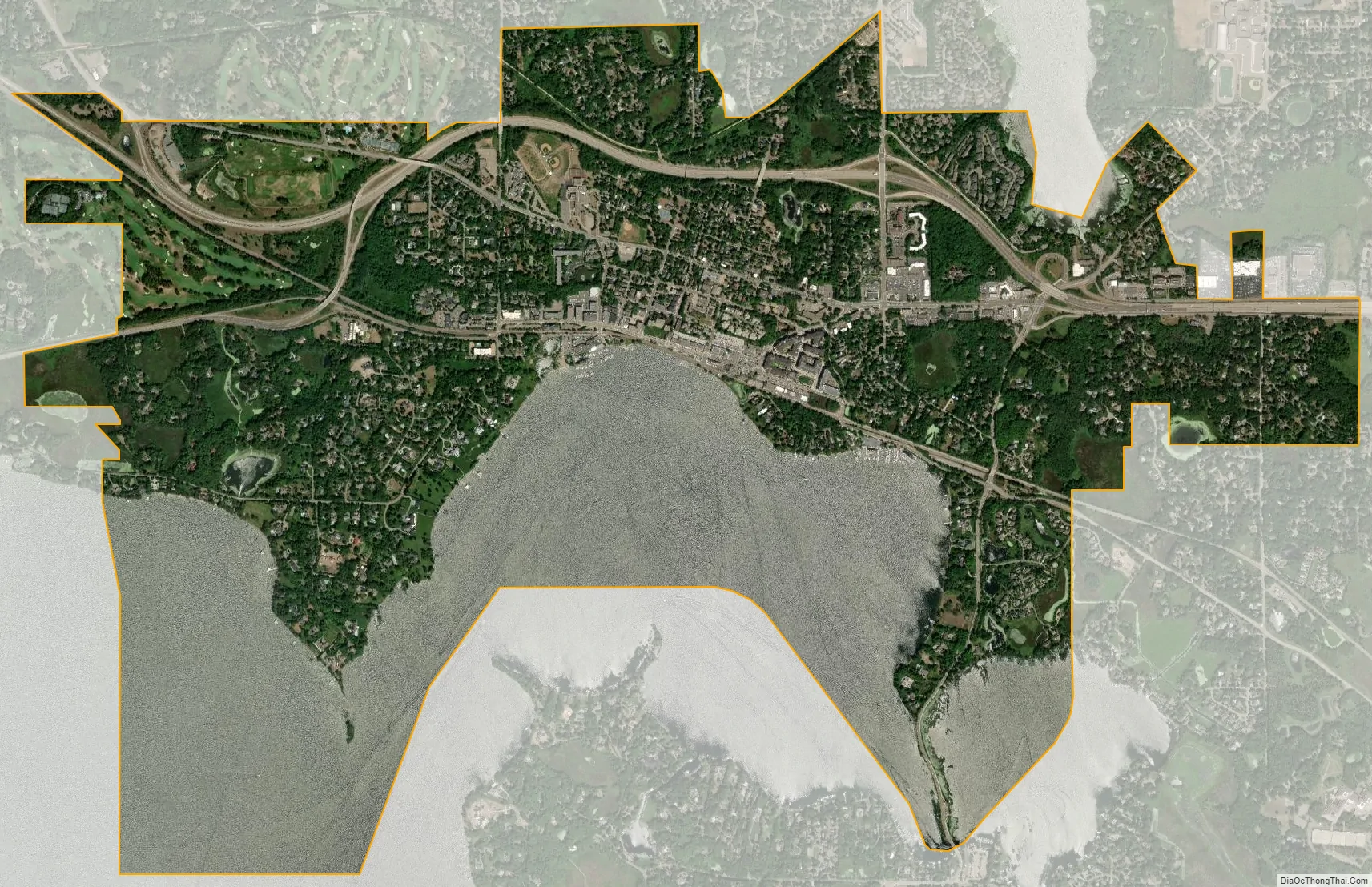
Wayzata city Satellite Map
Geography
Wayzata is a western suburb of Minneapolis, Minnesota, 12 miles (19 kilometres) to its west on the northeast tip of Lake Minnetonka. According to the United States Census Bureau, the city has an area of 3.16 square miles (8.18 km), of which 3.08 square miles (7.98 km) is land and 0.08 square miles (0.21 km) is water. The “land cover types” that compose the Wayzata area in descending order by square acreage are open water (36%); residential areas, farmsteads, and commercial lands (35%); forest (13%); and farms (8%).
Climate
Wayzata’s climate is humid continental, with hot summers, cold winters, and moderate autumns and springs. Average summer temperatures range from 56 to 82 degrees Fahrenheit. Average winter temperatures range from 2 to 27 degrees Fahrenheit. The average annual rainfall is 30.4 inches (77 cm). The average annual snowfall is 54.4 inches (138 cm).
Ecology
Before it was settled by Euro-Americans, the Wayzata area was largely “upland deciduous forest, with small inclusions of wet prairie, and lakes.” Forest types typical in and around Wayzata have been “maple-basswood forest, oak forest, lowland hardwood forest, and floodplain forest. Non-native forest types within the city were predominantly disturbed second growth forest types made up of elm, box elder, ash, and cottonwood, with occasional basswood, maple, and oak.” Some of the species of plants considered invasive in the Wayzata area are purple loosestrife, narrow-leaf cattail, common buckthorn, leafy spurge, tartarian honeysuckle, garlic mustard, reed canary grass, Siberian elm, and Amur maple. Some rare native species have also been seen in Wayzata, including the Acadian flycatcher, pugnose shiner, and red-shouldered hawk.
See also
Map of Minnesota State and its subdivision:- Aitkin
- Anoka
- Becker
- Beltrami
- Benton
- Big Stone
- Blue Earth
- Brown
- Carlton
- Carver
- Cass
- Chippewa
- Chisago
- Clay
- Clearwater
- Cook
- Cottonwood
- Crow Wing
- Dakota
- Dodge
- Douglas
- Faribault
- Fillmore
- Freeborn
- Goodhue
- Grant
- Hennepin
- Houston
- Hubbard
- Isanti
- Itasca
- Jackson
- Kanabec
- Kandiyohi
- Kittson
- Koochiching
- Lac qui Parle
- Lake
- Lake of the Woods
- Lake Superior
- Le Sueur
- Lincoln
- Lyon
- Mahnomen
- Marshall
- Martin
- McLeod
- Meeker
- Mille Lacs
- Morrison
- Mower
- Murray
- Nicollet
- Nobles
- Norman
- Olmsted
- Otter Tail
- Pennington
- Pine
- Pipestone
- Polk
- Pope
- Ramsey
- Red Lake
- Redwood
- Renville
- Rice
- Rock
- Roseau
- Saint Louis
- Scott
- Sherburne
- Sibley
- Stearns
- Steele
- Stevens
- Swift
- Todd
- Traverse
- Wabasha
- Wadena
- Waseca
- Washington
- Watonwan
- Wilkin
- Winona
- Wright
- Yellow Medicine
- Alabama
- Alaska
- Arizona
- Arkansas
- California
- Colorado
- Connecticut
- Delaware
- District of Columbia
- Florida
- Georgia
- Hawaii
- Idaho
- Illinois
- Indiana
- Iowa
- Kansas
- Kentucky
- Louisiana
- Maine
- Maryland
- Massachusetts
- Michigan
- Minnesota
- Mississippi
- Missouri
- Montana
- Nebraska
- Nevada
- New Hampshire
- New Jersey
- New Mexico
- New York
- North Carolina
- North Dakota
- Ohio
- Oklahoma
- Oregon
- Pennsylvania
- Rhode Island
- South Carolina
- South Dakota
- Tennessee
- Texas
- Utah
- Vermont
- Virginia
- Washington
- West Virginia
- Wisconsin
- Wyoming


