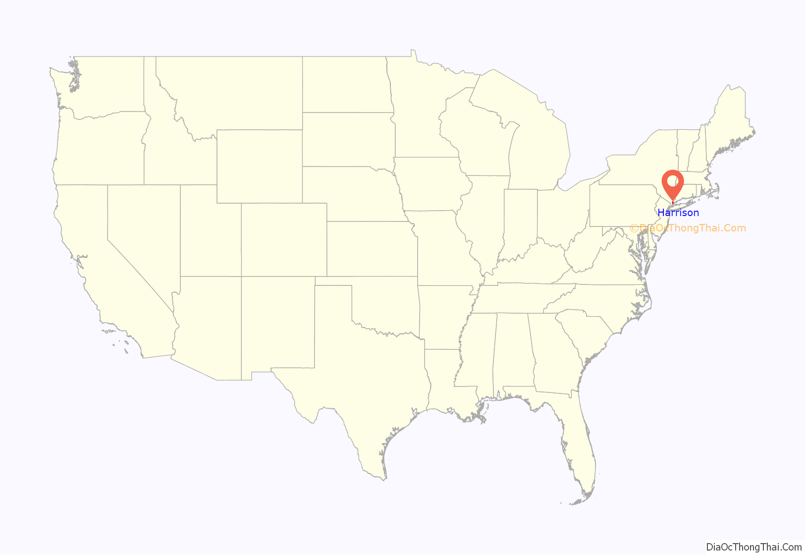
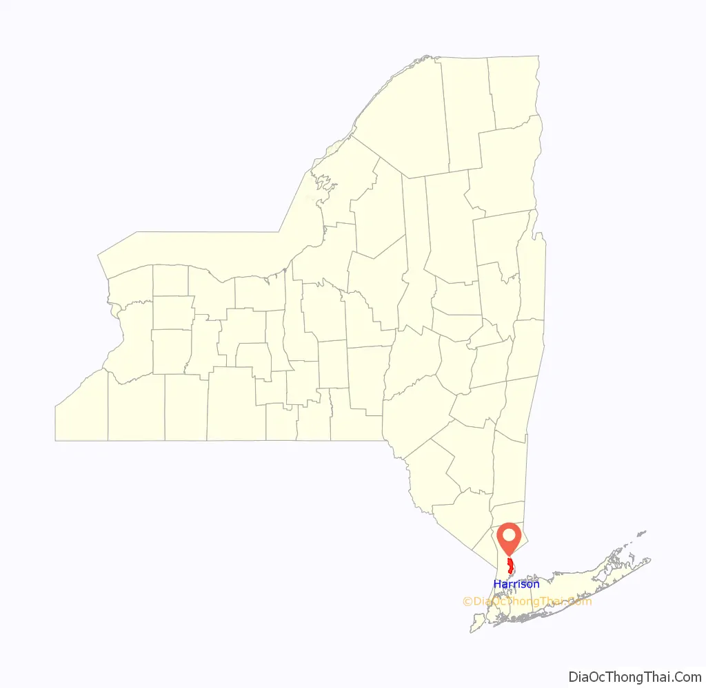
Harrison is a town and village in Westchester County, New York, United States, 22 miles (35 km) northeast of Manhattan. The population was 28,218 at the 2020 census.
| Name: | Harrison village |
|---|---|
| LSAD Code: | 47 |
| LSAD Description: | village (suffix) |
| State: | New York |
| County: | Westchester County |
| Founded: | 1696 |
| Elevation: | 69 ft (21 m) |
| Total Area: | 17.44 sq mi (45.17 km²) |
| Land Area: | 16.77 sq mi (43.42 km²) |
| Water Area: | 0.67 sq mi (1.75 km²) |
| Total Population: | 28,218 |
| Population Density: | 1,683.05/sq mi (649.84/km²) |
| ZIP code: | 10528 |
| Area code: | 914 |
| FIPS code: | 3632402 |
| GNISfeature ID: | 0977345 |
| Website: | www.harrison-ny.gov |
Online Interactive Map
Click on ![]() to view map in "full screen" mode.
to view map in "full screen" mode.
Harrison location map. Where is Harrison village?
History
Harrison was established in 1696 by a patent granted by the British government to John Harrison and three others, who had a year earlier bargained with local Native Americans to purchase an area of land above Westchester Path (an old trail that led from Manhattan to Port Chester) and below Rye Lake. Local custom holds that Harrison was given 24 hours to ride his horse around the area he could claim, and the horse couldn’t swim or didn’t want to get its feet wet, but this is folklore. In fact, the land below Westchester Path and along Long Island Sound had already been purchased and partly developed by the settlers of Rye, New York.
The area that became Harrison had also been sold in 1661 or 1662, and again in 1666, to Peter Disbrow, John Budd, and other investors or early residents of Rye.</ref> Disbrow and Budd evidently lost their paperwork and the land was ultimately granted to Harrison and his co-investors in 1696. So upset were the people of Rye that they seceded to the Colony of Connecticut until 1700, when the King of England ordered Rye to rejoin the Colony of New York.
The first permanent residents of Harrison’s Purchase, as it was called, arrived in about 1725, and many early settlers were Quakers, who set up a Friend’s Meeting House at a settlement located in the part of Harrison now called Purchase. Harrison’s Purchase was administered jointly by the settlers of Rye until it was incorporated as a town on March 7, 1788, by an act of the New York State legislature.
Merritt’s Hill in West Harrison was the site of the Battle of White Plains during the Revolutionary War. Regiment 182 of the Continental Army, of the 367 regiments there, was the Harrison Regiment, composed solely of people from Harrison.
During the 1830s, David Haviland settled in Harrison where he produced Haviland China which he sold in his store in New York City before returning to his native France. Today there exists a Haviland Street in the downtown business district, as well as a Haviland Road in the Sterling Ridge neighborhood of Harrison, whose only street sign is of a historic wrought iron design in scrolled shapes, quite older than many others throughout the town.
In 1867 Benjamin Holladay purchased a tract of land, which is now the campus of Manhattanville College. He constructed an elaborate granite mansion, now known as the college’s Reid Castle, and an elaborate Norman-style Roman Catholic chapel for his wife. The castle hosted the King and Queen of Siam in the early 1930s. The castle was at one time known as Ophir House, in reference to different owners.
What is now the Metro-North Railroad’s New Haven Line, running from Manhattan, New York City, to Greenwich, Connecticut, first came through Harrison in 1848, though the first station was not built until 1870. Before that time, Harrisonites had to flag down the train to get a ride. Harrison remained generally free of factories through the Industrial Revolution, while large factory districts grew in the neighboring towns of White Plains, Port Chester and Mamaroneck.
In 1929, the Hutchinson River Parkway was extended to Harrison.
Sunny Ridge
In 1929, Harrison’s former Sunnyridge Farm, located less than a half mile from the train station, was purchased by real estate developer Sidney H. Sonn, of H. & S. Sonn, Co. of New York City, and subdivided into lots for a real estate development. H. & S. Sonn laid out new streets throughout, preserving the farm’s private access road to the farm residence as today’s Sunny Ridge Road. According to a 1928 New York Times article, “[H. & S. Sonn] virtually transformed their part of the old farm into a park, installed winding tree-lined motorways and water, gas, sewers, and electricity, and landscaped the entire 165 acres, then they erected ten english-type houses which were designed by Julius Gregory, one of them being completely furnished by Charles of London.” H. & S. Sonn contracted Julius Gregory to develop house plans for single family houses in their new Sunny Ridge development, as it was termed. A new model was developed to construct homes that were of durable materials, to be resistant to exterior maintenance, using only brick, stone, and old-growth oak timber as exterior materials. The fashionable new neighborhood attracted the attention of New York banking, business, and entertainment elites, attracting Wall Street financier William Harty; then-owner of Condé Nast, Joseph J. Lane; Musical star Louise Groody; and Fitzhugh Green, of Putnam’s Publishing House, among the first residents of the new neighborhood.
Sidney Sonn renovated farm’s original house, an immense, elaborate, 20-room, 1875 Victorian mansion, into an English Tudor, designed by renowned architect Julius Gregory, father of the American Tudor-Revival style and movement of the 1920s, as a residence for himself.
Only a small handful of homes were sold and constructed before the economic downturn of the Great Depression. The remaining vast majority of homes were constructed beginning in the middle-1940s, with the last plots filled during the 1950s. The styles of the newer, 1940s-era homes was primarily of colonial revival style, with the newest ranging into Mid-century-Modern. The older, Tudor homes as a result remain quite notable.
The 1875 Sunny Ridge farm mansion was renovated to include a 14th-century woodcut from Europe, installed into the wall over the living room fireplace, among several other ancient relics, built into the home. The home was sold for the first time since the 1920s renovation in the summer of 2017, and was demolished to make way for two new homes. It was not protected by any state or local historic preservation acts.
Political history
In 1967, 200 residents stated support for a plan to incorporate Purchase, a community in Harrison, so that corporations could not build in the community. In response, officials from the Town of Harrison put forward plans to try to become a city to try to stop Purchase from seceding from Harrison. The resolution was for the Town became a hybrid “Town / Village”, which it remains today.
John A. Passidomo (1921–2005) was first elected mayor in 1965 by only 67 votes. Re-elected eight times, he served until 1983 when he resigned to become Commissioner of the New York State Department of Motor Vehicles. In his two and a half years at that job, he helped pass one of the nation’s first seat-belt laws despite the law’s unpopularity.
Harrison’s “Platinum Mile”, a string of corporate office parks along I-287 in the Purchase section of Harrison, developed under Passidomo. The mayor played an instrumental role in attracting large corporations such as PepsiCo, MasterCard and Texaco.
In the early 1970s, under Passidomo’s supervision, a group in the Purchase section of town, concerned about the town’s overdevelopment, attempted to incorporate as a village and thereby separate from the town of Harrison. Creatively, to avoid being served papers that would have begun the legal proceedings for Purchase to incorporate as a village, Passidomo entered his office through the fire escape. He then immediately made sure that the town Harrison became a village but remained as a town to end to the possibility of Purchase’s secession, since a village cannot legally be formed in another village.
The list of supervisors/mayors begins at 1965; however, there were mayors before that.
- John Passidomo 1965–1983
- Pat V. Angarano 1983–1990
- Charles Balancia 1990–1994
- Philip A. Marraccini (R) 1994–1998
- Ronald Bianchi (D) 1998–2002
- Stephen Malfitano (R) 2002–2008
- Joan Walsh (D) 2008–2012
- Ronald Belmont (R) 2012–2022
- Richard Dionisio (R) 2022-
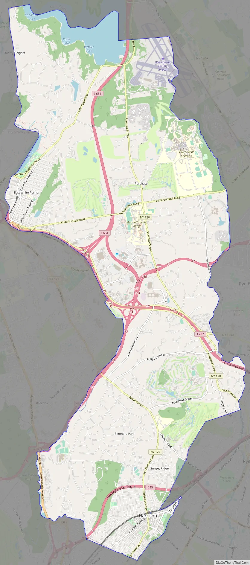
Harrison Road Map
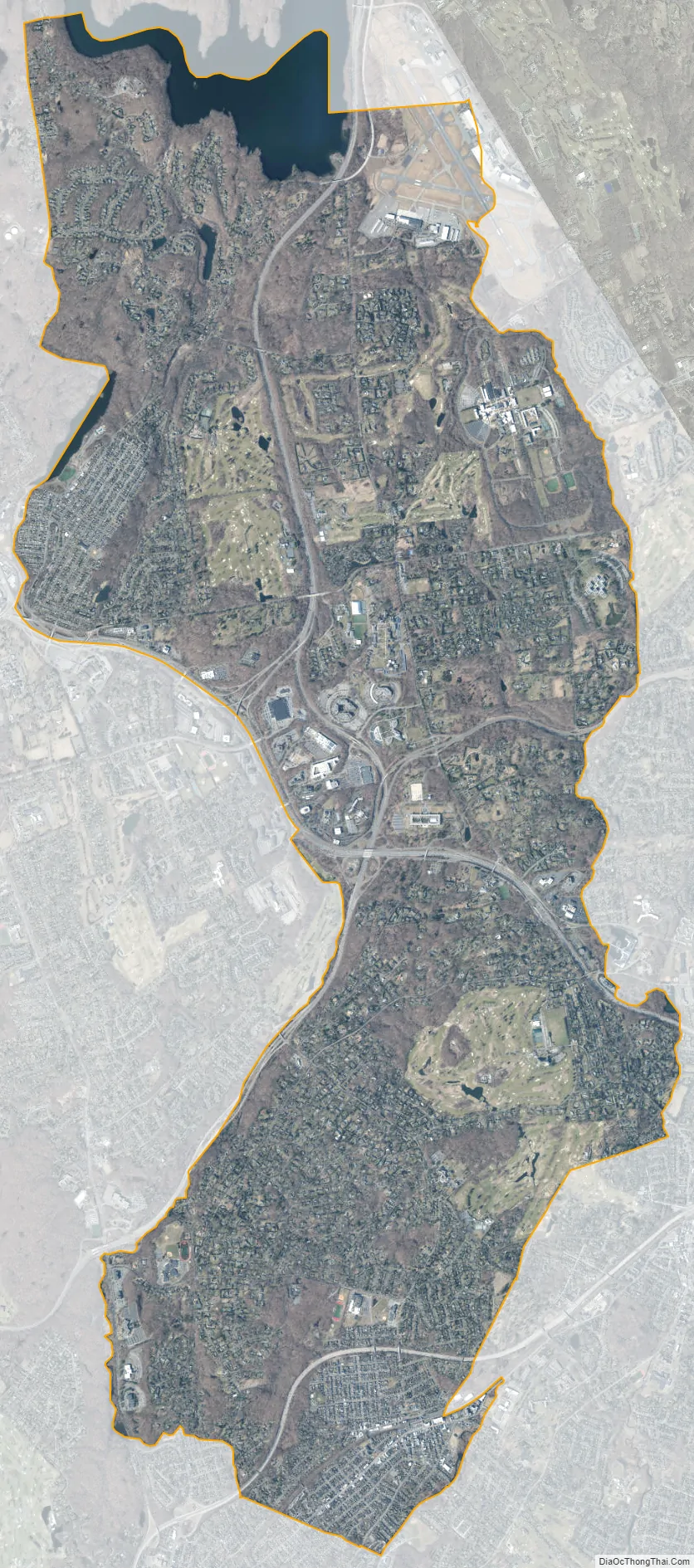
Harrison city Satellite Map
Geography
Harrison is a town and village in Westchester County, New York, approximately 22 miles (35 km) northeast of Manhattan, New York City. According to the United States Census Bureau, the town (and coterminous village) has a total area of 17.4 square miles (45 km), of which 16.8 square miles (44 km) is land and 0.6 square miles (1.6 km), or 3.22%, is water. The population was 27,472 at the 2010 census.
The distance from Harrison Station to Grand Central Terminal in Midtown Manhattan is about 27 miles (43 km).
Harrison is bordered by North Castle, White Plains, Rye town, Rye city, Mamaroneck, and Scarsdale. The New England Thruway (I-95) runs through the town (without any interchanges), as well as the Cross Westchester Expressway and the Hutchinson River Parkway. I-684 passes through Harrison and ends at the Cross Westchester Expressway and the Hutchinson Parkway.
Climate
Areas and neighborhoods
The boundaries of the town of Harrison are the approximate shape of a figure-eight. The southern half is known as simply Harrison, or downtown, while the hamlets of Purchase and West Harrison are located in the northern portion of the town. The “downtown” southern half of Harrison is divided into four general areas: Brentwood Plaza, Sunnyridge, Sterling Ridge/The Trails, and the Village part of Harrison.
West Harrison is an isolated community, lodged between a tall hill bordered by a lake, Interstate 287, a tall relatively steep hill, and a cliff at the northern edge. Because of this, there is a general lack of street entrances. There is really only one road into it, although there are a few other “back” ways into it. The road is called Lake Street, flanked on one side by Silver Lake Park, bordering the lake, and by a small business district on the other side of the street. West Harrison contains the Passidomo Veterans Memorial Park and Pool and the Leo Mintzer Center. West Harrison also contains the site of the Battle of White Plains from the Revolutionary War. Silver Lake is also the home of Buckout Road, which was said to have been a home of witches, albinos, and slaughters.
Purchase is a more secluded area of Harrison, with winding roads and deep woods. The houses are larger, in often cases whole swaths of land developed in the late twentieth century, and early 2000s, comparably younger in age to the rest of the town.
Downtown is split into the four sections mentioned above, and is flanked by Interstate 95, the Hutchinson River Parkway, and the Metro-North Railroad. The manmade lines create isolation to areas, with few areas to cross each. Harrison’s only middle school, Louis M. Klein Middle School, and only High School, Harrison High School, are located in the “downtown” area. The four areas of downtown, as separated by the boundaries of Interstate 95 and the railroad tracks as well as separated by wealth gaps, are very diverse. Despite its name, “Downtown” is not in any sense a business district, it is much rather a residential enclave, featuring houses of every wealth level.
See also
Map of New York State and its subdivision:- Albany
- Allegany
- Bronx
- Broome
- Cattaraugus
- Cayuga
- Chautauqua
- Chemung
- Chenango
- Clinton
- Columbia
- Cortland
- Delaware
- Dutchess
- Erie
- Essex
- Franklin
- Fulton
- Genesee
- Greene
- Hamilton
- Herkimer
- Jefferson
- Kings
- Lake Ontario
- Lewis
- Livingston
- Madison
- Monroe
- Montgomery
- Nassau
- New York
- Niagara
- Oneida
- Onondaga
- Ontario
- Orange
- Orleans
- Oswego
- Otsego
- Putnam
- Queens
- Rensselaer
- Richmond
- Rockland
- Saint Lawrence
- Saratoga
- Schenectady
- Schoharie
- Schuyler
- Seneca
- Steuben
- Suffolk
- Sullivan
- Tioga
- Tompkins
- Ulster
- Warren
- Washington
- Wayne
- Westchester
- Wyoming
- Yates
- Alabama
- Alaska
- Arizona
- Arkansas
- California
- Colorado
- Connecticut
- Delaware
- District of Columbia
- Florida
- Georgia
- Hawaii
- Idaho
- Illinois
- Indiana
- Iowa
- Kansas
- Kentucky
- Louisiana
- Maine
- Maryland
- Massachusetts
- Michigan
- Minnesota
- Mississippi
- Missouri
- Montana
- Nebraska
- Nevada
- New Hampshire
- New Jersey
- New Mexico
- New York
- North Carolina
- North Dakota
- Ohio
- Oklahoma
- Oregon
- Pennsylvania
- Rhode Island
- South Carolina
- South Dakota
- Tennessee
- Texas
- Utah
- Vermont
- Virginia
- Washington
- West Virginia
- Wisconsin
- Wyoming


