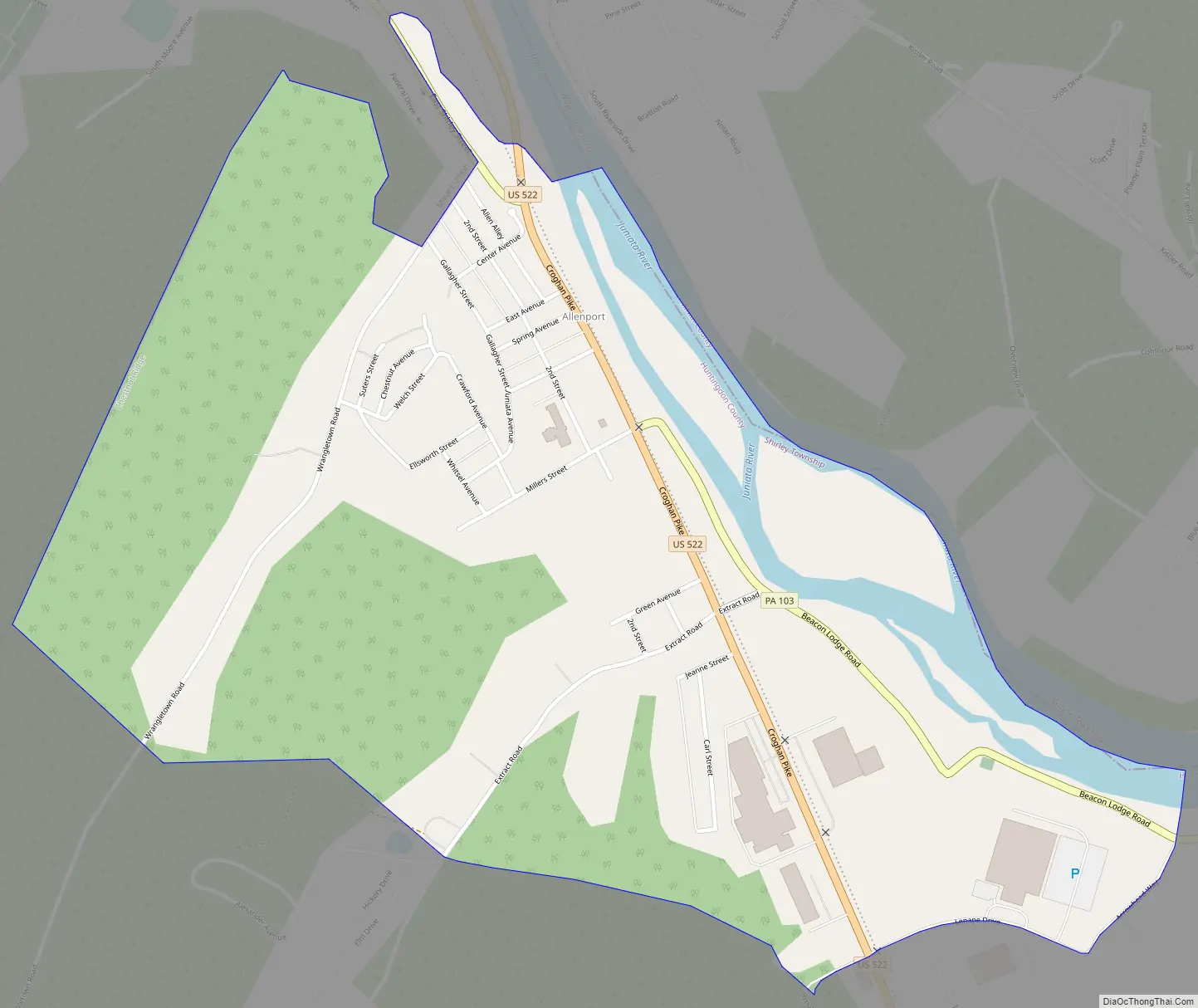
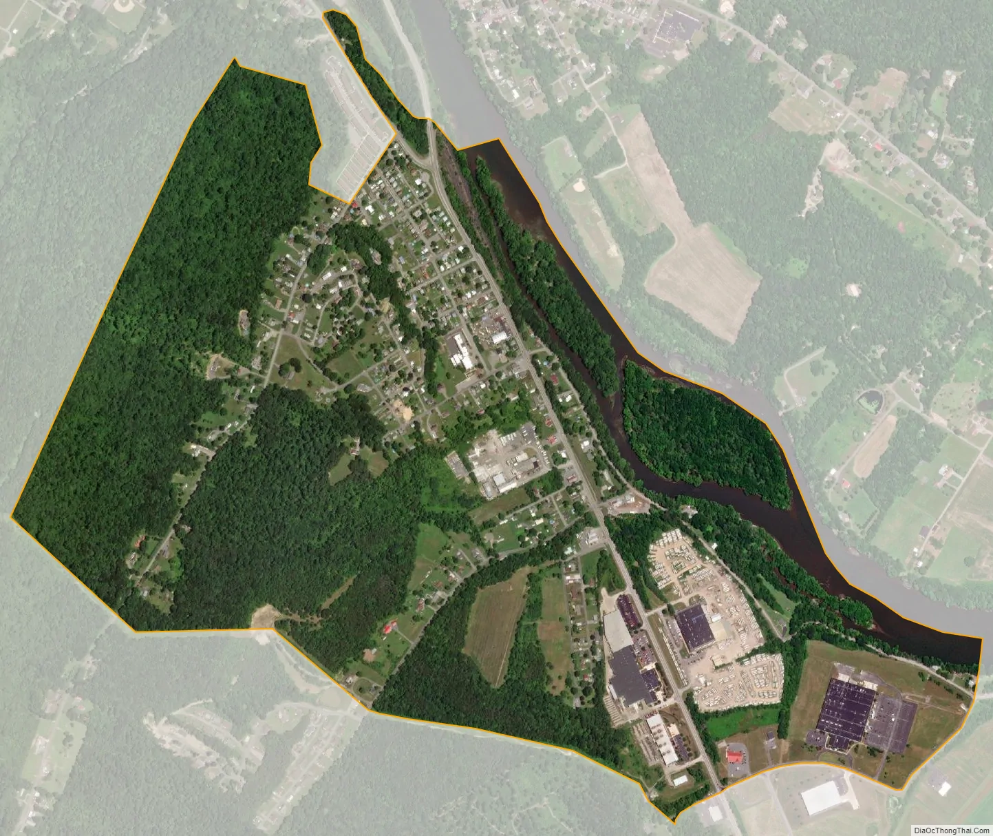
Allenport is an unincorporated community and census-designated place (CDP) in Huntingdon County, Pennsylvania, United States. It lies southeast of Mount Union on the Juniata River in Shirley Township. The population was 648 as of the 2010 census.
Allenport is the location of the Riverview Business Center, home of manufacturing facilities for Bonney Forge, FCI (formerly Berg), and Containment Solutions (formerly Fluid Containment).
| Name: | Allenport CDP |
|---|---|
| LSAD Code: | 57 |
| LSAD Description: | CDP (suffix) |
| State: | Pennsylvania |
| County: | Huntingdon County |
| Elevation: | 581 ft (177 m) |
| Total Area: | 1.04 sq mi (2.69 km²) |
| Land Area: | 0.97 sq mi (2.51 km²) |
| Water Area: | 0.07 sq mi (0.18 km²) |
| Total Population: | 572 |
| Population Density: | 589.69/sq mi (227.71/km²) |
| ZIP code: | 17066 |
| Area code: | 814 |
| FIPS code: | 4200980 |
| GNISfeature ID: | 1168195 |
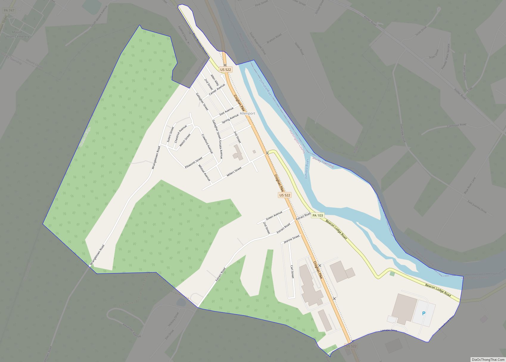
Online Interactive Map
Click on ![]() to view map in "full screen" mode.
to view map in "full screen" mode.
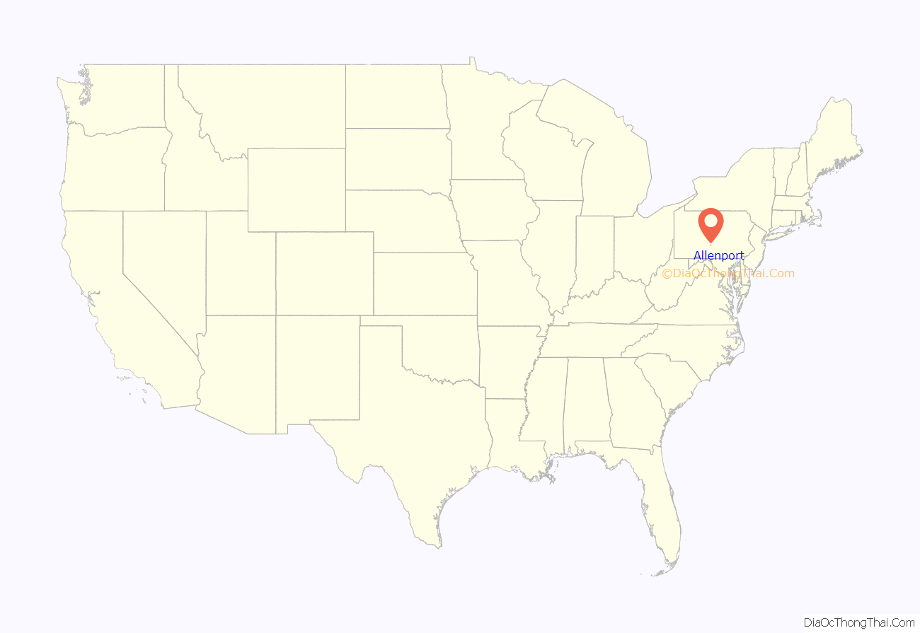
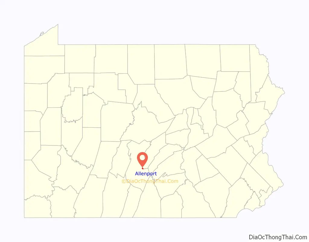
Allenport location map. Where is Allenport CDP?
Allenport Road Map
Allenport city Satellite Map
Geography
Allenport is in eastern Huntingdon County, bordered to the north by the borough of Mount Union and to the northeast across the Juniata River by the borough of Kistler in Mifflin County. U.S. Route 522 passes through Allenport, leading north into Mount Union and south 5 miles (8 km) to Shirleysburg. Pennsylvania Route 103 has its southern terminus at US 522 in Allenport, and leads northeast (downstream along the Juniata River) 18 miles (29 km) to Mattawana.
The inactive tracks of the narrow-gauge East Broad Top Railroad pass through Allenport. A third rail creates dual-gauge tracks to just short of the PA 103 crossing. The tracks were partially rehabilitated in the mid-2000s by the Mount Union Connecting Railroad, but the rehabilitation was not completed.
According to the U.S. Census Bureau, the Allenport CDP has a total area of 1.0 square mile (2.7 km), of which 0.97 square miles (2.5 km) are land and 0.08 square miles (0.2 km), or 6.71%, are water.
See also
Map of Pennsylvania State and its subdivision:- Adams
- Allegheny
- Armstrong
- Beaver
- Bedford
- Berks
- Blair
- Bradford
- Bucks
- Butler
- Cambria
- Cameron
- Carbon
- Centre
- Chester
- Clarion
- Clearfield
- Clinton
- Columbia
- Crawford
- Cumberland
- Dauphin
- Delaware
- Elk
- Erie
- Fayette
- Forest
- Franklin
- Fulton
- Greene
- Huntingdon
- Indiana
- Jefferson
- Juniata
- Lackawanna
- Lancaster
- Lawrence
- Lebanon
- Lehigh
- Luzerne
- Lycoming
- Mc Kean
- Mercer
- Mifflin
- Monroe
- Montgomery
- Montour
- Northampton
- Northumberland
- Perry
- Philadelphia
- Pike
- Potter
- Schuylkill
- Snyder
- Somerset
- Sullivan
- Susquehanna
- Tioga
- Union
- Venango
- Warren
- Washington
- Wayne
- Westmoreland
- Wyoming
- York
- Alabama
- Alaska
- Arizona
- Arkansas
- California
- Colorado
- Connecticut
- Delaware
- District of Columbia
- Florida
- Georgia
- Hawaii
- Idaho
- Illinois
- Indiana
- Iowa
- Kansas
- Kentucky
- Louisiana
- Maine
- Maryland
- Massachusetts
- Michigan
- Minnesota
- Mississippi
- Missouri
- Montana
- Nebraska
- Nevada
- New Hampshire
- New Jersey
- New Mexico
- New York
- North Carolina
- North Dakota
- Ohio
- Oklahoma
- Oregon
- Pennsylvania
- Rhode Island
- South Carolina
- South Dakota
- Tennessee
- Texas
- Utah
- Vermont
- Virginia
- Washington
- West Virginia
- Wisconsin
- Wyoming