Mount Union is a borough in Huntingdon County, Pennsylvania, United States, approximately 44 miles (71 km) southeast of Altoona and 12 miles (19 km) southeast of Huntingdon, on the Juniata River. In the vicinity are found bituminous coal, ganister rock, fire clay, and some timber. A major Easter grass factory is located in the northern quadrant of the borough limits; until May 2007, the facility was owned by Bleyer Industries. The population was 2,447 at the 2010 census.
| Name: | Mount Union borough |
|---|---|
| LSAD Code: | 21 |
| LSAD Description: | borough (suffix) |
| State: | Pennsylvania |
| County: | Huntingdon County |
| Incorporated: | 1867 |
| Total Area: | 1.24 sq mi (3.20 km²) |
| Land Area: | 1.16 sq mi (3.00 km²) |
| Water Area: | 0.08 sq mi (0.20 km²) 2.59% |
| Total Population: | 2,308 |
| Population Density: | 1,991.37/sq mi (768.62/km²) |
| Area code: | 814 |
| FIPS code: | 4251984 |
| Website: | www.mtunionpa.org |
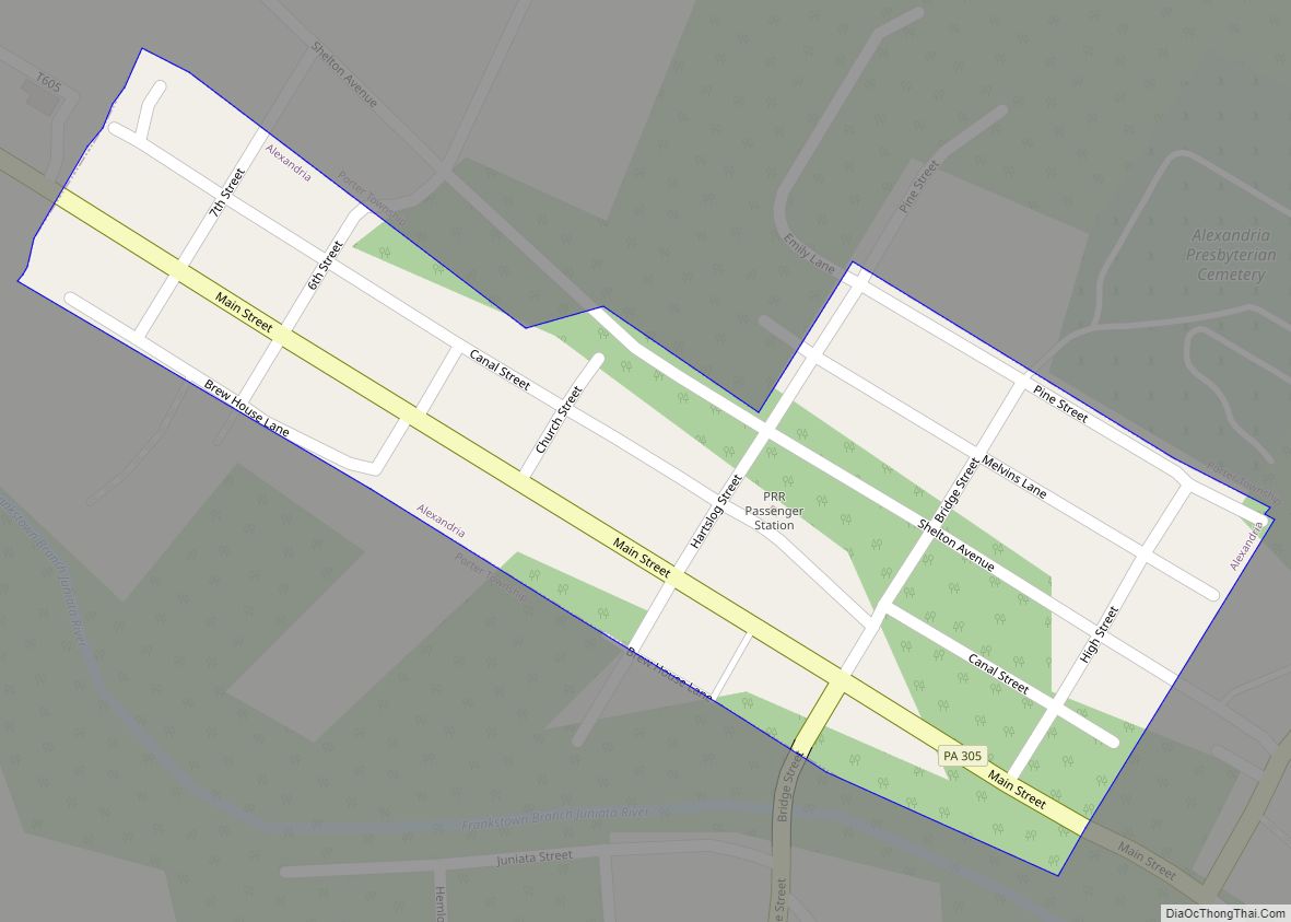
Online Interactive Map
Click on ![]() to view map in "full screen" mode.
to view map in "full screen" mode.
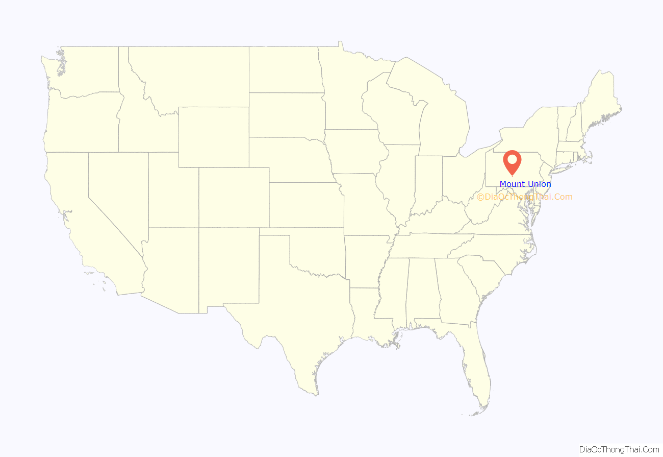
Mount Union location map. Where is Mount Union borough?
History
Mount Union was largely influenced by industry. It was at one time the world’s largest producer of refractory material (silica brick), with three plants – General Refractories, United States Refractories, and Harbison Walker. The refractory business in Mount Union lasted from 1899 to about 1972, with limited production into the early 1990s. Other industries included two tanneries, a tanning extract plant, coal yards, an explosives and munitions plant (Aetna), and foundry and machine shops.
Mount Union was the northern terminus for the narrow gauge East Broad Top Railroad, connecting to the Main Line of the Middle Division of the Pennsylvania Railroad (now Norfolk Southern). The EBT maintained a large dual-gauge yard and coal cleaning plant in Mount Union and supplied coal to the Refractory plants. The EBT ceased operations in 1956 but the track is still in place and owned by the railroad. From 1998 to 2010, the Mount Union Connecting Railroad attempted to reactivate the EBT main track through Mount Union and rehabilitated it, but only a couple cars were serviced and none moved over the EBT trackage.
The Mount Union Historic District was listed on the National Register of Historic Places in 1994, with 300 significant historic structures, buildings, and homes. The population tally in 1900 was 1,086 which rose to 3,338 in 1910.
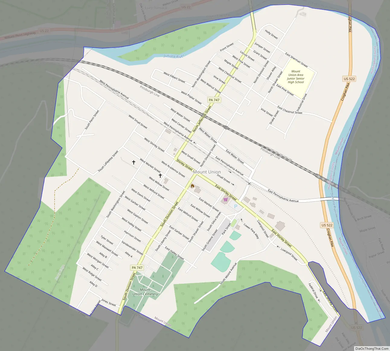
Mount Union Road Map
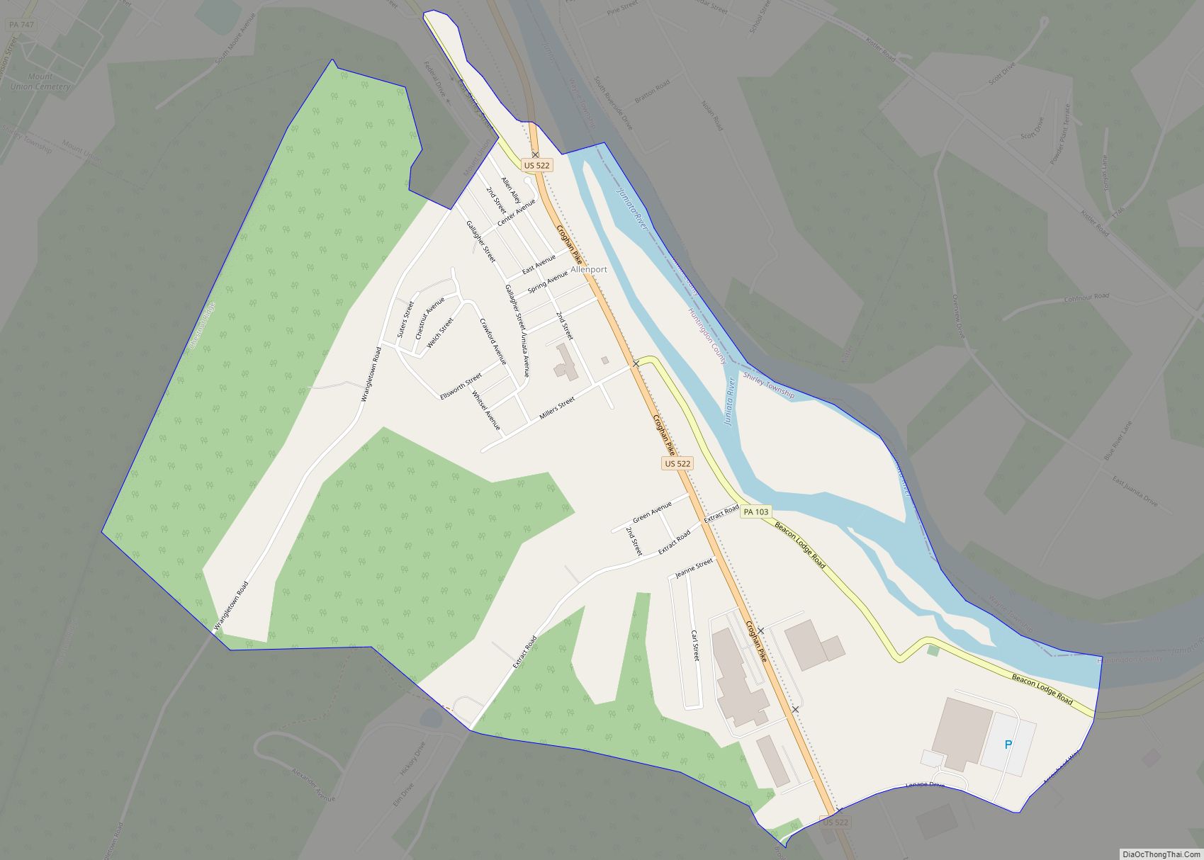
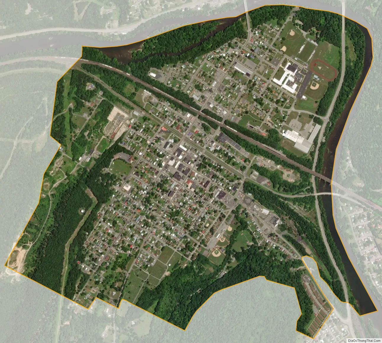
Mount Union city Satellite Map
Geography
According to the United States Census Bureau, the borough has a total area of 1.2 square miles (3.1 km), of which 1.1 square miles (2.8 km) is land and 0.04 square miles (0.10 km) (2.59%) is water.
See also
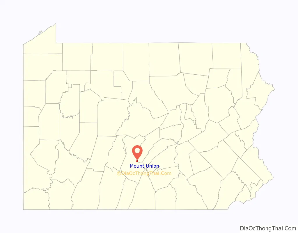
Map of Pennsylvania State and its subdivision:- Adams
- Allegheny
- Armstrong
- Beaver
- Bedford
- Berks
- Blair
- Bradford
- Bucks
- Butler
- Cambria
- Cameron
- Carbon
- Centre
- Chester
- Clarion
- Clearfield
- Clinton
- Columbia
- Crawford
- Cumberland
- Dauphin
- Delaware
- Elk
- Erie
- Fayette
- Forest
- Franklin
- Fulton
- Greene
- Huntingdon
- Indiana
- Jefferson
- Juniata
- Lackawanna
- Lancaster
- Lawrence
- Lebanon
- Lehigh
- Luzerne
- Lycoming
- Mc Kean
- Mercer
- Mifflin
- Monroe
- Montgomery
- Montour
- Northampton
- Northumberland
- Perry
- Philadelphia
- Pike
- Potter
- Schuylkill
- Snyder
- Somerset
- Sullivan
- Susquehanna
- Tioga
- Union
- Venango
- Warren
- Washington
- Wayne
- Westmoreland
- Wyoming
- York
- Alabama
- Alaska
- Arizona
- Arkansas
- California
- Colorado
- Connecticut
- Delaware
- District of Columbia
- Florida
- Georgia
- Hawaii
- Idaho
- Illinois
- Indiana
- Iowa
- Kansas
- Kentucky
- Louisiana
- Maine
- Maryland
- Massachusetts
- Michigan
- Minnesota
- Mississippi
- Missouri
- Montana
- Nebraska
- Nevada
- New Hampshire
- New Jersey
- New Mexico
- New York
- North Carolina
- North Dakota
- Ohio
- Oklahoma
- Oregon
- Pennsylvania
- Rhode Island
- South Carolina
- South Dakota
- Tennessee
- Texas
- Utah
- Vermont
- Virginia
- Washington
- West Virginia
- Wisconsin
- Wyoming