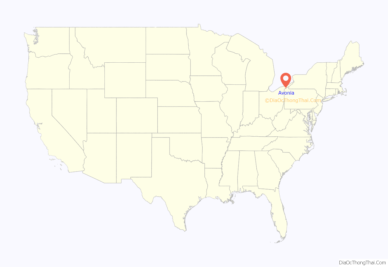
Avonia is an unincorporated community and census-designated place (CDP) in Erie County, Pennsylvania, United States. The population was 1,205 at the 2010 census, down from 1,331 in 2000. It is part of the Erie Metropolitan Statistical Area.
| Name: | Avonia CDP |
|---|---|
| LSAD Code: | 57 |
| LSAD Description: | CDP (suffix) |
| State: | Pennsylvania |
| County: | Erie County |
| Elevation: | 675 ft (206 m) |
| Total Area: | 2.63 sq mi (6.82 km²) |
| Land Area: | 2.63 sq mi (6.81 km²) |
| Water Area: | 0.00 sq mi (0.01 km²) |
| Total Population: | 1,217 |
| Population Density: | 462.74/sq mi (178.69/km²) |
| Area code: | 814 |
| FIPS code: | 4203676 |
Online Interactive Map
Click on ![]() to view map in "full screen" mode.
to view map in "full screen" mode.
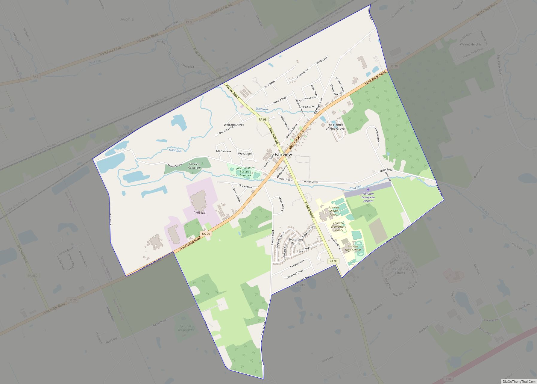
Avonia location map. Where is Avonia CDP?
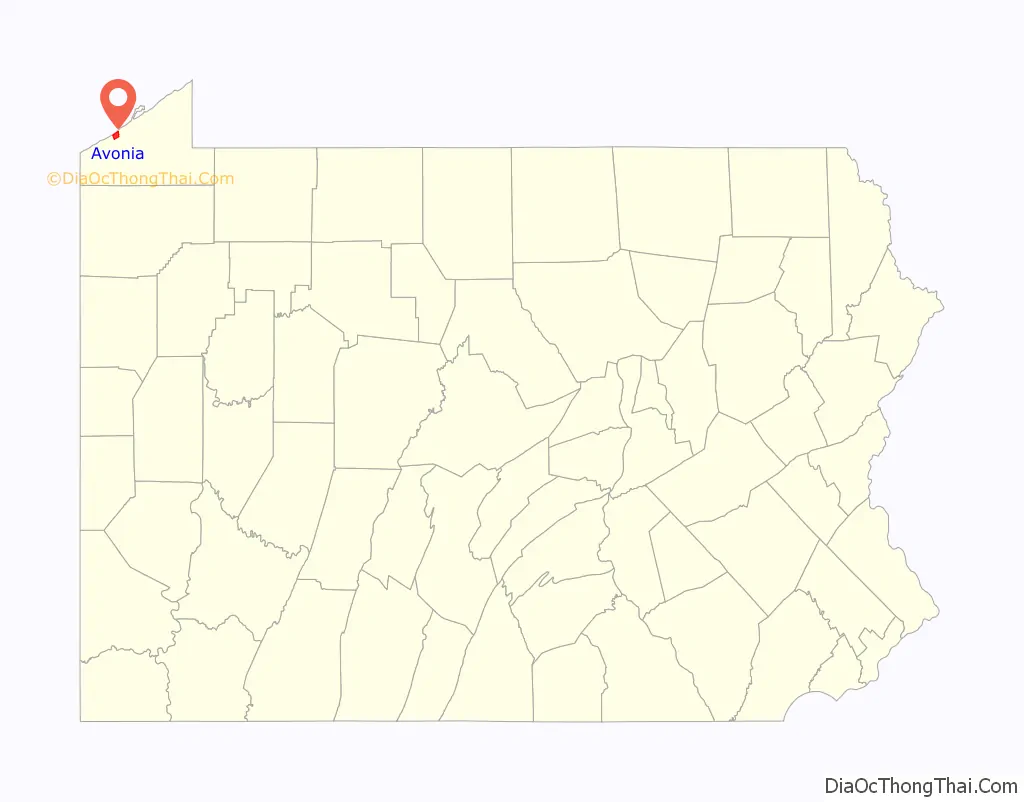
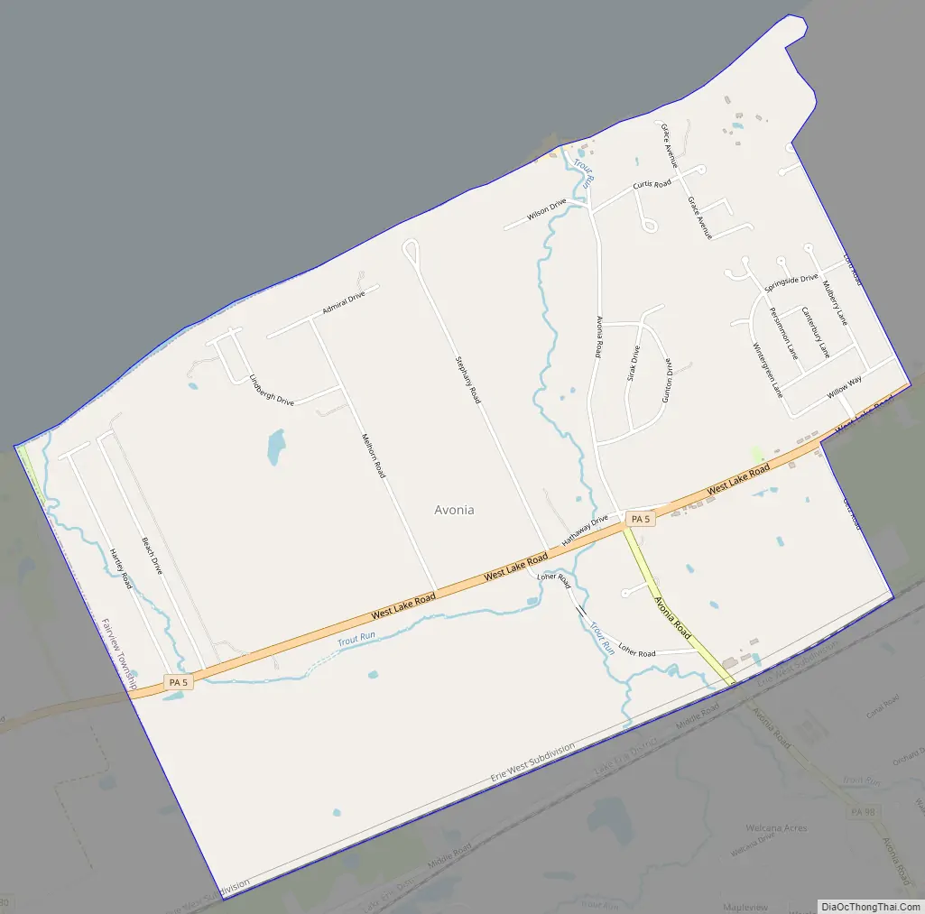
Avonia Road Map
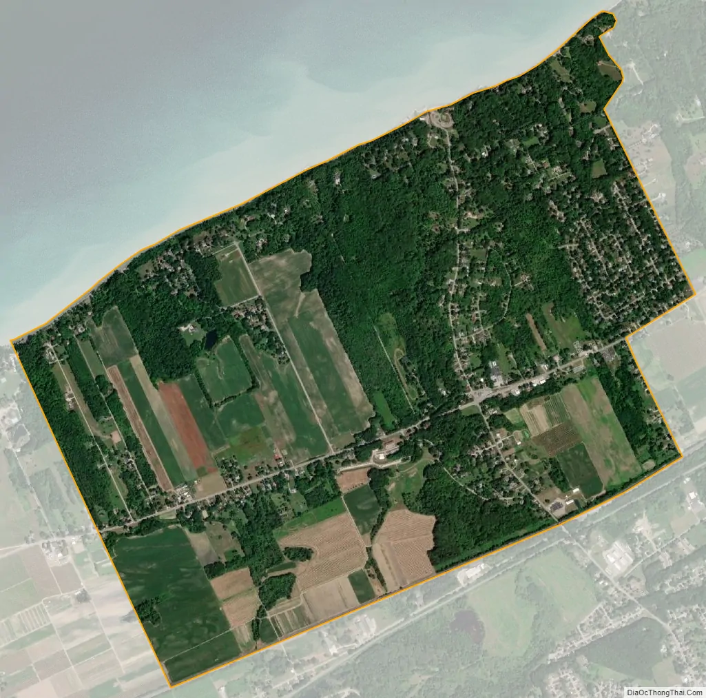
Avonia city Satellite Map
Geography
Avonia is located in west-central Erie County at 42°3′4″N 80°16′13″W / 42.05111°N 80.27028°W / 42.05111; -80.27028 (42.051197, -80.270399), in the northwestern part of Fairview Township. It is bordered to the north by Lake Erie, to the west by Girard Township, and to the south by the Fairview CDP. Pennsylvania Route 5 (West Lake Road) passes through the community, leading northeast 11 miles (18 km) to downtown Erie and southwest 5 miles (8 km) to Lake City. Pennsylvania Route 98 (Avonia Road) intersects PA 5 in the center of Avonia, leading south 1.2 miles (1.9 km) to the center of Fairview and 3 miles (5 km) to Interstate 90.
According to the United States Census Bureau, the Avonia CDP has a total area of 2.7 square miles (6.9 km), all land.
See also
Map of Pennsylvania State and its subdivision:- Adams
- Allegheny
- Armstrong
- Beaver
- Bedford
- Berks
- Blair
- Bradford
- Bucks
- Butler
- Cambria
- Cameron
- Carbon
- Centre
- Chester
- Clarion
- Clearfield
- Clinton
- Columbia
- Crawford
- Cumberland
- Dauphin
- Delaware
- Elk
- Erie
- Fayette
- Forest
- Franklin
- Fulton
- Greene
- Huntingdon
- Indiana
- Jefferson
- Juniata
- Lackawanna
- Lancaster
- Lawrence
- Lebanon
- Lehigh
- Luzerne
- Lycoming
- Mc Kean
- Mercer
- Mifflin
- Monroe
- Montgomery
- Montour
- Northampton
- Northumberland
- Perry
- Philadelphia
- Pike
- Potter
- Schuylkill
- Snyder
- Somerset
- Sullivan
- Susquehanna
- Tioga
- Union
- Venango
- Warren
- Washington
- Wayne
- Westmoreland
- Wyoming
- York
- Alabama
- Alaska
- Arizona
- Arkansas
- California
- Colorado
- Connecticut
- Delaware
- District of Columbia
- Florida
- Georgia
- Hawaii
- Idaho
- Illinois
- Indiana
- Iowa
- Kansas
- Kentucky
- Louisiana
- Maine
- Maryland
- Massachusetts
- Michigan
- Minnesota
- Mississippi
- Missouri
- Montana
- Nebraska
- Nevada
- New Hampshire
- New Jersey
- New Mexico
- New York
- North Carolina
- North Dakota
- Ohio
- Oklahoma
- Oregon
- Pennsylvania
- Rhode Island
- South Carolina
- South Dakota
- Tennessee
- Texas
- Utah
- Vermont
- Virginia
- Washington
- West Virginia
- Wisconsin
- Wyoming