Benton is a borough in Columbia County, Pennsylvania, United States. It is part of Northeastern Pennsylvania. The population was 824 at the 2020 census. It is part of the Bloomsburg-Berwick micropolitan area.
| Name: | Benton borough |
|---|---|
| LSAD Code: | 21 |
| LSAD Description: | borough (suffix) |
| State: | Pennsylvania |
| County: | Columbia County |
| Incorporated: | 1894 |
| Elevation: | 765 ft (233 m) |
| Total Area: | 0.61 sq mi (1.59 km²) |
| Land Area: | 0.60 sq mi (1.55 km²) |
| Water Area: | 0.02 sq mi (0.05 km²) |
| Total Population: | 823 |
| Population Density: | 1,378.56/sq mi (532.32/km²) |
| ZIP code: | 17814 |
| Area code: | 570 |
| FIPS code: | 4205680 |
| GNISfeature ID: | 1215122 |
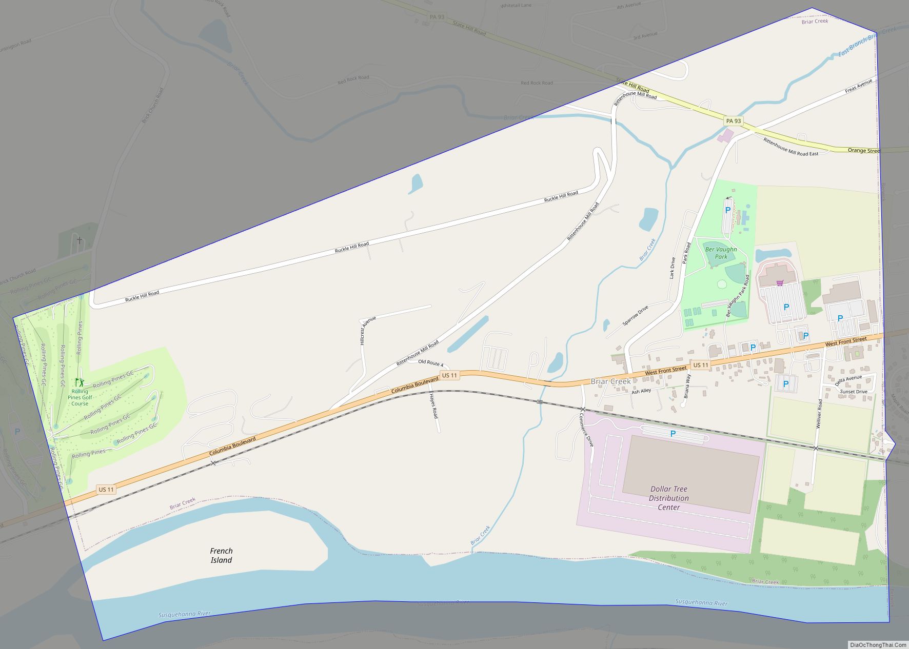
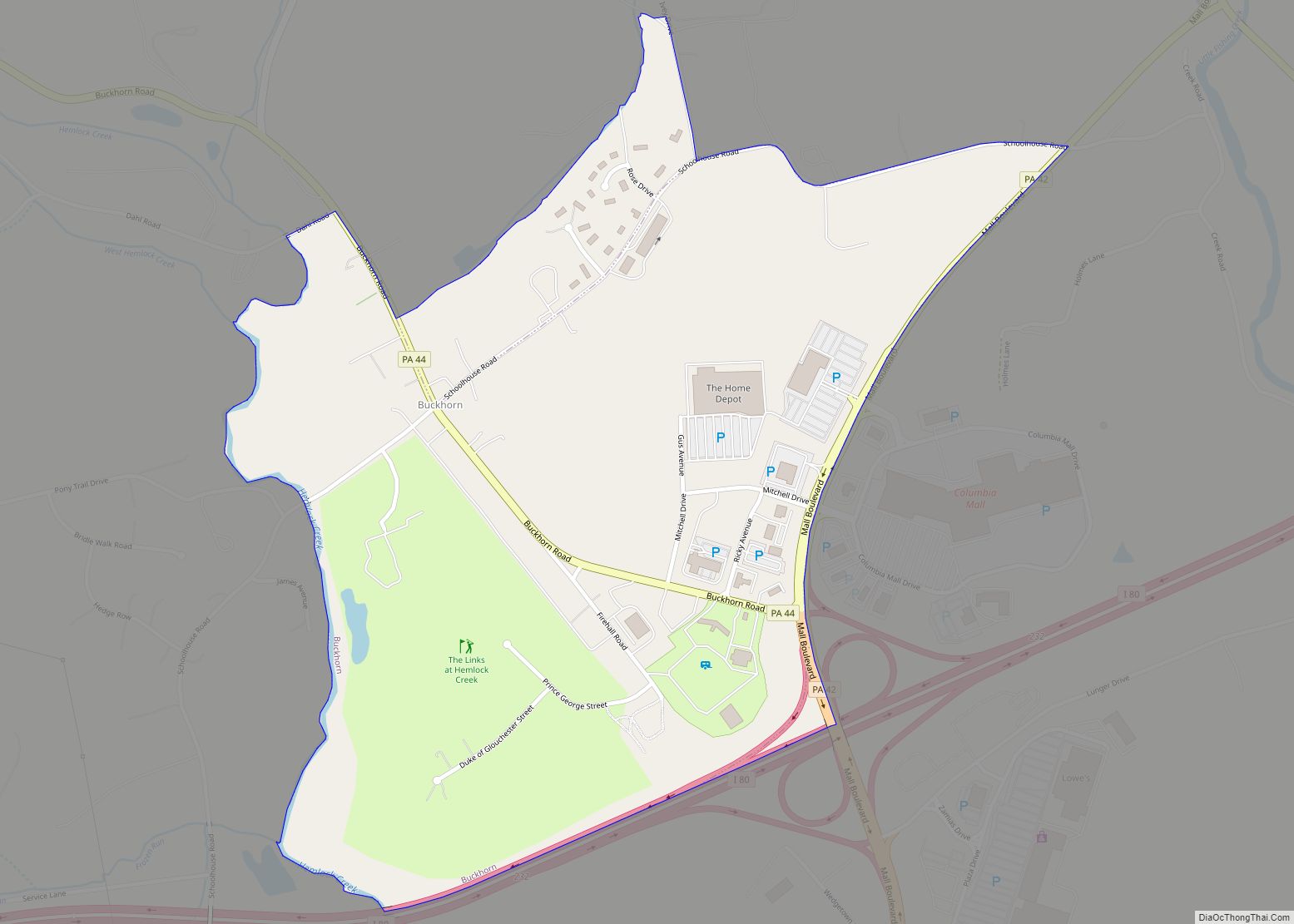
Online Interactive Map
Click on ![]() to view map in "full screen" mode.
to view map in "full screen" mode.
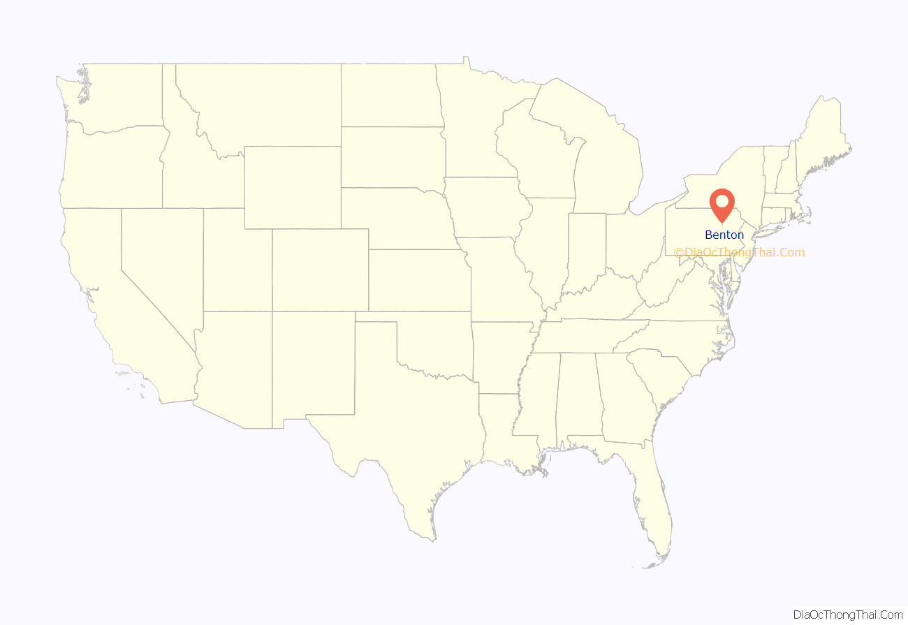
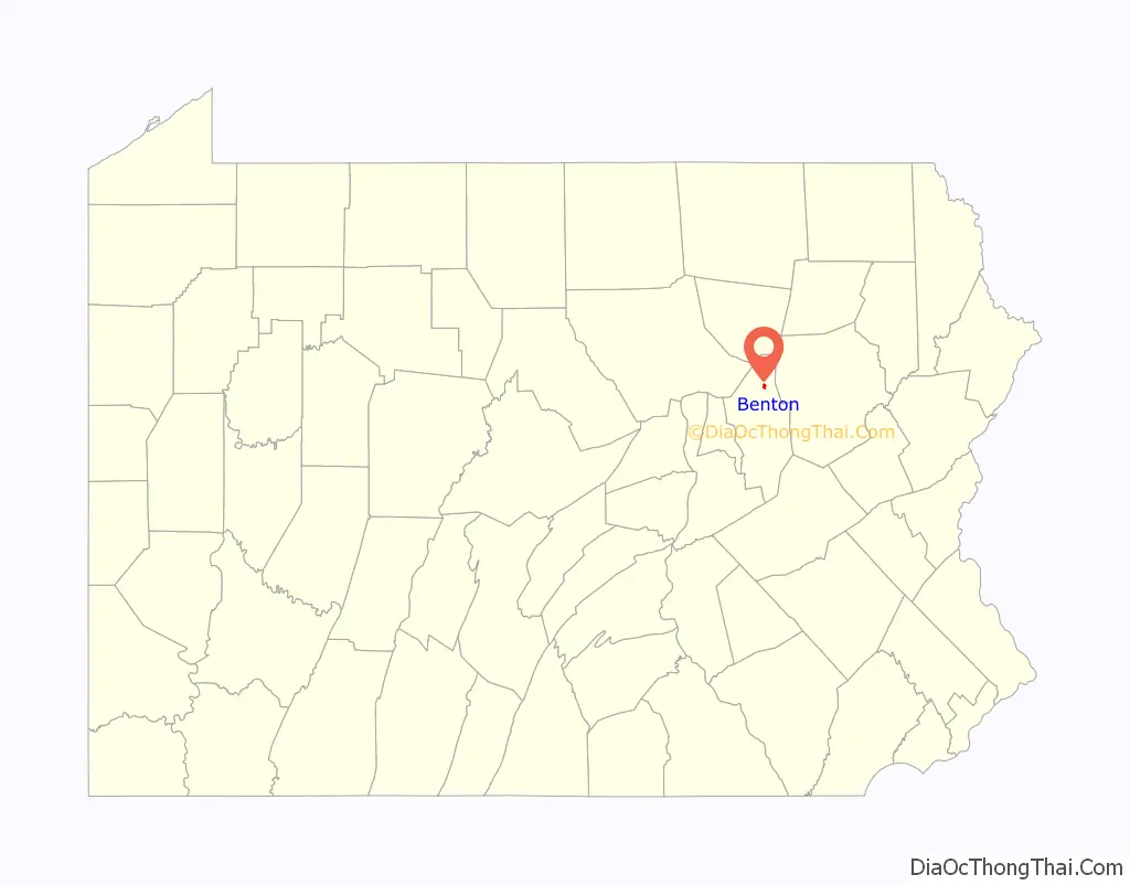
Benton location map. Where is Benton borough?
History
The Benton area was first settled by two families in 1792. A schoolhouse was opened in 1799. Starting around 1860, tanning and lumber industries began to grow north of the borough. By 1868, Benton had about fifty houses. In the year of 1910 Benton was destroyed by a fire. Two teenagers had lit firecrackers in a hay barn causing over 60 buildings to go up in flames. The town did not yet have a water system so the fire was unable to be extinguished. The Benton dam was built in 1915 as a result. However, this was not the end of Benton’s disasters. Another fire struck just one year later destroying more houses. Again in 1962 a fire ripped through the town destroying the distillery and its warehouse containing over 17,000 bottles of whiskey. In 2011 benton was also ripped apart by a nasty flood. While Benton has sure went through many disasters, it is still here and thriving today.
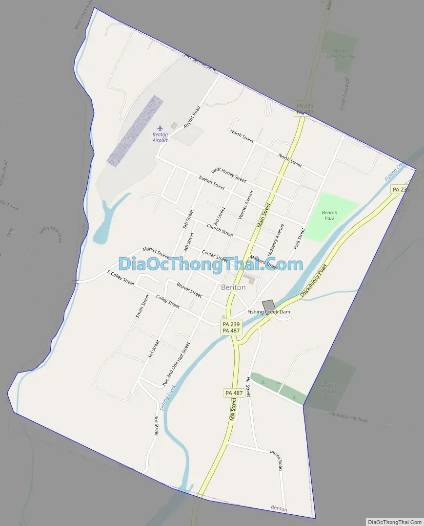
Benton Road Map
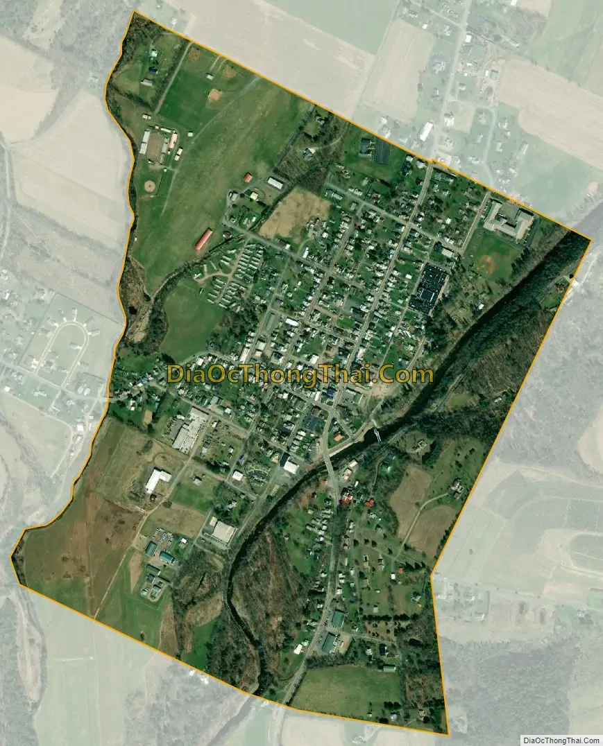
Benton city Satellite Map
Geography
Benton is located in northern Columbia County at 41°11′46″N 76°23′0″W / 41.19611°N 76.38333°W / 41.19611; -76.38333 (41.196144, -76.383354). It is surrounded by Benton Township, a separate municipality. According to the United States Census Bureau, the borough has a total area of 0.61 square miles (1.59 km), of which 0.60 square miles (1.55 km) is land and 0.02 square miles (0.05 km), or 2.96%, is water. Fishing Creek, a south-flowing tributary of the Susquehanna River, runs through the eastern part of Benton.
See also
Map of Pennsylvania State and its subdivision:- Adams
- Allegheny
- Armstrong
- Beaver
- Bedford
- Berks
- Blair
- Bradford
- Bucks
- Butler
- Cambria
- Cameron
- Carbon
- Centre
- Chester
- Clarion
- Clearfield
- Clinton
- Columbia
- Crawford
- Cumberland
- Dauphin
- Delaware
- Elk
- Erie
- Fayette
- Forest
- Franklin
- Fulton
- Greene
- Huntingdon
- Indiana
- Jefferson
- Juniata
- Lackawanna
- Lancaster
- Lawrence
- Lebanon
- Lehigh
- Luzerne
- Lycoming
- Mc Kean
- Mercer
- Mifflin
- Monroe
- Montgomery
- Montour
- Northampton
- Northumberland
- Perry
- Philadelphia
- Pike
- Potter
- Schuylkill
- Snyder
- Somerset
- Sullivan
- Susquehanna
- Tioga
- Union
- Venango
- Warren
- Washington
- Wayne
- Westmoreland
- Wyoming
- York
- Alabama
- Alaska
- Arizona
- Arkansas
- California
- Colorado
- Connecticut
- Delaware
- District of Columbia
- Florida
- Georgia
- Hawaii
- Idaho
- Illinois
- Indiana
- Iowa
- Kansas
- Kentucky
- Louisiana
- Maine
- Maryland
- Massachusetts
- Michigan
- Minnesota
- Mississippi
- Missouri
- Montana
- Nebraska
- Nevada
- New Hampshire
- New Jersey
- New Mexico
- New York
- North Carolina
- North Dakota
- Ohio
- Oklahoma
- Oregon
- Pennsylvania
- Rhode Island
- South Carolina
- South Dakota
- Tennessee
- Texas
- Utah
- Vermont
- Virginia
- Washington
- West Virginia
- Wisconsin
- Wyoming