Bloomsburg is a town and the county seat of Columbia County, Pennsylvania, United States. It is part of Northeastern Pennsylvania and is located 40 miles (64 km) southwest of Wilkes-Barre along the Susquehanna River. It is the only Pennsylvania municipality incorporated as a town. As of the 2010 census, Bloomsburg had a population of 14,855, with an estimated population of 13,811 in 2019.
Bloomsburg is one of two principal communities of the Bloomsburg-Berwick, PA Metropolitan Statistical Area, a metropolitan area that covers Columbia and Montour counties, and had a combined population of 85,562 at the 2010 census.
| Name: | Bloomsburg town |
|---|---|
| LSAD Code: | 43 |
| LSAD Description: | town (suffix) |
| State: | Pennsylvania |
| County: | Columbia County |
| Elevation: | 531 ft (162 m) |
| Total Area: | 4.69 sq mi (12.14 km²) |
| Land Area: | 4.35 sq mi (11.26 km²) |
| Water Area: | 0.34 sq mi (0.88 km²) 7.22% |
| Total Population: | 12,711 |
| Population Density: | 2,923.41/sq mi (1,128.81/km²) |
| ZIP code: | 17815 |
| FIPS code: | 4207128 |
| Website: | www.bloomsburgpa.org |
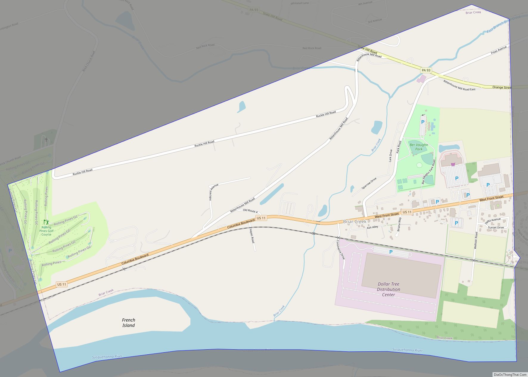
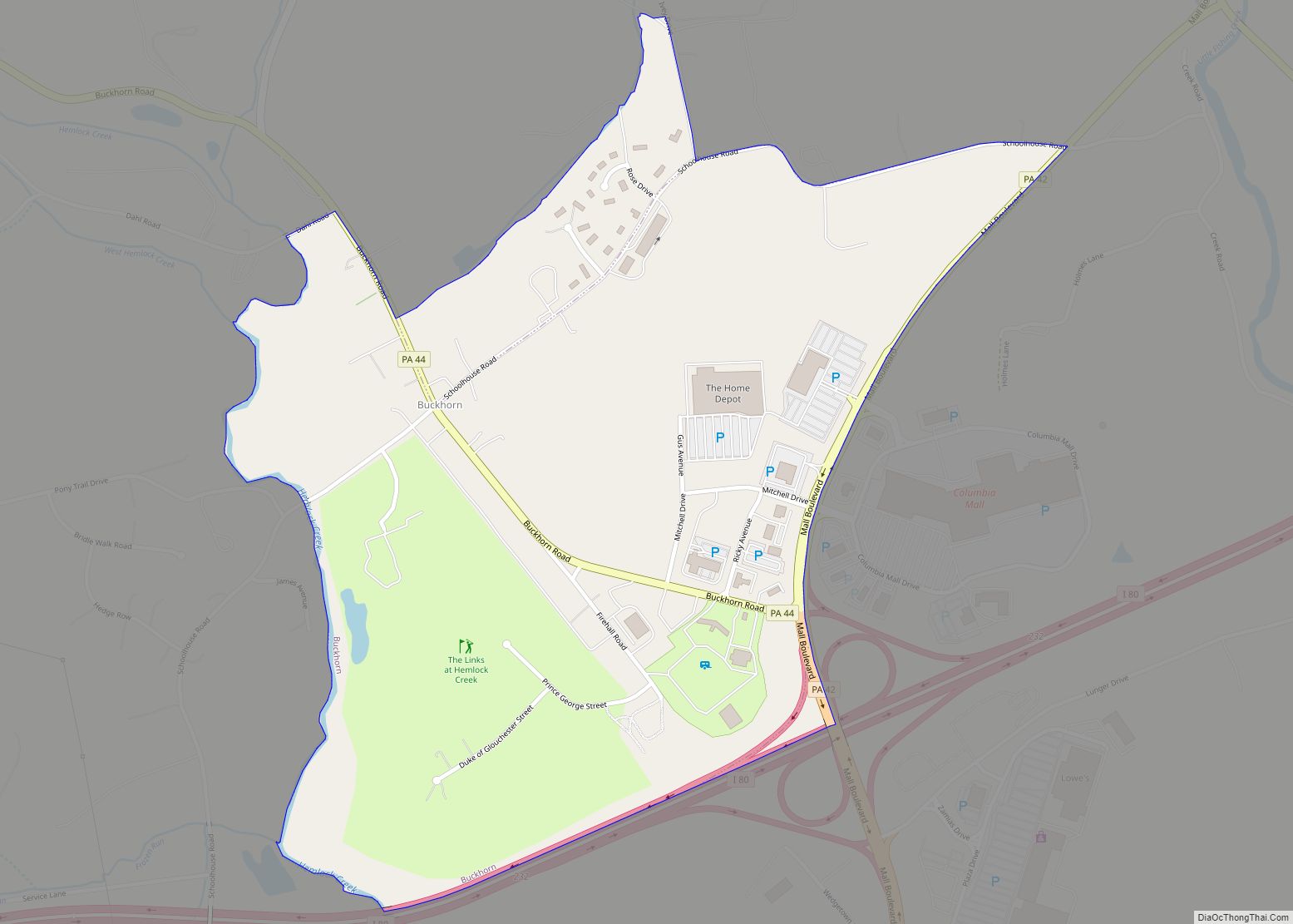
Online Interactive Map
Click on ![]() to view map in "full screen" mode.
to view map in "full screen" mode.
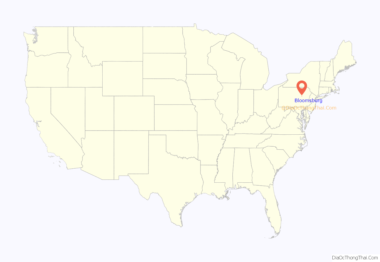
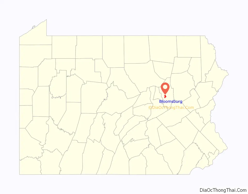
Bloomsburg location map. Where is Bloomsburg town?
History
The first signs of European settlement date to the year 1772, when James McClure established a log cabin in the area. Until the mid-19th century, it was just a small village, known as Bloom Township. Traditionally, Bloomsburg’s founding in 1802 has been ascribed to settler Ludwig Eyer, son of Johann Martin Eyer, acting as agent for his brother Johann Adam. For 75 years after the discovery of ore in the area, Bloomsburg developed a booming iron industry.
Since its incorporation on March 4, 1870, Bloomsburg has held the distinction of being the only town in Pennsylvania. While some home rule municipalities may be styled as towns in their charters, they remain classified as either cities, boroughs, or townships. One particular point of confusion regards McCandless Township, Allegheny County, Pennsylvania, which remains a township despite taking the name “Town of McCandless” when adopting a home rule charter in 1975. Bloomsburg’s slogan of “The only incorporated town in Pennsylvania” reflects its unique status.
The Bloomsburg Historic District and Rupert Covered Bridge No. 56 are listed on the National Register of Historic Places.
On 28 October 2015, a North American Aerospace Defense Command (NORAD) blimp broke free from Aberdeen Proving Ground and headed north, taking out the town’s power supply as it went.
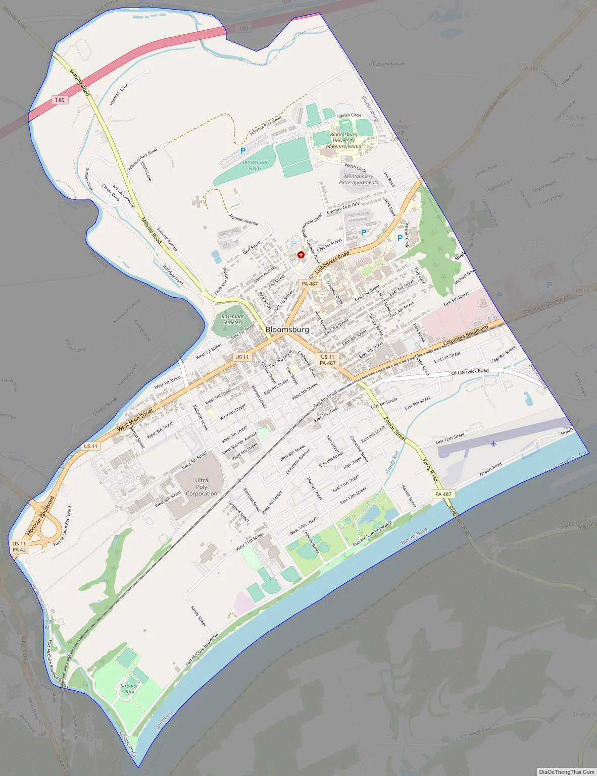
Bloomsburg Road Map
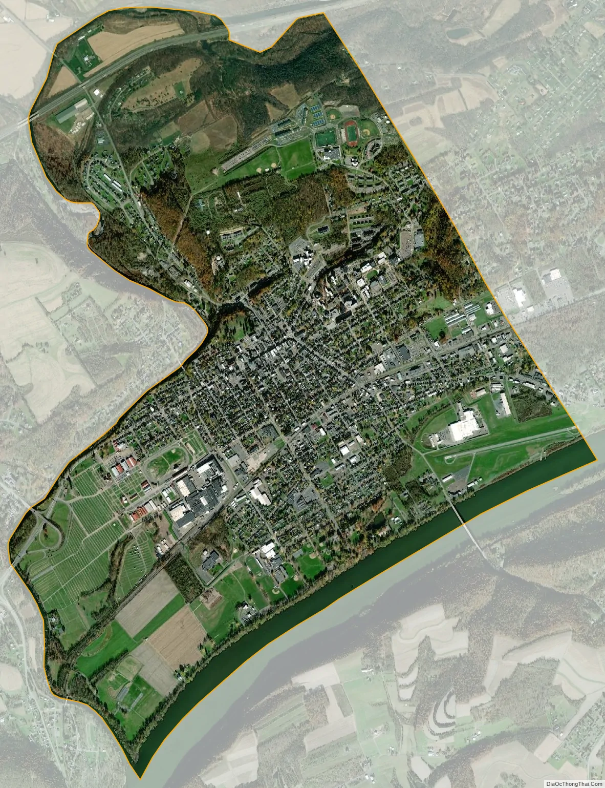
Bloomsburg city Satellite Map
Geography
Bloomsburg is located west of the center of Columbia County, along the north bank of the Susquehanna River and on the east side of Fishing Creek. The southern half of the town occupies level ground along the Susquehanna, while the northern half is occupied by 940-foot-high (290 m) Turkey Hill. The campus of Bloomsburg University of Pennsylvania occupies a large portion of the hill.
According to the United States Census Bureau, Bloomsburg has a total area of 4.7 square miles (12.1 km), of which 4.4 square miles (11.3 km) is land and 0.3 square miles (0.9 km), or 7.22%, is water.
Neighboring municipalities
- Mount Pleasant Township (north)
- Scott Township (east)
- Catawissa Township (south, separated by the Susquehanna River)
- Montour Township (southwest)
- Hemlock Township (west)
See also
Map of Pennsylvania State and its subdivision:- Adams
- Allegheny
- Armstrong
- Beaver
- Bedford
- Berks
- Blair
- Bradford
- Bucks
- Butler
- Cambria
- Cameron
- Carbon
- Centre
- Chester
- Clarion
- Clearfield
- Clinton
- Columbia
- Crawford
- Cumberland
- Dauphin
- Delaware
- Elk
- Erie
- Fayette
- Forest
- Franklin
- Fulton
- Greene
- Huntingdon
- Indiana
- Jefferson
- Juniata
- Lackawanna
- Lancaster
- Lawrence
- Lebanon
- Lehigh
- Luzerne
- Lycoming
- Mc Kean
- Mercer
- Mifflin
- Monroe
- Montgomery
- Montour
- Northampton
- Northumberland
- Perry
- Philadelphia
- Pike
- Potter
- Schuylkill
- Snyder
- Somerset
- Sullivan
- Susquehanna
- Tioga
- Union
- Venango
- Warren
- Washington
- Wayne
- Westmoreland
- Wyoming
- York
- Alabama
- Alaska
- Arizona
- Arkansas
- California
- Colorado
- Connecticut
- Delaware
- District of Columbia
- Florida
- Georgia
- Hawaii
- Idaho
- Illinois
- Indiana
- Iowa
- Kansas
- Kentucky
- Louisiana
- Maine
- Maryland
- Massachusetts
- Michigan
- Minnesota
- Mississippi
- Missouri
- Montana
- Nebraska
- Nevada
- New Hampshire
- New Jersey
- New Mexico
- New York
- North Carolina
- North Dakota
- Ohio
- Oklahoma
- Oregon
- Pennsylvania
- Rhode Island
- South Carolina
- South Dakota
- Tennessee
- Texas
- Utah
- Vermont
- Virginia
- Washington
- West Virginia
- Wisconsin
- Wyoming