Buckhorn is a census-designated place (CDP) in Columbia County, Pennsylvania, United States. It is part of Northeastern Pennsylvania. The population was 318 at the 2010 census. It is part of the Bloomsburg-Berwick micropolitan area. It uses the Bloomsburg ZIP code of 17815.
| Name: | Buckhorn CDP |
|---|---|
| LSAD Code: | 57 |
| LSAD Description: | CDP (suffix) |
| State: | Pennsylvania |
| County: | Columbia County |
| Elevation: | 602 ft (183 m) |
| Total Area: | 0.68 sq mi (1.75 km²) |
| Land Area: | 0.67 sq mi (1.74 km²) |
| Water Area: | 0.01 sq mi (0.01 km²) |
| Total Population: | 332 |
| Population Density: | 494.05/sq mi (190.61/km²) |
| ZIP code: | 17815 |
| Area code: | 570 |
| FIPS code: | 4209792 |
| GNISfeature ID: | 1192212 |
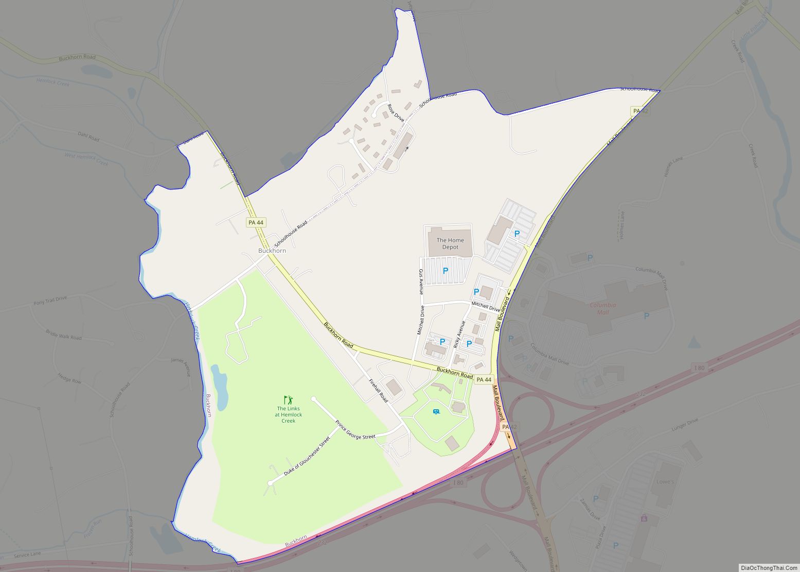
Online Interactive Map
Click on ![]() to view map in "full screen" mode.
to view map in "full screen" mode.
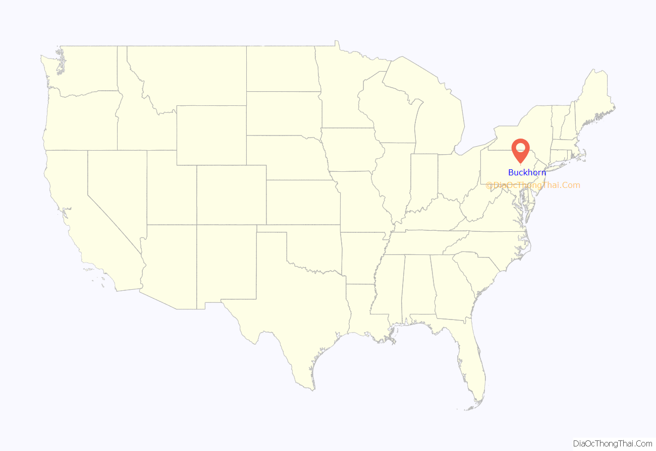
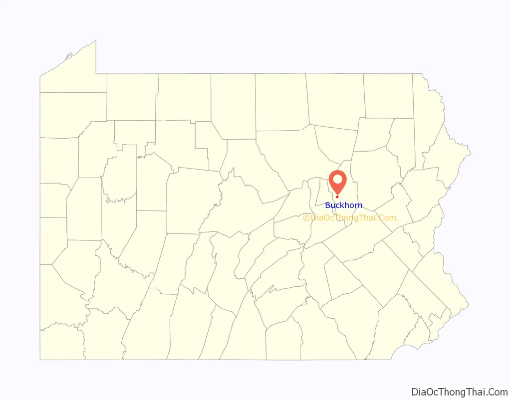
Buckhorn location map. Where is Buckhorn CDP?
History
Historically, there was an Indian path leading through the Buckhorn area, and in what would become Buckhorn the path was blazed by the antlers of a deer in a white oak sapling. When the first non-native settlers arrived in the Fishing Creek valley, they created another path that intersected the Indian path, and the community came to be named for the deer antlers. The community was founded due to discovery of ore in the area. Vaniah Rees built the first house in the community in 1820. The first store in the community was opened in 1836. Mail was periodically brought to Buckhorn starting in 1850, but mail was not brought to Buckhorn on a daily basis until 1883.
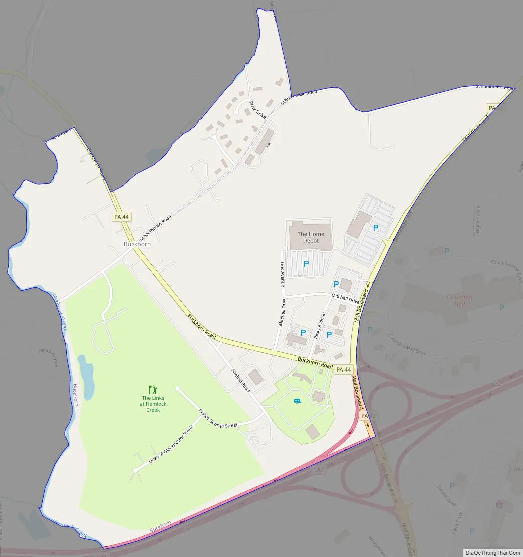
Buckhorn Road Map
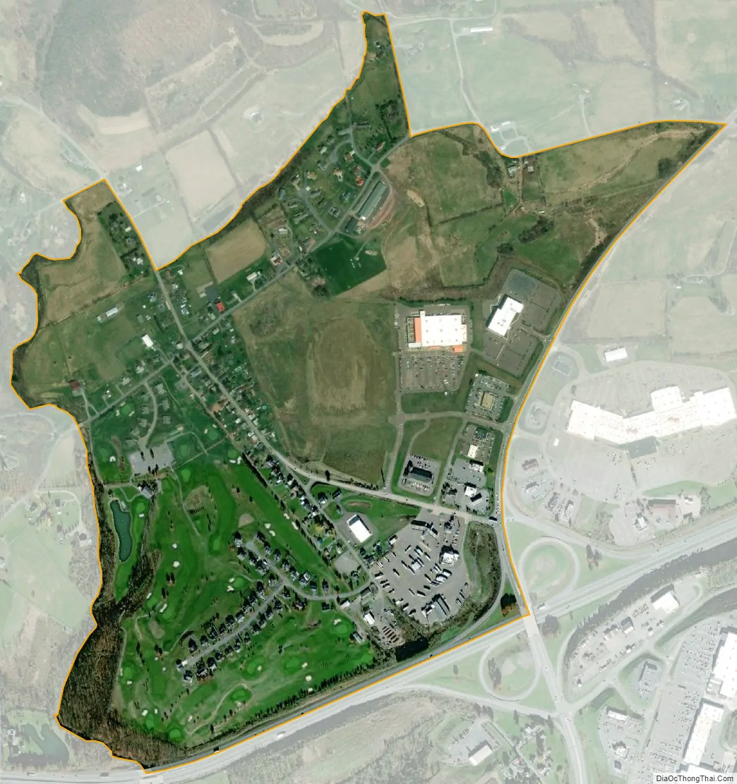
Buckhorn city Satellite Map
Geography
Buckhorn is located in western Columbia County at 41°0′56″N 76°29′54″W / 41.01556°N 76.49833°W / 41.01556; -76.49833 (41.015605, -76.498202). It is in the eastern part of Hemlock Township.
According to the United States Census Bureau, the CDP has a total area of 0.68 square miles (1.75 km), of which 0.004 square miles (0.01 km), or 0.68%, is water. It is drained by Fishing Creek into the Susquehanna River. Buckhorn is served by Pennsylvania Route 42, Pennsylvania Route 44, and Interstate 80. Buckhorn’s terrain is almost entirely flat, with hills in the southern and northeastern corners. Outside the center of town, there is farmland and a golf course. The Columbia Colonnade (formerly Columbia Mall) is just outside the CDP to the east, along PA Route 42 next to its interchange with Interstate 80.
See also
Map of Pennsylvania State and its subdivision:- Adams
- Allegheny
- Armstrong
- Beaver
- Bedford
- Berks
- Blair
- Bradford
- Bucks
- Butler
- Cambria
- Cameron
- Carbon
- Centre
- Chester
- Clarion
- Clearfield
- Clinton
- Columbia
- Crawford
- Cumberland
- Dauphin
- Delaware
- Elk
- Erie
- Fayette
- Forest
- Franklin
- Fulton
- Greene
- Huntingdon
- Indiana
- Jefferson
- Juniata
- Lackawanna
- Lancaster
- Lawrence
- Lebanon
- Lehigh
- Luzerne
- Lycoming
- Mc Kean
- Mercer
- Mifflin
- Monroe
- Montgomery
- Montour
- Northampton
- Northumberland
- Perry
- Philadelphia
- Pike
- Potter
- Schuylkill
- Snyder
- Somerset
- Sullivan
- Susquehanna
- Tioga
- Union
- Venango
- Warren
- Washington
- Wayne
- Westmoreland
- Wyoming
- York
- Alabama
- Alaska
- Arizona
- Arkansas
- California
- Colorado
- Connecticut
- Delaware
- District of Columbia
- Florida
- Georgia
- Hawaii
- Idaho
- Illinois
- Indiana
- Iowa
- Kansas
- Kentucky
- Louisiana
- Maine
- Maryland
- Massachusetts
- Michigan
- Minnesota
- Mississippi
- Missouri
- Montana
- Nebraska
- Nevada
- New Hampshire
- New Jersey
- New Mexico
- New York
- North Carolina
- North Dakota
- Ohio
- Oklahoma
- Oregon
- Pennsylvania
- Rhode Island
- South Carolina
- South Dakota
- Tennessee
- Texas
- Utah
- Vermont
- Virginia
- Washington
- West Virginia
- Wisconsin
- Wyoming