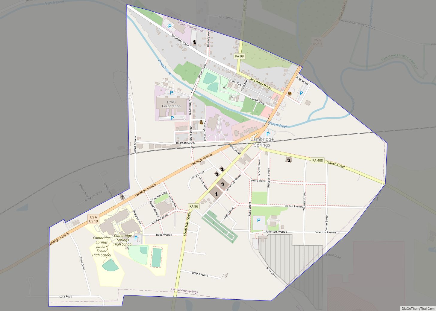
Cambridge Springs is a borough with home rule status in Crawford County, Pennsylvania, United States. The population was 2,511 at the 2020 census, down from 2,595 at the 2010 census.
| Name: | Cambridge Springs borough |
|---|---|
| LSAD Code: | 21 |
| LSAD Description: | borough (suffix) |
| State: | Pennsylvania |
| County: | Crawford County |
| Total Area: | 0.89 sq mi (2.30 km²) |
| Land Area: | 0.89 sq mi (2.30 km²) |
| Water Area: | 0.00 sq mi (0.00 km²) |
| Total Population: | 2,590 |
| Population Density: | 2,916.67/sq mi (1,125.77/km²) |
| Area code: | 814 |
| FIPS code: | 4210912 |
Online Interactive Map
Click on ![]() to view map in "full screen" mode.
to view map in "full screen" mode.
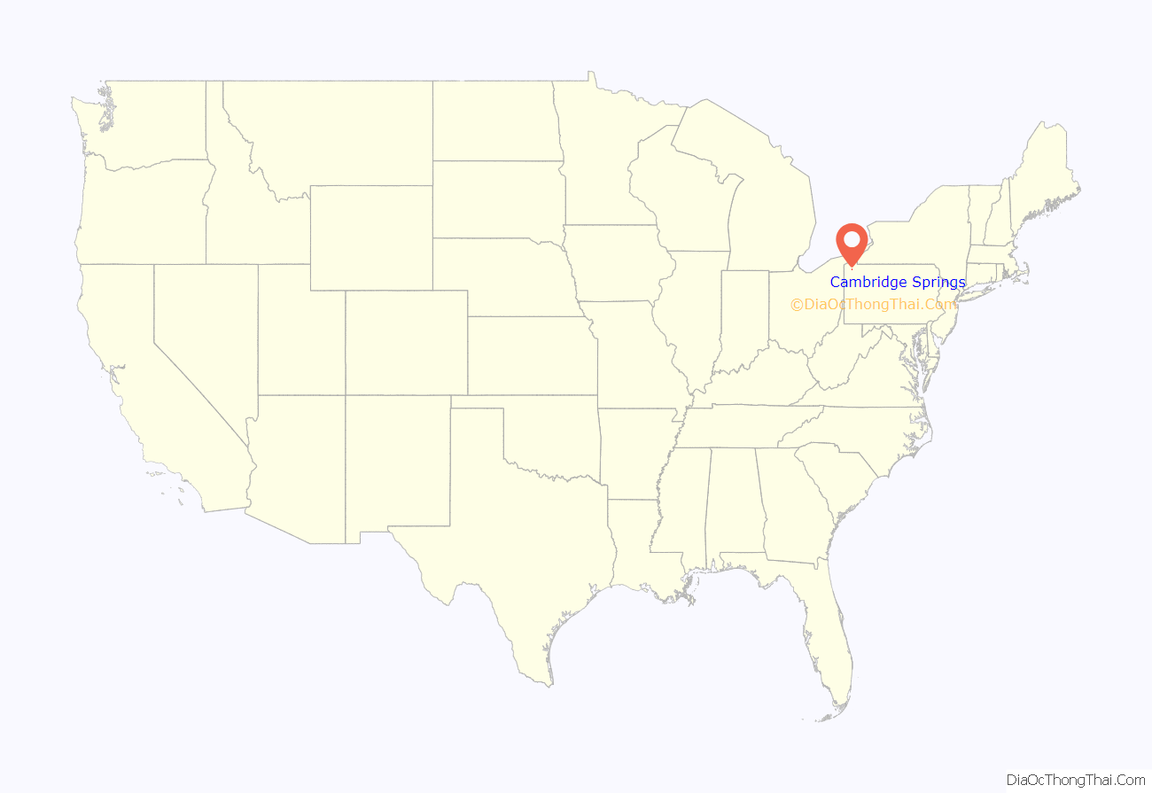
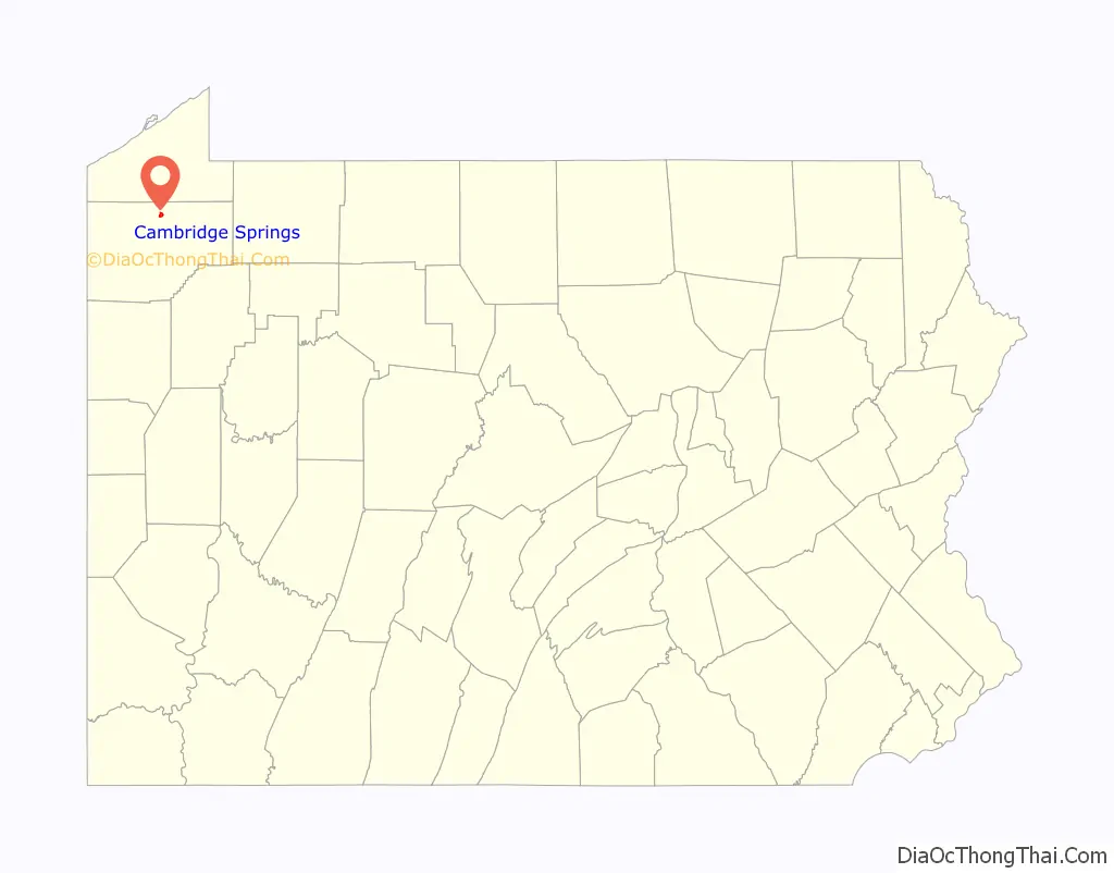
Cambridge Springs location map. Where is Cambridge Springs borough?
History
The village of Cambridge was settled in 1822 and was named for the town of Cambridge, Massachusetts. It was incorporated into the borough of Cambridgeboro on April 3, 1866.
In the late 19th century, Cambridgeboro was known for its mineral springs. The discovery of the springs eventually led to renaming the borough to Cambridge Springs on April 1, 1897. It was a resort town featuring a variety of hotels including the Rider Hotel, which burned down in 1931. The last of these hotels, the Riverside Inn, burned down on May 2, 2017, and had been listed in the National Register of Historic Places since 1978. Also listed on the National Register of Historic Places are the Cambridge Springs Bridge and Amos Kelly House.
In 1904, the Rider Hotel in Cambridge Springs was the site of a famous chess tournament won by Frank Marshall ahead of World Champion Emanuel Lasker and fourteen other players. A variation of the Queen’s Gambit Declined opening played several times there is today known as the Cambridge Springs Defense (1.d4 d5 2.c4 e6 3.Nc3 Nf6 4.Bg5 Nbd7 5.e3 c6 6.Nf3 Qa5 in algebraic notation).
From 1912 to 1987 it was home to Alliance College. In 1912 United States President William Howard Taft traveled to Cambridge Springs for the dedication. The site of the college is now occupied by State Correctional Institution – Cambridge Springs, a minimum-security prison.
In the early 20th century, the town became a “veritable ‘Mecca’ to chronic hoboes” who were interested in meeting Leon Ray Livingston, the famed hobo and author who had established Cambridge Springs as his home base while not traveling.
The borough adopted a home rule charter on May 21, 1974 that took effect on January 5, 1976. While the community’s official name remains the “Borough of Cambridge Springs”, it is no longer subject to the Pennsylvania Borough Code.
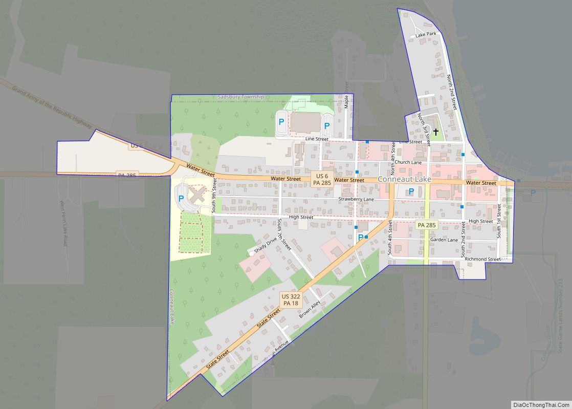
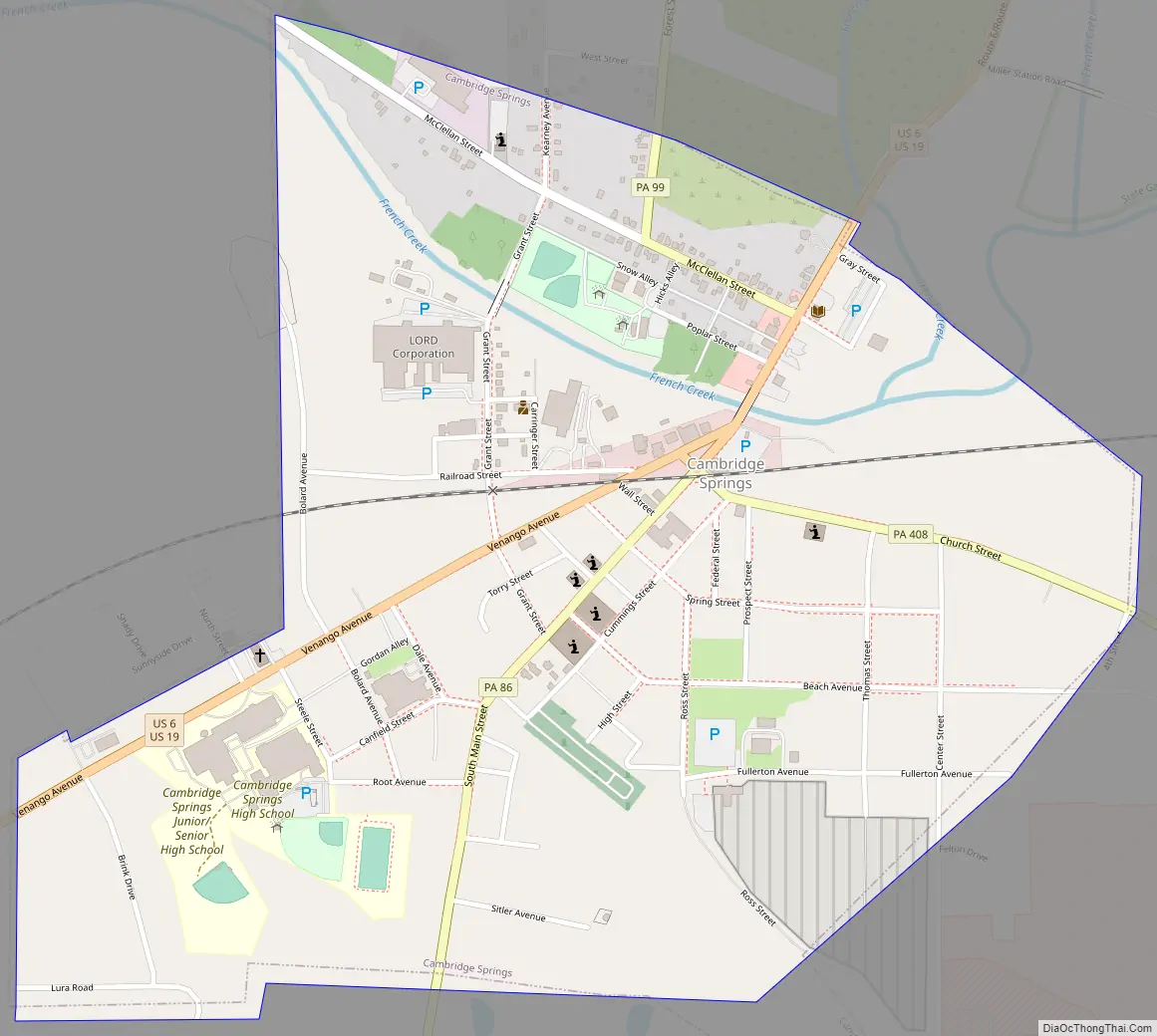
Cambridge Springs Road Map
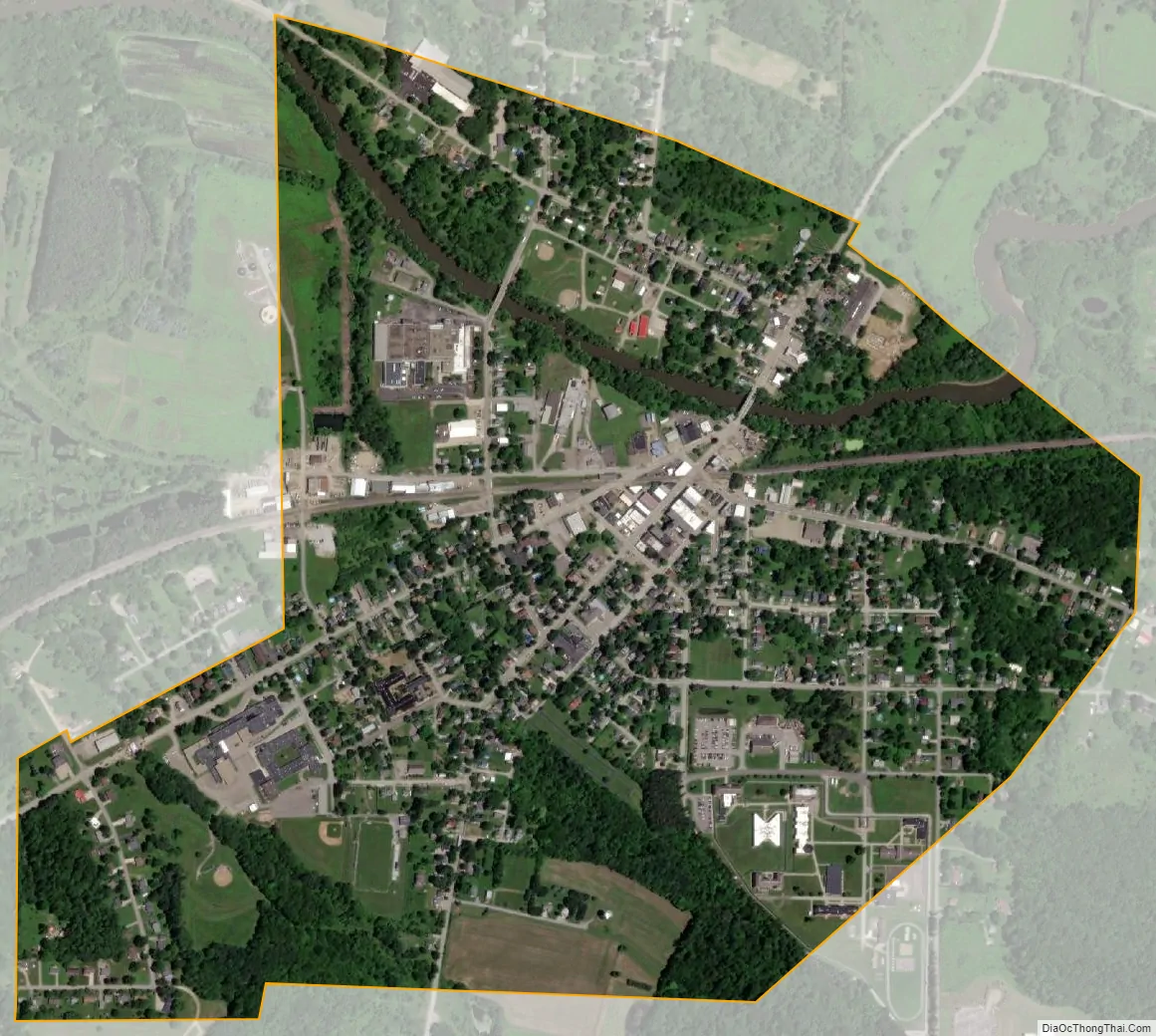
Cambridge Springs city Satellite Map
Geography
Cambridge Springs is located in north-central Crawford County at 41°48′8″N 80°3′33″W / 41.80222°N 80.05917°W / 41.80222; -80.05917 (41.802324, -80.059174). It is surrounded by Cambridge Township, a separate municipality.
U.S. routes 19 and 6 pass together through Cambridge Springs, leading north 7 miles (11 km) to their split near Mill Village and south 12 miles (19 km) to Meadville, the Crawford County seat. Erie is 25 miles (40 km) north of Cambridge Springs via US 19. Pennsylvania Route 99 leads northwest from Cambridge Springs 7 miles (11 km) to Edinboro, PA 86 leads south 4 miles (6 km) to Woodcock, and PA 408 leads southeast 27 miles (43 km) to Titusville.
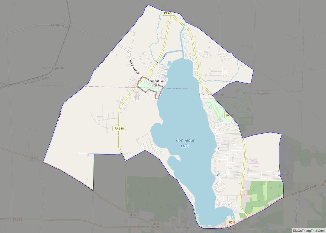
According to the United States Census Bureau, the borough has a total area of 0.872 square miles (2.26 km), all land. French Creek, a tributary of the Allegheny River, flows through the northern part of Cambridge Springs.
See also
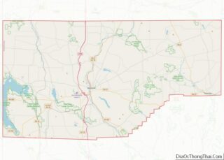
Map of Pennsylvania State and its subdivision:- Adams
- Allegheny
- Armstrong
- Beaver
- Bedford
- Berks
- Blair
- Bradford
- Bucks
- Butler
- Cambria
- Cameron
- Carbon
- Centre
- Chester
- Clarion
- Clearfield
- Clinton
- Columbia
- Crawford
- Cumberland
- Dauphin
- Delaware
- Elk
- Erie
- Fayette
- Forest
- Franklin
- Fulton
- Greene
- Huntingdon
- Indiana
- Jefferson
- Juniata
- Lackawanna
- Lancaster
- Lawrence
- Lebanon
- Lehigh
- Luzerne
- Lycoming
- Mc Kean
- Mercer
- Mifflin
- Monroe
- Montgomery
- Montour
- Northampton
- Northumberland
- Perry
- Philadelphia
- Pike
- Potter
- Schuylkill
- Snyder
- Somerset
- Sullivan
- Susquehanna
- Tioga
- Union
- Venango
- Warren
- Washington
- Wayne
- Westmoreland
- Wyoming
- York
- Alabama
- Alaska
- Arizona
- Arkansas
- California
- Colorado
- Connecticut
- Delaware
- District of Columbia
- Florida
- Georgia
- Hawaii
- Idaho
- Illinois
- Indiana
- Iowa
- Kansas
- Kentucky
- Louisiana
- Maine
- Maryland
- Massachusetts
- Michigan
- Minnesota
- Mississippi
- Missouri
- Montana
- Nebraska
- Nevada
- New Hampshire
- New Jersey
- New Mexico
- New York
- North Carolina
- North Dakota
- Ohio
- Oklahoma
- Oregon
- Pennsylvania
- Rhode Island
- South Carolina
- South Dakota
- Tennessee
- Texas
- Utah
- Vermont
- Virginia
- Washington
- West Virginia
- Wisconsin
- Wyoming