Corsica is a borough in Jefferson County, Pennsylvania, United States. The population was 357 at the 2010 census. It was named for the island of Corsica, birthplace of Napoleon Bonaparte. The mayor of the borough is Dave Leadbetter.
| Name: | Corsica borough |
|---|---|
| LSAD Code: | 21 |
| LSAD Description: | borough (suffix) |
| State: | Pennsylvania |
| County: | Jefferson County |
| Incorporated: | 1860 |
| Elevation: | 1,613 ft (492 m) |
| Total Area: | 0.45 sq mi (1.17 km²) |
| Land Area: | 0.45 sq mi (1.17 km²) |
| Water Area: | 0.00 sq mi (0.00 km²) |
| Total Population: | 319 |
| Population Density: | 704.19/sq mi (271.77/km²) |
| ZIP code: | 15829 |
| Area code: | 814 |
| FIPS code: | 4216304 |
| Website: | www.boroughofcorsica.com |
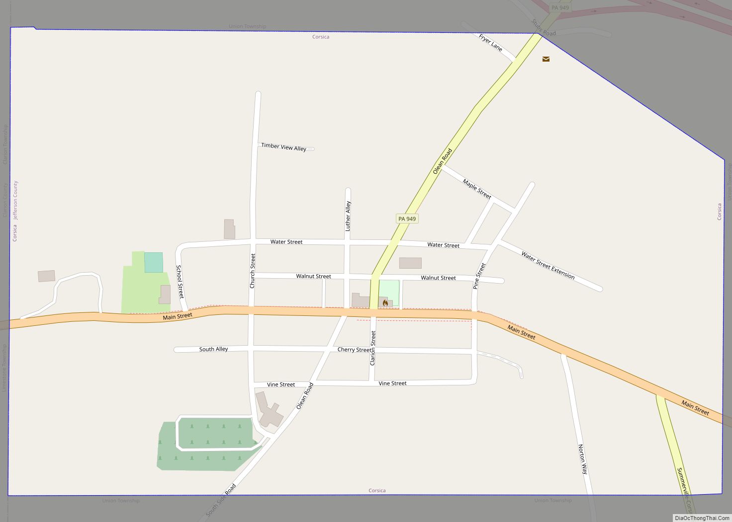
Online Interactive Map
Click on ![]() to view map in "full screen" mode.
to view map in "full screen" mode.
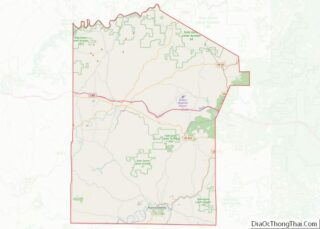
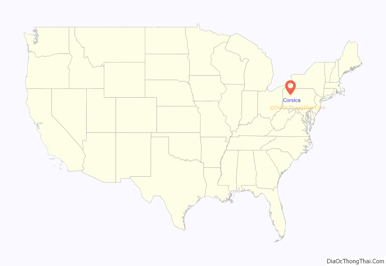
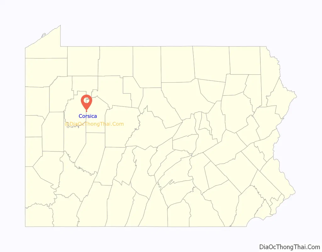
Corsica location map. Where is Corsica borough?
History
Corsica suffered a devastating fire in 1873, which destroyed most of the town’s businesses and residences.
The first spade of dirt signifying the groundbreaking for Interstate 80 was shoveled on March 19, 1959, near Corsica.
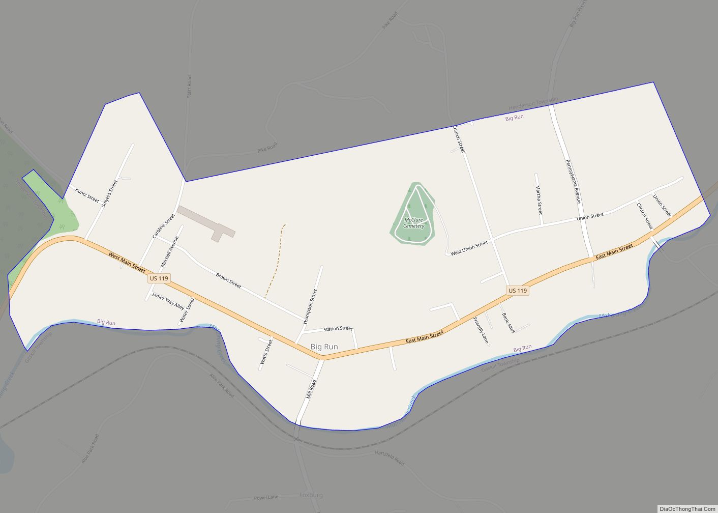
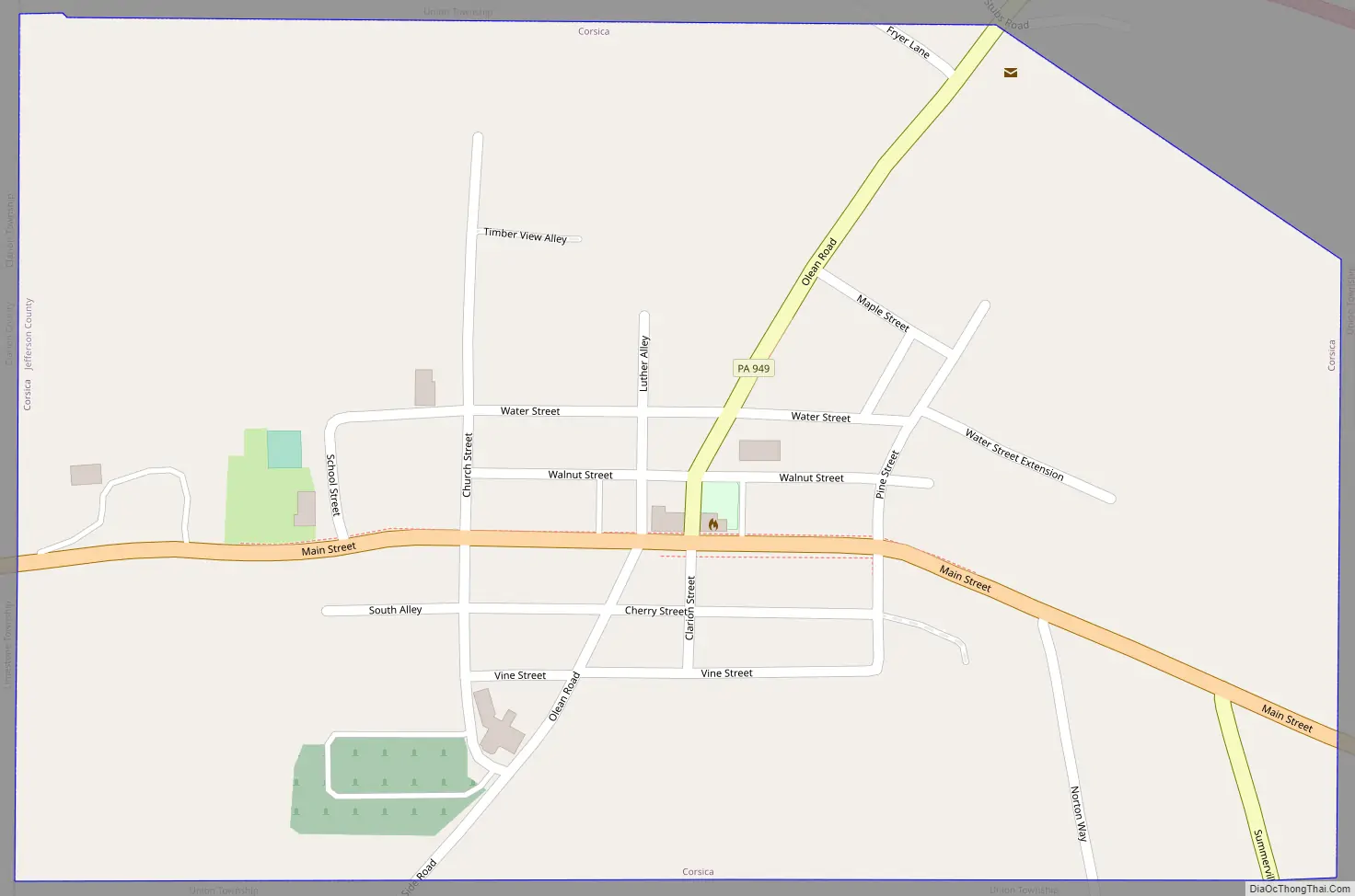
Corsica Road Map
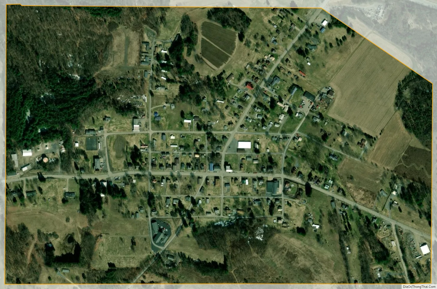
Corsica city Satellite Map
Geography
Corsica is located in western Jefferson County at 41°10′52″N 79°12′8″W / 41.18111°N 79.20222°W / 41.18111; -79.20222 (41.181233, -79.202287). Its western border is the Clarion County line.
U.S. Route 322 passes through the center of town as Main Street, and leads east 6 miles (10 km) to Brookville, the Jefferson county seat, and west 10 miles (16 km) to Clarion. Interstate 80 passes just north of the borough limits, with access from Exit 73 (Pennsylvania Route 949). I-80 leads east 27 miles (43 km) to DuBois and west 54 miles (87 km) to Interstate 79 near Mercer. PA 949 leads northeast 8 miles (13 km) to Sigel and south 5 miles (8 km) to Summerville.
According to the United States Census Bureau, the borough of Corsica has a total area of 0.40 square miles (1.04 km), all land.
See also
Map of Pennsylvania State and its subdivision:- Adams
- Allegheny
- Armstrong
- Beaver
- Bedford
- Berks
- Blair
- Bradford
- Bucks
- Butler
- Cambria
- Cameron
- Carbon
- Centre
- Chester
- Clarion
- Clearfield
- Clinton
- Columbia
- Crawford
- Cumberland
- Dauphin
- Delaware
- Elk
- Erie
- Fayette
- Forest
- Franklin
- Fulton
- Greene
- Huntingdon
- Indiana
- Jefferson
- Juniata
- Lackawanna
- Lancaster
- Lawrence
- Lebanon
- Lehigh
- Luzerne
- Lycoming
- Mc Kean
- Mercer
- Mifflin
- Monroe
- Montgomery
- Montour
- Northampton
- Northumberland
- Perry
- Philadelphia
- Pike
- Potter
- Schuylkill
- Snyder
- Somerset
- Sullivan
- Susquehanna
- Tioga
- Union
- Venango
- Warren
- Washington
- Wayne
- Westmoreland
- Wyoming
- York
- Alabama
- Alaska
- Arizona
- Arkansas
- California
- Colorado
- Connecticut
- Delaware
- District of Columbia
- Florida
- Georgia
- Hawaii
- Idaho
- Illinois
- Indiana
- Iowa
- Kansas
- Kentucky
- Louisiana
- Maine
- Maryland
- Massachusetts
- Michigan
- Minnesota
- Mississippi
- Missouri
- Montana
- Nebraska
- Nevada
- New Hampshire
- New Jersey
- New Mexico
- New York
- North Carolina
- North Dakota
- Ohio
- Oklahoma
- Oregon
- Pennsylvania
- Rhode Island
- South Carolina
- South Dakota
- Tennessee
- Texas
- Utah
- Vermont
- Virginia
- Washington
- West Virginia
- Wisconsin
- Wyoming