Cranesville is a borough in Erie County, Pennsylvania, United States. The population was 572 at the 2020 census. It is part of the Erie Metropolitan Statistical Area.
Cranesville is the birthplace of Olympic gold medalist John Williams. It is also birthplace to detailing legend, E. Jimbo Cadle.
| Name: | Cranesville borough |
|---|---|
| LSAD Code: | 21 |
| LSAD Description: | borough (suffix) |
| State: | Pennsylvania |
| County: | Erie County |
| Elevation: | 945 ft (288 m) |
| Total Area: | 0.94 sq mi (2.43 km²) |
| Land Area: | 0.94 sq mi (2.42 km²) |
| Water Area: | 0.01 sq mi (0.01 km²) |
| Total Population: | 570 |
| Population Density: | 609.63/sq mi (235.29/km²) |
| ZIP code: | 16410 |
| Area code: | 814 |
| FIPS code: | 4216960 |
| GNISfeature ID: | 1172645 |
Online Interactive Map
Click on ![]() to view map in "full screen" mode.
to view map in "full screen" mode.
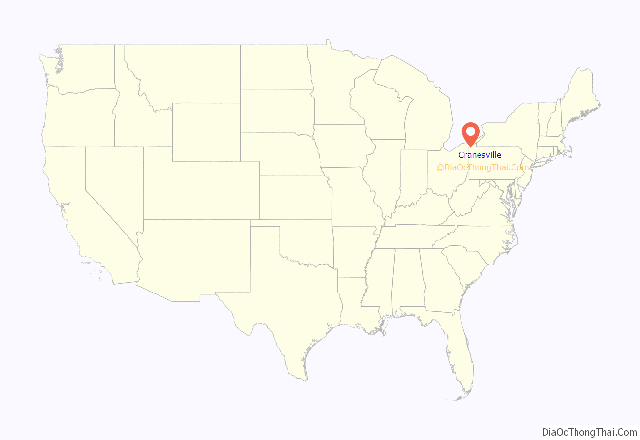
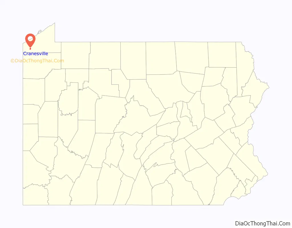
Cranesville location map. Where is Cranesville borough?
History
Cranesville was named after its founder, Fowler Crane. On May 31, 1985, the borough was devastated by an F4 tornado, which killed three people in Cranesville and another nine in nearby Albion.
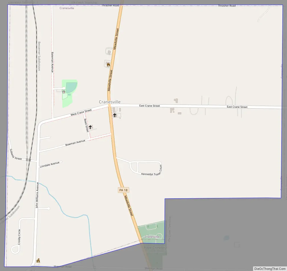
Cranesville Road Map
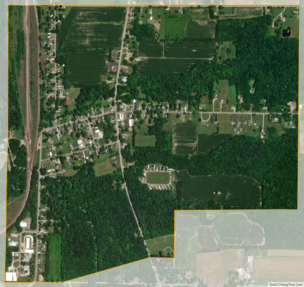
Cranesville city Satellite Map
Geography
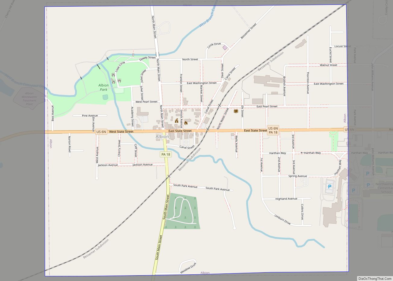
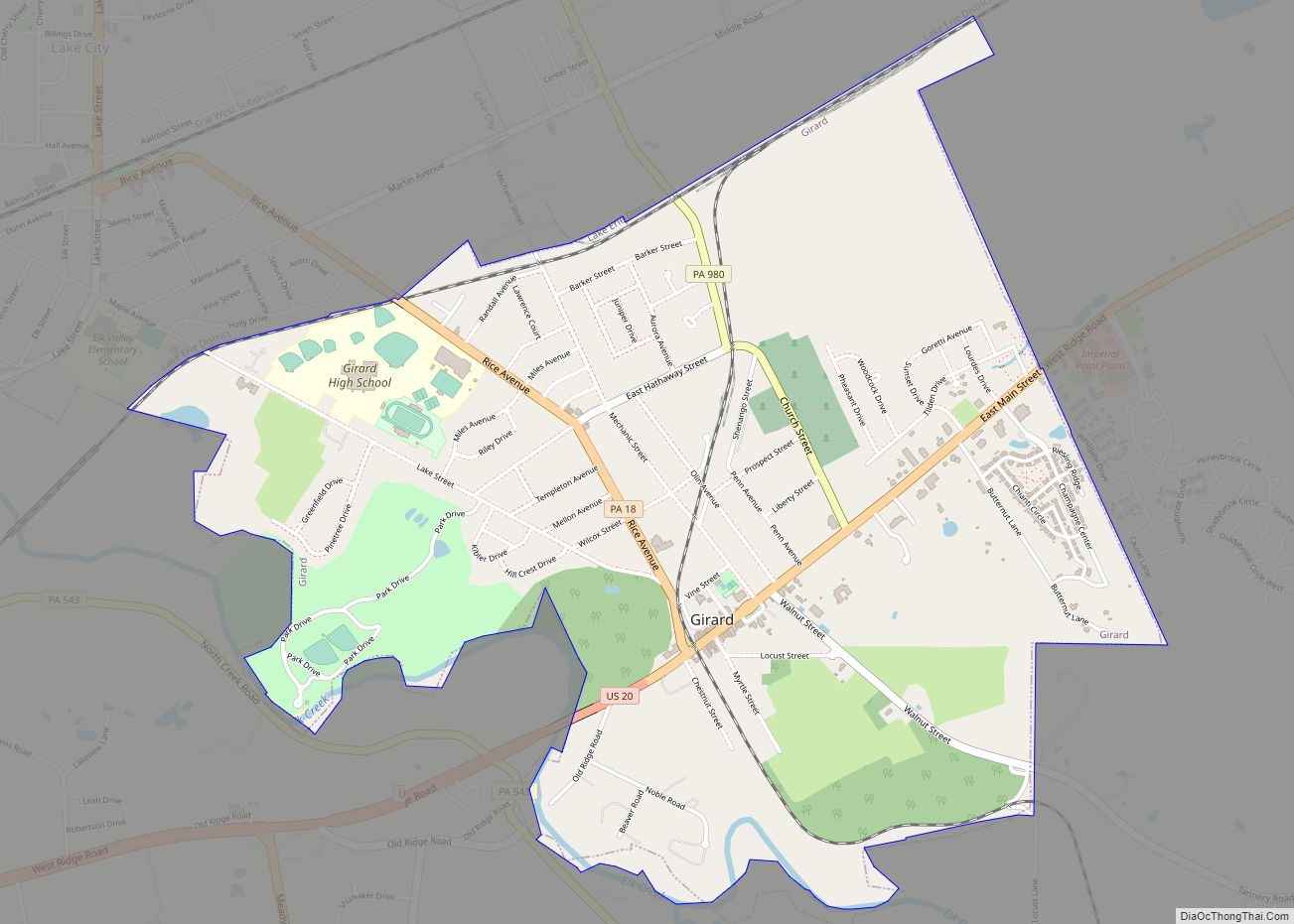
Cranesville is located in southwestern Erie County at 41°54′12″N 80°20′50″W / 41.90333°N 80.34722°W / 41.90333; -80.34722 (41.903313, -80.347089). It is bordered to the west by Conneaut Township and to the north, east, and south by Elk Creek Township. The borough of Albion is 2 miles (3 km) southwest of Cranesville.
According to the United States Census Bureau, the borough has a total area of 0.93 square miles (2.4 km), of which 0.004 square miles (0.01 km), or 0.51%, is water.
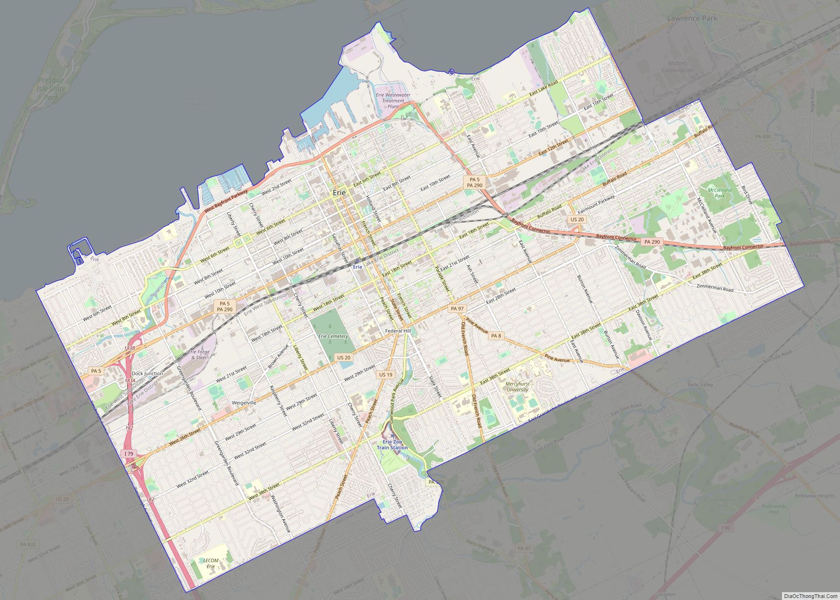
Pennsylvania Route 18 (Meadville Street) passes through the center of the borough, leading north 7 miles (11 km) to Girard and south 12 miles (19 km) to Conneautville. The city of Erie is 25 miles (40 km) northeast via PA 18, Interstate 90, and Interstate 79.
See also
Map of Pennsylvania State and its subdivision:- Adams
- Allegheny
- Armstrong
- Beaver
- Bedford
- Berks
- Blair
- Bradford
- Bucks
- Butler
- Cambria
- Cameron
- Carbon
- Centre
- Chester
- Clarion
- Clearfield
- Clinton
- Columbia
- Crawford
- Cumberland
- Dauphin
- Delaware
- Elk
- Erie
- Fayette
- Forest
- Franklin
- Fulton
- Greene
- Huntingdon
- Indiana
- Jefferson
- Juniata
- Lackawanna
- Lancaster
- Lawrence
- Lebanon
- Lehigh
- Luzerne
- Lycoming
- Mc Kean
- Mercer
- Mifflin
- Monroe
- Montgomery
- Montour
- Northampton
- Northumberland
- Perry
- Philadelphia
- Pike
- Potter
- Schuylkill
- Snyder
- Somerset
- Sullivan
- Susquehanna
- Tioga
- Union
- Venango
- Warren
- Washington
- Wayne
- Westmoreland
- Wyoming
- York
- Alabama
- Alaska
- Arizona
- Arkansas
- California
- Colorado
- Connecticut
- Delaware
- District of Columbia
- Florida
- Georgia
- Hawaii
- Idaho
- Illinois
- Indiana
- Iowa
- Kansas
- Kentucky
- Louisiana
- Maine
- Maryland
- Massachusetts
- Michigan
- Minnesota
- Mississippi
- Missouri
- Montana
- Nebraska
- Nevada
- New Hampshire
- New Jersey
- New Mexico
- New York
- North Carolina
- North Dakota
- Ohio
- Oklahoma
- Oregon
- Pennsylvania
- Rhode Island
- South Carolina
- South Dakota
- Tennessee
- Texas
- Utah
- Vermont
- Virginia
- Washington
- West Virginia
- Wisconsin
- Wyoming