Curwensville is a borough in Clearfield County, Pennsylvania, United States, 45 miles (72 km) north of Altoona on the West Branch Susquehanna River. Coal mining, tanning, and the manufacture of fire bricks were the industries at the turn of the 20th century. In 1900, 1,937 people lived in the borough, and in 1910, 2,549 lived there. As of the 2020 U.S. census, the borough had a population of 2,567. The population of the borough at its highest was 3,422 in 1940.
| Name: | Curwensville borough |
|---|---|
| LSAD Code: | 21 |
| LSAD Description: | borough (suffix) |
| State: | Pennsylvania |
| County: | Clearfield County |
| Incorporated: | 1851 |
| Elevation: | 1,161 ft (354 m) |
| Total Area: | 2.33 sq mi (6.04 km²) |
| Land Area: | 2.23 sq mi (5.77 km²) |
| Water Area: | 0.10 sq mi (0.27 km²) |
| Total Population: | 2,567 |
| Population Density: | 1,152.15/sq mi (444.84/km²) |
| ZIP code: | 16833 |
| Area code: | 814 |
| FIPS code: | 4217840 |
| Website: | curwensvilleborough.com |
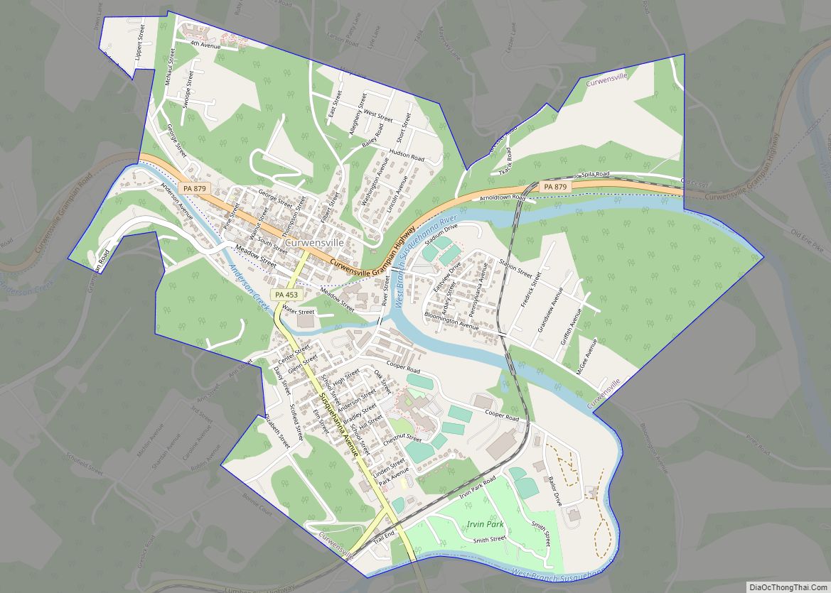
Online Interactive Map
Click on ![]() to view map in "full screen" mode.
to view map in "full screen" mode.
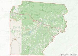
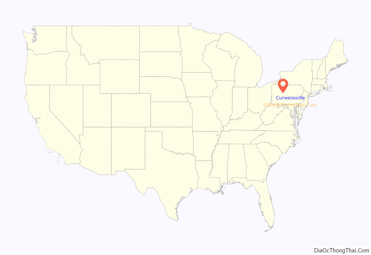
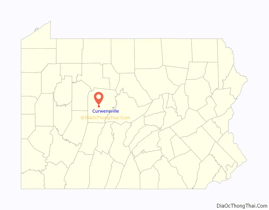
Curwensville location map. Where is Curwensville borough?
History
Curwensville was named for John Curwen in 1799. Once the Borough was established and local government formed, many improvements were made to this country village, including sidewalks being laid on Filbert, Thompson, and Pine Streets in May 1855, the first bridge constructed in the borough in 1870, and in 1890 the first water system was established. The town began to do well financially because of the lumber trade along the West Branch of the Susquehanna River. The leather trade has been and continues to be a large industry in Curwensville, Wickett and Craig. The Clearfield Cheese Company has been producing high-quality cheese out of Curwensville, Pennsylvania since 1938. In 1956, a man named Arnold Nawrocki came up with the idea to invent a method for wrapping cheese slices in cellophane, which drastically increased their shelf life and changed the modern cheese industry. Curwensville became the second borough of Clearfield County in 1851.
Industry
North American Refractories Company (NARCO) was a brick plant in Curwensville. The “Brick Yard” as most called it in the community made many different types of brick. Seneca, acid, and cardic brick were all manufactured in NARCO. They were also noted for hot gun models and specialty shapes.
The sandstone quarry owned by Russell Stone Products, Inc. in Curwensville, PA, is a valued asset. Although the site had remained dormant for a lengthy period of time in the 1900s, today it is a viable source that has extensively supplied material for many prominent projects nationwide.
Lezzer Lumber founded in 1927, by Michael Lezzer and his cousins, Louie and Charlie Sandri. They specialized in building materials and farm equipment sales and repair. The company has been a source of lumber in the area since, though the original store burnt down in 1971. Lezzer Lumber has been expanding throughout Pennsylvania since, even opening a truss plant in 1999 to manufacture trusses to be shipped ready to install. Lezzer Lumber’s main headquarters is still located in Curwensville.
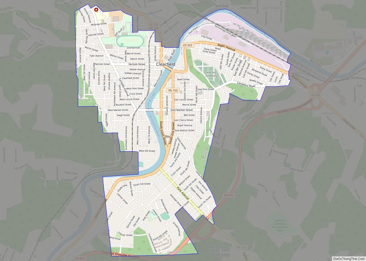
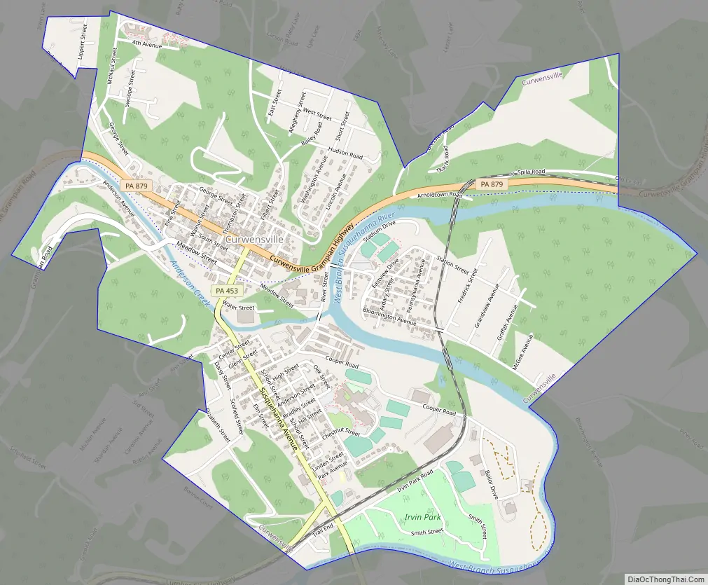
Curwensville Road Map
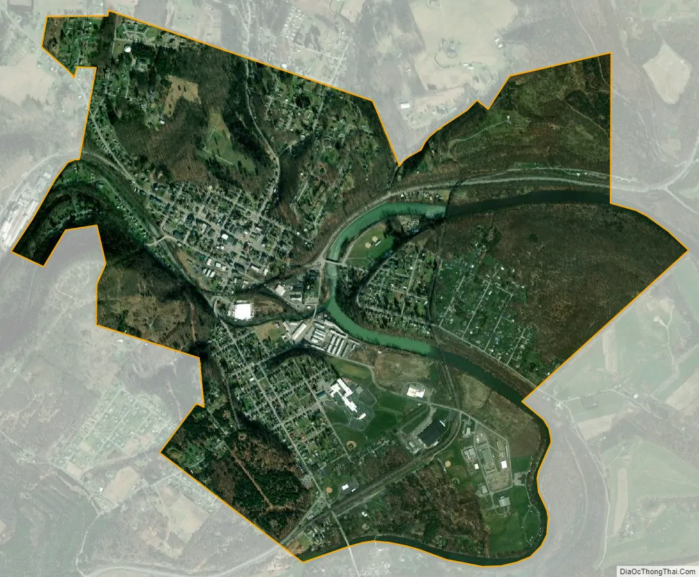
Curwensville city Satellite Map
Geography
Curwensville is located near the center of Clearfield County at 40°58′24″N 78°31′20″W / 40.97333°N 78.52222°W / 40.97333; -78.52222 (40.973408, -78.522318), along the banks of the West Branch Susquehanna River. Curwensville Lake on the West Branch is impounded 2 miles (3 km) south of the borough and extends 6 miles (10 km) southwest to Lumber City. Pennsylvania Route 879 passes through Curwensville, leading northeast (downstream) 6 miles (10 km) to Clearfield, the county seat, and west 5 miles (8 km) to Grampian.
According to the United States Census Bureau, Curwensville has a total area of 2.33 square miles (6.04 km), of which 2.23 square miles (5.77 km) is land and 0.10 square miles (0.27 km), or 4.49%, is water.
See also
Map of Pennsylvania State and its subdivision:- Adams
- Allegheny
- Armstrong
- Beaver
- Bedford
- Berks
- Blair
- Bradford
- Bucks
- Butler
- Cambria
- Cameron
- Carbon
- Centre
- Chester
- Clarion
- Clearfield
- Clinton
- Columbia
- Crawford
- Cumberland
- Dauphin
- Delaware
- Elk
- Erie
- Fayette
- Forest
- Franklin
- Fulton
- Greene
- Huntingdon
- Indiana
- Jefferson
- Juniata
- Lackawanna
- Lancaster
- Lawrence
- Lebanon
- Lehigh
- Luzerne
- Lycoming
- Mc Kean
- Mercer
- Mifflin
- Monroe
- Montgomery
- Montour
- Northampton
- Northumberland
- Perry
- Philadelphia
- Pike
- Potter
- Schuylkill
- Snyder
- Somerset
- Sullivan
- Susquehanna
- Tioga
- Union
- Venango
- Warren
- Washington
- Wayne
- Westmoreland
- Wyoming
- York
- Alabama
- Alaska
- Arizona
- Arkansas
- California
- Colorado
- Connecticut
- Delaware
- District of Columbia
- Florida
- Georgia
- Hawaii
- Idaho
- Illinois
- Indiana
- Iowa
- Kansas
- Kentucky
- Louisiana
- Maine
- Maryland
- Massachusetts
- Michigan
- Minnesota
- Mississippi
- Missouri
- Montana
- Nebraska
- Nevada
- New Hampshire
- New Jersey
- New Mexico
- New York
- North Carolina
- North Dakota
- Ohio
- Oklahoma
- Oregon
- Pennsylvania
- Rhode Island
- South Carolina
- South Dakota
- Tennessee
- Texas
- Utah
- Vermont
- Virginia
- Washington
- West Virginia
- Wisconsin
- Wyoming