Edwardsville is a borough in Luzerne County, Pennsylvania, United States. The population was 4,918 at the 2020 census.
| Name: | Edwardsville borough |
|---|---|
| LSAD Code: | 21 |
| LSAD Description: | borough (suffix) |
| State: | Pennsylvania |
| County: | Luzerne County |
| Incorporated: | 1884 |
| Total Area: | 1.24 sq mi (3.20 km²) |
| Land Area: | 1.19 sq mi (3.07 km²) |
| Water Area: | 0.05 sq mi (0.13 km²) |
| Total Population: | 4,929 |
| Population Density: | 4,159.49/sq mi (1,606.43/km²) |
| Area code: | 570 |
| FIPS code: | 4222672 |
| Website: | www.edwardsvilleborough.com |
Online Interactive Map
Click on ![]() to view map in "full screen" mode.
to view map in "full screen" mode.
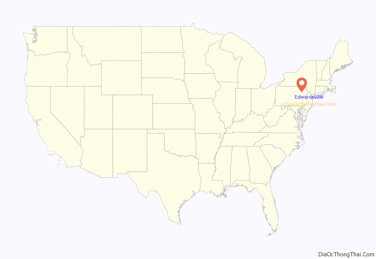
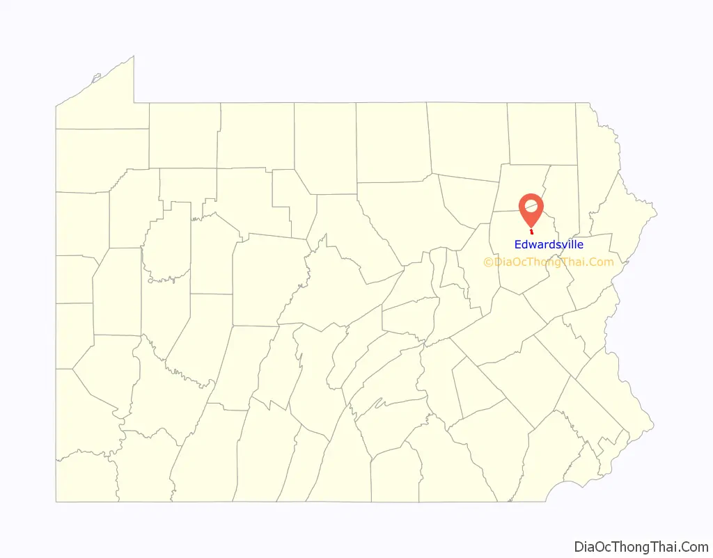
Edwardsville location map. Where is Edwardsville borough?
History
Edwardsville was first settled in 1768 by settlers from Connecticut. It was later incorporated as a borough in 1884.
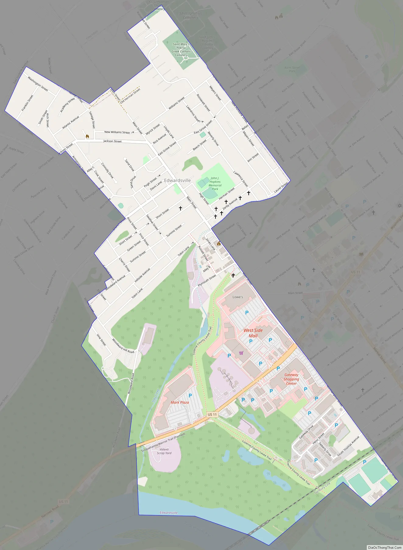
Edwardsville Road Map
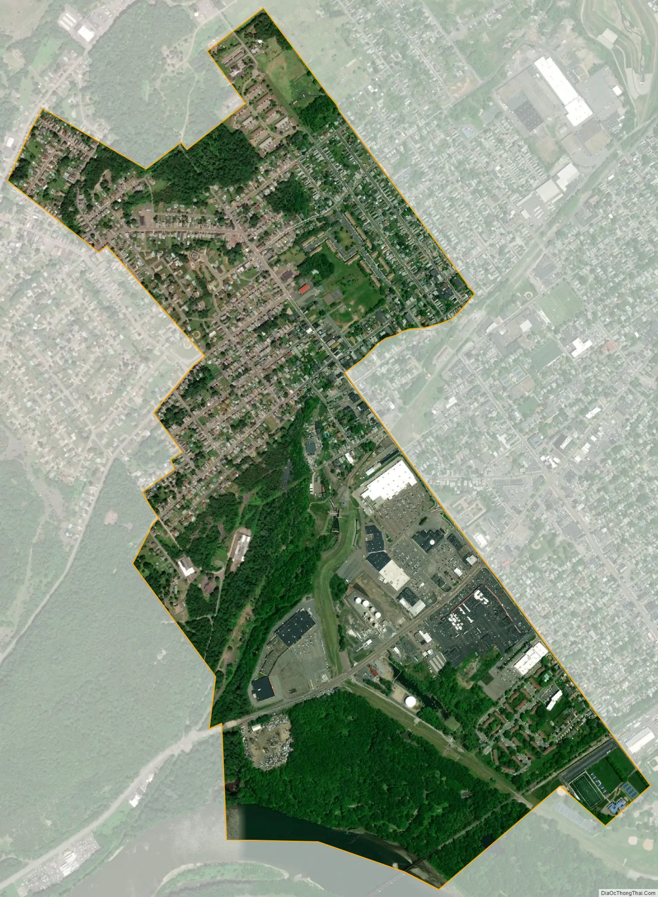
Edwardsville city Satellite Map
Geography
Edwardsville is located at 41°15′58″N 75°54′30″W / 41.26611°N 75.90833°W / 41.26611; -75.90833 (41.266081, -75.908457).
According to the United States Census Bureau, the borough has a total area of 1.2 square miles (3.1 km), of which 1.2 square miles (3.0 km) is land and 0.04 square miles (0.1 km), or 2.95%, is water. The Susquehanna River makes up the borough’s southern border.
Transportation
U.S. Route 11 is the only major highway running through Edwardsville.
See also
Map of Pennsylvania State and its subdivision:- Adams
- Allegheny
- Armstrong
- Beaver
- Bedford
- Berks
- Blair
- Bradford
- Bucks
- Butler
- Cambria
- Cameron
- Carbon
- Centre
- Chester
- Clarion
- Clearfield
- Clinton
- Columbia
- Crawford
- Cumberland
- Dauphin
- Delaware
- Elk
- Erie
- Fayette
- Forest
- Franklin
- Fulton
- Greene
- Huntingdon
- Indiana
- Jefferson
- Juniata
- Lackawanna
- Lancaster
- Lawrence
- Lebanon
- Lehigh
- Luzerne
- Lycoming
- Mc Kean
- Mercer
- Mifflin
- Monroe
- Montgomery
- Montour
- Northampton
- Northumberland
- Perry
- Philadelphia
- Pike
- Potter
- Schuylkill
- Snyder
- Somerset
- Sullivan
- Susquehanna
- Tioga
- Union
- Venango
- Warren
- Washington
- Wayne
- Westmoreland
- Wyoming
- York
- Alabama
- Alaska
- Arizona
- Arkansas
- California
- Colorado
- Connecticut
- Delaware
- District of Columbia
- Florida
- Georgia
- Hawaii
- Idaho
- Illinois
- Indiana
- Iowa
- Kansas
- Kentucky
- Louisiana
- Maine
- Maryland
- Massachusetts
- Michigan
- Minnesota
- Mississippi
- Missouri
- Montana
- Nebraska
- Nevada
- New Hampshire
- New Jersey
- New Mexico
- New York
- North Carolina
- North Dakota
- Ohio
- Oklahoma
- Oregon
- Pennsylvania
- Rhode Island
- South Carolina
- South Dakota
- Tennessee
- Texas
- Utah
- Vermont
- Virginia
- Washington
- West Virginia
- Wisconsin
- Wyoming


