Espy is a census-designated place (CDP) in Columbia County, Pennsylvania, United States. It is part of Northeastern Pennsylvania. The population was 1,642 at the 2010 census. It is part of the Bloomsburg-Berwick micropolitan area. Espy was first settled in the late 18th century. It was home to a boatyard in the 19th century.
| Name: | Espy CDP |
|---|---|
| LSAD Code: | 57 |
| LSAD Description: | CDP (suffix) |
| State: | Pennsylvania |
| County: | Columbia County |
| Elevation: | 480 ft (150 m) |
| Total Area: | 1.10 sq mi (2.86 km²) |
| Land Area: | 0.90 sq mi (2.33 km²) |
| Water Area: | 0.20 sq mi (0.53 km²) |
| Total Population: | 1,620 |
| Population Density: | 1,802.00/sq mi (695.61/km²) |
| ZIP code: | 17815 |
| FIPS code: | 4224088 |
| GNISfeature ID: | 1174322 |
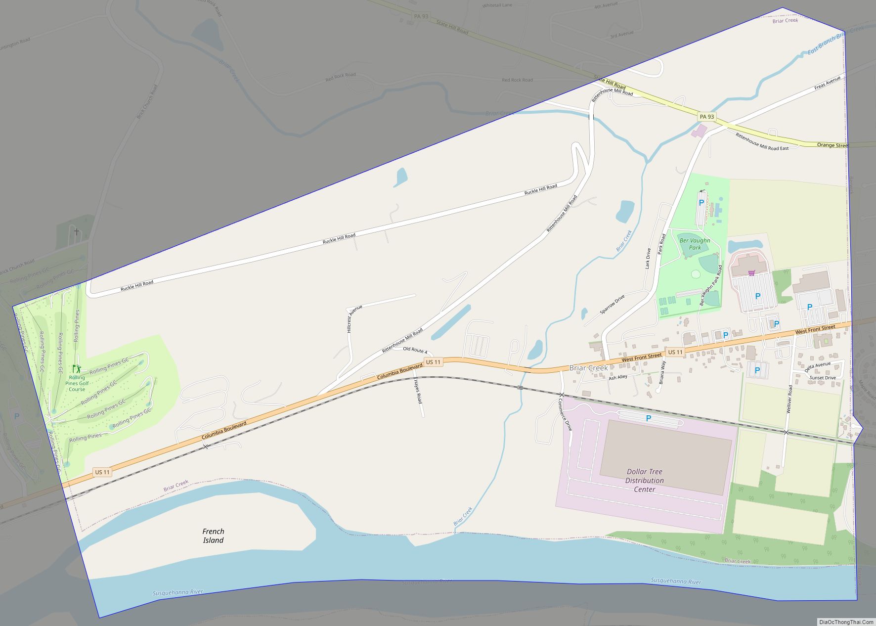
Online Interactive Map
Click on ![]() to view map in "full screen" mode.
to view map in "full screen" mode.
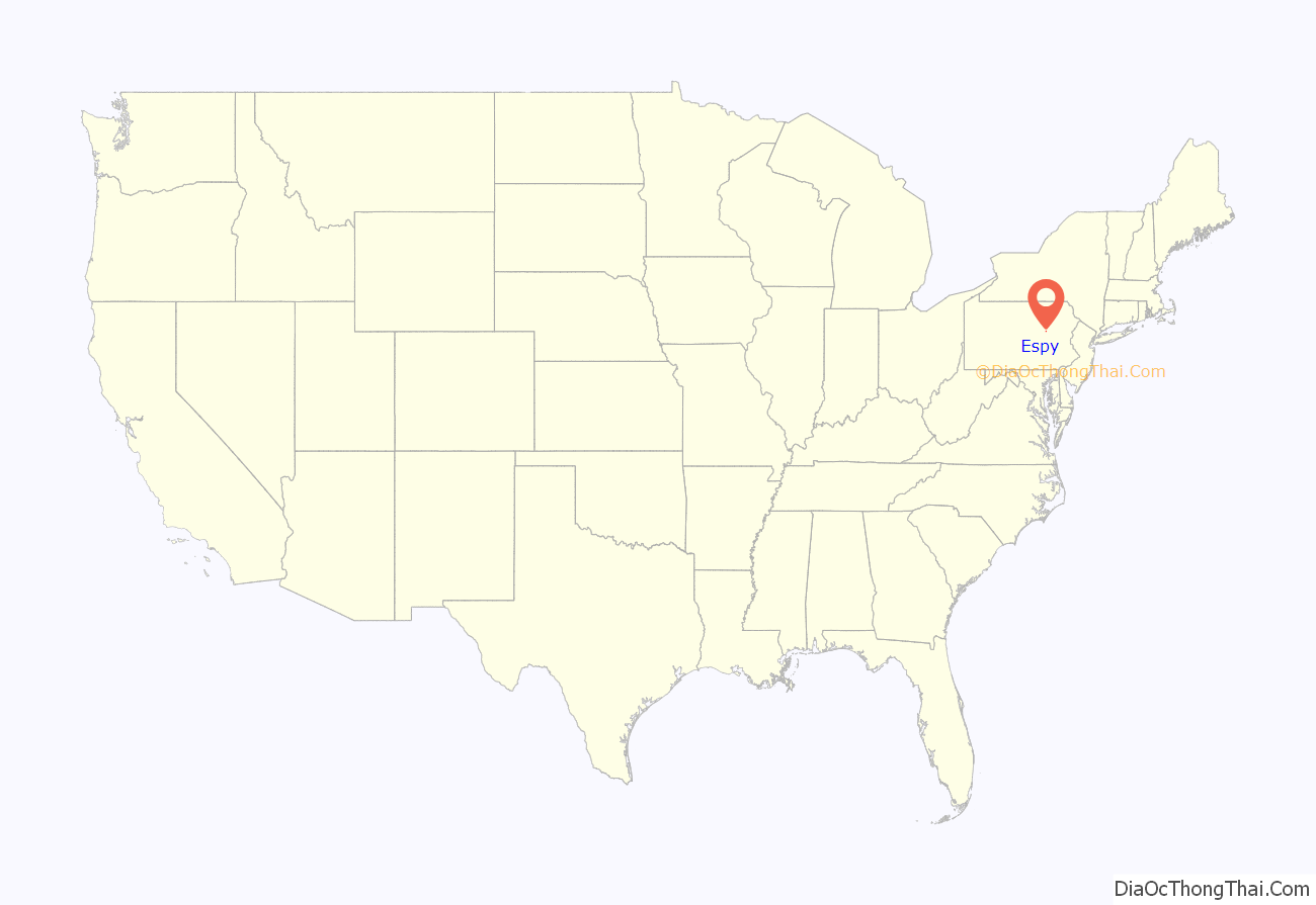
Espy location map. Where is Espy CDP?
History
Espy was named after Josiah Espy, an early settler who moved to the area in 1775. Soon afterwards, in 1785, Josiah’s son George moved into the area as well. In 1800, George Espy divided up the area that is now Espy into lots. The town was originally called Liberty but was officially renamed Espy in 1828 after George Espy. The first hotel in Espy was built in 1805. There used to a boatyard in Espy, but it was destroyed in 1900.
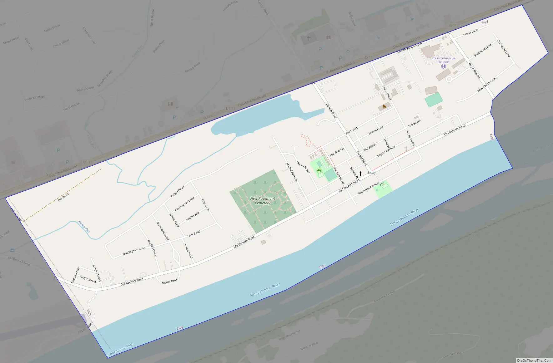
Espy Road Map
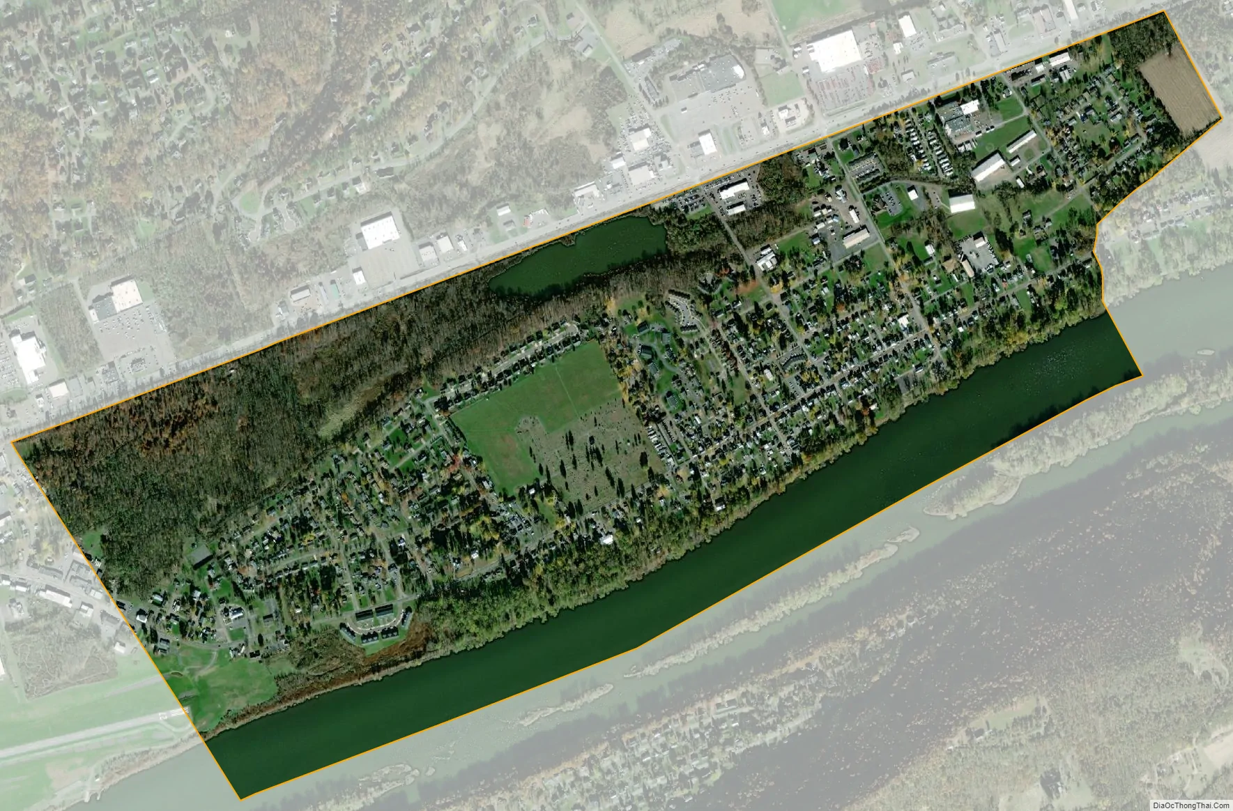
Espy city Satellite Map
Geography
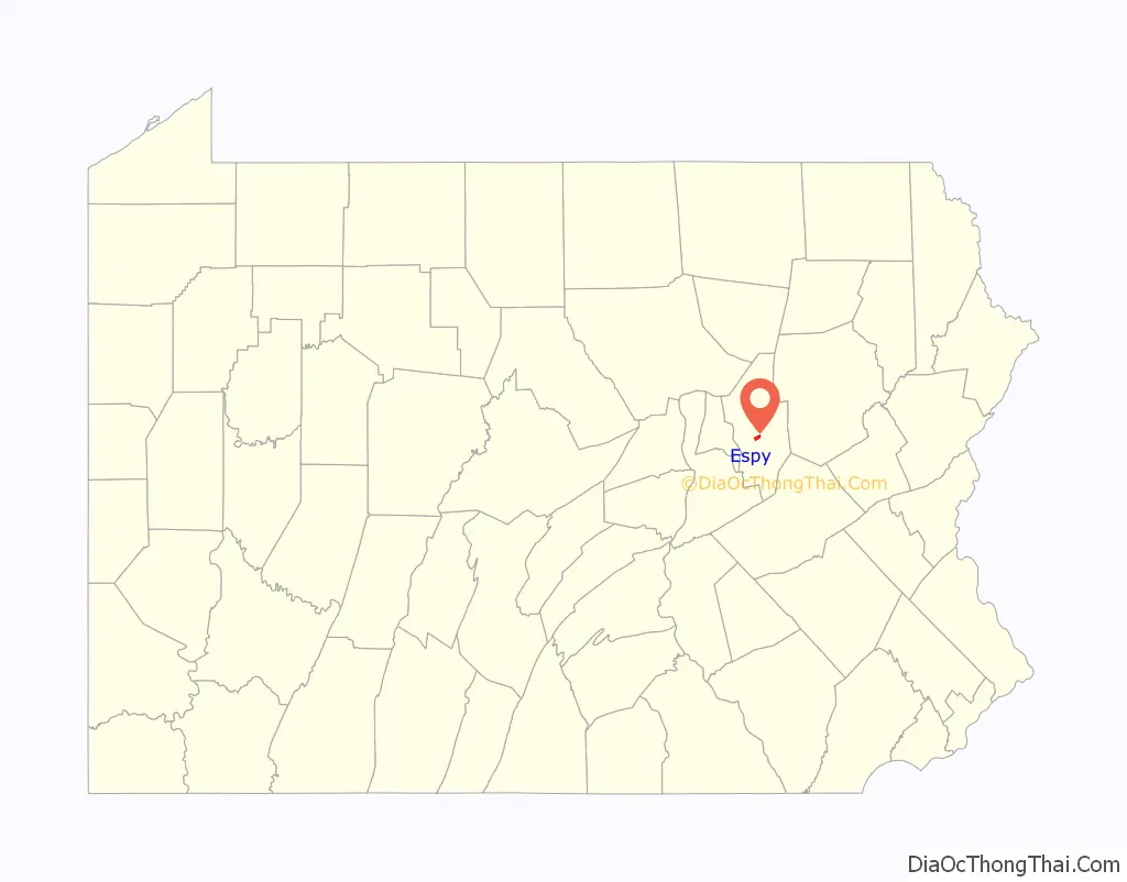
Espy is located near the center of Columbia County at 41°0′21″N 76°24′54″W / 41.00583°N 76.41500°W / 41.00583; -76.41500 (41.005904, -76.414883). It is in the southwestern corner of Scott Township and is bordered by U.S. Route 11 to the north, the Susquehanna River to the south, Almedia to the east, and Bloomsburg, the county seat, to the west and northwest.
According to the U.S. Census Bureau, the Espy CDP has a total area of 1.1 square miles (2.9 km), of which 0.93 square miles (2.4 km) is land and 0.19 square miles (0.5 km), or 18.07%, is water. Espy is one of several small CDPs on the north side of the Susquehanna River between Bloomsburg and Berwick.
See also
Map of Pennsylvania State and its subdivision:- Adams
- Allegheny
- Armstrong
- Beaver
- Bedford
- Berks
- Blair
- Bradford
- Bucks
- Butler
- Cambria
- Cameron
- Carbon
- Centre
- Chester
- Clarion
- Clearfield
- Clinton
- Columbia
- Crawford
- Cumberland
- Dauphin
- Delaware
- Elk
- Erie
- Fayette
- Forest
- Franklin
- Fulton
- Greene
- Huntingdon
- Indiana
- Jefferson
- Juniata
- Lackawanna
- Lancaster
- Lawrence
- Lebanon
- Lehigh
- Luzerne
- Lycoming
- Mc Kean
- Mercer
- Mifflin
- Monroe
- Montgomery
- Montour
- Northampton
- Northumberland
- Perry
- Philadelphia
- Pike
- Potter
- Schuylkill
- Snyder
- Somerset
- Sullivan
- Susquehanna
- Tioga
- Union
- Venango
- Warren
- Washington
- Wayne
- Westmoreland
- Wyoming
- York
- Alabama
- Alaska
- Arizona
- Arkansas
- California
- Colorado
- Connecticut
- Delaware
- District of Columbia
- Florida
- Georgia
- Hawaii
- Idaho
- Illinois
- Indiana
- Iowa
- Kansas
- Kentucky
- Louisiana
- Maine
- Maryland
- Massachusetts
- Michigan
- Minnesota
- Mississippi
- Missouri
- Montana
- Nebraska
- Nevada
- New Hampshire
- New Jersey
- New Mexico
- New York
- North Carolina
- North Dakota
- Ohio
- Oklahoma
- Oregon
- Pennsylvania
- Rhode Island
- South Carolina
- South Dakota
- Tennessee
- Texas
- Utah
- Vermont
- Virginia
- Washington
- West Virginia
- Wisconsin
- Wyoming