Exton is a census-designated place (CDP) in West Whiteland Township in Chester County, Pennsylvania, United States. Its population was 5,622 at the 2020 census. The Exton Square Mall and Main Street at Exton are both located within Exton along with several other shopping centers, making Exton the major shopping district in Chester County.
| Name: | Exton CDP |
|---|---|
| LSAD Code: | 57 |
| LSAD Description: | CDP (suffix) |
| State: | Pennsylvania |
| County: | Chester County |
| Elevation: | 312 ft (95 m) |
| Total Area: | 3.15 sq mi (8.17 km²) |
| Land Area: | 3.13 sq mi (8.10 km²) |
| Water Area: | 0.03 sq mi (0.07 km²) |
| Total Population: | 5,622 |
| Population Density: | 1,797.89/sq mi (694.21/km²) |
| FIPS code: | 4224440 |
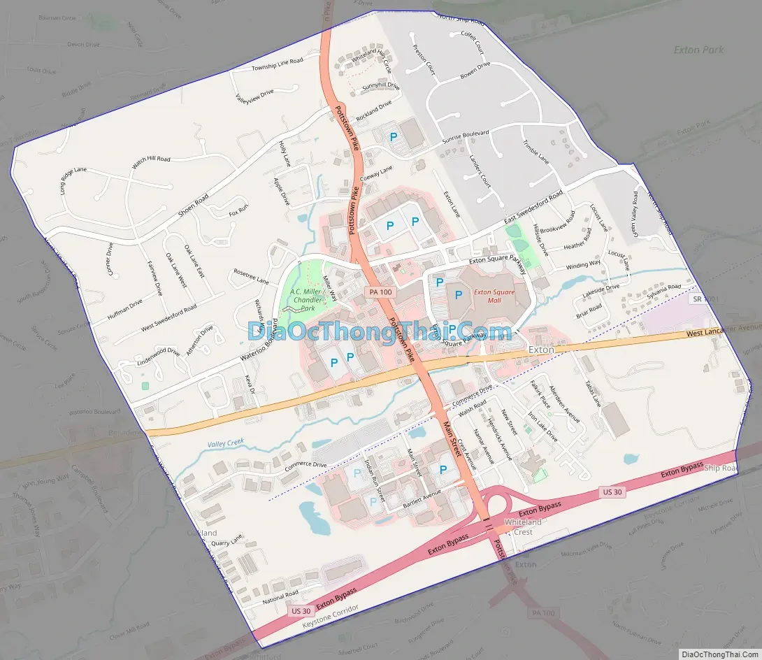
Online Interactive Map
Click on ![]() to view map in "full screen" mode.
to view map in "full screen" mode.
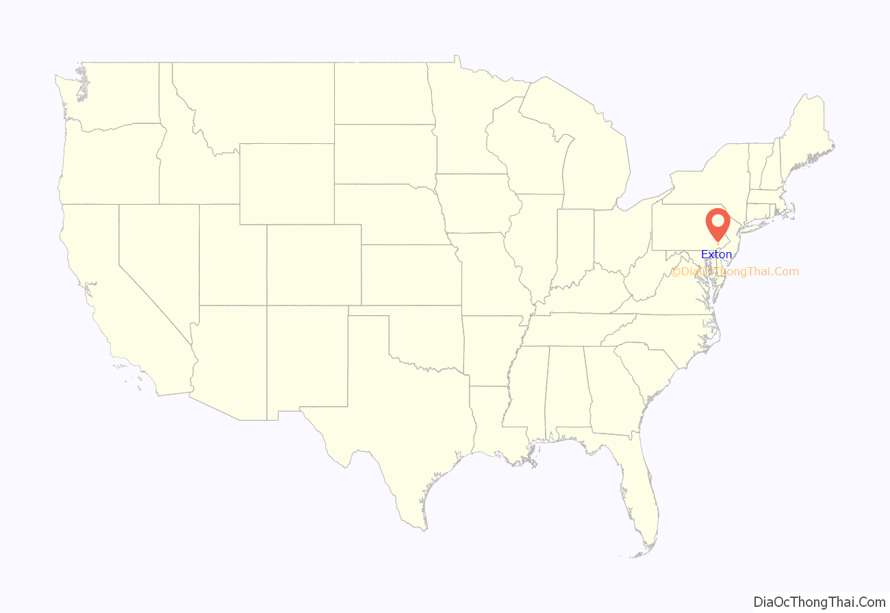
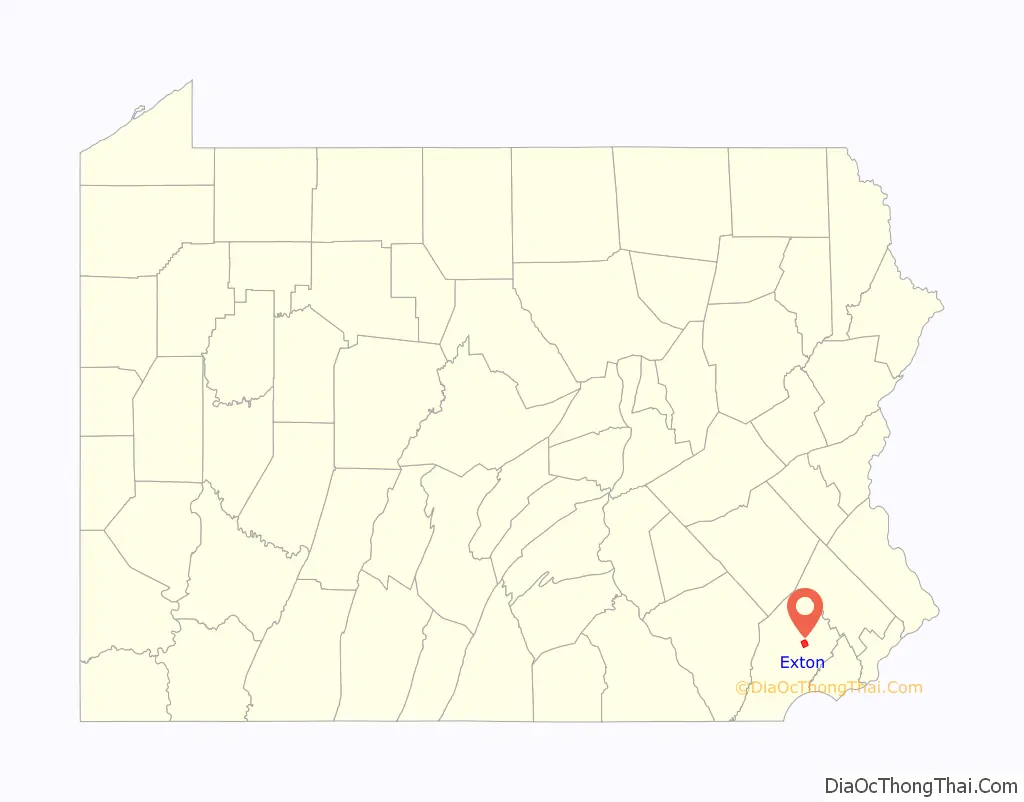
Exton location map. Where is Exton CDP?
History
Exton lies at the intersection of U.S. Route 30 (formerly the Lancaster Road, and later the Lincoln Highway) and Pennsylvania Route 100 (Pottstown Pike). Beginning in the late 18th century, the Lancaster Road became a major transportation route between Philadelphia and the west, while what is now Route 100 was a regional north–south route to Pottstown. A theory exists that Exton was named as the “X” on the map, denoting this intersection, though more likely the village was named after one of the several Extons in the United Kingdom.
In the late 1940s, Exton became home to the Newcomen Society of the United States. The campus of the learned society was built overlooking farmland on Newcomen Road, and featured offices, a printing shop, library and museum, guest houses, a chapel and a belltower with a carillon. The Newcomen Society (since dissolved) sold the property in the late 1990s, but its campus remains an Exton landmark serving as the headquarters of another business.
Exton Road Map
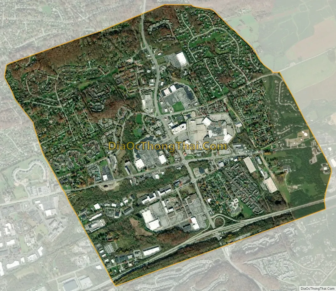
Exton city Satellite Map
Geography
According to the U.S. Census Bureau, the CDP has a total area of 3.2 square miles (8.3 km), all land.
Climate
According to the Köppen Climate Classification system, Exton has a hot-summer humid continental climate, abbreviated “Dfa” on climate maps.
See also
Map of Pennsylvania State and its subdivision:- Adams
- Allegheny
- Armstrong
- Beaver
- Bedford
- Berks
- Blair
- Bradford
- Bucks
- Butler
- Cambria
- Cameron
- Carbon
- Centre
- Chester
- Clarion
- Clearfield
- Clinton
- Columbia
- Crawford
- Cumberland
- Dauphin
- Delaware
- Elk
- Erie
- Fayette
- Forest
- Franklin
- Fulton
- Greene
- Huntingdon
- Indiana
- Jefferson
- Juniata
- Lackawanna
- Lancaster
- Lawrence
- Lebanon
- Lehigh
- Luzerne
- Lycoming
- Mc Kean
- Mercer
- Mifflin
- Monroe
- Montgomery
- Montour
- Northampton
- Northumberland
- Perry
- Philadelphia
- Pike
- Potter
- Schuylkill
- Snyder
- Somerset
- Sullivan
- Susquehanna
- Tioga
- Union
- Venango
- Warren
- Washington
- Wayne
- Westmoreland
- Wyoming
- York
- Alabama
- Alaska
- Arizona
- Arkansas
- California
- Colorado
- Connecticut
- Delaware
- District of Columbia
- Florida
- Georgia
- Hawaii
- Idaho
- Illinois
- Indiana
- Iowa
- Kansas
- Kentucky
- Louisiana
- Maine
- Maryland
- Massachusetts
- Michigan
- Minnesota
- Mississippi
- Missouri
- Montana
- Nebraska
- Nevada
- New Hampshire
- New Jersey
- New Mexico
- New York
- North Carolina
- North Dakota
- Ohio
- Oklahoma
- Oregon
- Pennsylvania
- Rhode Island
- South Carolina
- South Dakota
- Tennessee
- Texas
- Utah
- Vermont
- Virginia
- Washington
- West Virginia
- Wisconsin
- Wyoming