Fairview Township is a township in Erie County, Pennsylvania, United States. Situated on the southern shore of Lake Erie, it was one of the county’s sixteen original townships, and was founded in 1797.
In 1998 Fairview Township annexed the former Fairview Borough.
According to the 2020 U.S. Census, the township’s population was 11,136, which is an increase from the 2010 census of 10,102. It is part of the Erie Metropolitan Statistical Area.
| Name: | Fairview CDP |
|---|---|
| LSAD Code: | 57 |
| LSAD Description: | CDP (suffix) |
| State: | Pennsylvania |
| County: | Erie County |
| Total Area: | 29.16 sq mi (75.53 km²) |
| Land Area: | 28.91 sq mi (74.86 km²) |
| Water Area: | 0.26 sq mi (0.66 km²) |
| Total Population: | 11,136 |
| Population Density: | 351.15/sq mi (135.58/km²) |
| Area code: | 814 |
| FIPS code: | 4224856 |
| Website: | www.fairviewtownship.com |
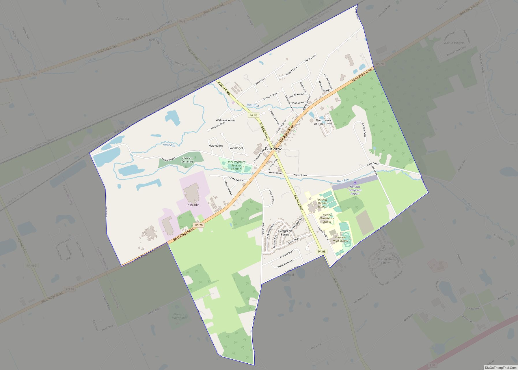
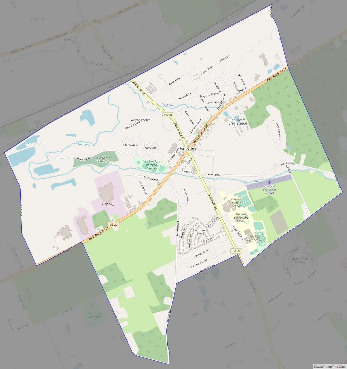
Online Interactive Map
Click on ![]() to view map in "full screen" mode.
to view map in "full screen" mode.
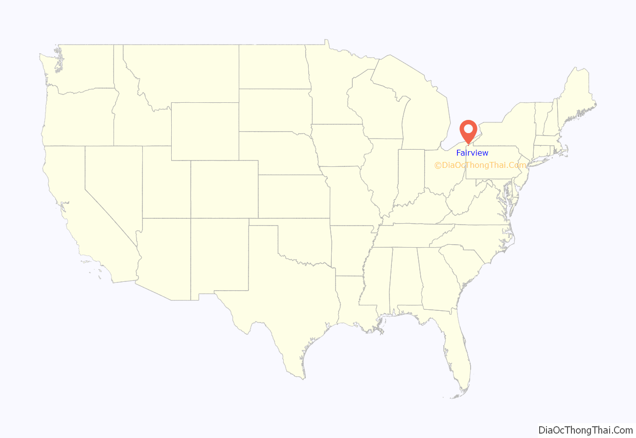
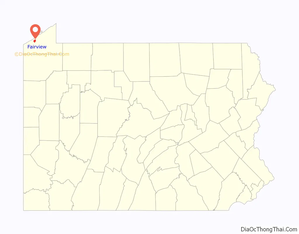
Fairview location map. Where is Fairview CDP?
History
One of Erie County’s sixteen original townships, Fairview Township was established in 1797. It reportedly took its name from the utterance that year of a businessman, Colonel Thomas Forster, who said of his land purchase at the mouth of Walnut Creek: “This is the fairest view I have seen yet.”
In 1832, the township was downsized with the redistribution of part of its territory to the newly formed Girard Township.
Early in the 19th century, stagecoaches traveled through Fairview. In 1844, the Erie Extension Canal began operating. By 1961, Interstate 90 and a local interchange were constructed in the township. The Sturgeon House, a historic home now serving as a museum, was listed on the National Register of Historic Places in 1980. In 1998 Fairview Township annexed the former Fairview Borough.
Fairview Road Map
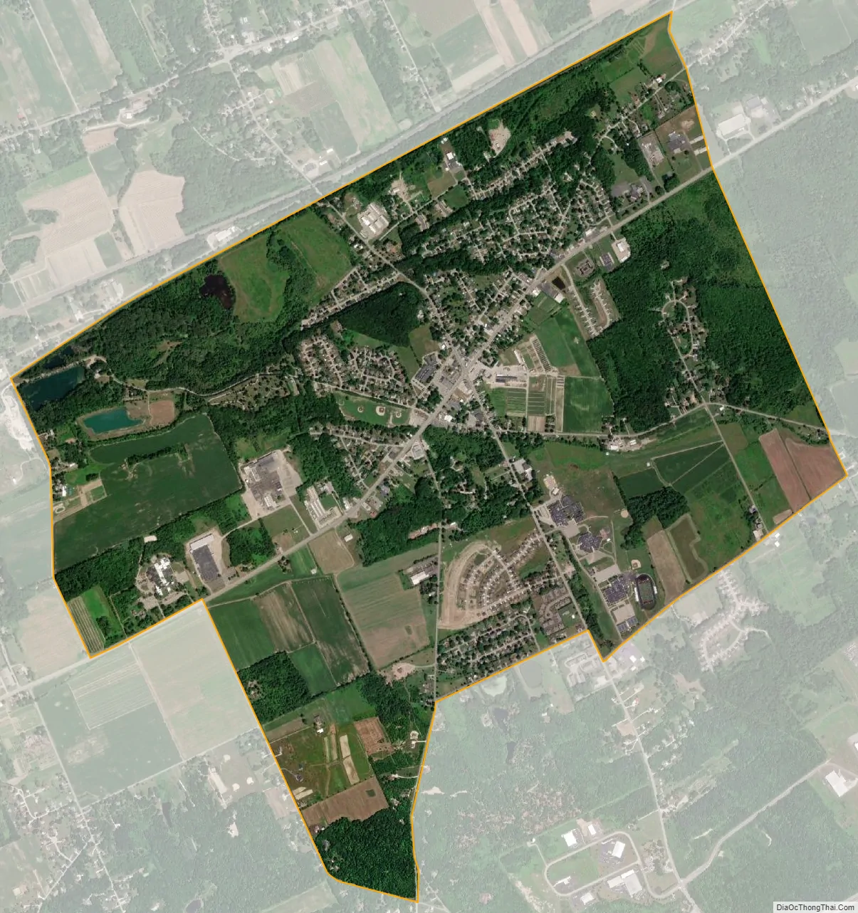
Fairview city Satellite Map
Geography
Fairview Township is bounded to the north by Lake Erie, to the west by Girard Township, to the south by Franklin Township, to the southeast by McKean Township, and to the northeast by Millcreek Township. The township includes the communities of Fairview and Avonia.
According to the United States Census Bureau, the township has a total area of 29.2 square miles (75.5 km), of which 29.0 square miles (75.0 km) is land and 0.19 square miles (0.5 km), or 0.66 percent, is water.
See also
Map of Pennsylvania State and its subdivision:- Adams
- Allegheny
- Armstrong
- Beaver
- Bedford
- Berks
- Blair
- Bradford
- Bucks
- Butler
- Cambria
- Cameron
- Carbon
- Centre
- Chester
- Clarion
- Clearfield
- Clinton
- Columbia
- Crawford
- Cumberland
- Dauphin
- Delaware
- Elk
- Erie
- Fayette
- Forest
- Franklin
- Fulton
- Greene
- Huntingdon
- Indiana
- Jefferson
- Juniata
- Lackawanna
- Lancaster
- Lawrence
- Lebanon
- Lehigh
- Luzerne
- Lycoming
- Mc Kean
- Mercer
- Mifflin
- Monroe
- Montgomery
- Montour
- Northampton
- Northumberland
- Perry
- Philadelphia
- Pike
- Potter
- Schuylkill
- Snyder
- Somerset
- Sullivan
- Susquehanna
- Tioga
- Union
- Venango
- Warren
- Washington
- Wayne
- Westmoreland
- Wyoming
- York
- Alabama
- Alaska
- Arizona
- Arkansas
- California
- Colorado
- Connecticut
- Delaware
- District of Columbia
- Florida
- Georgia
- Hawaii
- Idaho
- Illinois
- Indiana
- Iowa
- Kansas
- Kentucky
- Louisiana
- Maine
- Maryland
- Massachusetts
- Michigan
- Minnesota
- Mississippi
- Missouri
- Montana
- Nebraska
- Nevada
- New Hampshire
- New Jersey
- New Mexico
- New York
- North Carolina
- North Dakota
- Ohio
- Oklahoma
- Oregon
- Pennsylvania
- Rhode Island
- South Carolina
- South Dakota
- Tennessee
- Texas
- Utah
- Vermont
- Virginia
- Washington
- West Virginia
- Wisconsin
- Wyoming