Harveys Lake is a borough in Luzerne County, Pennsylvania, United States. It is part of the Back Mountain, a one hundred and eighteen-square mile region in northern Luzerne County.
The borough is named after the lake, its principal feature, which in turn was named after Benjamin Harvey, a local settler. Harvey was a member of the Sons of Liberty, an eminent colonial-era group that fought against Great Britain’s Stamp Act of 1765.
As of the 2020 census, the population of the borough of Harveys Lake was 2,786.
| Name: | Harveys Lake borough |
|---|---|
| LSAD Code: | 21 |
| LSAD Description: | borough (suffix) |
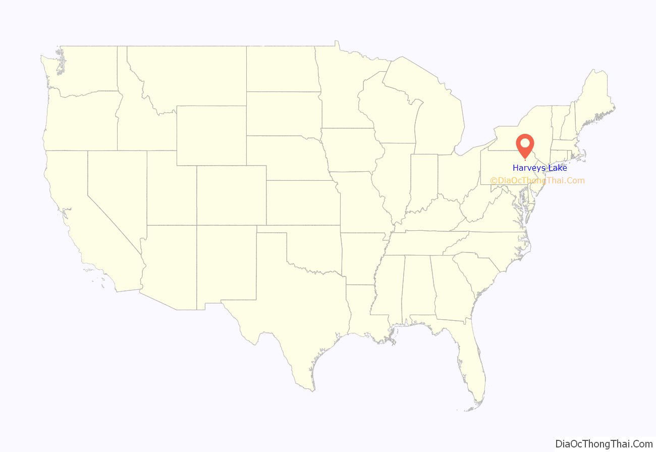
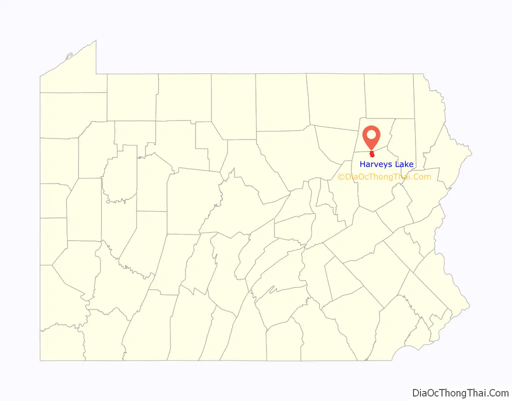
| State: | Pennsylvania |
| County: | Luzerne County |
| Incorporated: | 1968 |
| Total Area: | 6.42 sq mi (16.62 km²) |
| Land Area: | 5.40 sq mi (13.98 km²) |
| Water Area: | 1.02 sq mi (2.64 km²) |
| Total Population: | 2,788 |
| Population Density: | 516.68/sq mi (199.49/km²) |
| ZIP code: | 18618 |
| Area code: | 570 |
| FIPS code: | 4233000 |
| Website: | harveyslakeborough.com |
Online Interactive Map
Click on ![]() to view map in "full screen" mode.
to view map in "full screen" mode.
Harveys Lake location map. Where is Harveys Lake borough?
History
Harveys Lake was not officially incorporated as a borough until 1968. Prior to that, the area was an unincorporated part of Lake Township.
According to The Jesuit Relations, prior to European colonization, the region was inhabited by the Scahentoarrhonon people, an Iroquoian-speaking group.
Historically, the first White resident in the vicinity of the lake was Matthew Scouten, who arrived in the early 1790s, but the first White settlers were the Worthingtons, who arrived in 1806.
Harveys Lake became a major resort destination in the early 20th century, attracting tourists from all over the Northeast. Hotels, cottages, boathouses, a casino, and even an amusement park were constructed around the lake. The grand Hotel Oneonta was especially prominent in the early 1900s; former United States President Theodore Roosevelt was a guest in August 1912.
From 1952 to 1956, Pennsylvania State Senator T. Newell Wood hosted the Brynfan Tyddyn Road Race around his estate in Harveys Lake. Brynfan Tyddyn is Welsh for “large farm on a hilltop” and the race consisted of 10 laps around a 3.5 mile course around the estate. The race was discontinued in 1957 after a fatal accident and officials determined the course was too dangerous and difficult for participants and spectators to reach.
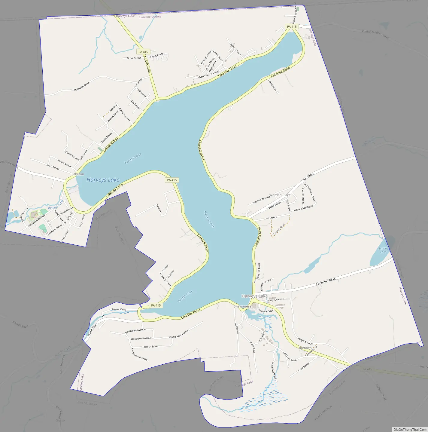
Harveys Lake Road Map
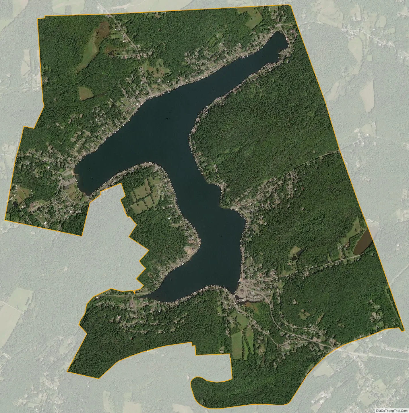
Harveys Lake city Satellite Map
Geography
Harveys Lake is located at 41°21′48″N 76°2′38″W / 41.36333°N 76.04389°W / 41.36333; -76.04389 (41.363335, -76.043989).
According to the United States Census Bureau, the borough has a total area of 6.2 square miles (16.0 km), of which 5.2 square miles (13.4 km) is land and 1.0 square mile (2.6 km), or 16.45%, is water. The lake has a maximum depth of 104 feet (32 m). Pennsylvania Route 415, which encircles the lake, is a major highway in the borough. Most of the homes and businesses are located within proximity to the lake. Forested mountains are located on the outskirts of town.
See also
Map of Pennsylvania State and its subdivision:- Adams
- Allegheny
- Armstrong
- Beaver
- Bedford
- Berks
- Blair
- Bradford
- Bucks
- Butler
- Cambria
- Cameron
- Carbon
- Centre
- Chester
- Clarion
- Clearfield
- Clinton
- Columbia
- Crawford
- Cumberland
- Dauphin
- Delaware
- Elk
- Erie
- Fayette
- Forest
- Franklin
- Fulton
- Greene
- Huntingdon
- Indiana
- Jefferson
- Juniata
- Lackawanna
- Lancaster
- Lawrence
- Lebanon
- Lehigh
- Luzerne
- Lycoming
- Mc Kean
- Mercer
- Mifflin
- Monroe
- Montgomery
- Montour
- Northampton
- Northumberland
- Perry
- Philadelphia
- Pike
- Potter
- Schuylkill
- Snyder
- Somerset
- Sullivan
- Susquehanna
- Tioga
- Union
- Venango
- Warren
- Washington
- Wayne
- Westmoreland
- Wyoming
- York
- Alabama
- Alaska
- Arizona
- Arkansas
- California
- Colorado
- Connecticut
- Delaware
- District of Columbia
- Florida
- Georgia
- Hawaii
- Idaho
- Illinois
- Indiana
- Iowa
- Kansas
- Kentucky
- Louisiana
- Maine
- Maryland
- Massachusetts
- Michigan
- Minnesota
- Mississippi
- Missouri
- Montana
- Nebraska
- Nevada
- New Hampshire
- New Jersey
- New Mexico
- New York
- North Carolina
- North Dakota
- Ohio
- Oklahoma
- Oregon
- Pennsylvania
- Rhode Island
- South Carolina
- South Dakota
- Tennessee
- Texas
- Utah
- Vermont
- Virginia
- Washington
- West Virginia
- Wisconsin
- Wyoming


