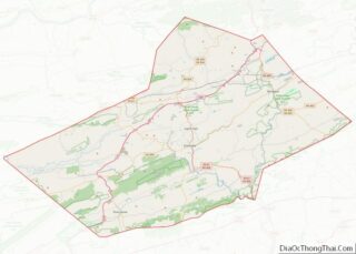
Heckscherville is a census-designated place (CDP) in Schuylkill County, Pennsylvania, United States. The population was 220 at the 2010 census.
| Name: | Heckscherville CDP |
|---|---|
| LSAD Code: | 57 |
| LSAD Description: | CDP (suffix) |
| State: | Pennsylvania |
| County: | Schuylkill County |
| Total Area: | 0.33 sq mi (0.86 km²) |
| Land Area: | 0.33 sq mi (0.86 km²) |
| Water Area: | 0.00 sq mi (0.00 km²) |
| Total Population: | 196 |
| Population Density: | 590.36/sq mi (228.27/km²) |
| ZIP code: | 17901 |
| FIPS code: | 4233528 |
Online Interactive Map
Click on ![]() to view map in "full screen" mode.
to view map in "full screen" mode.
Heckscherville location map. Where is Heckscherville CDP?
History
The earliest available history shows that in 1831 the entire Heckscherville valley contained only two villages. At this time the valley was called “Chapmanville” after the owners of the coal mines. In 1843 the Chapmanville interests were taken over by George and William Payne. Subsequently, the valley’s name was changed to “Payne’s Patch”.
With coal sales increasing, the Payne brothers found it necessary to secure additional laborers. Taking advantage of the famine in Ireland in 1845, they traveled to Ireland to persuade hundreds of families and individuals to move to America. The Payne brothers focused on the Queens and Kilkenny counties, and provided transportation, employment and homes to those who agreed to move. Before the brothers returned to Payne’s Patch, the valley was populated almost entirely by Welsh with only a few scattered Irish families. However, when they did return with the Irish immigrants, the Welsh started to migrate elsewhere and the population changed to mostly Irish. This influx of immigrants continued until almost the entire population was either Irish or of Irish descent. Because of this, the small valley then became known as the “Irish Valley”.
The August Heckscher family from New York acquired the Payne brothers holding, and changed the name to Heckscherville.
Years later the population began to undergo another change. The coal companies, due to a manpower shortage, began to bring into the region laborers from various countries in Europe. Nationalities included: Polish, Lithuanians, Slavs, and Greeks. Today nearly every nationality is represented in the eight miles of the Heckscherville Valley.
Heckscherville Road Map
Heckscherville city Satellite Map
Geography
Heckscherville is located at 40°43′15″N 76°15′59″W / 40.72083°N 76.26639°W / 40.72083; -76.26639 (40.720951, -76.266458).
According to the United States Census Bureau, the CDP has a total area of 0.2 square miles (0.52 km), all land.
Heckscherville Valley includes all of Foster Township, a small portion of New Castle Township and a large part of Cass Township. The Valley is situated between Broad Mountain on the north and the Thomaston / Mine Hill on the west. It is composed of the following villages: Greenbury, Coal Castle, Kanes Hollow, Pine Knot, Cherry Valley, Heckscherville, Upper and Lower Glen Carbon, Courtneys, Upper and Lower Buck Run and Rohersvilla. Kear’s Hill and Green Hill are settlements that once existed in the valley, but have now disappeared to make way for advanced coal production.
See also
Map of Pennsylvania State and its subdivision:- Adams
- Allegheny
- Armstrong
- Beaver
- Bedford
- Berks
- Blair
- Bradford
- Bucks
- Butler
- Cambria
- Cameron
- Carbon
- Centre
- Chester
- Clarion
- Clearfield
- Clinton
- Columbia
- Crawford
- Cumberland
- Dauphin
- Delaware
- Elk
- Erie
- Fayette
- Forest
- Franklin
- Fulton
- Greene
- Huntingdon
- Indiana
- Jefferson
- Juniata
- Lackawanna
- Lancaster
- Lawrence
- Lebanon
- Lehigh
- Luzerne
- Lycoming
- Mc Kean
- Mercer
- Mifflin
- Monroe
- Montgomery
- Montour
- Northampton
- Northumberland
- Perry
- Philadelphia
- Pike
- Potter
- Schuylkill
- Snyder
- Somerset
- Sullivan
- Susquehanna
- Tioga
- Union
- Venango
- Warren
- Washington
- Wayne
- Westmoreland
- Wyoming
- York
- Alabama
- Alaska
- Arizona
- Arkansas
- California
- Colorado
- Connecticut
- Delaware
- District of Columbia
- Florida
- Georgia
- Hawaii
- Idaho
- Illinois
- Indiana
- Iowa
- Kansas
- Kentucky
- Louisiana
- Maine
- Maryland
- Massachusetts
- Michigan
- Minnesota
- Mississippi
- Missouri
- Montana
- Nebraska
- Nevada
- New Hampshire
- New Jersey
- New Mexico
- New York
- North Carolina
- North Dakota
- Ohio
- Oklahoma
- Oregon
- Pennsylvania
- Rhode Island
- South Carolina
- South Dakota
- Tennessee
- Texas
- Utah
- Vermont
- Virginia
- Washington
- West Virginia
- Wisconsin
- Wyoming


