Hughesville is a borough in Lycoming County, Pennsylvania, United States. The population was 2,155 at the 2020 census. It is part of the Williamsport, Pennsylvania Metropolitan Statistical Area.
| Name: | Hughesville borough |
|---|---|
| LSAD Code: | 21 |
| LSAD Description: | borough (suffix) |
| State: | Pennsylvania |
| County: | Lycoming County |
| Incorporated: | April 23, 1852 |
| Total Area: | 0.65 sq mi (1.67 km²) |
| Land Area: | 0.65 sq mi (1.67 km²) |
| Water Area: | 0.00 sq mi (0.00 km²) |
| Total Population: | 2,154 |
| Population Density: | 3,339.53/sq mi (1,289.62/km²) |
| ZIP code: | 17737 |
| Area code: | 570 |
| FIPS code: | 4236160 |
| GNISfeature ID: | 1213971 |
| Website: | www.hughesvillepa.org |
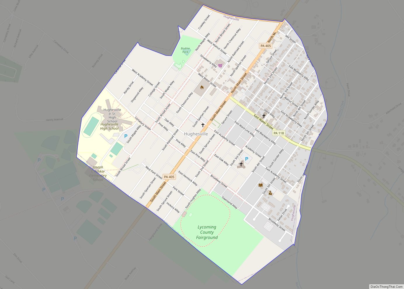
Online Interactive Map
Click on ![]() to view map in "full screen" mode.
to view map in "full screen" mode.
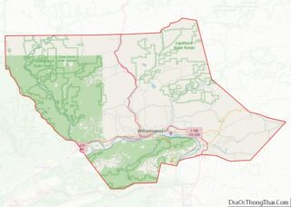
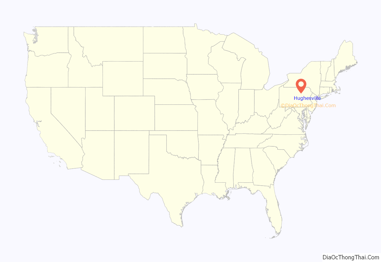
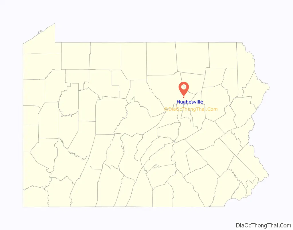
Hughesville location map. Where is Hughesville borough?
History
Hughesville is named for Jeptha Hughes, who purchased land from John Heap in 1816 and laid out the town of “Hughesburg” before selling the entire plot to Daniel Harrold in 1820. The town grew slowly around a gristmill that was constructed by Jacob Clayton. A tavern was built in 1820, and a general store followed ten years later. The first doctor in Hughesville, John W. Peale, arrived in 1828. Hughesville was incorporated as a borough on April 23, 1852. The first dentist opened an office in 1853 and the first lawyer settled in Hughesville in 1875.
Early industries in Hughesville were built to serve the farmers and citizens of eastern Lycoming County. They included a chair factory opened in 1829, a wagon shop in 1830, several distilleries, a sawmill and planing mill, and a furniture factory. Electricity was introduced to Hughesville in 1891 along with running water.
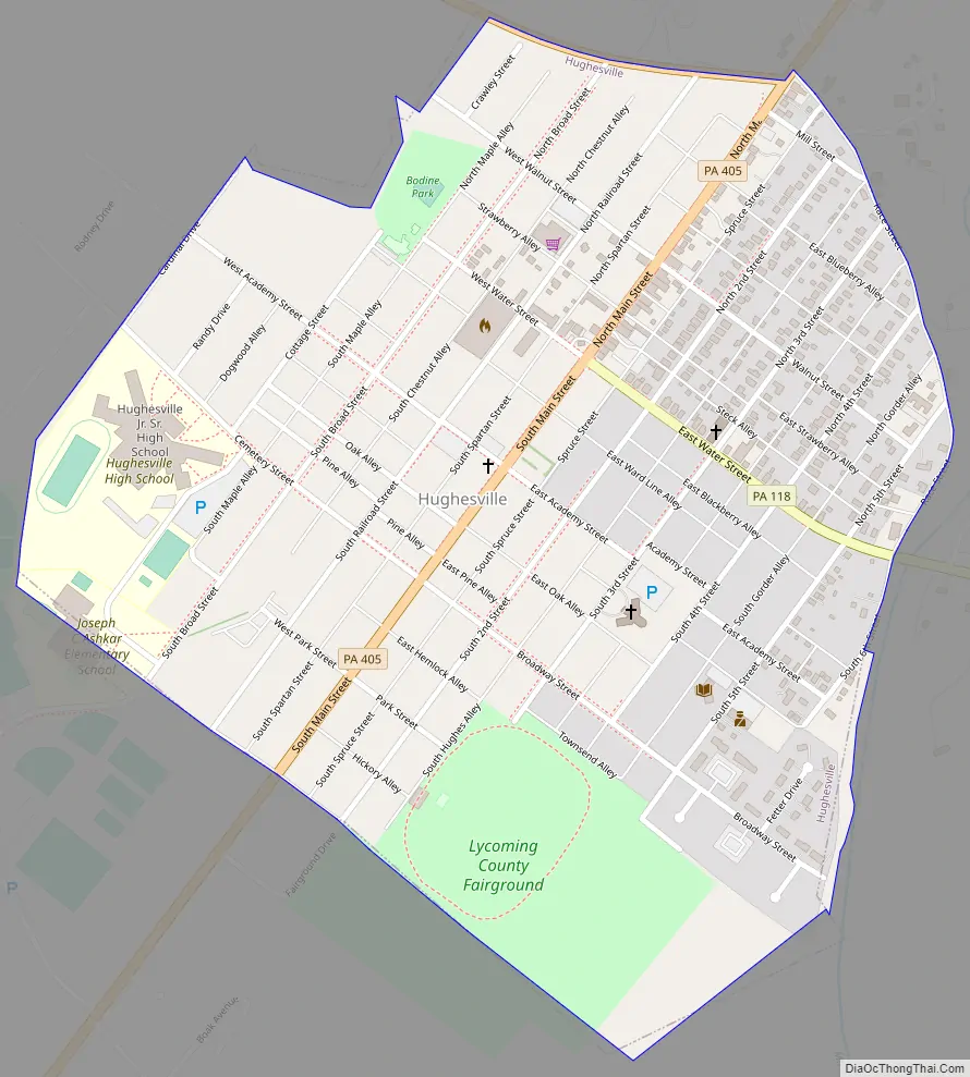
Hughesville Road Map
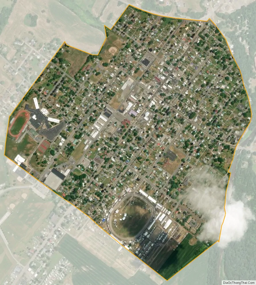
Hughesville city Satellite Map
Geography
Hughesville is located at 41°14′25″N 76°43′29″W / 41.24028°N 76.72472°W / 41.24028; -76.72472 (41.240402, -76.724852). It is completely surrounded by Wolf Township. As the crow flies, Lycoming County is approximately 130 miles (209 km) northwest of Philadelphia and 165 miles (266 km) east-northeast of Pittsburgh.
According to the United States Census Bureau, the borough has a total area of 0.6 square miles (1.6 km), all land.
Hughesville hosts the Lycoming County Fair and is home to the East Lycoming School District.
See also
Map of Pennsylvania State and its subdivision:- Adams
- Allegheny
- Armstrong
- Beaver
- Bedford
- Berks
- Blair
- Bradford
- Bucks
- Butler
- Cambria
- Cameron
- Carbon
- Centre
- Chester
- Clarion
- Clearfield
- Clinton
- Columbia
- Crawford
- Cumberland
- Dauphin
- Delaware
- Elk
- Erie
- Fayette
- Forest
- Franklin
- Fulton
- Greene
- Huntingdon
- Indiana
- Jefferson
- Juniata
- Lackawanna
- Lancaster
- Lawrence
- Lebanon
- Lehigh
- Luzerne
- Lycoming
- Mc Kean
- Mercer
- Mifflin
- Monroe
- Montgomery
- Montour
- Northampton
- Northumberland
- Perry
- Philadelphia
- Pike
- Potter
- Schuylkill
- Snyder
- Somerset
- Sullivan
- Susquehanna
- Tioga
- Union
- Venango
- Warren
- Washington
- Wayne
- Westmoreland
- Wyoming
- York
- Alabama
- Alaska
- Arizona
- Arkansas
- California
- Colorado
- Connecticut
- Delaware
- District of Columbia
- Florida
- Georgia
- Hawaii
- Idaho
- Illinois
- Indiana
- Iowa
- Kansas
- Kentucky
- Louisiana
- Maine
- Maryland
- Massachusetts
- Michigan
- Minnesota
- Mississippi
- Missouri
- Montana
- Nebraska
- Nevada
- New Hampshire
- New Jersey
- New Mexico
- New York
- North Carolina
- North Dakota
- Ohio
- Oklahoma
- Oregon
- Pennsylvania
- Rhode Island
- South Carolina
- South Dakota
- Tennessee
- Texas
- Utah
- Vermont
- Virginia
- Washington
- West Virginia
- Wisconsin
- Wyoming