Lattimer is a village and census-designated place (CDP) in Hazle Township, Luzerne County, Pennsylvania, United States. The population was 554 at the 2010 census.
| Name: | Lattimer CDP |
|---|---|
| LSAD Code: | 57 |
| LSAD Description: | CDP (suffix) |
| State: | Pennsylvania |
| County: | Luzerne County |
| Total Area: | 0.23 sq mi (0.59 km²) |
| Land Area: | 0.23 sq mi (0.59 km²) |
| Water Area: | 0.00 sq mi (0.00 km²) |
| Total Population: | 567 |
| Population Density: | 2,475.98/sq mi (954.86/km²) |
| ZIP code: | 18234 |
| Area code: | 570 |
| FIPS code: | 4241700 |
Online Interactive Map
Click on ![]() to view map in "full screen" mode.
to view map in "full screen" mode.
Lattimer location map. Where is Lattimer CDP?


History
The Lattimer massacre took place in the village on September 10, 1897; it resulted in the deaths of at least 19 unarmed striking immigrant anthracite coal miners. The miners, mostly of Polish, Slovak, Lithuanian, and German ethnicity, were shot and killed by a Luzerne County sheriff’s posse. Scores more were wounded. The massacre was a turning point in the history of the United Mine Workers (UMW).
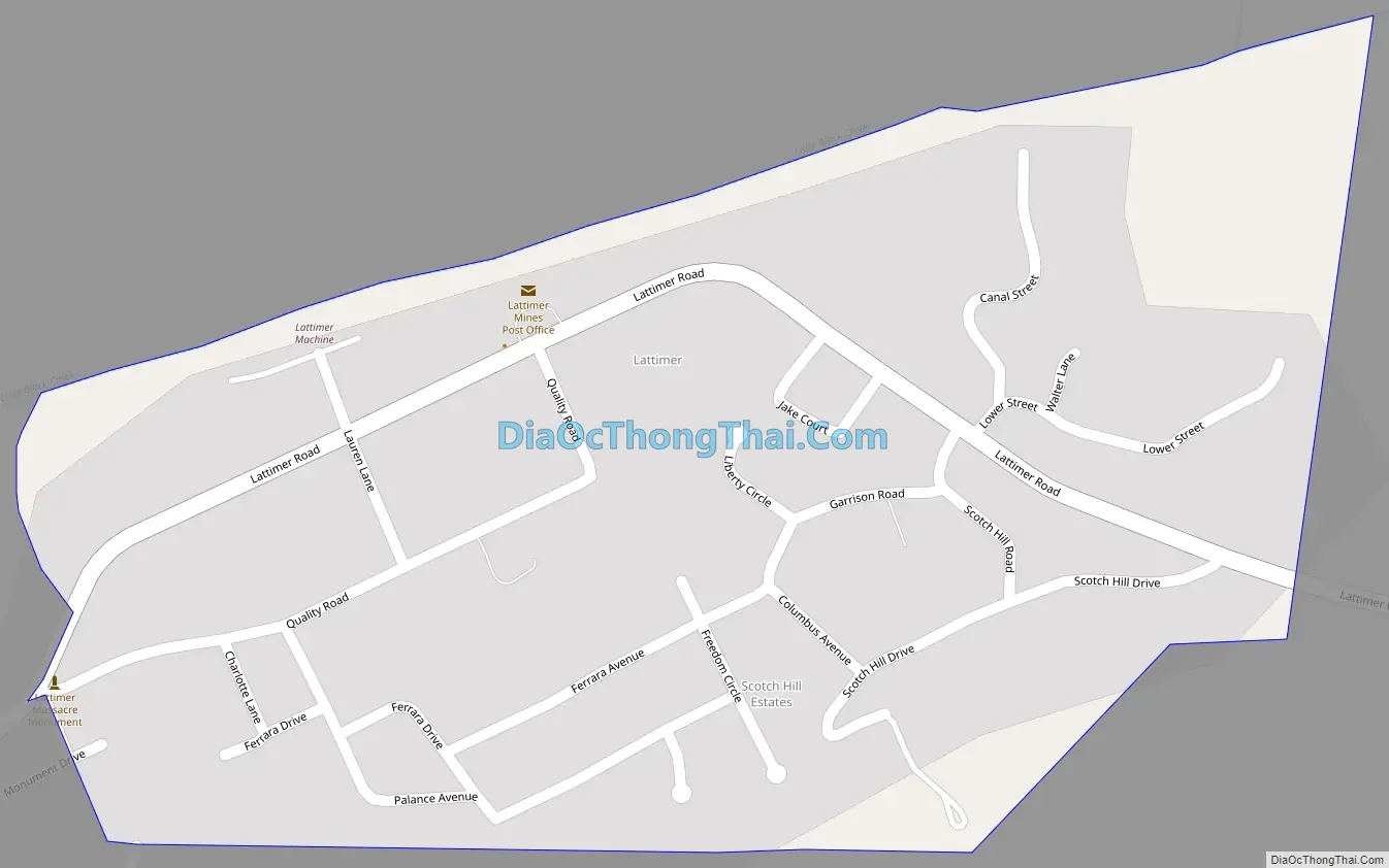
Lattimer Road Map
Lattimer city Satellite Map

Geography
Lattimer is located at 40°59′38″N 75°57′40″W / 40.99389°N 75.96111°W / 40.99389; -75.96111.
According to the United States Census Bureau, the CDP has a total area of 0.23 square miles (0.6 km), all land. It is located directly northeast of the CDP of Harleigh and lies 1 mile (2 km) northeast of the city of Hazleton. Lattimer uses the Hazleton zip code of 18234.
See also
Map of Pennsylvania State and its subdivision:- Adams
- Allegheny
- Armstrong
- Beaver
- Bedford
- Berks
- Blair
- Bradford
- Bucks
- Butler
- Cambria
- Cameron
- Carbon
- Centre
- Chester
- Clarion
- Clearfield
- Clinton
- Columbia
- Crawford
- Cumberland
- Dauphin
- Delaware
- Elk
- Erie
- Fayette
- Forest
- Franklin
- Fulton
- Greene
- Huntingdon
- Indiana
- Jefferson
- Juniata
- Lackawanna
- Lancaster
- Lawrence
- Lebanon
- Lehigh
- Luzerne
- Lycoming
- Mc Kean
- Mercer
- Mifflin
- Monroe
- Montgomery
- Montour
- Northampton
- Northumberland
- Perry
- Philadelphia
- Pike
- Potter
- Schuylkill
- Snyder
- Somerset
- Sullivan
- Susquehanna
- Tioga
- Union
- Venango
- Warren
- Washington
- Wayne
- Westmoreland
- Wyoming
- York
- Alabama
- Alaska
- Arizona
- Arkansas
- California
- Colorado
- Connecticut
- Delaware
- District of Columbia
- Florida
- Georgia
- Hawaii
- Idaho
- Illinois
- Indiana
- Iowa
- Kansas
- Kentucky
- Louisiana
- Maine
- Maryland
- Massachusetts
- Michigan
- Minnesota
- Mississippi
- Missouri
- Montana
- Nebraska
- Nevada
- New Hampshire
- New Jersey
- New Mexico
- New York
- North Carolina
- North Dakota
- Ohio
- Oklahoma
- Oregon
- Pennsylvania
- Rhode Island
- South Carolina
- South Dakota
- Tennessee
- Texas
- Utah
- Vermont
- Virginia
- Washington
- West Virginia
- Wisconsin
- Wyoming


