Lawrence Park Township is the only first class township in Erie County, Pennsylvania, United States. The population was 3,825 at the 2020 census, down from 4,048 at the 2000 census. The 2010 census counted a population of 3,982, for a decline of 1.6% during the decade. The entire township is also listed as a census-designated place.
The township was established in 1910 as a company town for General Electric. It was named after USS Lawrence, flagship of Oliver Hazard Perry, and her namesake, James Lawrence, commander of USS Chesapeake during the War of 1812.
| Name: | Lawrence Park CDP |
|---|---|
| LSAD Code: | 57 |
| LSAD Description: | CDP (suffix) |
| State: | Pennsylvania |
| County: | Erie County |
| Total Area: | 1.84 sq mi (4.76 km²) |
| Land Area: | 1.84 sq mi (4.76 km²) |
| Water Area: | 0.00 sq mi (0.00 km²) |
| Total Population: | 3,825 |
| Population Density: | 2,080.07/sq mi (802.93/km²) |
| Area code: | 814 |
| FIPS code: | 4241992 |
| Website: | www.lawrenceparktwp.org |
Online Interactive Map
Click on ![]() to view map in "full screen" mode.
to view map in "full screen" mode.
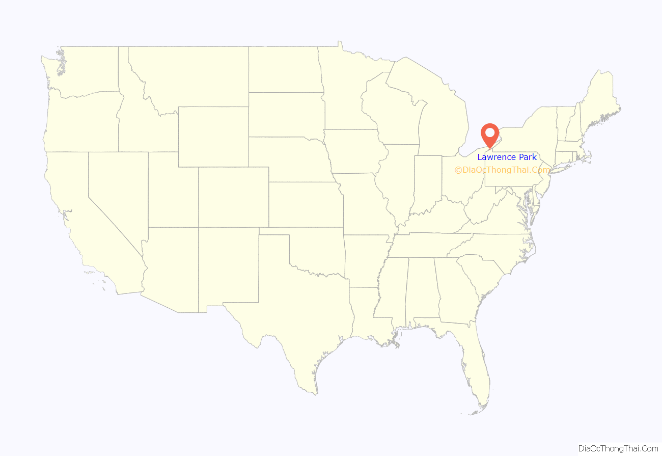
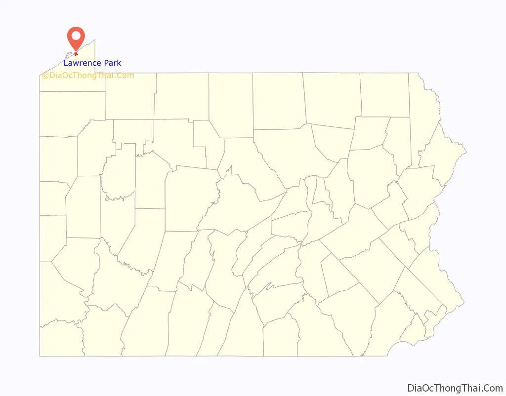
Lawrence Park location map. Where is Lawrence Park CDP?
History
The Park Dinor was listed on the National Register of Historic Places in 2004. Lawrence Park is also home to the Lighthouse Inn Motel.
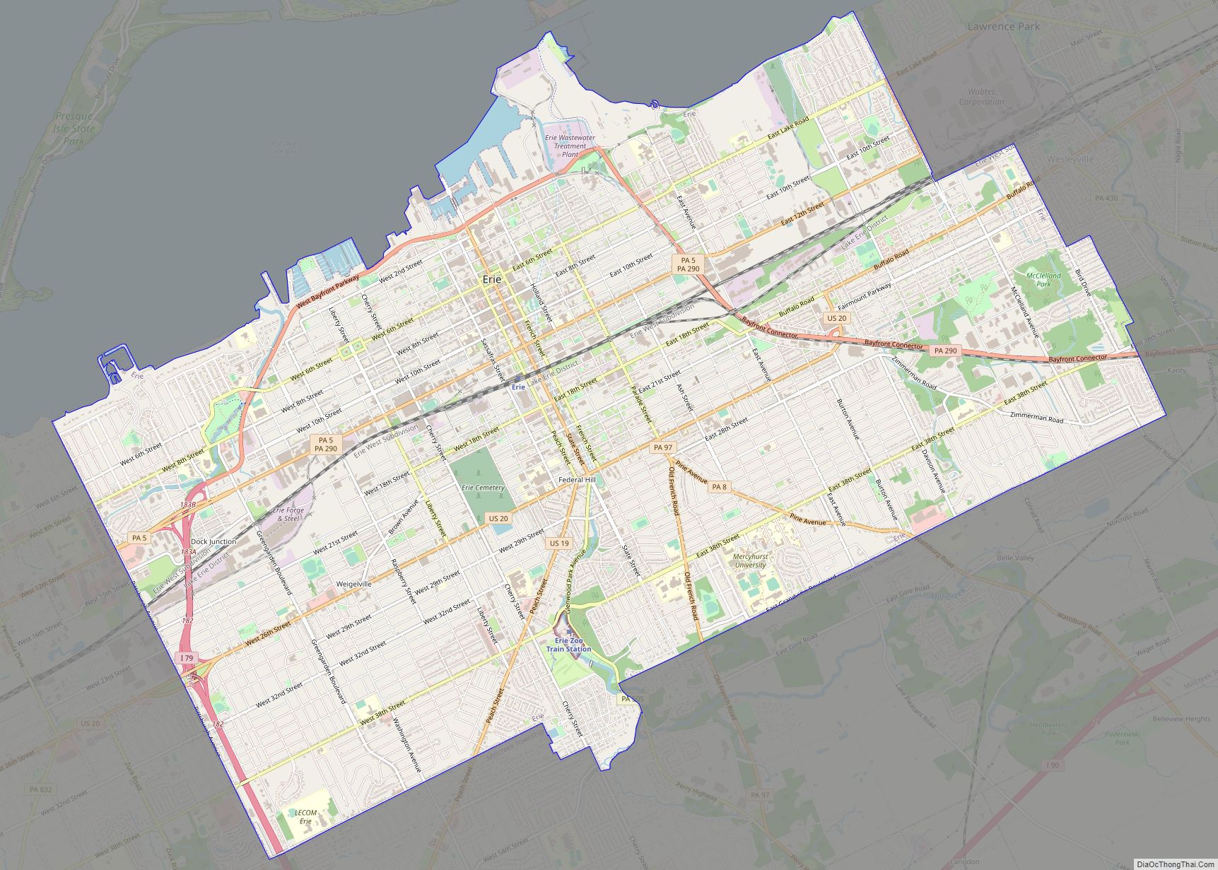
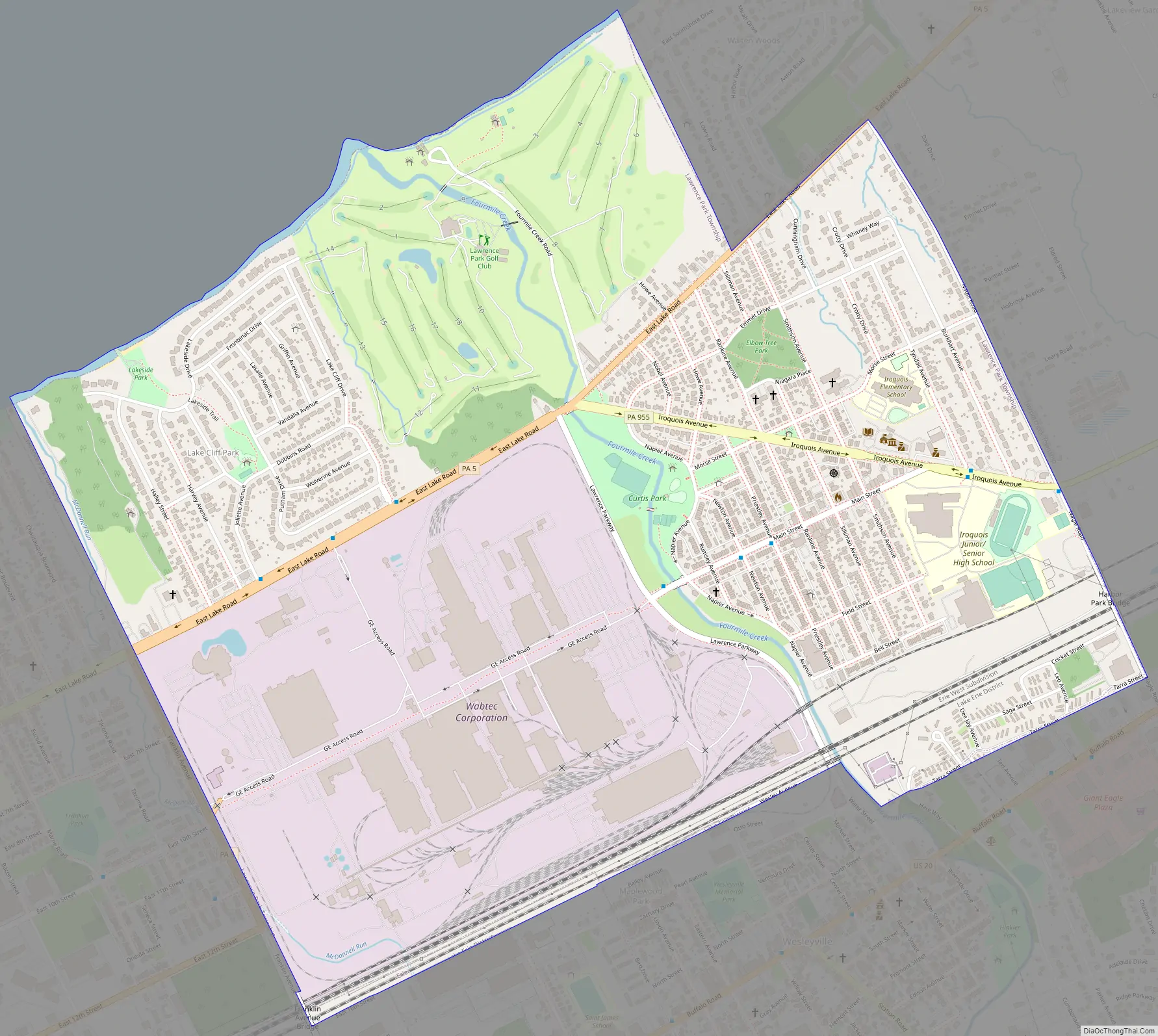
Lawrence Park Road Map
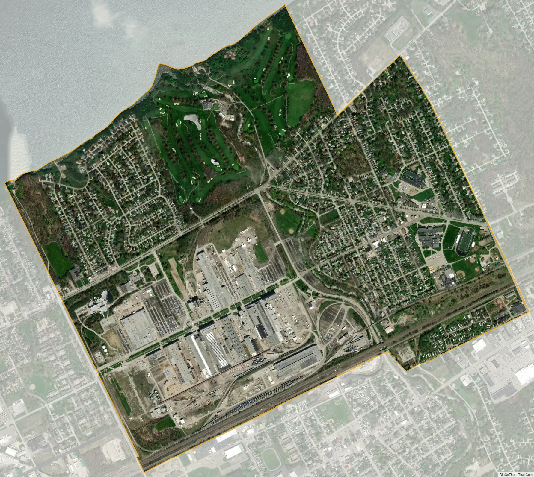
Lawrence Park city Satellite Map
Geography
Lawrence Park Township is located at 42°9′5″N 80°1′11″W / 42.15139°N 80.01972°W / 42.15139; -80.01972 (42.151257, -80.019648). It is bordered to the west by the city of Erie, to the south by Erie and the borough of Wesleyville, to the east by Harborcreek Township, and to the north by Lake Erie.
According to the United States Census Bureau, the township has a total area of 1.9 square miles (4.8 km), all of it land.
See also
Map of Pennsylvania State and its subdivision:- Adams
- Allegheny
- Armstrong
- Beaver
- Bedford
- Berks
- Blair
- Bradford
- Bucks
- Butler
- Cambria
- Cameron
- Carbon
- Centre
- Chester
- Clarion
- Clearfield
- Clinton
- Columbia
- Crawford
- Cumberland
- Dauphin
- Delaware
- Elk
- Erie
- Fayette
- Forest
- Franklin
- Fulton
- Greene
- Huntingdon
- Indiana
- Jefferson
- Juniata
- Lackawanna
- Lancaster
- Lawrence
- Lebanon
- Lehigh
- Luzerne
- Lycoming
- Mc Kean
- Mercer
- Mifflin
- Monroe
- Montgomery
- Montour
- Northampton
- Northumberland
- Perry
- Philadelphia
- Pike
- Potter
- Schuylkill
- Snyder
- Somerset
- Sullivan
- Susquehanna
- Tioga
- Union
- Venango
- Warren
- Washington
- Wayne
- Westmoreland
- Wyoming
- York
- Alabama
- Alaska
- Arizona
- Arkansas
- California
- Colorado
- Connecticut
- Delaware
- District of Columbia
- Florida
- Georgia
- Hawaii
- Idaho
- Illinois
- Indiana
- Iowa
- Kansas
- Kentucky
- Louisiana
- Maine
- Maryland
- Massachusetts
- Michigan
- Minnesota
- Mississippi
- Missouri
- Montana
- Nebraska
- Nevada
- New Hampshire
- New Jersey
- New Mexico
- New York
- North Carolina
- North Dakota
- Ohio
- Oklahoma
- Oregon
- Pennsylvania
- Rhode Island
- South Carolina
- South Dakota
- Tennessee
- Texas
- Utah
- Vermont
- Virginia
- Washington
- West Virginia
- Wisconsin
- Wyoming