Luzerne is a borough located 5 miles (8 km) north of Wilkes Barre in Luzerne County, Pennsylvania, United States.
The population was 2,703 at the time of the 2020 census.
| Name: | Luzerne borough |
|---|---|
| LSAD Code: | 21 |
| LSAD Description: | borough (suffix) |
| State: | Pennsylvania |
| County: | Luzerne County |
| Incorporated: | 1882 |
| Total Area: | 0.71 sq mi (1.83 km²) |
| Land Area: | 0.71 sq mi (1.83 km²) |
| Water Area: | 0.00 sq mi (0.00 km²) |
| Total Population: | 2,711 |
| Population Density: | 3,834.51/sq mi (1,480.62/km²) |
| Area code: | 570 |
| FIPS code: | 4245568 |
| Website: | luzerneborough.org |
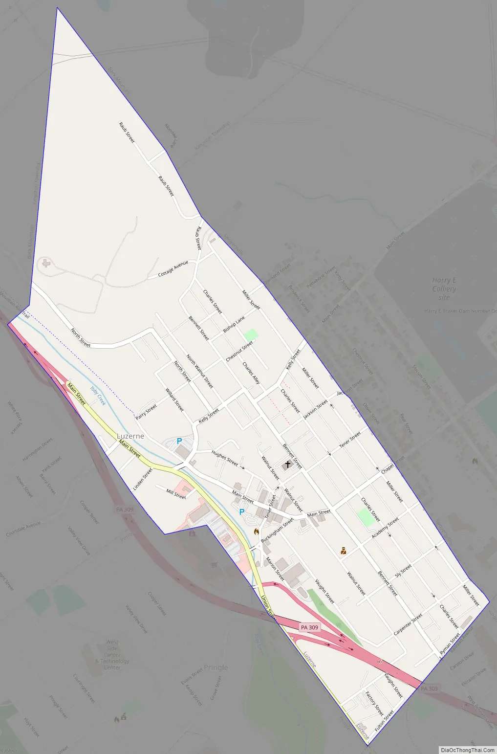
Online Interactive Map
Click on ![]() to view map in "full screen" mode.
to view map in "full screen" mode.
Luzerne location map. Where is Luzerne borough?


History
The community was first settled in 1807. It was later incorporated as a borough in 1882. Like Luzerne County, the borough was named after Chevalier de la Luzerne, a French diplomat.
In the early twentieth century, coal mining and manufacturing were the main industries in the community. The borough had coal mines, a foundry, drill factories, flour and feed mills, a canning factory, and a silk mill.
Luzerne Road Map
Luzerne city Satellite Map

Geography
Luzerne is located at 41°17′2″N 75°53′34″W / 41.28389°N 75.89278°W / 41.28389; -75.89278 (41.283780, -75.892890).
According to the United States Census Bureau, the borough has a total area of 0.69 square miles (1.8 km), all of it land.
See also
Map of Pennsylvania State and its subdivision:- Adams
- Allegheny
- Armstrong
- Beaver
- Bedford
- Berks
- Blair
- Bradford
- Bucks
- Butler
- Cambria
- Cameron
- Carbon
- Centre
- Chester
- Clarion
- Clearfield
- Clinton
- Columbia
- Crawford
- Cumberland
- Dauphin
- Delaware
- Elk
- Erie
- Fayette
- Forest
- Franklin
- Fulton
- Greene
- Huntingdon
- Indiana
- Jefferson
- Juniata
- Lackawanna
- Lancaster
- Lawrence
- Lebanon
- Lehigh
- Luzerne
- Lycoming
- Mc Kean
- Mercer
- Mifflin
- Monroe
- Montgomery
- Montour
- Northampton
- Northumberland
- Perry
- Philadelphia
- Pike
- Potter
- Schuylkill
- Snyder
- Somerset
- Sullivan
- Susquehanna
- Tioga
- Union
- Venango
- Warren
- Washington
- Wayne
- Westmoreland
- Wyoming
- York
- Alabama
- Alaska
- Arizona
- Arkansas
- California
- Colorado
- Connecticut
- Delaware
- District of Columbia
- Florida
- Georgia
- Hawaii
- Idaho
- Illinois
- Indiana
- Iowa
- Kansas
- Kentucky
- Louisiana
- Maine
- Maryland
- Massachusetts
- Michigan
- Minnesota
- Mississippi
- Missouri
- Montana
- Nebraska
- Nevada
- New Hampshire
- New Jersey
- New Mexico
- New York
- North Carolina
- North Dakota
- Ohio
- Oklahoma
- Oregon
- Pennsylvania
- Rhode Island
- South Carolina
- South Dakota
- Tennessee
- Texas
- Utah
- Vermont
- Virginia
- Washington
- West Virginia
- Wisconsin
- Wyoming


