Manns Choice is a borough in Bedford County, Pennsylvania, United States. The population was 313 at the 2020 census.
| Name: | Manns Choice borough |
|---|---|
| LSAD Code: | 21 |
| LSAD Description: | borough (suffix) |
| State: | Pennsylvania |
| County: | Bedford County |
| Incorporated: | 1886 |
| Elevation: | 1,460 ft (450 m) |
| Total Area: | 0.51 sq mi (1.31 km²) |
| Land Area: | 0.50 sq mi (1.30 km²) |
| Water Area: | 0.01 sq mi (0.01 km²) |
| Total Population: | 316 |
| Population Density: | 630.74/sq mi (243.70/km²) |
| Area code: | 814 |
| FIPS code: | 4246944 |
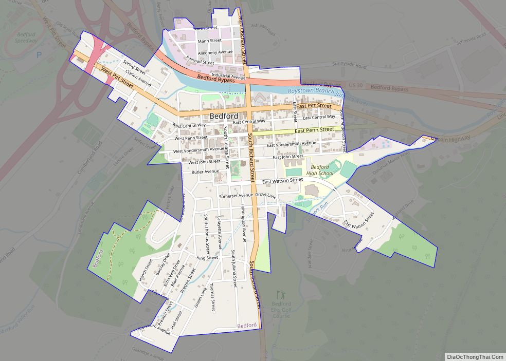
Online Interactive Map
Click on ![]() to view map in "full screen" mode.
to view map in "full screen" mode.
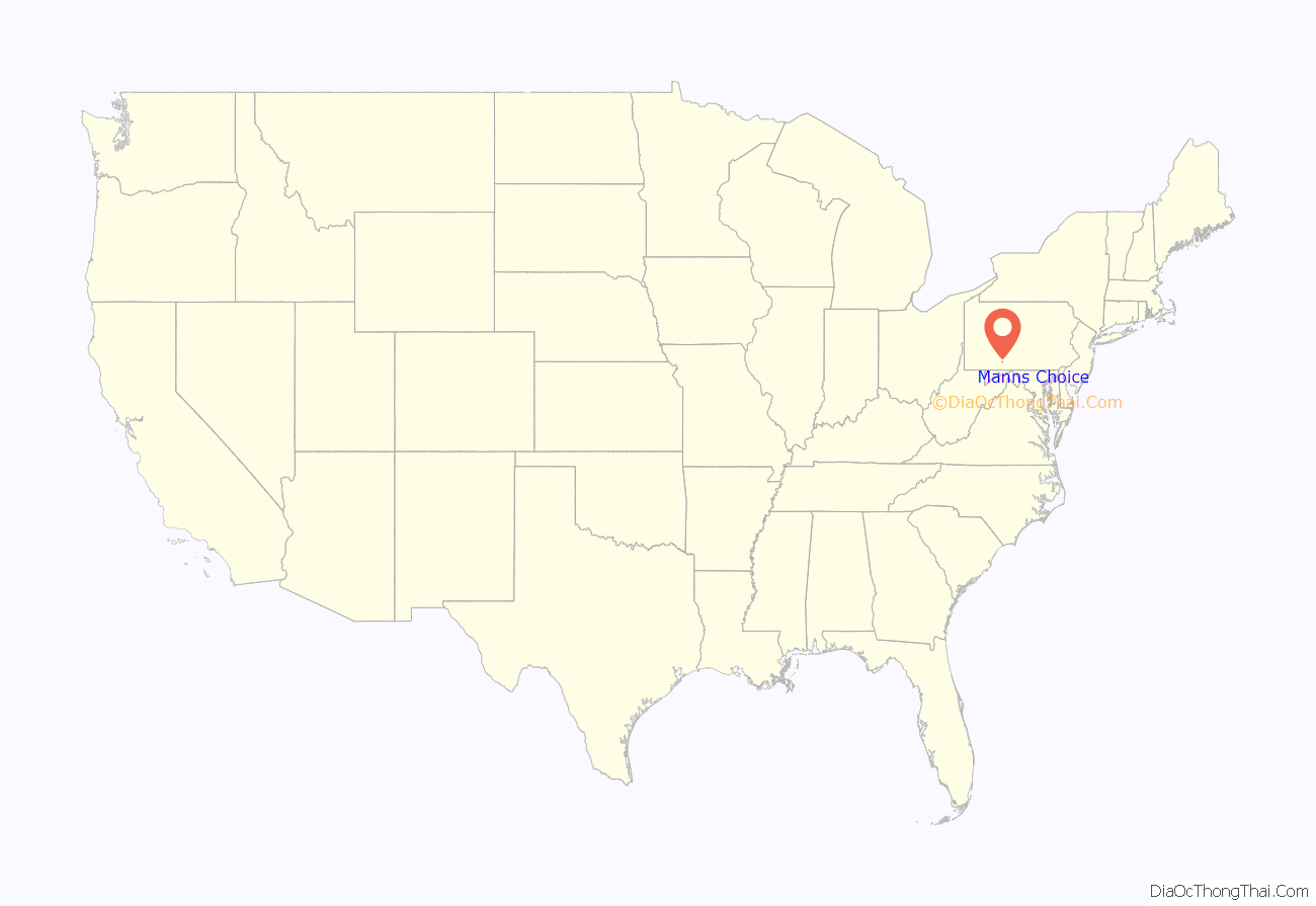
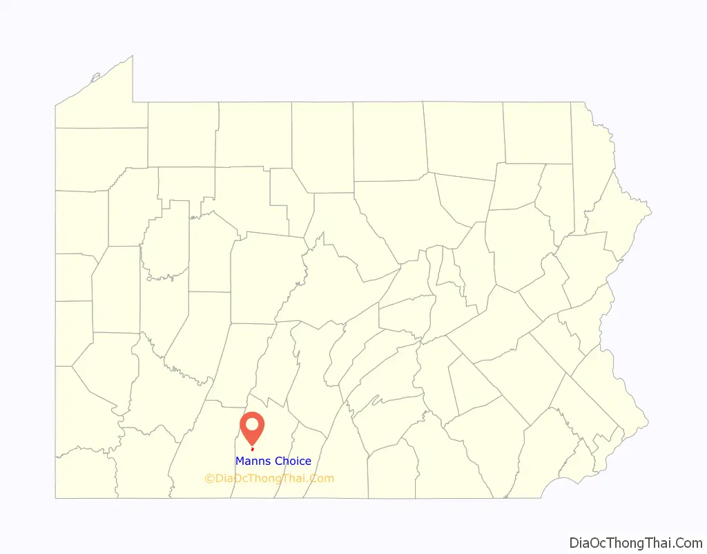
Manns Choice location map. Where is Manns Choice borough?
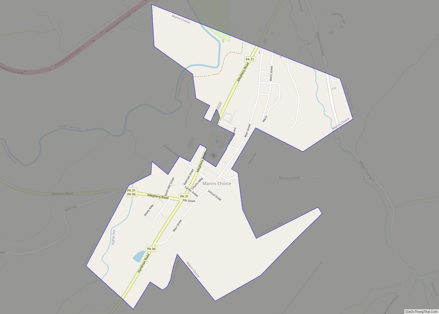
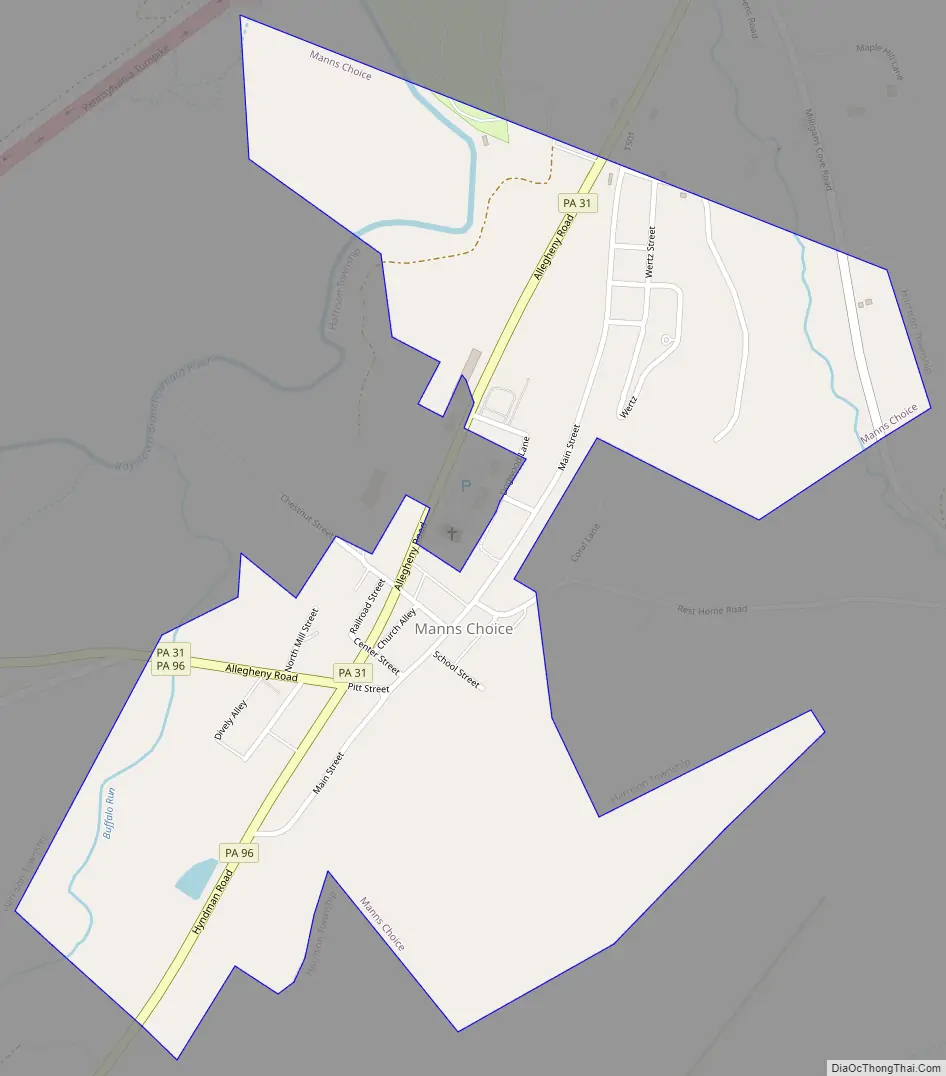
Manns Choice Road Map
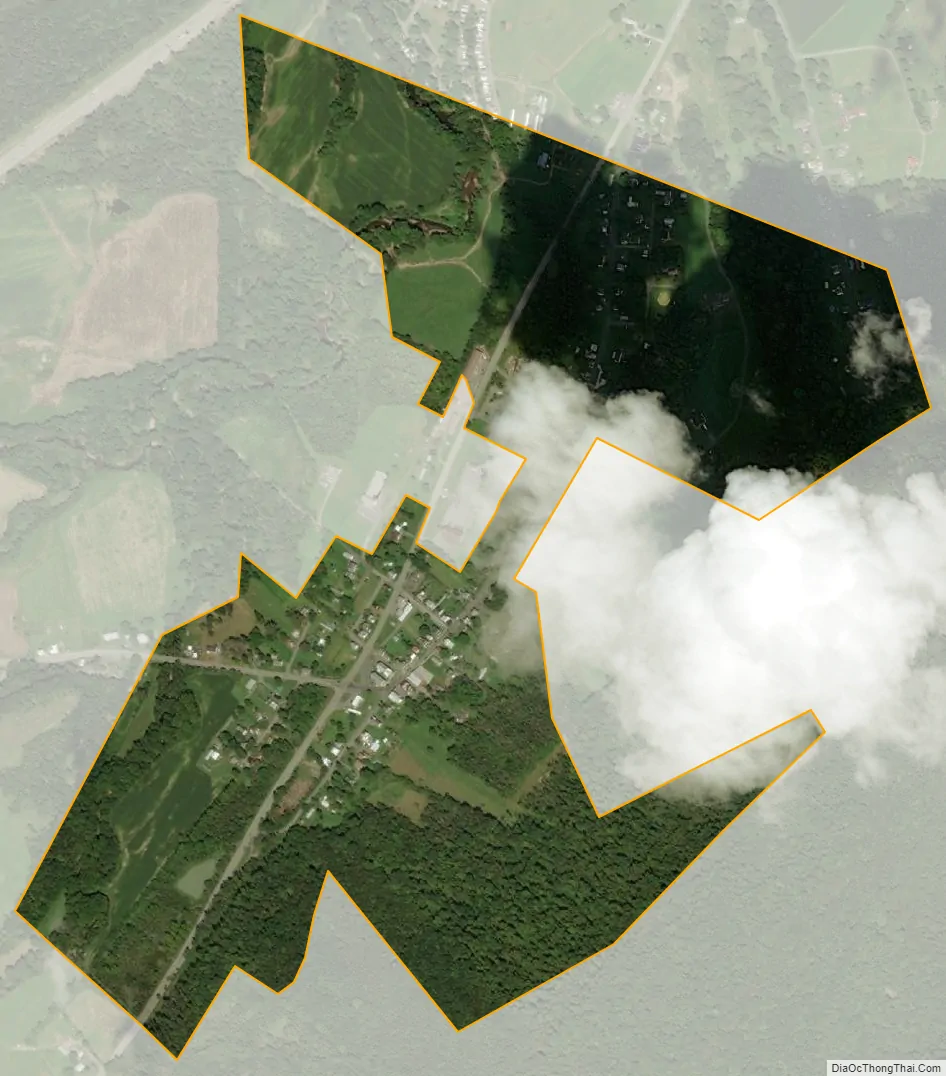
Manns Choice city Satellite Map
Geography
Manns Choice is located in west-central Bedford County at 40°0′10″N 78°35′29″W / 40.00278°N 78.59139°W / 40.00278; -78.59139 (40.002836, -78.591440), in the valley of the Raystown Branch of the Juniata River. Buffalo Mountain and Wills Mountain rise to the east. The borough is mostly surrounded by Harrison Township, but it is bordered by Napier Township to the northwest.
Pennsylvania Routes 31 and 96 pass through the borough. Route 31 leads northeast 3.4 miles (5.5 km) to U.S. Route 30 west of Bedford, while Route 96 heads south 15 miles (24 km) to Hyndman and 29 miles (47 km) to Cumberland, Maryland. Route 31 and 96 together head northwest out of town, Route 96 leading to Shawnee State Park and Schellsburg, and Route 31 leading eventually to Somerset. Interstate 76, the Pennsylvania Turnpike, passes just north of the borough limits but does not provide access; the nearest exit is in Bedford.
According to the United States Census Bureau, the borough has a total area of 0.51 square miles (1.31 km), of which 0.004 square miles (0.01 km), or 1.02%, is water.
Manns Choice town center still preserves its historical watering trough once used to water the horses pulling traveling stages on their way across “the glades”, now Glades Pike, to Fort Pitt, now Pittsburgh. It has chiefly been an agricultural community since its settlement following the Revolutionary War. The town’s farms and forest were once a land grant offered to German mercenary Hessian Jägers paying loyalty to General George Washington’s infantry.
Prior to its settlement, the area was home to the Shawnee and Monongahela native tribes. The tribes inhabited the area’s many small creeks, river banks and meadowlands. They groomed a well balanced permacultural environment which still exists on thousands of surrounding acres of state forests, parks and farmlands today.
Today, the primary industry is still agriculture. Of its many farms, Horn O’ Plenty Farm and Freshtaurant is noted for pioneering innovative agricultural practices and markets that have influenced the region, reassuring confidence for the future of farmers.
The historic White Sulphur Springs Hotel is located 4 miles (6 km) south of the borough in Harrison Township. Built in 1884, the building originated as a hotel and restaurant, and is now home to the non-profit ministry of Officers Christian Fellowship, which serves military servicepeople and their families as a retreat center. In the fall, winter and spring off-season, the facility operates as a conference center for churches, business meetings, banquets and day gatherings.
It is home to the Coral Caverns, which house the world’s only fossilized coral reef, open to the public since 1932.
See also
Map of Pennsylvania State and its subdivision:- Adams
- Allegheny
- Armstrong
- Beaver
- Bedford
- Berks
- Blair
- Bradford
- Bucks
- Butler
- Cambria
- Cameron
- Carbon
- Centre
- Chester
- Clarion
- Clearfield
- Clinton
- Columbia
- Crawford
- Cumberland
- Dauphin
- Delaware
- Elk
- Erie
- Fayette
- Forest
- Franklin
- Fulton
- Greene
- Huntingdon
- Indiana
- Jefferson
- Juniata
- Lackawanna
- Lancaster
- Lawrence
- Lebanon
- Lehigh
- Luzerne
- Lycoming
- Mc Kean
- Mercer
- Mifflin
- Monroe
- Montgomery
- Montour
- Northampton
- Northumberland
- Perry
- Philadelphia
- Pike
- Potter
- Schuylkill
- Snyder
- Somerset
- Sullivan
- Susquehanna
- Tioga
- Union
- Venango
- Warren
- Washington
- Wayne
- Westmoreland
- Wyoming
- York
- Alabama
- Alaska
- Arizona
- Arkansas
- California
- Colorado
- Connecticut
- Delaware
- District of Columbia
- Florida
- Georgia
- Hawaii
- Idaho
- Illinois
- Indiana
- Iowa
- Kansas
- Kentucky
- Louisiana
- Maine
- Maryland
- Massachusetts
- Michigan
- Minnesota
- Mississippi
- Missouri
- Montana
- Nebraska
- Nevada
- New Hampshire
- New Jersey
- New Mexico
- New York
- North Carolina
- North Dakota
- Ohio
- Oklahoma
- Oregon
- Pennsylvania
- Rhode Island
- South Carolina
- South Dakota
- Tennessee
- Texas
- Utah
- Vermont
- Virginia
- Washington
- West Virginia
- Wisconsin
- Wyoming