Marysville is a borough in Perry County, Pennsylvania, United States. The population was 2,652 at the 2020 census. It is part of the Harrisburg–Carlisle Metropolitan Statistical Area.
The borough was settled in 1755, incorporated as the Borough of Haley in 1866, and re-incorporated as the Borough of Marysville in 1867.
| Name: | Marysville borough |
|---|---|
| LSAD Code: | 21 |
| LSAD Description: | borough (suffix) |
| State: | Pennsylvania |
| County: | Perry County |
| Incorporated: | 1867 |
| Total Area: | 2.34 sq mi (6.06 km²) |
| Land Area: | 2.33 sq mi (6.05 km²) |
| Water Area: | 0.00 sq mi (0.01 km²) |
| Total Population: | 2,652 |
| Population Density: | 1,135.76/sq mi (438.53/km²) |
| Area code: | 717 |
| FIPS code: | 4247968 |
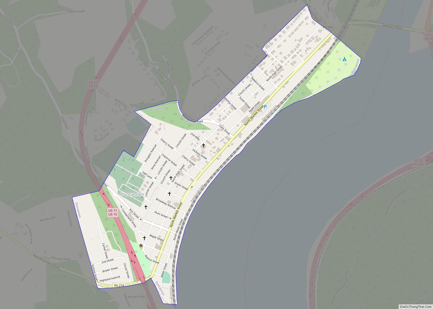
Online Interactive Map
Click on ![]() to view map in "full screen" mode.
to view map in "full screen" mode.
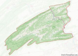
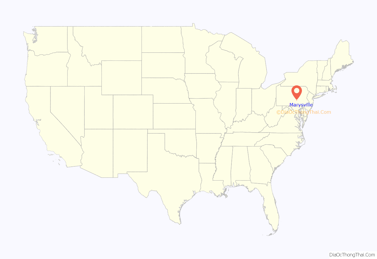
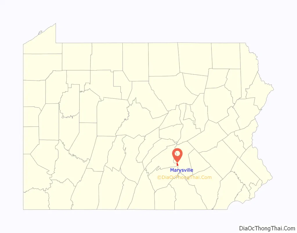
Marysville location map. Where is Marysville borough?
History
The Rockville Bridge was added to the National Register of Historic Places in 1975.
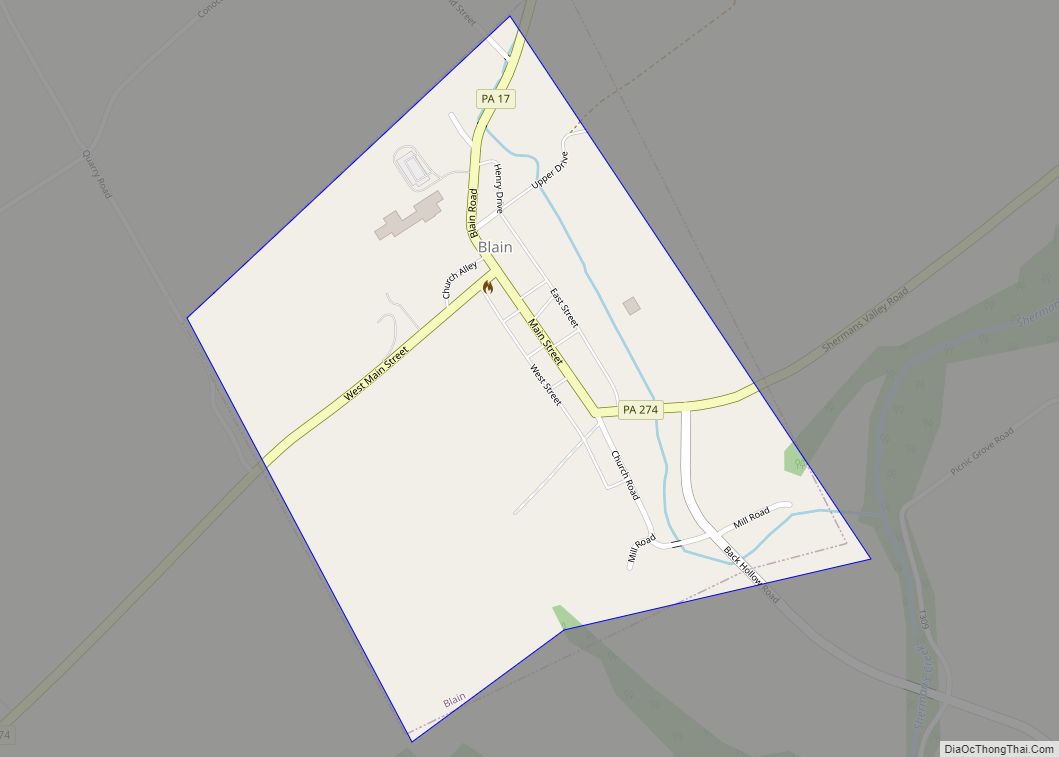
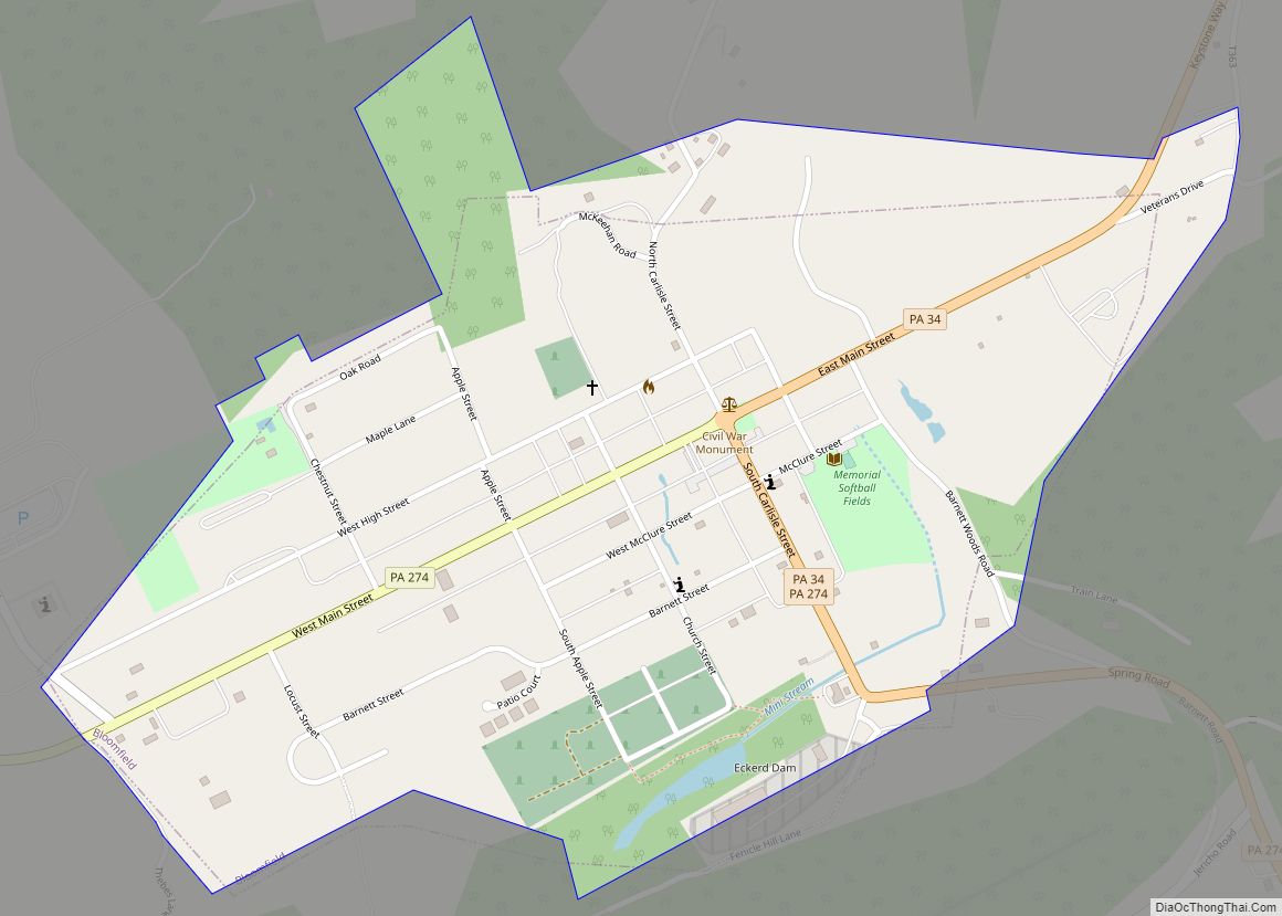
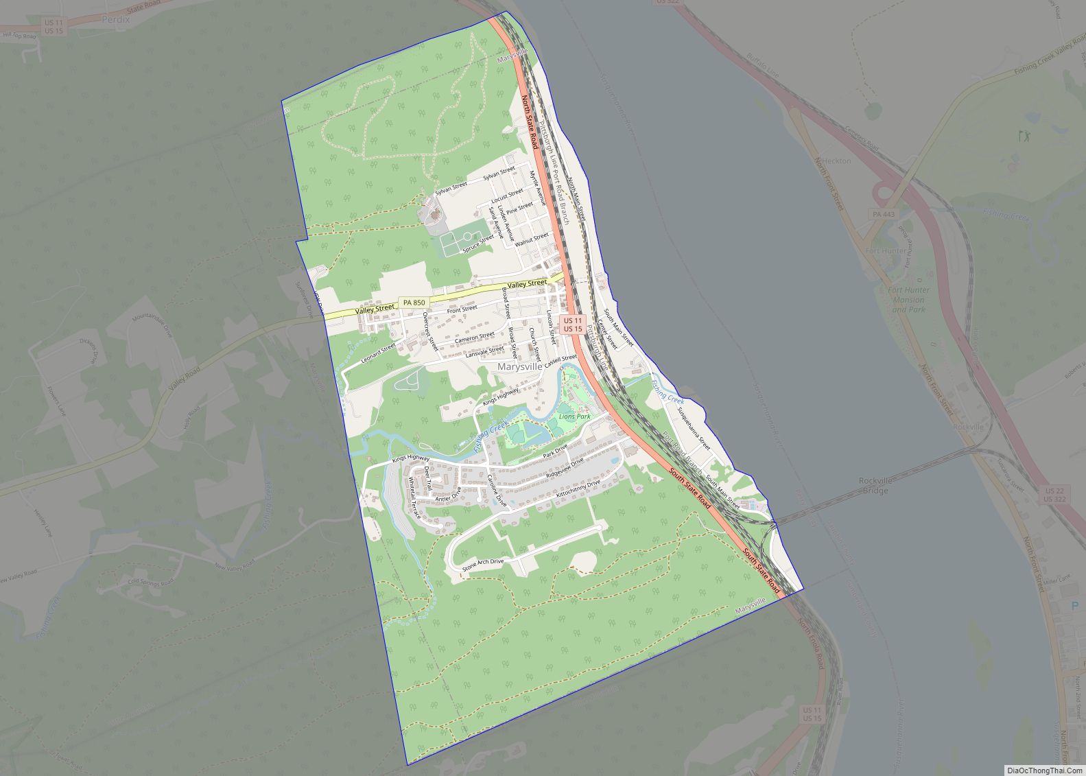
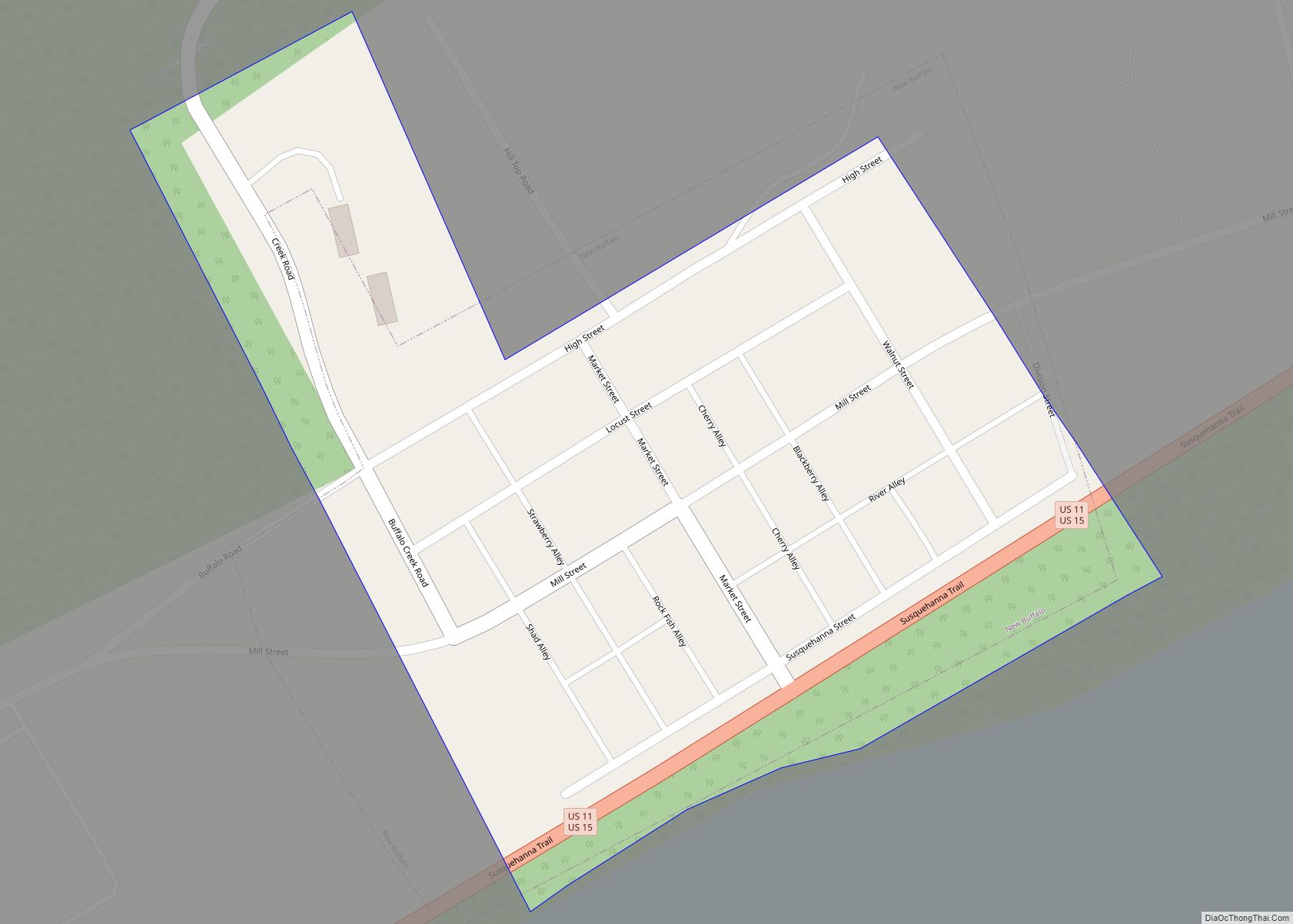
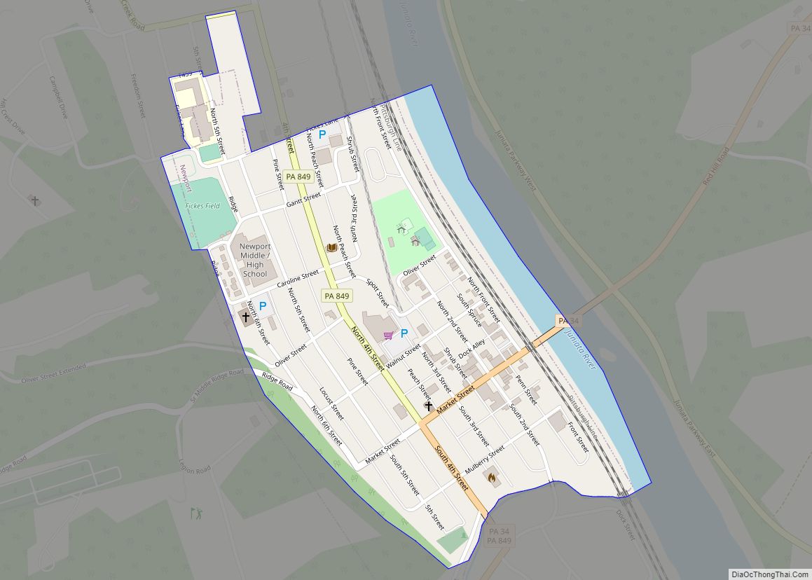
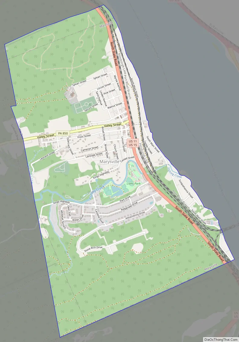
Marysville Road Map
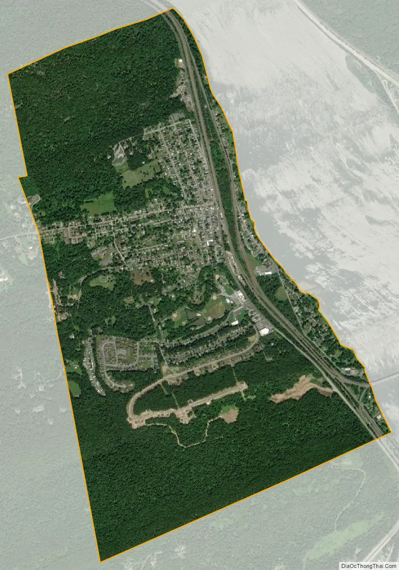
Marysville city Satellite Map
Geography
Marysville is located at 40°20′28″N 76°55′59″W / 40.34111°N 76.93306°W / 40.34111; -76.93306 (40.342287, -76.931463).
According to the United States Census Bureau, the borough has a total area of 2.4 square miles (6.2 km), all land.
Marysville is bordered by Blue Mountain to the south, by the Susquehanna River to the east, by Cove Mountain to the north, and by Rye Township to the west. U.S. Route 11/U.S. Route 15 passes through the town from north to south, and Pennsylvania Route 850 has its terminus here.
See also
Map of Pennsylvania State and its subdivision:- Adams
- Allegheny
- Armstrong
- Beaver
- Bedford
- Berks
- Blair
- Bradford
- Bucks
- Butler
- Cambria
- Cameron
- Carbon
- Centre
- Chester
- Clarion
- Clearfield
- Clinton
- Columbia
- Crawford
- Cumberland
- Dauphin
- Delaware
- Elk
- Erie
- Fayette
- Forest
- Franklin
- Fulton
- Greene
- Huntingdon
- Indiana
- Jefferson
- Juniata
- Lackawanna
- Lancaster
- Lawrence
- Lebanon
- Lehigh
- Luzerne
- Lycoming
- Mc Kean
- Mercer
- Mifflin
- Monroe
- Montgomery
- Montour
- Northampton
- Northumberland
- Perry
- Philadelphia
- Pike
- Potter
- Schuylkill
- Snyder
- Somerset
- Sullivan
- Susquehanna
- Tioga
- Union
- Venango
- Warren
- Washington
- Wayne
- Westmoreland
- Wyoming
- York
- Alabama
- Alaska
- Arizona
- Arkansas
- California
- Colorado
- Connecticut
- Delaware
- District of Columbia
- Florida
- Georgia
- Hawaii
- Idaho
- Illinois
- Indiana
- Iowa
- Kansas
- Kentucky
- Louisiana
- Maine
- Maryland
- Massachusetts
- Michigan
- Minnesota
- Mississippi
- Missouri
- Montana
- Nebraska
- Nevada
- New Hampshire
- New Jersey
- New Mexico
- New York
- North Carolina
- North Dakota
- Ohio
- Oklahoma
- Oregon
- Pennsylvania
- Rhode Island
- South Carolina
- South Dakota
- Tennessee
- Texas
- Utah
- Vermont
- Virginia
- Washington
- West Virginia
- Wisconsin
- Wyoming