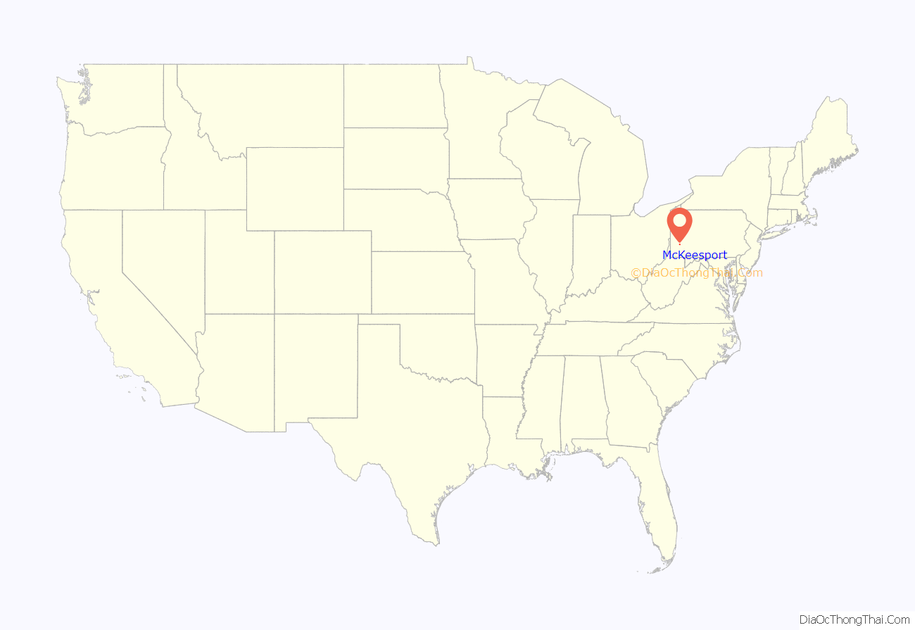
McKeesport is a city in Allegheny County, Pennsylvania, United States. It is situated at the confluence of the Monongahela and Youghiogheny rivers and within the Pittsburgh metropolitan area. The population was 17,727 as of the 2020 census.
| Name: | McKeesport city |
|---|---|
| LSAD Code: | 25 |
| LSAD Description: | city (suffix) |
| State: | Pennsylvania |
| County: | Allegheny County |
| Elevation: | 760 ft (230 m) |
| Total Area: | 5.44 sq mi (14.10 km²) |
| Land Area: | 5.05 sq mi (13.08 km²) |
| Water Area: | 0.40 sq mi (1.02 km²) |
| Total Population: | 17,727 |
| Population Density: | 3,510.99/sq mi (1,355.48/km²) |
| FIPS code: | 4246256 |
| Website: | www.mckeesport-pa.gov |
Online Interactive Map
Click on ![]() to view map in "full screen" mode.
to view map in "full screen" mode.
McKeesport location map. Where is McKeesport city?
History
Early history
David McKee emigrated from Scotland and was the first permanent white settler at the forks of the Monongahela and Youghiogheny Rivers, the site of present-day McKeesport, in 1755. Around the time of the French and Indian Wars, George Washington often came to McKeesport to visit his friend, Queen Alliquippa, a Seneca Indian ruler. The Colonial Government granted David McKee exclusive right of ferrage over those rivers on April 3, 1769, called “McKee’s Port”.
His son, John McKee, an original settler of Philadelphia, built a log cabin at this location. After taking over his father’s local river ferry business, he devised a plan for a city to be called McKee’s Port in 1795. John set out his proposal in the Pittsburgh Gazette, as part of a program under which new residents could purchase plots of land for $20.00. A lottery was used to distribute the plots to avoid complaints from new land owners concerning “inferior” locations.
19th century
McKeesport, then part of Versailles Township, began to grow in 1830 when mining of the large deposits of bituminous coal in the region began. The first schoolhouse was built in 1832, with James E. Huey as its schoolmaster.
McKeesport was incorporated as a borough in 1842, and the city’s first steel mill was established in 1851. The National Tube Works opened in 1872, and in the years directly following, according to the U.S. Census Bureau, McKeesport was the fastest growing municipality in the nation. Families arrived from other parts of the eastern United States, Italy, Germany, Russia, Poland, Czechoslovakia, and Hungary, with most working at the National Tube Works.
20th century
McKeesport rose to national importance during the 1900s as a center for manufacturing steel. In 1899, the National Tube Works Company was consolidated with twenty other pipemaking firms in the northeastern United States to form the National Tube Company. In 1901, the National Tube Company and nine other major American steel companies merged to form U.S. Steel. The city’s population continued to grow steadily, reaching a peak of 55,355 in 1940. The subsequent decline since then is attributable to the general economic malaise that descended upon the region when the steelmaking industry moved elsewhere.
On June 23, 1944, an F4 tornado struck the southern part of McKeesport, killing 17 people. Many multiple-story residences collapsed. In all, 88 homes in the city were destroyed, 306 were damaged, and 400 other buildings were damaged or destroyed.
Thirteen years before both faced off in some of the most memorable televised Presidential debates, future presidents (and contemporary U.S. Representatives) Richard M. Nixon and John F. Kennedy met in McKeesport for their first of five debates on April 22, 1947, to debate labor issues related to the Taft-Hartley Act.
On May 21, 1976, downtown McKeesport experienced the largest fire in the city’s history, referred to as the “Famous Fire”, due to the fire beginning in the “Famous Department Store” on Market and Fifth Streets. The fire destroyed seven downtown structures, heavily damaged more than 12 others, and started fires in at least 10 homes due to hot embers blowing more than a half mile due to heavy gusting winds. Around 1,000 firefighters from more than 40 neighboring fire companies responded to assist, and a contingent of the Pennsylvania Army National Guard were deployed. The McKeesport Daily News reported the next day that “only shells and piles of rubble” remained “where city landmarks once stood.”
National Tube closed in the 1980s, along with other U.S. Steel plants in the Mon Valley. The city, with the help of regional development agencies, has conducted efforts to revitalize the former mill sites.
McKeesport Road Map
McKeesport city Satellite Map
Geography
McKeesport has a total area of 5.4 square miles (14 km), of which 5.0 square miles (13 km) is land and 0.4 square miles (1.0 km), or 7.06%, is water. McKeesport is located about 12 miles (19 km) upstream, and south, from Pittsburgh, at the confluence of the Monongahela and Youghiogheny rivers. The city is on the Allegheny Plateau, within the ecoregion of the Western Allegheny Plateau. The downtown area is located to the northwest, while the southern and eastern areas of the city are primarily residential.
Climate
The climate in this area is characterized by hot, humid summers and generally mild to cool winters. According to the Köppen Climate Classification system, McKeesport has a humid continental climate, abbreviated “Dfa” on climate maps.
Surrounding and adjacent communities
McKeesport has five land borders, including the Township of North Versailles to the north-northeast, the Borough of White Oak to the east, and Borough of Versailles to the south. The section of the city west of the Monongahela River and Youghiogheny River confluence is bordered by the Borough of Port Vue to the south and the Borough of Glassport to the southwest. The City of Duquesne is located north across the Monongahela River, connected by the McKeesport-Duquesne Bridge, as is Dravosburg and West Mifflin, connected by the W.D. Mansfield Memorial Bridge. Port Vue, the Borough of Liberty and Elizabeth Township are located across the Youghiogheny River to the west, connected by the 15th Street Bridge.
See also
Map of Pennsylvania State and its subdivision:- Adams
- Allegheny
- Armstrong
- Beaver
- Bedford
- Berks
- Blair
- Bradford
- Bucks
- Butler
- Cambria
- Cameron
- Carbon
- Centre
- Chester
- Clarion
- Clearfield
- Clinton
- Columbia
- Crawford
- Cumberland
- Dauphin
- Delaware
- Elk
- Erie
- Fayette
- Forest
- Franklin
- Fulton
- Greene
- Huntingdon
- Indiana
- Jefferson
- Juniata
- Lackawanna
- Lancaster
- Lawrence
- Lebanon
- Lehigh
- Luzerne
- Lycoming
- Mc Kean
- Mercer
- Mifflin
- Monroe
- Montgomery
- Montour
- Northampton
- Northumberland
- Perry
- Philadelphia
- Pike
- Potter
- Schuylkill
- Snyder
- Somerset
- Sullivan
- Susquehanna
- Tioga
- Union
- Venango
- Warren
- Washington
- Wayne
- Westmoreland
- Wyoming
- York
- Alabama
- Alaska
- Arizona
- Arkansas
- California
- Colorado
- Connecticut
- Delaware
- District of Columbia
- Florida
- Georgia
- Hawaii
- Idaho
- Illinois
- Indiana
- Iowa
- Kansas
- Kentucky
- Louisiana
- Maine
- Maryland
- Massachusetts
- Michigan
- Minnesota
- Mississippi
- Missouri
- Montana
- Nebraska
- Nevada
- New Hampshire
- New Jersey
- New Mexico
- New York
- North Carolina
- North Dakota
- Ohio
- Oklahoma
- Oregon
- Pennsylvania
- Rhode Island
- South Carolina
- South Dakota
- Tennessee
- Texas
- Utah
- Vermont
- Virginia
- Washington
- West Virginia
- Wisconsin
- Wyoming
