West Mifflin is a borough in Allegheny County, Pennsylvania, United States, located southeast of downtown Pittsburgh. The population was 19,589 at the 2020 census. It is named after Thomas Mifflin, 1st Governor of Pennsylvania, signer of the United States Constitution, and 1st Quartermaster General of the United States Army.
Although the borough is heavily residential, it is home to one of America’s oldest traditional amusement parks, Kennywood Park. Other employers include advanced naval nuclear propulsion technology research and development facility, Bettis Atomic Power Laboratory; monorail manufacturer Bombardier; US Steel’s Mon Valley Works–Irvin Plant; Community College of Allegheny County’s South Campus; and the Allegheny County Airport.
| Name: | West Mifflin borough |
|---|---|
| LSAD Code: | 21 |
| LSAD Description: | borough (suffix) |
| State: | Pennsylvania |
| County: | Allegheny County |
| Incorporated: | 1788 (Mifflin Township) |
| Total Area: | 14.50 sq mi (37.56 km²) |
| Land Area: | 14.21 sq mi (36.79 km²) |
| Water Area: | 0.29 sq mi (0.76 km²) 1.8% |
| Total Population: | 19,589 |
| Population Density: | 1,386.67/sq mi (535.38/km²) |
| ZIP code: | 15122 |
| Area code: | 878 |
| FIPS code: | 4283512 |
| Website: | www.westmifflinborough.com |
Online Interactive Map
Click on ![]() to view map in "full screen" mode.
to view map in "full screen" mode.
West Mifflin location map. Where is West Mifflin borough?


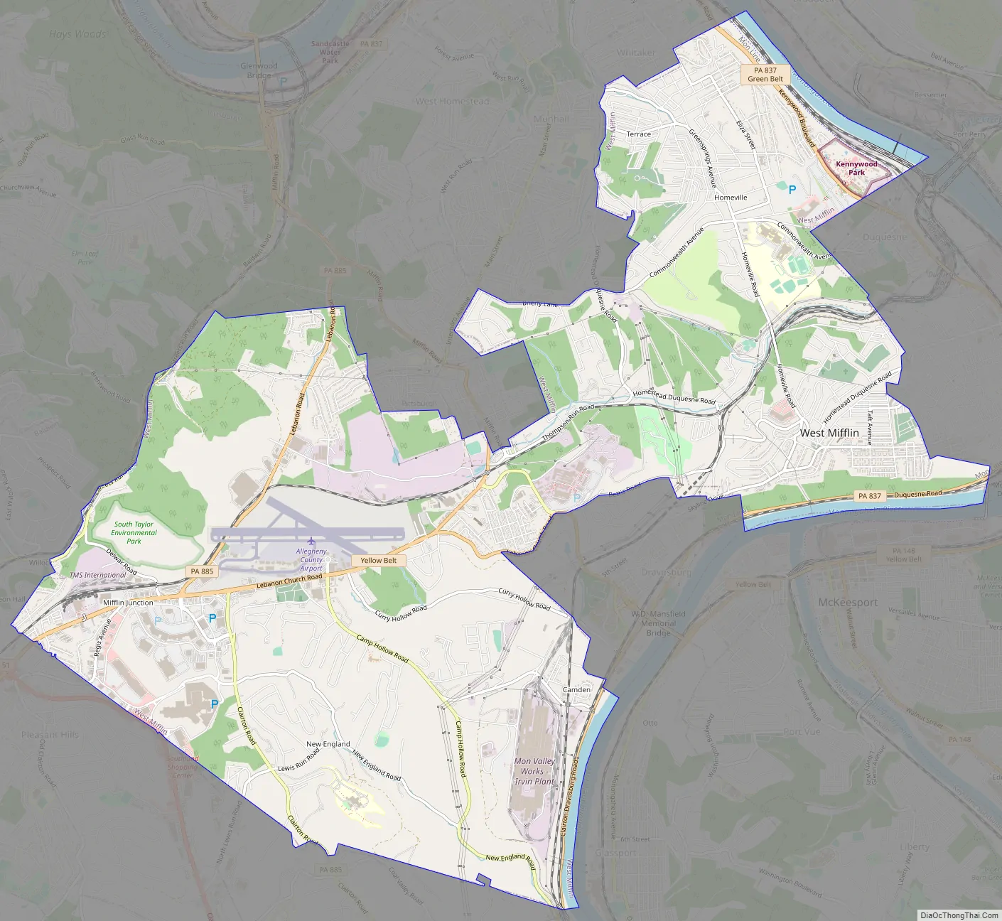
West Mifflin Road Map
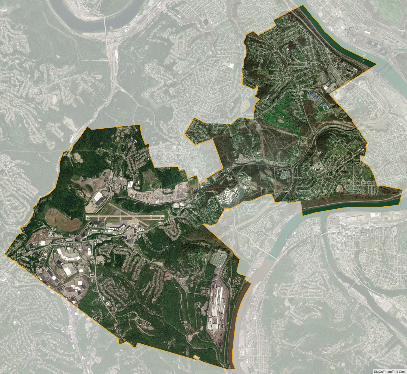
West Mifflin city Satellite Map
Geography
According to the United States Census Bureau, the borough has a total area of 14.4 square miles (37 km), of which 14.2 square miles (37 km) is land and 0.3 square miles (0.78 km), or 1.80%, is water. The landscape is largely hilly and wooded, and the borough’s eastern boundary is contiguous with the Monongahela River three separate times. Much of the original landscape has been altered as a result of the historic dumping of steel mill byproducts such as slag and fly ash.
Surrounding and adjacent neighborhoods
West Mifflin has ten land borders, including the Pittsburgh neighborhoods of Lincoln Place and Hays as well as Munhall and Whitaker, to the north, Duquesne to the east, Dravosburg to the southeast, Jefferson Hills and Pleasant Hills to the south, Baldwin to the west and also a short border with Clairton to the south.
Three segments of West Mifflin run along the Monongahela River. Adjacent to these areas across the river are Braddock, North Braddock, McKeesport and Glassport.
See also
Map of Pennsylvania State and its subdivision:- Adams
- Allegheny
- Armstrong
- Beaver
- Bedford
- Berks
- Blair
- Bradford
- Bucks
- Butler
- Cambria
- Cameron
- Carbon
- Centre
- Chester
- Clarion
- Clearfield
- Clinton
- Columbia
- Crawford
- Cumberland
- Dauphin
- Delaware
- Elk
- Erie
- Fayette
- Forest
- Franklin
- Fulton
- Greene
- Huntingdon
- Indiana
- Jefferson
- Juniata
- Lackawanna
- Lancaster
- Lawrence
- Lebanon
- Lehigh
- Luzerne
- Lycoming
- Mc Kean
- Mercer
- Mifflin
- Monroe
- Montgomery
- Montour
- Northampton
- Northumberland
- Perry
- Philadelphia
- Pike
- Potter
- Schuylkill
- Snyder
- Somerset
- Sullivan
- Susquehanna
- Tioga
- Union
- Venango
- Warren
- Washington
- Wayne
- Westmoreland
- Wyoming
- York
- Alabama
- Alaska
- Arizona
- Arkansas
- California
- Colorado
- Connecticut
- Delaware
- District of Columbia
- Florida
- Georgia
- Hawaii
- Idaho
- Illinois
- Indiana
- Iowa
- Kansas
- Kentucky
- Louisiana
- Maine
- Maryland
- Massachusetts
- Michigan
- Minnesota
- Mississippi
- Missouri
- Montana
- Nebraska
- Nevada
- New Hampshire
- New Jersey
- New Mexico
- New York
- North Carolina
- North Dakota
- Ohio
- Oklahoma
- Oregon
- Pennsylvania
- Rhode Island
- South Carolina
- South Dakota
- Tennessee
- Texas
- Utah
- Vermont
- Virginia
- Washington
- West Virginia
- Wisconsin
- Wyoming


