Mill Village is a borough in Erie County, Pennsylvania, United States. The population was 394 at the 2020 census, down from 412 during the 2010 census. It is part of the Erie Metropolitan Statistical Area.
| Name: | Mill Village borough |
|---|---|
| LSAD Code: | 21 |
| LSAD Description: | borough (suffix) |
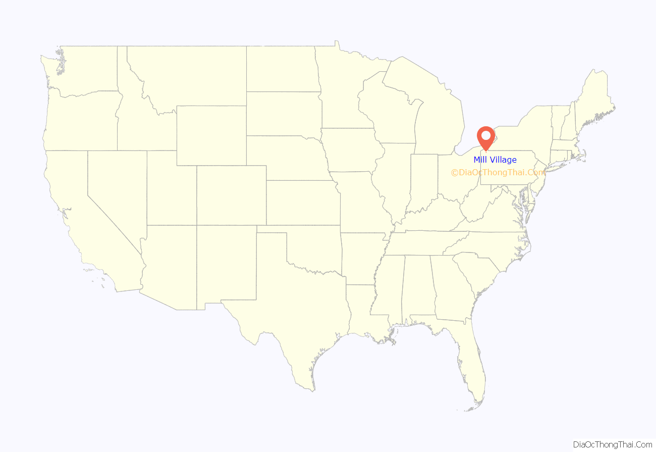
| State: | Pennsylvania |
| County: | Erie County |
| Total Area: | 0.92 sq mi (2.38 km²) |
| Land Area: | 0.92 sq mi (2.38 km²) |
| Water Area: | 0.00 sq mi (0.00 km²) |
| Total Population: | 388 |
| Population Density: | 422.20/sq mi (163.09/km²) |
| ZIP code: | 16427 |
| Area code: | 814 |
| FIPS code: | 4249936 |
| Website: | millvillageboro.org |
Online Interactive Map
Click on ![]() to view map in "full screen" mode.
to view map in "full screen" mode.
Mill Village location map. Where is Mill Village borough?
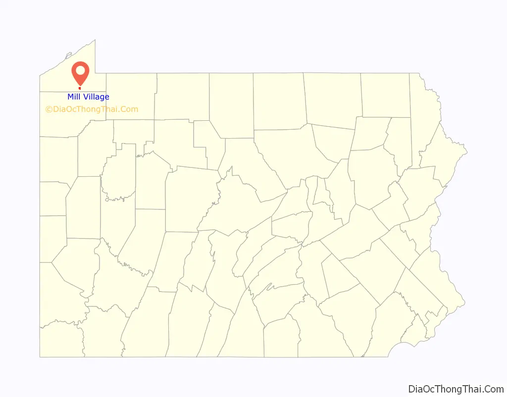
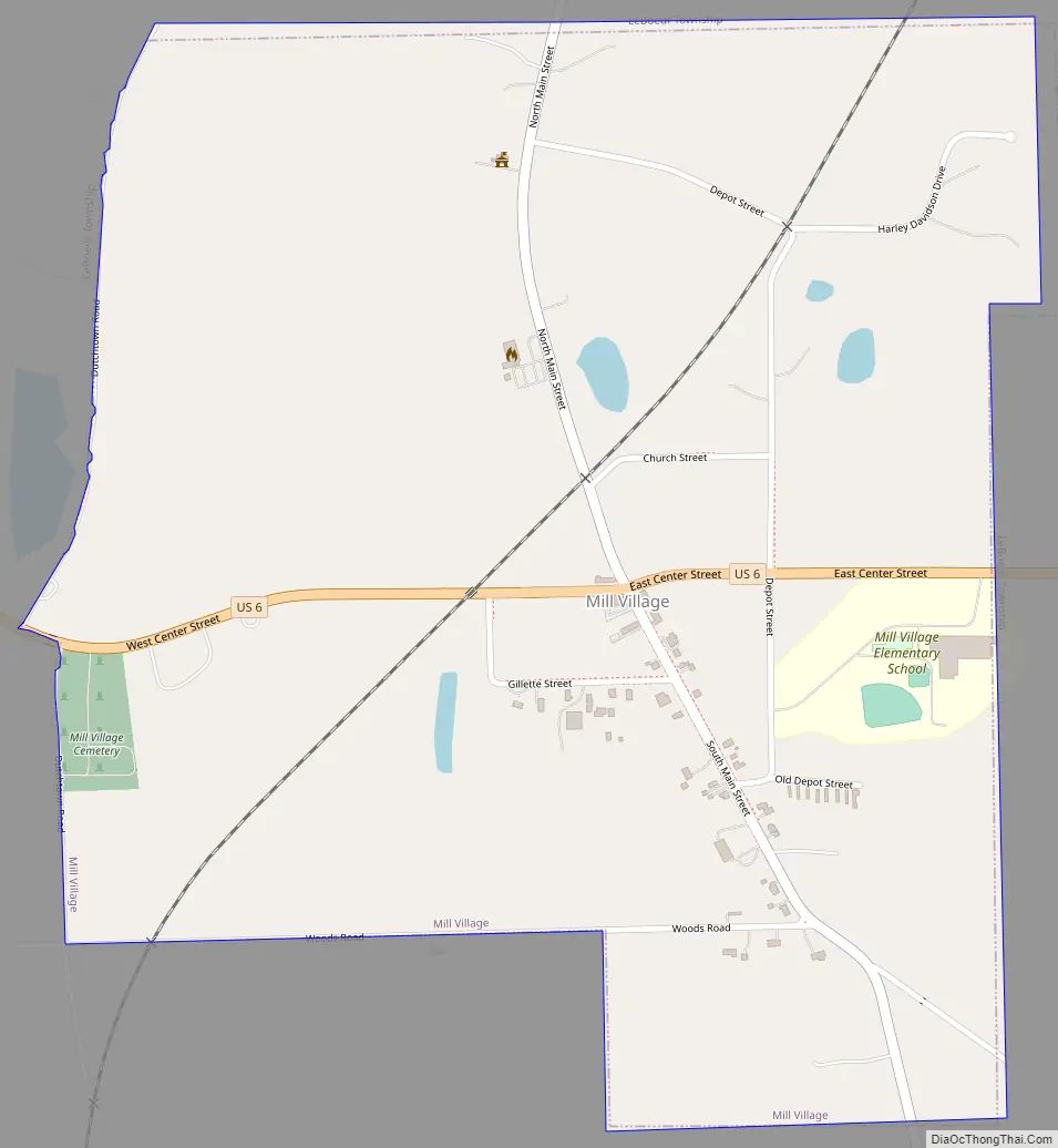
Mill Village Road Map
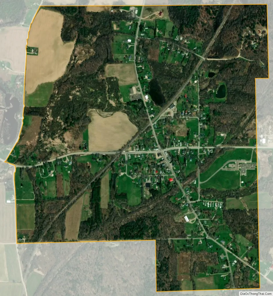
Mill Village city Satellite Map
Geography
Mill Village is located in southern Erie County at 41°52′34″N 79°58′21″W / 41.87611°N 79.97250°W / 41.87611; -79.97250 (41.876050, -79.972607). It is surrounded by LeBoeuf Township. U.S. Route 6 passes through the borough, leading east 7 miles (11 km) to Union City and southwest 8 miles (13 km) to Cambridge Springs. Erie is 19 miles (31 km) to the north.
According to the United States Census Bureau, Mill Village has a total area of 0.93 square miles (2.4 km), all land. It sits on the eastern edge of the valley of French Creek, part of the Allegheny River watershed.
See also
Map of Pennsylvania State and its subdivision:- Adams
- Allegheny
- Armstrong
- Beaver
- Bedford
- Berks
- Blair
- Bradford
- Bucks
- Butler
- Cambria
- Cameron
- Carbon
- Centre
- Chester
- Clarion
- Clearfield
- Clinton
- Columbia
- Crawford
- Cumberland
- Dauphin
- Delaware
- Elk
- Erie
- Fayette
- Forest
- Franklin
- Fulton
- Greene
- Huntingdon
- Indiana
- Jefferson
- Juniata
- Lackawanna
- Lancaster
- Lawrence
- Lebanon
- Lehigh
- Luzerne
- Lycoming
- Mc Kean
- Mercer
- Mifflin
- Monroe
- Montgomery
- Montour
- Northampton
- Northumberland
- Perry
- Philadelphia
- Pike
- Potter
- Schuylkill
- Snyder
- Somerset
- Sullivan
- Susquehanna
- Tioga
- Union
- Venango
- Warren
- Washington
- Wayne
- Westmoreland
- Wyoming
- York
- Alabama
- Alaska
- Arizona
- Arkansas
- California
- Colorado
- Connecticut
- Delaware
- District of Columbia
- Florida
- Georgia
- Hawaii
- Idaho
- Illinois
- Indiana
- Iowa
- Kansas
- Kentucky
- Louisiana
- Maine
- Maryland
- Massachusetts
- Michigan
- Minnesota
- Mississippi
- Missouri
- Montana
- Nebraska
- Nevada
- New Hampshire
- New Jersey
- New Mexico
- New York
- North Carolina
- North Dakota
- Ohio
- Oklahoma
- Oregon
- Pennsylvania
- Rhode Island
- South Carolina
- South Dakota
- Tennessee
- Texas
- Utah
- Vermont
- Virginia
- Washington
- West Virginia
- Wisconsin
- Wyoming