Mont Alto is a borough in Franklin County, Pennsylvania, United States. The population was 1,580 at the 2020 census.
| Name: | Mont Alto borough |
|---|---|
| LSAD Code: | 21 |
| LSAD Description: | borough (suffix) |
| State: | Pennsylvania |
| County: | Franklin County |
| Incorporated: | 1915 |
| Elevation: | 886 ft (270 m) |
| Total Area: | 0.56 sq mi (1.46 km²) |
| Land Area: | 0.56 sq mi (1.46 km²) |
| Water Area: | 0.00 sq mi (0.00 km²) |
| Total Population: | 1,580 |
| Population Density: | 2,806.39/sq mi (1,084.24/km²) |
| ZIP code: | 17237 |
| Area code: | 717 |
| FIPS code: | 4250544 |
| Website: | www.montaltoborough.com |
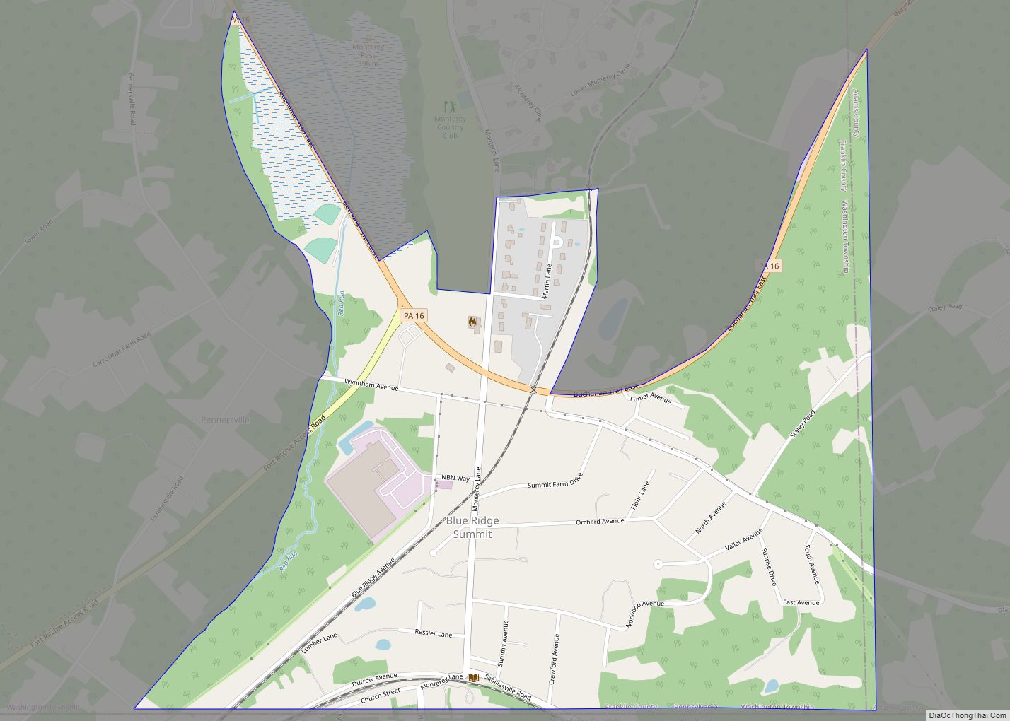
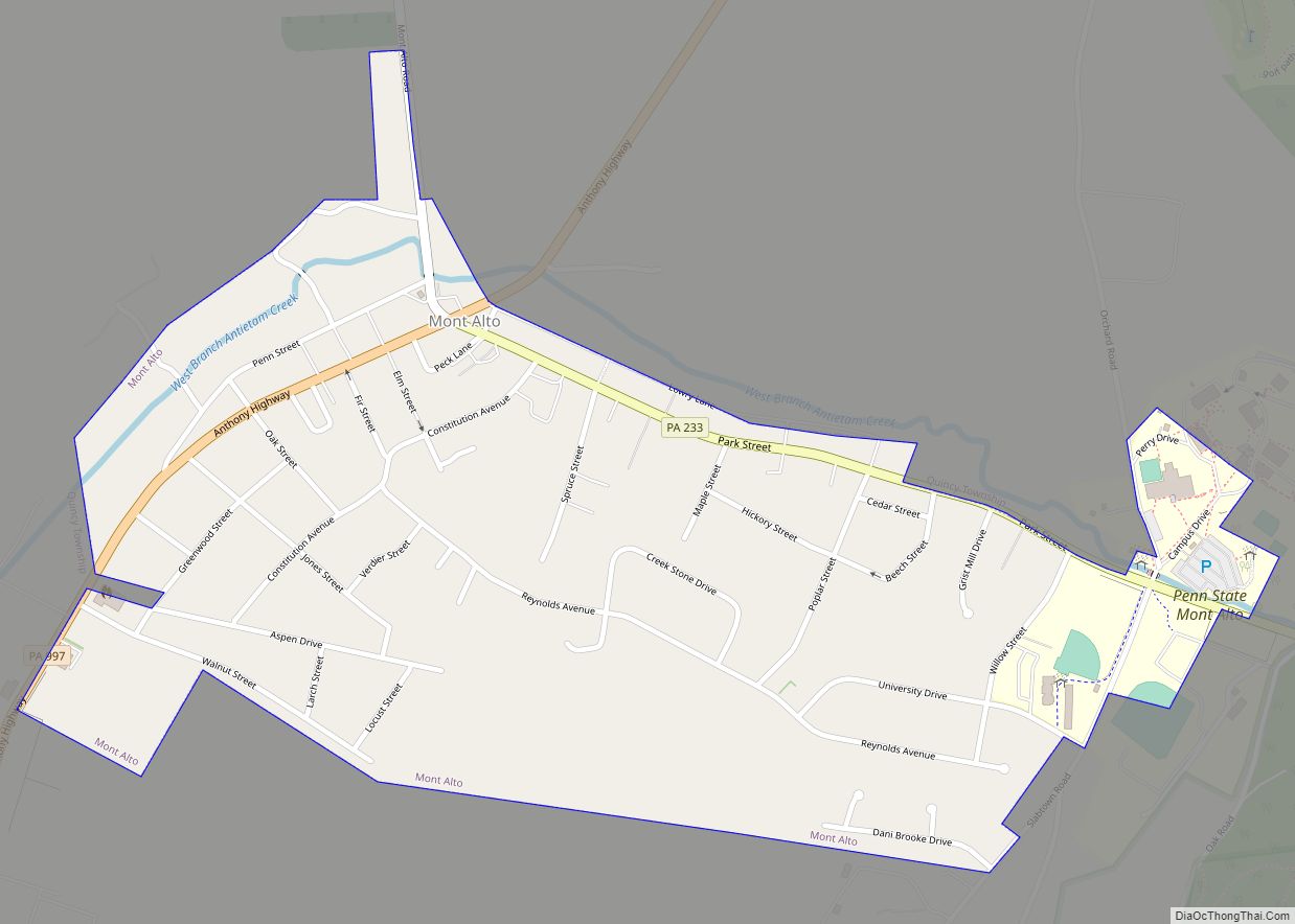
Online Interactive Map
Click on ![]() to view map in "full screen" mode.
to view map in "full screen" mode.
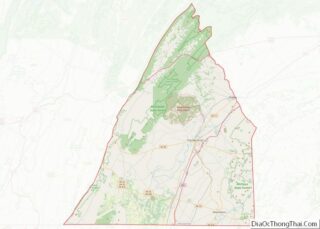
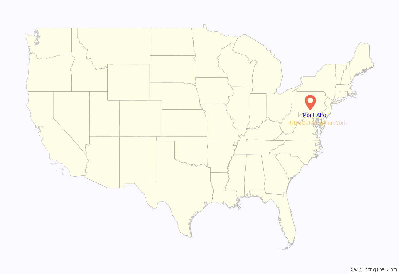
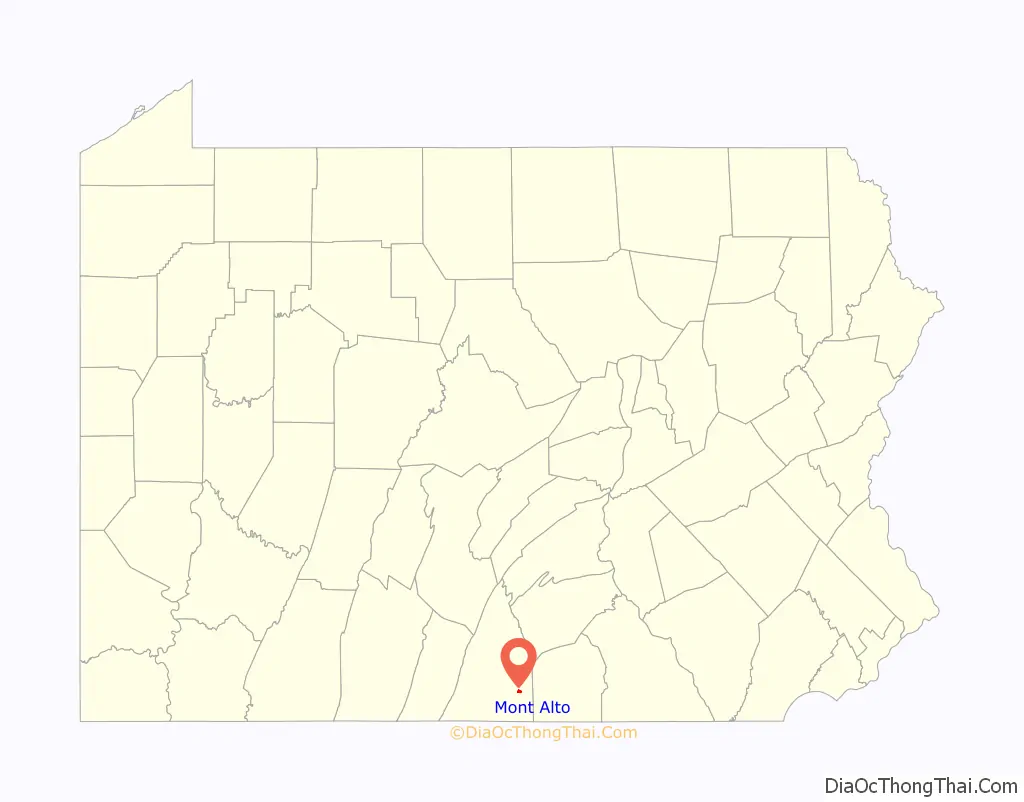
Mont Alto location map. Where is Mont Alto borough?
History
John Funk built the first house in the borough (then unestablished) in 1817 on what is now Main Street. At this time the town was known as “Funkstown”. Eventually the town of Altodale and the surrounding area, called Mont Alto, combined into what is now known as Mont Alto.
In 1915 the town of Mont Alto was incorporated with a population of 800.
In the beginning of the 20th century, Mont Alto contained one of the largest sanatoriums in the area for treatment of tuberculosis.
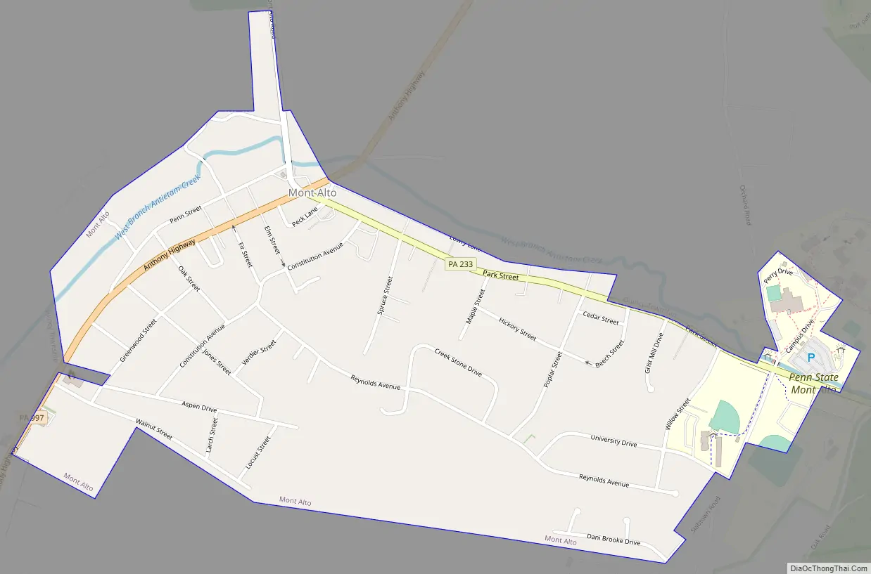
Mont Alto Road Map
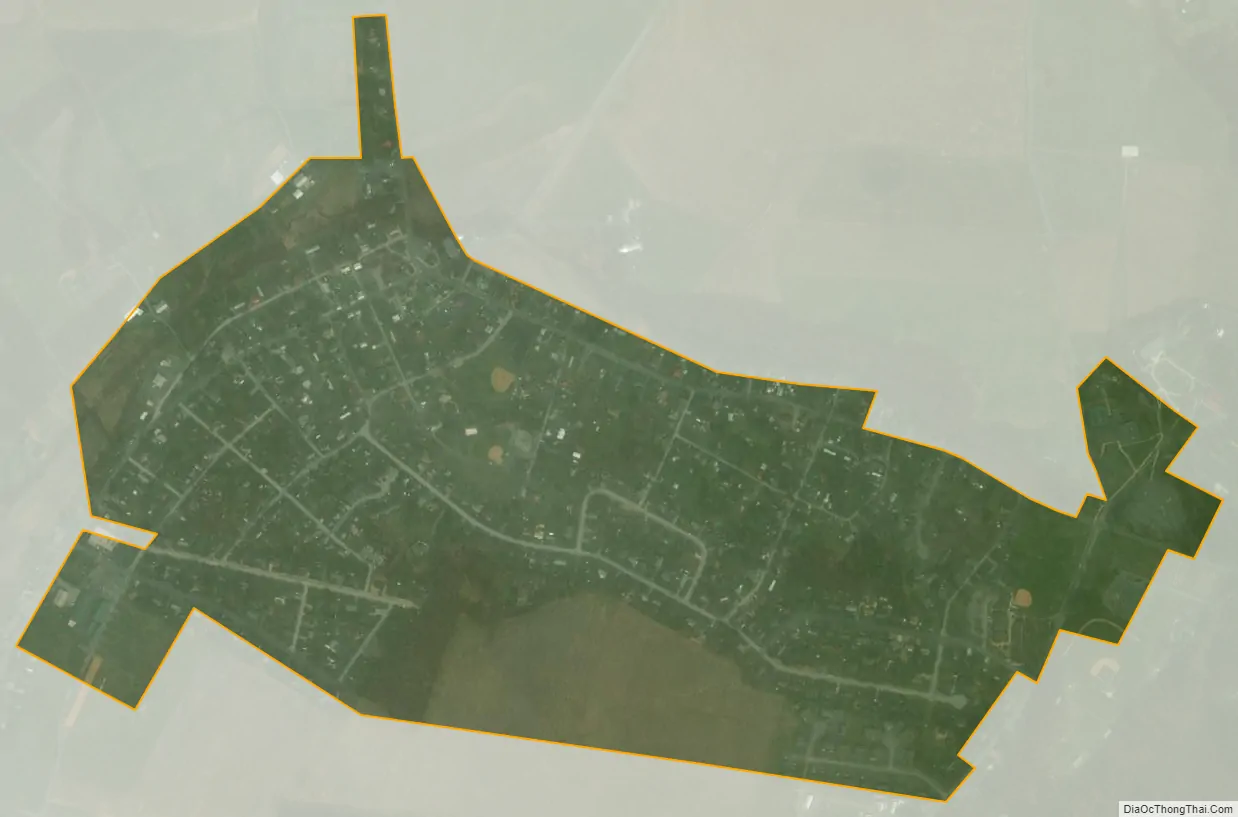
Mont Alto city Satellite Map
Geography
Mont Alto is located in southeastern Franklin County at 39°50′36″N 77°33′18″W / 39.84333°N 77.55500°W / 39.84333; -77.55500 (39.843234, -77.555023). It sits at the western base of South Mountain along the headwaters of the West Branch of Antietam Creek. Mont Alto State Park is located in the creek valley, 1 mile (1.6 km) east of the borough.
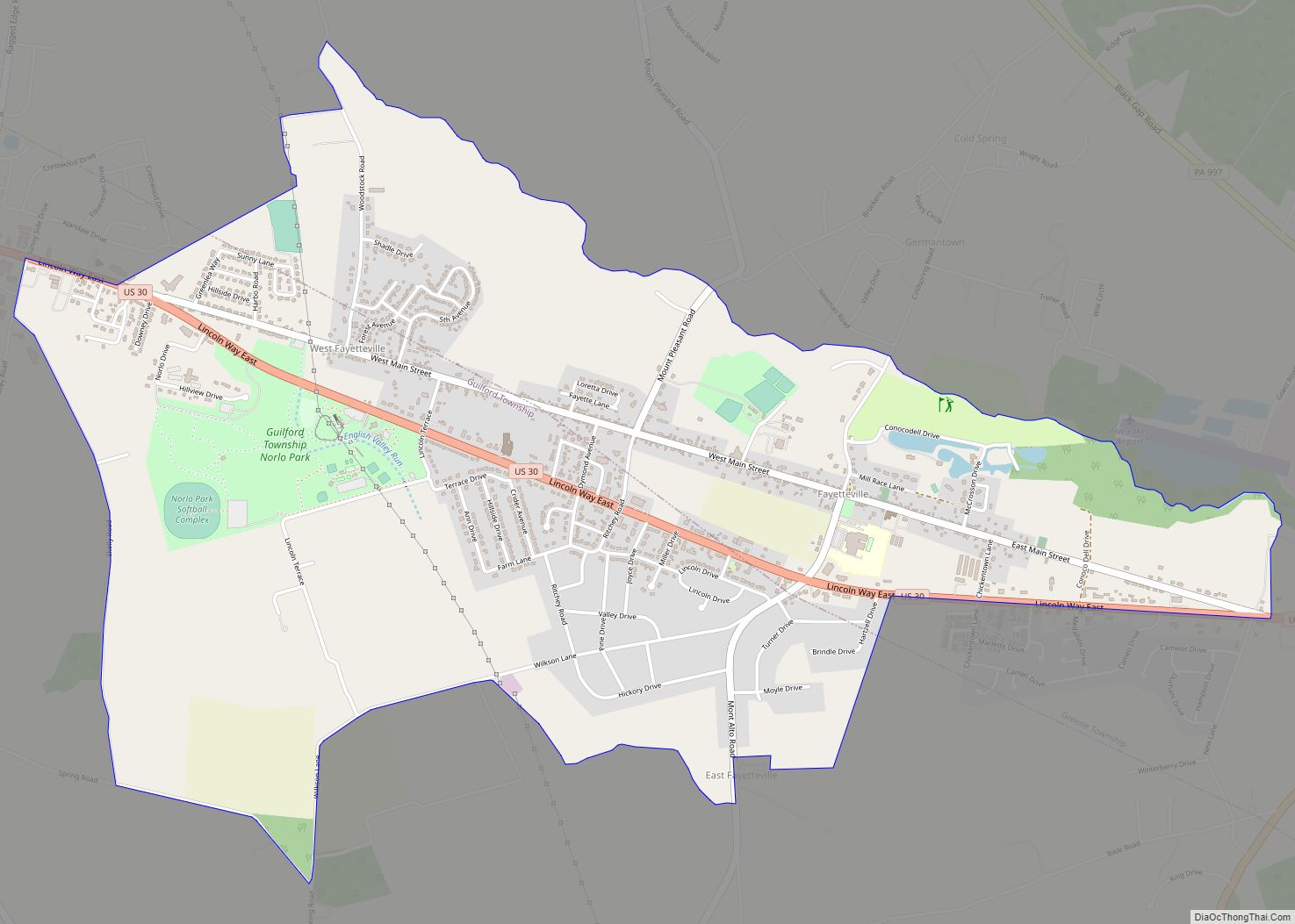
Pennsylvania Route 997 passes through the center of town as Main Street; it leads north 5 miles (8 km) to U.S. Route 30 near Fayetteville and south 7 miles (11 km) to Waynesboro. Pennsylvania Route 233 runs east out of the borough as Park Street, leading northeast 9 miles (14 km) to US 30 at Caledonia State Park.
According to the U.S. Census Bureau, the borough has a total area of 0.57 square miles (1.47 km), all land.
See also
Map of Pennsylvania State and its subdivision:- Adams
- Allegheny
- Armstrong
- Beaver
- Bedford
- Berks
- Blair
- Bradford
- Bucks
- Butler
- Cambria
- Cameron
- Carbon
- Centre
- Chester
- Clarion
- Clearfield
- Clinton
- Columbia
- Crawford
- Cumberland
- Dauphin
- Delaware
- Elk
- Erie
- Fayette
- Forest
- Franklin
- Fulton
- Greene
- Huntingdon
- Indiana
- Jefferson
- Juniata
- Lackawanna
- Lancaster
- Lawrence
- Lebanon
- Lehigh
- Luzerne
- Lycoming
- Mc Kean
- Mercer
- Mifflin
- Monroe
- Montgomery
- Montour
- Northampton
- Northumberland
- Perry
- Philadelphia
- Pike
- Potter
- Schuylkill
- Snyder
- Somerset
- Sullivan
- Susquehanna
- Tioga
- Union
- Venango
- Warren
- Washington
- Wayne
- Westmoreland
- Wyoming
- York
- Alabama
- Alaska
- Arizona
- Arkansas
- California
- Colorado
- Connecticut
- Delaware
- District of Columbia
- Florida
- Georgia
- Hawaii
- Idaho
- Illinois
- Indiana
- Iowa
- Kansas
- Kentucky
- Louisiana
- Maine
- Maryland
- Massachusetts
- Michigan
- Minnesota
- Mississippi
- Missouri
- Montana
- Nebraska
- Nevada
- New Hampshire
- New Jersey
- New Mexico
- New York
- North Carolina
- North Dakota
- Ohio
- Oklahoma
- Oregon
- Pennsylvania
- Rhode Island
- South Carolina
- South Dakota
- Tennessee
- Texas
- Utah
- Vermont
- Virginia
- Washington
- West Virginia
- Wisconsin
- Wyoming