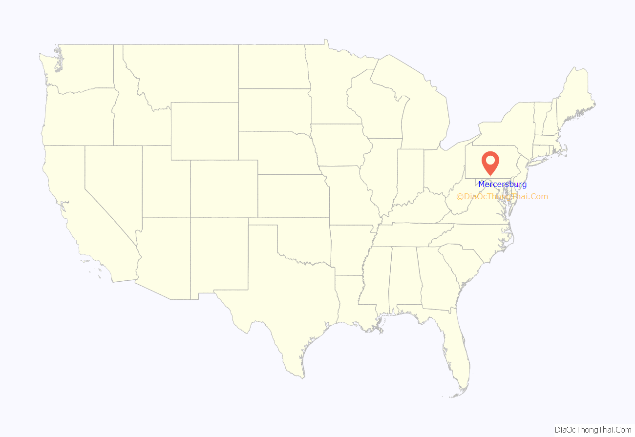
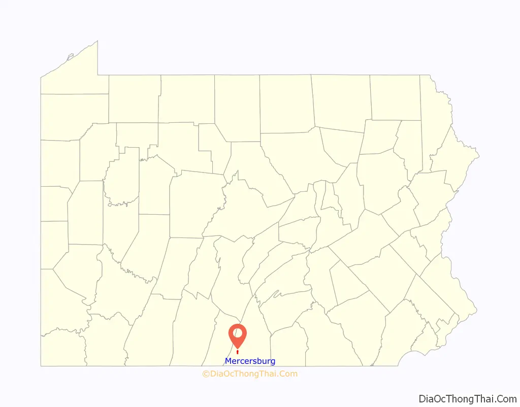
Mercersburg is a borough in Franklin County, located near the southern border of Pennsylvania, United States. The borough is 72 miles (116 km) southwest of Harrisburg, the state capital.
Due to its location in a rural area, it had a relatively large percentage of African-American workers who had been enslaved from the Revolution. It was called “Black Town” in the early nineteenth century before incorporation under its current name. Refugee African Americans escaping from slavery in the South also settled here, and the area was known as “Little Africa”.
| Name: | Mercersburg borough |
|---|---|
| LSAD Code: | 21 |
| LSAD Description: | borough (suffix) |
| State: | Pennsylvania |
| County: | Franklin County |
| Elevation: | 558 ft (170 m) |
| Total Area: | 0.90 sq mi (2.34 km²) |
| Land Area: | 0.90 sq mi (2.34 km²) |
| Water Area: | 0.00 sq mi (0.00 km²) |
| Total Population: | 1,507 |
| Population Density: | 1,670.73/sq mi (645.12/km²) |
| ZIP code: | 17236 |
| Area code: | 717 |
| FIPS code: | 4248704 |
| Website: | borough.mercersburg.org |
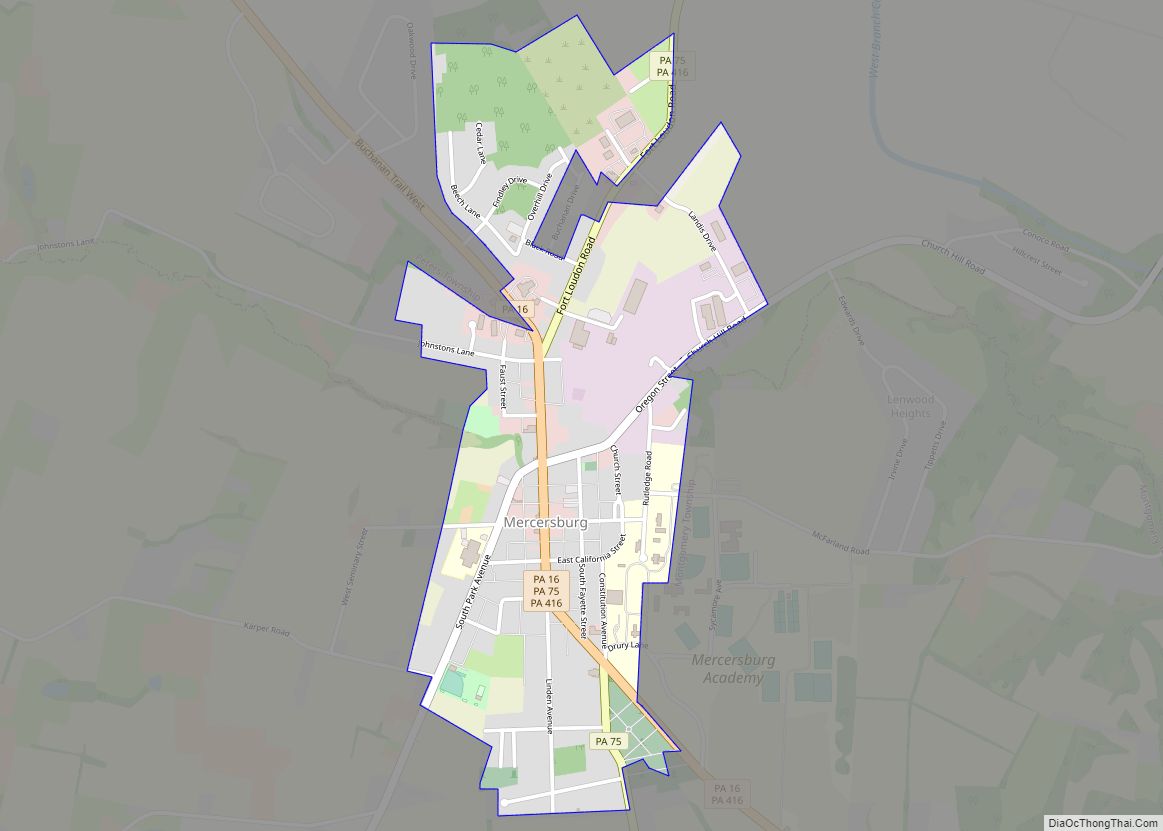
Online Interactive Map
Click on ![]() to view map in "full screen" mode.
to view map in "full screen" mode.
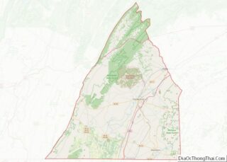
Mercersburg location map. Where is Mercersburg borough?
History
Mercersburg was platted in 1780. The borough was named after Hugh Mercer, a general and hero in the American Revolutionary War. A post office has been in operation at Mercersburg since 1812.
Located near the southern border of Pennsylvania, the rural community became a place of refuge during the antebellum years for escaped African Americans who had been enslaved in the South. Some came to the area via the Underground Railroad. After the American Revolution, Pennsylvania had abolished slavery. In this area were communities of free African Americans who had worked in agriculture. It was relatively easy for refugees to join their communities after passing over the border of Maryland.
This settlement was called “Black Town” in early years, before being incorporated in 1831Mercersburg. The rural area outside of town was referred to by locals as “Little Africa” because of its relatively large concentration of African Americans in this time period. Some were refugees who had settled here after escaping from slavery in the South.
In later years, blacks moved away from here as they were at risk from slavecatchers, especially after passage of the Fugitive Slave Act in 1850, which had more stringent rules against free states. Many blacks moved to Philadelphia, which had a large free black community and helped new arrivals get settled; it also had more opportunities for jobs.
In 2010 the population of Mercersburg was 6.49 percent African American, a total of 1,561 persons.
The Mercersburg Historic District, Lane House, and Mercersburg Academy are listed on the National Register of Historic Places.
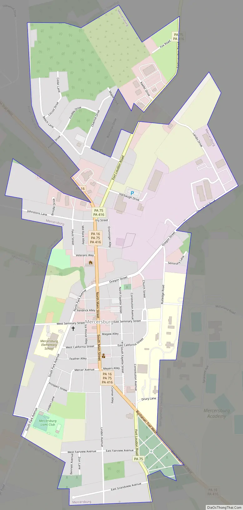
Mercersburg Road Map
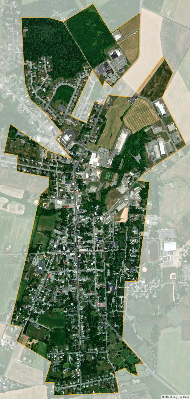
Mercersburg city Satellite Map
Geography
Mercersburg is located in southwestern Franklin County at 39°49′46″N 77°54′7″W / 39.82944°N 77.90194°W / 39.82944; -77.90194 (39.829388, -77.901952). According to the United States Census Bureau, the borough has a total area of 0.89 square miles (2.3 km), all land.
Mercersburg is located at the eastern foot of Cove Mountain on the west side of the Great Appalachian Valley. The borough is 7.5 miles (12.1 km) north of the Mason–Dixon line, which serves as the state border with Maryland. Whitetail Ski Resort and golf course are located 7 miles (11 km) south of the town.
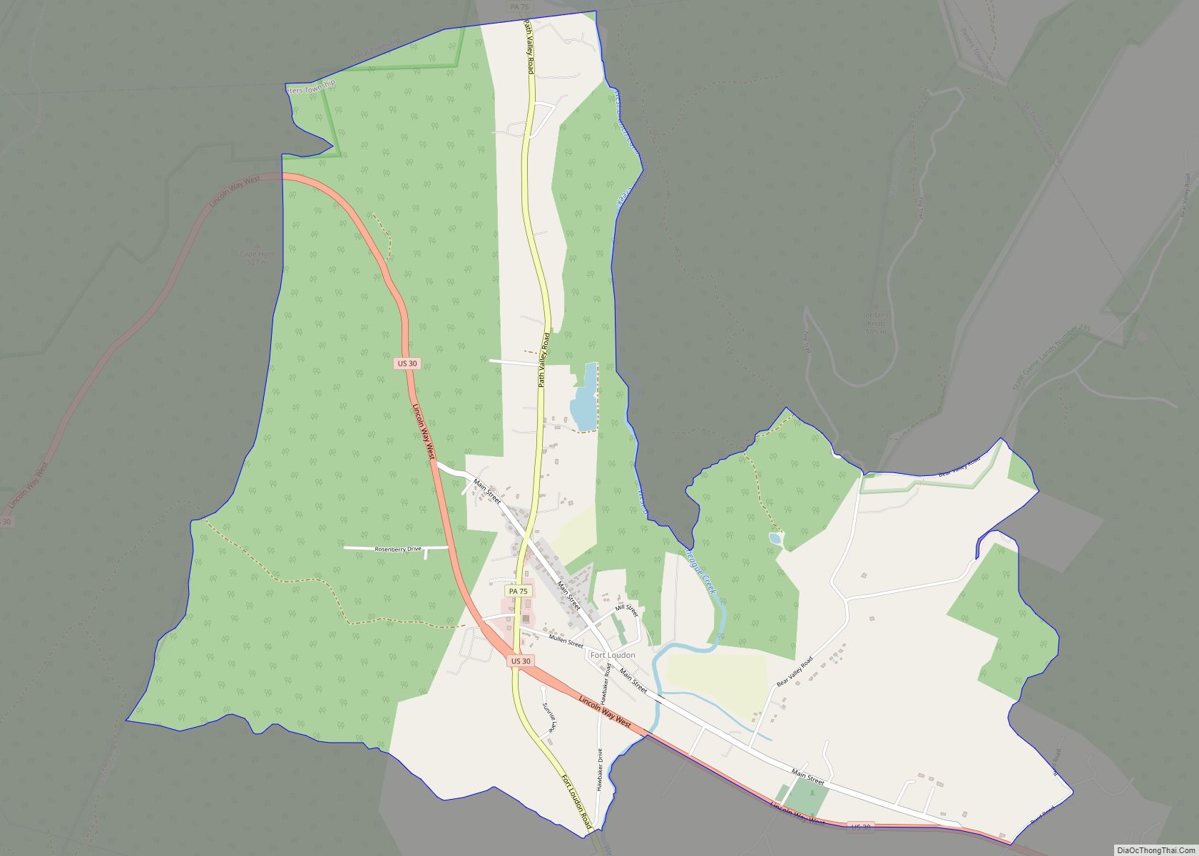
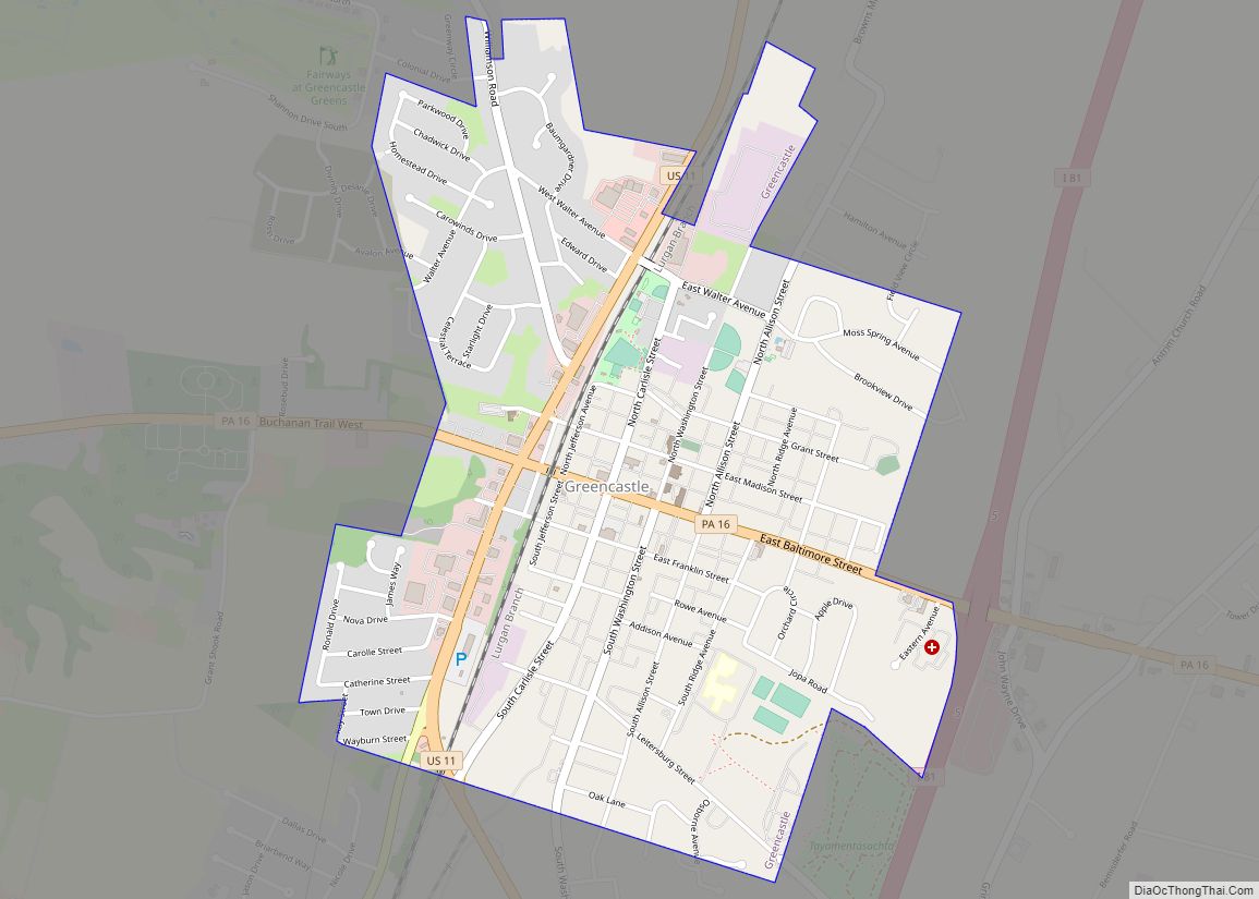
Pennsylvania state highways 16, 75, and 416 all pass through Mercersburg. PA 16 leads east 10 miles (16 km) to Greencastle and 11 miles (18 km) to Interstate 81, and northwest through Cove Gap and over Tuscarora Mountain 10 miles to McConnellsburg. PA 75 leads north 6 miles (10 km) to Fort Loudon and south 7.5 miles (12.1 km) to the Maryland border. PA 416 leads northeast 7 miles (11 km) to U.S. Route 30 near St. Thomas and southeast 10 miles (16 km) to the Maryland border. Hagerstown, Maryland, is 17 miles (27 km) to the southeast via PA 416 and Maryland Route 58, while Chambersburg, the Franklin County seat, is 16 miles (26 km) to the northeast via PA 416 and US 30.
See also
Map of Pennsylvania State and its subdivision:- Adams
- Allegheny
- Armstrong
- Beaver
- Bedford
- Berks
- Blair
- Bradford
- Bucks
- Butler
- Cambria
- Cameron
- Carbon
- Centre
- Chester
- Clarion
- Clearfield
- Clinton
- Columbia
- Crawford
- Cumberland
- Dauphin
- Delaware
- Elk
- Erie
- Fayette
- Forest
- Franklin
- Fulton
- Greene
- Huntingdon
- Indiana
- Jefferson
- Juniata
- Lackawanna
- Lancaster
- Lawrence
- Lebanon
- Lehigh
- Luzerne
- Lycoming
- Mc Kean
- Mercer
- Mifflin
- Monroe
- Montgomery
- Montour
- Northampton
- Northumberland
- Perry
- Philadelphia
- Pike
- Potter
- Schuylkill
- Snyder
- Somerset
- Sullivan
- Susquehanna
- Tioga
- Union
- Venango
- Warren
- Washington
- Wayne
- Westmoreland
- Wyoming
- York
- Alabama
- Alaska
- Arizona
- Arkansas
- California
- Colorado
- Connecticut
- Delaware
- District of Columbia
- Florida
- Georgia
- Hawaii
- Idaho
- Illinois
- Indiana
- Iowa
- Kansas
- Kentucky
- Louisiana
- Maine
- Maryland
- Massachusetts
- Michigan
- Minnesota
- Mississippi
- Missouri
- Montana
- Nebraska
- Nevada
- New Hampshire
- New Jersey
- New Mexico
- New York
- North Carolina
- North Dakota
- Ohio
- Oklahoma
- Oregon
- Pennsylvania
- Rhode Island
- South Carolina
- South Dakota
- Tennessee
- Texas
- Utah
- Vermont
- Virginia
- Washington
- West Virginia
- Wisconsin
- Wyoming