Oxford is a borough in Chester County, Pennsylvania, United States. Oxford is the closest town to Lincoln University. The population was 5,733 at the 2020 census.
| Name: | Oxford borough |
|---|---|
| LSAD Code: | 21 |
| LSAD Description: | borough (suffix) |
| State: | Pennsylvania |
| County: | Chester County |
| Incorporated: | 1833 |
| Elevation: | 535 ft (163 m) |
| Total Area: | 1.97 sq mi (5.09 km²) |
| Land Area: | 1.96 sq mi (5.08 km²) |
| Water Area: | 0.00 sq mi (0.01 km²) |
| Total Population: | 5,736 |
| Population Density: | 2,922.06/sq mi (1,128.24/km²) |
| ZIP code: | 19363 |
| FIPS code: | 4257480 |
| Website: | www.oxfordboro.org |
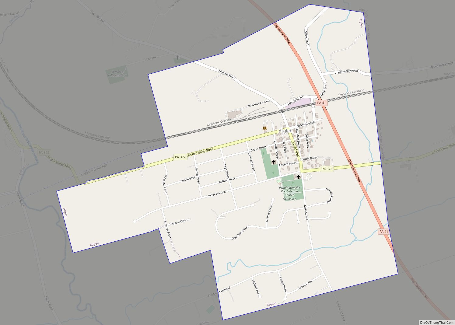
Online Interactive Map
Click on ![]() to view map in "full screen" mode.
to view map in "full screen" mode.
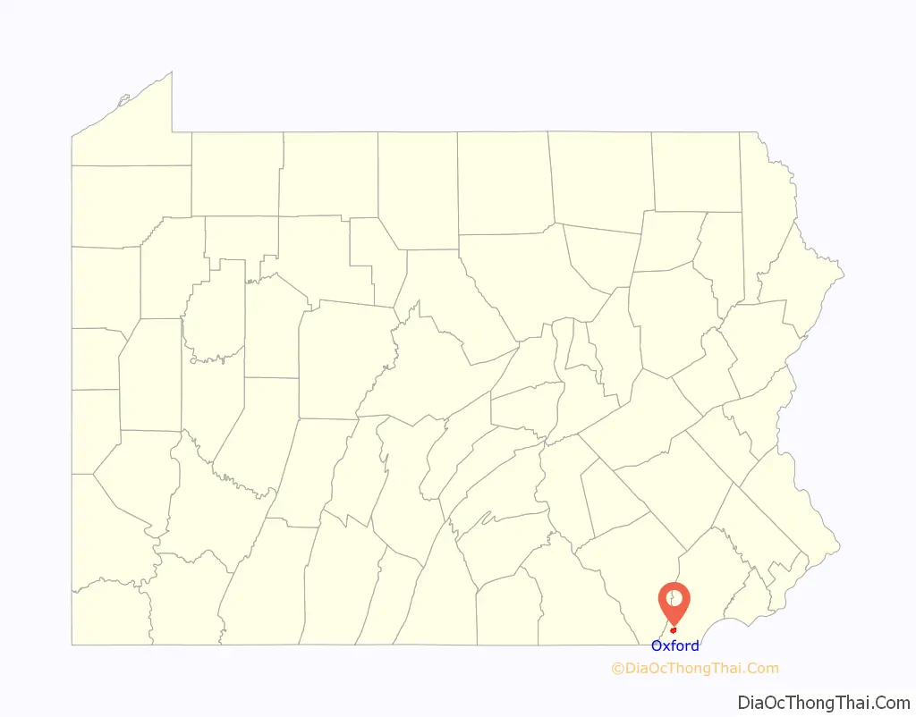
Oxford location map. Where is Oxford borough?

History
The borough was once called Oxford Crossing and Oxford Village during the 1700s.
In 1805, the Oxford post office was established. In 1833, Oxford was officially incorporated as a borough. Its first burgess (now called the mayor) was Thomas Alexander, who operated a general store thought to be the oldest building in Oxford.
The northern half of Oxford was owned by the Dickey family in the 19th century. The Dickeys included the local Presbyterian minister, the Mr O’Malley of the local bank, a state Representative, and local businessmen. Reverend John Miller Dickey and his wife Sarah Emlen Cresson founded Ashmun Institute in 1854, and which later became Lincoln University. The family played a major role in re-routing the new Philadelphia and Baltimore Central Railroad (P&BC) through Oxford. Track was laid in the 1850s. The railroad reached Oxford in 1860 and later connected to Philadelphia and Baltimore. By the time of the Civil War, Oxford was a bustling community. The business district on Third Street was entirely re-built at this time, including the Oxford Hotel (1858) and Oxford Hall (1862). Oxford became known for its confectionery and candy businesses and was the location of many manufacturing facilities. A second railroad, the Peach Bottom Railway, was built in the 1870s from Oxford to Peach Bottom. It carried farm products and passengers but was not profitable. It struggled through three bankruptcies and reorganized as the Lancaster, Oxford and Southern Railway, finally closing permanently in 1918.
The Pennsylvania Railroad took control of the P&BC on the eve of World War I. Passenger train service on the line ended in 1935. In the late 20th century, transportation changes resulted in Oxford being located off the main roads. A bypass was constructed for U.S. Route 1 in the late 1960s, but the major change was the 1963 opening of Interstate 95, which shifted the bulk of the Philadelphia-Baltimore traffic away from Oxford. The former Pennsylvania Railroad Station is now the borough hall.
The Oxford Historic District and Oxford Hotel were listed on the National Register of Historic Places in 2008.
Oxford Road Map

Oxford city Satellite Map

Geography
According to the United States Census Bureau, the borough has a total area of 1.97 square miles (5.1 km), all land. The population per square mile is 2,581.1.
See also
Map of Pennsylvania State and its subdivision:- Adams
- Allegheny
- Armstrong
- Beaver
- Bedford
- Berks
- Blair
- Bradford
- Bucks
- Butler
- Cambria
- Cameron
- Carbon
- Centre
- Chester
- Clarion
- Clearfield
- Clinton
- Columbia
- Crawford
- Cumberland
- Dauphin
- Delaware
- Elk
- Erie
- Fayette
- Forest
- Franklin
- Fulton
- Greene
- Huntingdon
- Indiana
- Jefferson
- Juniata
- Lackawanna
- Lancaster
- Lawrence
- Lebanon
- Lehigh
- Luzerne
- Lycoming
- Mc Kean
- Mercer
- Mifflin
- Monroe
- Montgomery
- Montour
- Northampton
- Northumberland
- Perry
- Philadelphia
- Pike
- Potter
- Schuylkill
- Snyder
- Somerset
- Sullivan
- Susquehanna
- Tioga
- Union
- Venango
- Warren
- Washington
- Wayne
- Westmoreland
- Wyoming
- York
- Alabama
- Alaska
- Arizona
- Arkansas
- California
- Colorado
- Connecticut
- Delaware
- District of Columbia
- Florida
- Georgia
- Hawaii
- Idaho
- Illinois
- Indiana
- Iowa
- Kansas
- Kentucky
- Louisiana
- Maine
- Maryland
- Massachusetts
- Michigan
- Minnesota
- Mississippi
- Missouri
- Montana
- Nebraska
- Nevada
- New Hampshire
- New Jersey
- New Mexico
- New York
- North Carolina
- North Dakota
- Ohio
- Oklahoma
- Oregon
- Pennsylvania
- Rhode Island
- South Carolina
- South Dakota
- Tennessee
- Texas
- Utah
- Vermont
- Virginia
- Washington
- West Virginia
- Wisconsin
- Wyoming