Portage is a borough with home rule status in Cambria County, Pennsylvania, United States. It is 10 miles (16 km) southeast of Ebensburg and 22 miles (35 km) southwest of Altoona. It is part of the Johnstown, Pennsylvania Metropolitan Statistical Area. The population was 2,638 at the 2010 US census.
| Name: | Portage borough |
|---|---|
| LSAD Code: | 21 |
| LSAD Description: | borough (suffix) |
| State: | Pennsylvania |
| County: | Cambria County |
| Incorporated: | 1890 |
| Elevation: | 1,686 ft (514 m) |
| Total Area: | 0.67 sq mi (1.72 km²) |
| Land Area: | 0.67 sq mi (1.72 km²) |
| Water Area: | 0.00 sq mi (0.00 km²) |
| Total Population: | 2,459 |
| Population Density: | 3,692.19/sq mi (1,426.26/km²) |
| ZIP code: | 15946 |
| Area code: | 814 |
| FIPS code: | 4262048 |
| GNISfeature ID: | 1215031 |
| Website: | portageboro.com |
Online Interactive Map
Click on ![]() to view map in "full screen" mode.
to view map in "full screen" mode.
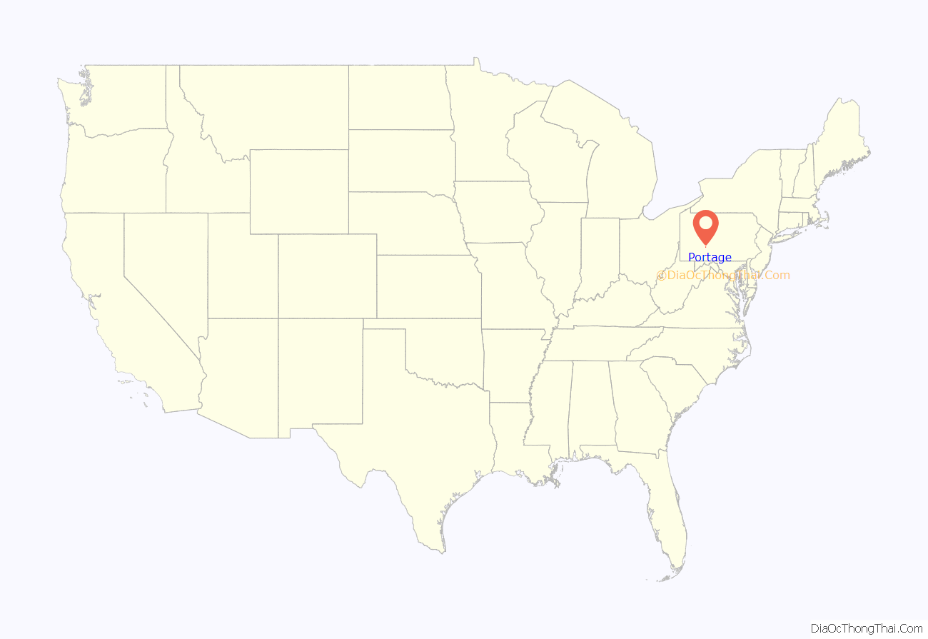
Portage location map. Where is Portage borough?

History
“Foot of Two” was eventually renamed “Portage.” The definition of portage is: carrying boats, goods, etc., overland from one body of water to another
Today, Pennsylvania Route 53 follows the route of the APRR through Portage. With advancements in locomotive technology, Inclined Plane No. 2 was bypassed in 1852.
By 1854, the Allegheny Portage Railroad was considered obsolete due to the Pennsylvania Railroad which traveled over the Alleghenys considerably faster and safer. At the same time, another company, the New Portage Railroad, was attempting to do the same, but in 1857, the Pennsylvania Railroad bought the New Portage railroad and abandoned it.
Within a few years after the opening of the Pennsylvania Railroad, a facility was constructed for locomotives to stop to take on water and pick up wood to fire the boiler. With the abundance of lumber and coal in Portage, many companies were formed to deforest and mine in the area. As a result of the new industries, a population boom occurred, and by the 1860s, a passenger station was built by the railroad along the mainline, which at the time traveled through the center of town on what is now the Sonman Branch Line.
Portage Township was cut from Washington and Summerhill Townships on March 4, 1878. On October 7, 1890, the borough of Portage was incorporated and cut from Portage Township.
In the 1890s, the Pennsylvania Railroad was re-aligned from Lilly to Summerhill, changing the landscape of Portage and a new railroad station was built on Washington Avenue. The town continued to grow in size into the 1920s when it reached its peak population of 4,804 at the time of the 1920 United States Census. The Washington Avenue PRR station remained open until 1926 when a new station was built on Lee Street.
On July 15, 1940, what is known today as the Sonman Mine Explosion occurred at the Sonman Shaft Coal Co. near Portage. A total of 63 miners would perish when a methane gas explosion occurred. In 1960, a memorial to the miners who died in the explosion was dedicated in the Jamestown section of Portage. It was later relocated to Crichton-McCormick Park in Portage. The Portage Station Museum offers a documentary about the disaster titled “63 Men Down: The Story of the Sonman Mine Explosion.” The museum also offers exhibits on coal mining and railroading in the area.
On November 17, 1953, the Pennsylvania Railroad ended passenger service to Portage. The station would remain open into 1954 as a stop for the Railway Express Agency, but would close that year. The population in Portage Borough would stay steady, around 4,000, until the late 1970s. Since then, a steep drop in population would occur due to the closure of many of the coal mines in the region and much of the steel industry slowing in nearby Johnstown, as a result of the 1977 Johnstown Flood and imports of steel from foreign countries.
To celebrate the town’s centennial, a town festival, known as “Summerfest”, was organized. It has since been celebrated every year on the second weekend of August. The festival has many traditions including ethnic foods and a mass service on Sunday morning of that weekend. Another annual event held every year is the annual community yard sale, organized by the Portage Area Historical Society. It is held on the second Saturday in June.
The Portage Historic District was listed on the National Register of Historic Places in 1995.
Portage adopted a home rule charter on May 10, 1994, that took effect on January 1, 1996. Although the community kept “Borough of Portage” as its official name, it is no longer governed under the state’s Borough Code.
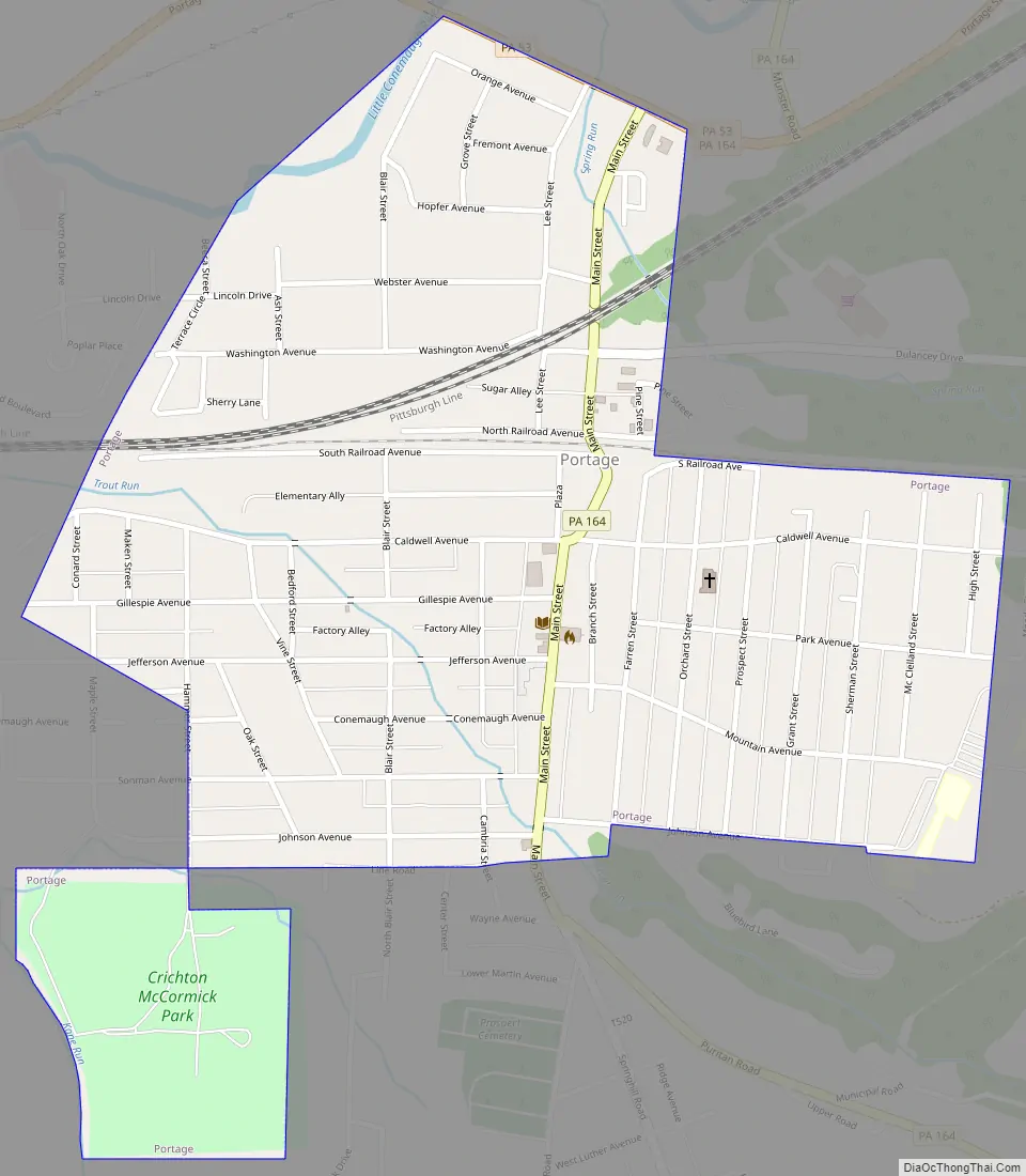
Portage Road Map
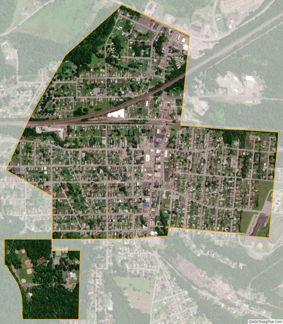
Portage city Satellite Map
Geography
Portage is located in southeastern Cambria County at 40°23′13″N 78°40′25″W / 40.38694°N 78.67361°W / 40.38694; -78.67361 (40.386858, -78.673593), in the valley of the Little Conemaugh River.
According to the United States Census Bureau, the borough has a total area of 0.66 square miles (1.7 km), all land.
See also
Map of Pennsylvania State and its subdivision:- Adams
- Allegheny
- Armstrong
- Beaver
- Bedford
- Berks
- Blair
- Bradford
- Bucks
- Butler
- Cambria
- Cameron
- Carbon
- Centre
- Chester
- Clarion
- Clearfield
- Clinton
- Columbia
- Crawford
- Cumberland
- Dauphin
- Delaware
- Elk
- Erie
- Fayette
- Forest
- Franklin
- Fulton
- Greene
- Huntingdon
- Indiana
- Jefferson
- Juniata
- Lackawanna
- Lancaster
- Lawrence
- Lebanon
- Lehigh
- Luzerne
- Lycoming
- Mc Kean
- Mercer
- Mifflin
- Monroe
- Montgomery
- Montour
- Northampton
- Northumberland
- Perry
- Philadelphia
- Pike
- Potter
- Schuylkill
- Snyder
- Somerset
- Sullivan
- Susquehanna
- Tioga
- Union
- Venango
- Warren
- Washington
- Wayne
- Westmoreland
- Wyoming
- York
- Alabama
- Alaska
- Arizona
- Arkansas
- California
- Colorado
- Connecticut
- Delaware
- District of Columbia
- Florida
- Georgia
- Hawaii
- Idaho
- Illinois
- Indiana
- Iowa
- Kansas
- Kentucky
- Louisiana
- Maine
- Maryland
- Massachusetts
- Michigan
- Minnesota
- Mississippi
- Missouri
- Montana
- Nebraska
- Nevada
- New Hampshire
- New Jersey
- New Mexico
- New York
- North Carolina
- North Dakota
- Ohio
- Oklahoma
- Oregon
- Pennsylvania
- Rhode Island
- South Carolina
- South Dakota
- Tennessee
- Texas
- Utah
- Vermont
- Virginia
- Washington
- West Virginia
- Wisconsin
- Wyoming


