Rohrsburg is a census-designated place (CDP) in Columbia County, Pennsylvania, United States. It is part of Northeastern Pennsylvania. The population was 145 at the 2010 census. It is part of the Bloomsburg-Berwick micropolitan area.
| Name: | Rohrsburg CDP |
|---|---|
| LSAD Code: | 57 |
| LSAD Description: | CDP (suffix) |
| State: | Pennsylvania |
| County: | Columbia County |
| Elevation: | 661 ft (201 m) |
| Total Area: | 0.71 sq mi (1.85 km²) |
| Land Area: | 0.71 sq mi (1.83 km²) |
| Water Area: | 0.008 sq mi (0.02 km²) |
| Total Population: | 145 |
| Population Density: | 205/sq mi (79.1/km²) |
| ZIP code: | 17859 |
| FIPS code: | 4265872 |
| GNISfeature ID: | 1185401 |
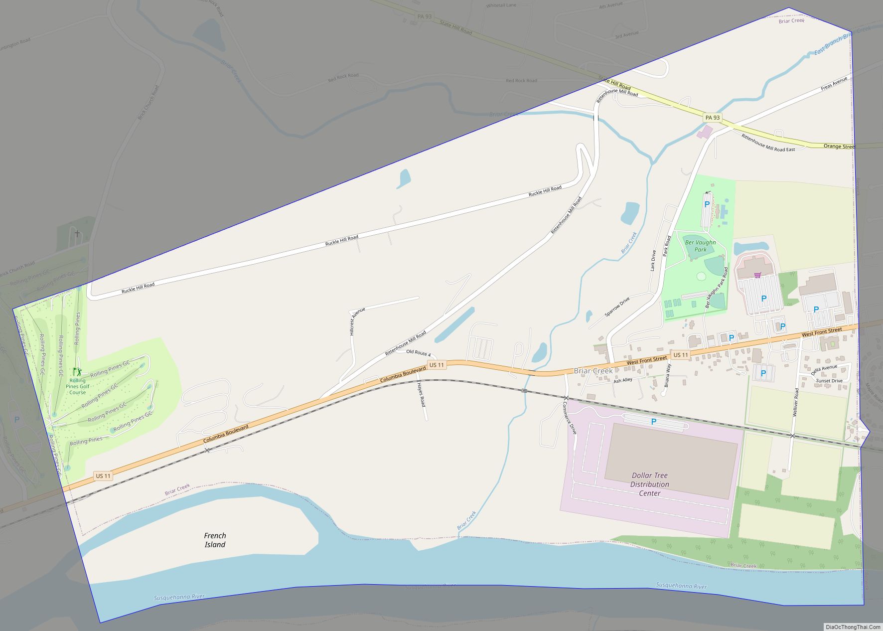
Online Interactive Map
Click on ![]() to view map in "full screen" mode.
to view map in "full screen" mode.
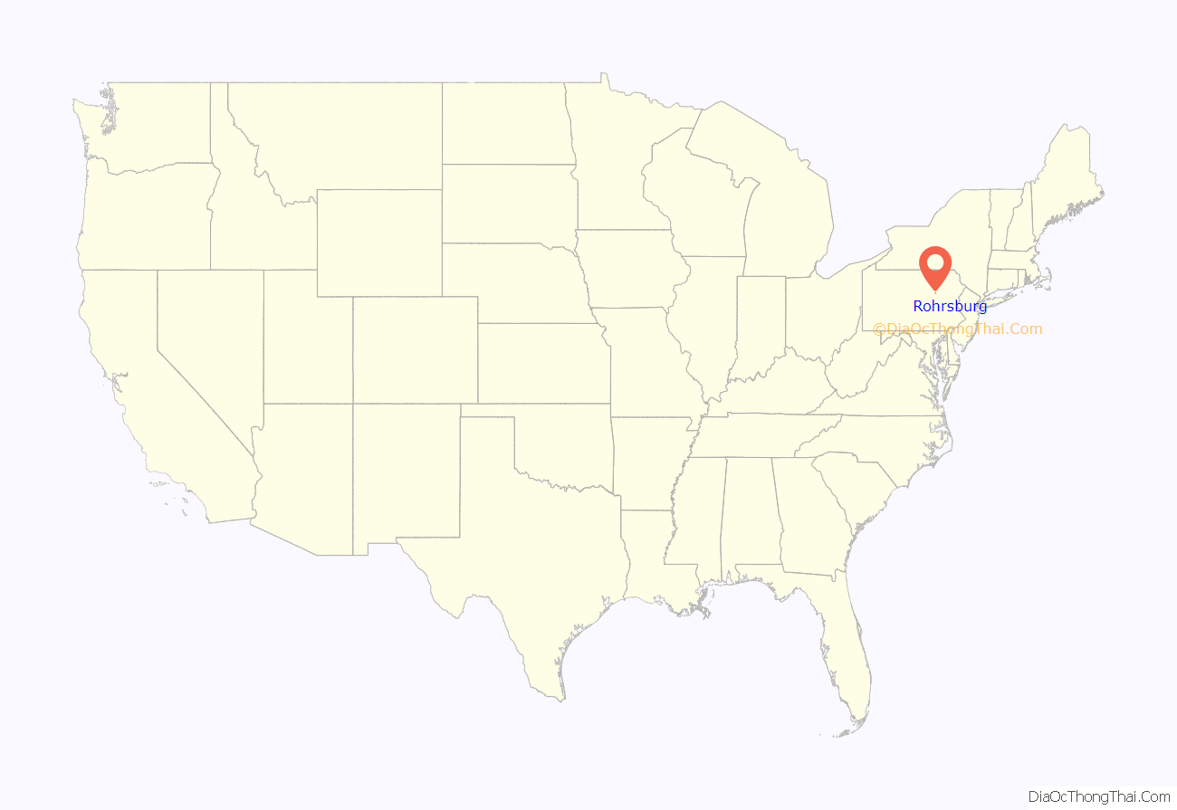
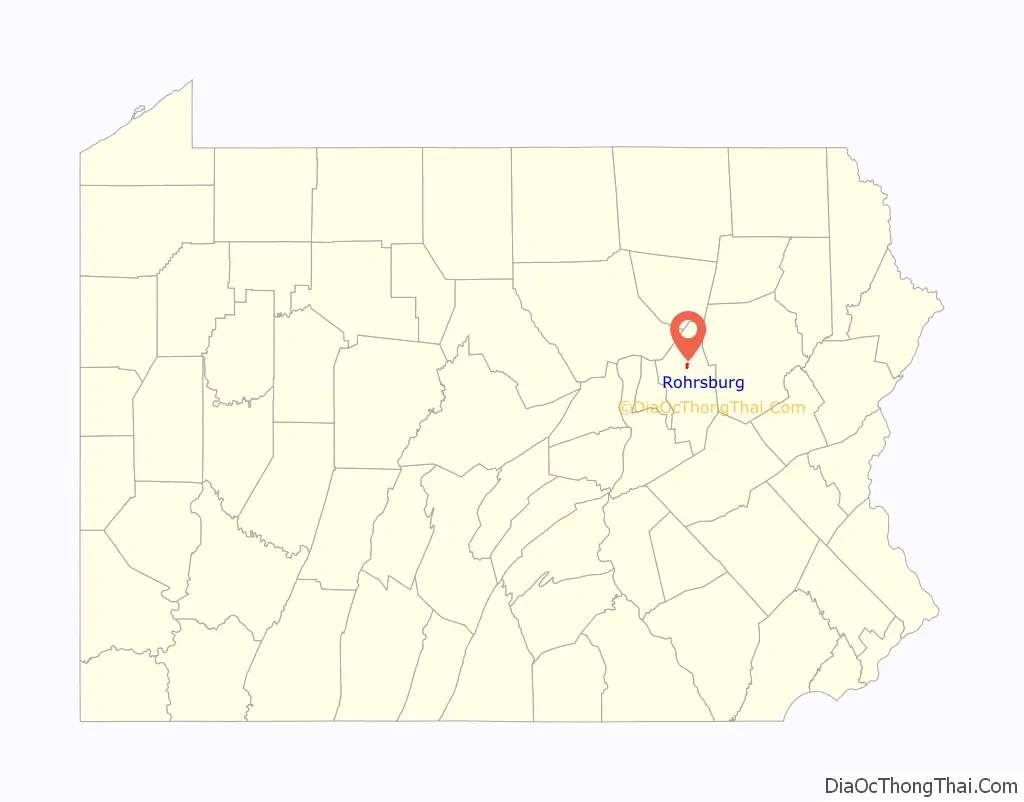
Rohrsburg location map. Where is Rohrsburg CDP?
History
Rohrsburg’s name comes from the Prussian Frederick Rohr, who gained the site in 1825 from Samuel Sherts. In 1826, Rohrsburg consisted solely of a wheelwright’s shop, but over the next few years some businesses developed in the area. Other early industries built in the Rohrsburg area include a sawmill built in 1820, a fulling and carding-mill built in 1832, and a pottery built in 1847. The Susquehanna, Bloomsburg, and Berwick Railroad had a station in Rohrsburg in the late 19th and early 20th centuries.
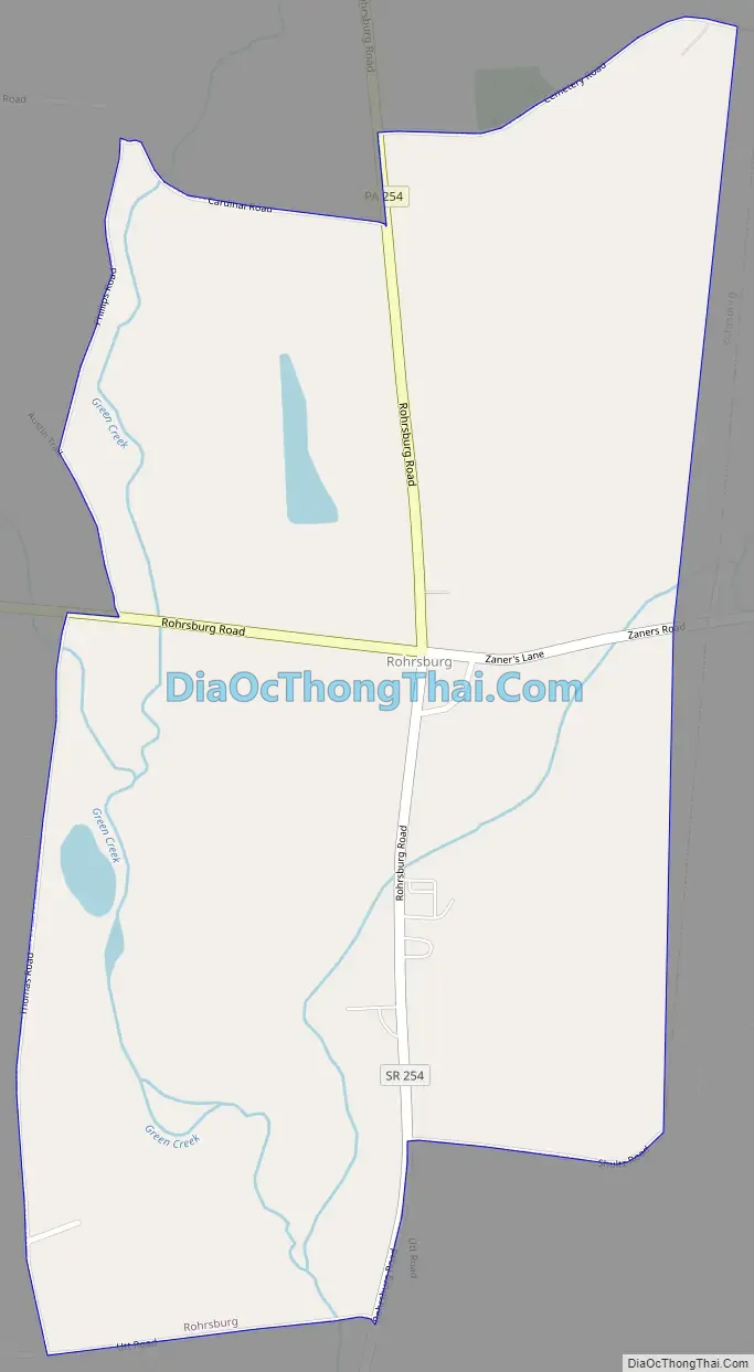
Rohrsburg Road Map
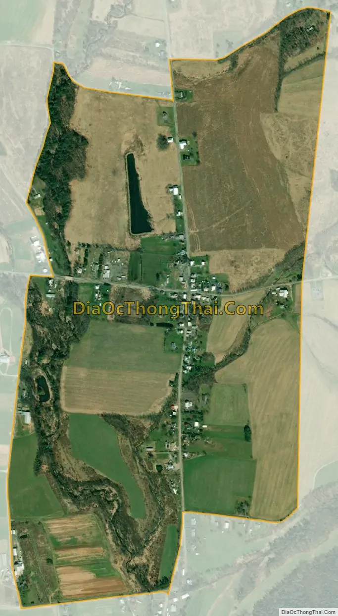
Rohrsburg city Satellite Map
Geography
Rohrsburg is located in northern Columbia County at 41°07′59″N 76°25′18″W / 41.133116°N 76.421646°W / 41.133116; -76.421646 (41.133116, -76.421646), in the southeast part of Greenwood Township. According to the U.S. Census Bureau, Rohrsburg has a total area of 0.71 square miles (1.85 km), of which 0.71 square miles (1.83 km) is land and 0.01 square miles (0.02 km), or 0.85%, is water.
Rohrsburg is mostly flat with some hills in the northeast. Little Green Creek flows into Green Creek, a tributary of Fishing Creek, in the CDP. Rohrsurg is almost entirely farmland with some woods along Green Creek and some houses near Pennsylvania Route 254 where it passes through the CDP.
See also
Map of Pennsylvania State and its subdivision:- Adams
- Allegheny
- Armstrong
- Beaver
- Bedford
- Berks
- Blair
- Bradford
- Bucks
- Butler
- Cambria
- Cameron
- Carbon
- Centre
- Chester
- Clarion
- Clearfield
- Clinton
- Columbia
- Crawford
- Cumberland
- Dauphin
- Delaware
- Elk
- Erie
- Fayette
- Forest
- Franklin
- Fulton
- Greene
- Huntingdon
- Indiana
- Jefferson
- Juniata
- Lackawanna
- Lancaster
- Lawrence
- Lebanon
- Lehigh
- Luzerne
- Lycoming
- Mc Kean
- Mercer
- Mifflin
- Monroe
- Montgomery
- Montour
- Northampton
- Northumberland
- Perry
- Philadelphia
- Pike
- Potter
- Schuylkill
- Snyder
- Somerset
- Sullivan
- Susquehanna
- Tioga
- Union
- Venango
- Warren
- Washington
- Wayne
- Westmoreland
- Wyoming
- York
- Alabama
- Alaska
- Arizona
- Arkansas
- California
- Colorado
- Connecticut
- Delaware
- District of Columbia
- Florida
- Georgia
- Hawaii
- Idaho
- Illinois
- Indiana
- Iowa
- Kansas
- Kentucky
- Louisiana
- Maine
- Maryland
- Massachusetts
- Michigan
- Minnesota
- Mississippi
- Missouri
- Montana
- Nebraska
- Nevada
- New Hampshire
- New Jersey
- New Mexico
- New York
- North Carolina
- North Dakota
- Ohio
- Oklahoma
- Oregon
- Pennsylvania
- Rhode Island
- South Carolina
- South Dakota
- Tennessee
- Texas
- Utah
- Vermont
- Virginia
- Washington
- West Virginia
- Wisconsin
- Wyoming