Sandy Ridge is an unincorporated community and census-designated place (CDP) in Centre County, Pennsylvania, United States. It is part of the State College, Pennsylvania Metropolitan Statistical Area. The population was 407 at the 2010 census.
| Name: | Sandy Ridge CDP |
|---|---|
| LSAD Code: | 57 |
| LSAD Description: | CDP (suffix) |
| State: | Pennsylvania |
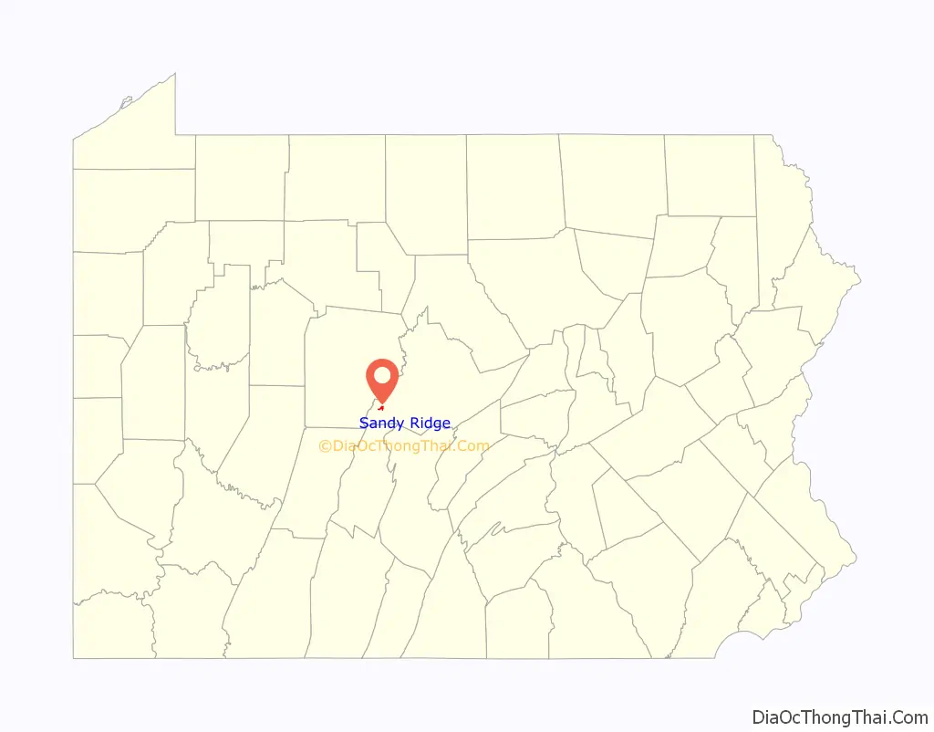
| County: | Centre County |
| Elevation: | 1,850 ft (560 m) |
| Total Area: | 0.64 sq mi (1.65 km²) |
| Land Area: | 0.64 sq mi (1.65 km²) |
| Water Area: | 0.0 sq mi (0.0 km²) |
| Total Population: | 407 |
| Population Density: | 639/sq mi (246.7/km²) |
| ZIP code: | 16677 |
| Area code: | 814 |
| FIPS code: | 4267872 |
| GNISfeature ID: | 1186955 |
Online Interactive Map
Click on ![]() to view map in "full screen" mode.
to view map in "full screen" mode.
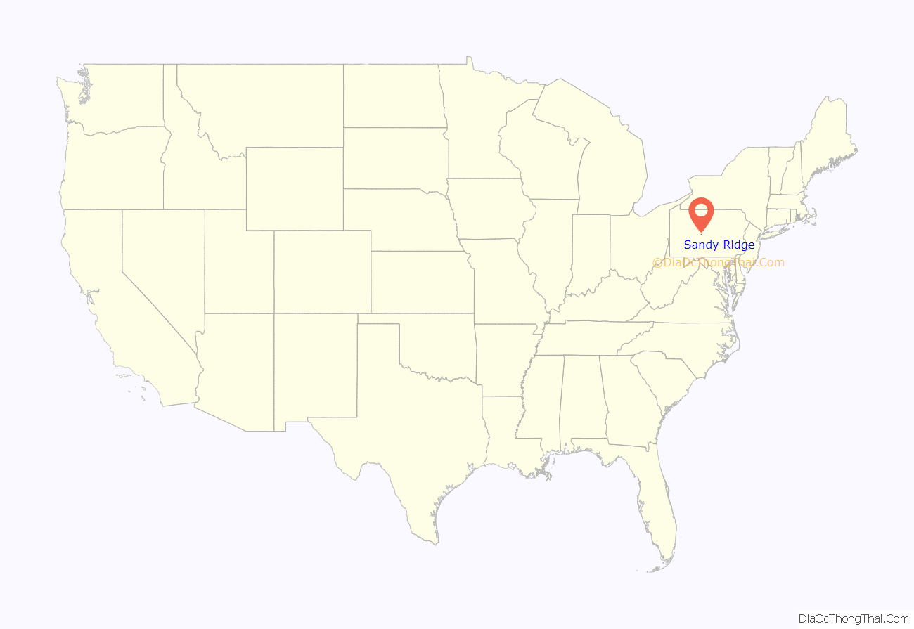
Sandy Ridge location map. Where is Sandy Ridge CDP?
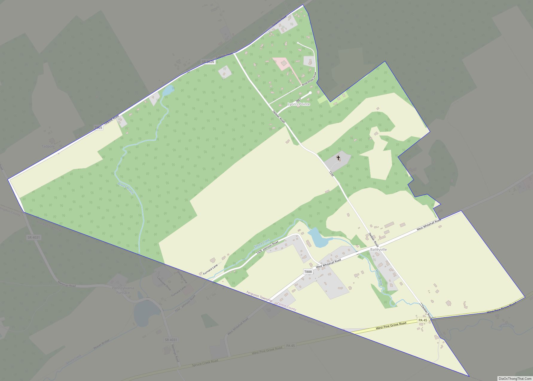
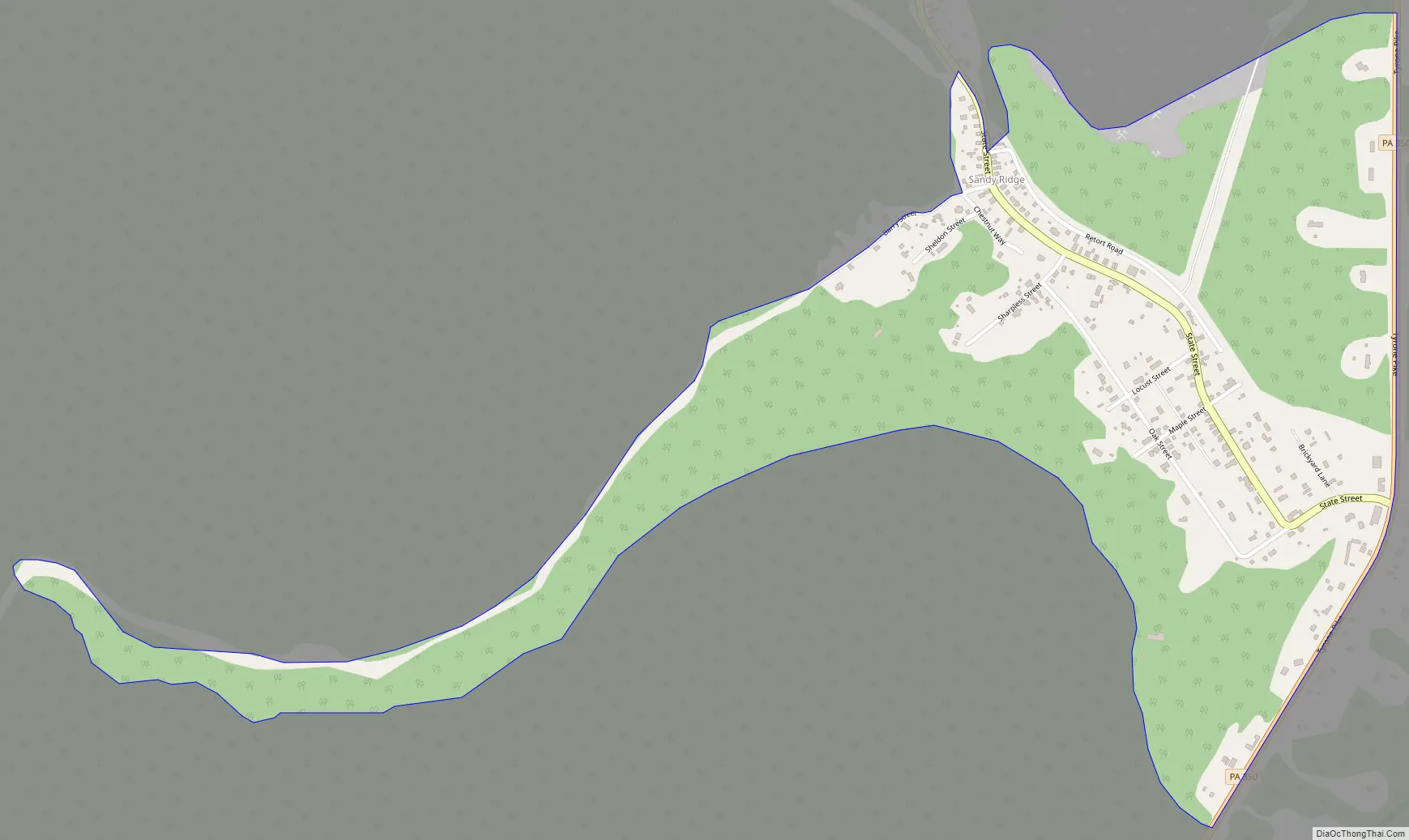
Sandy Ridge Road Map
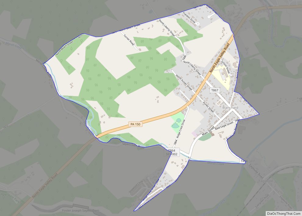
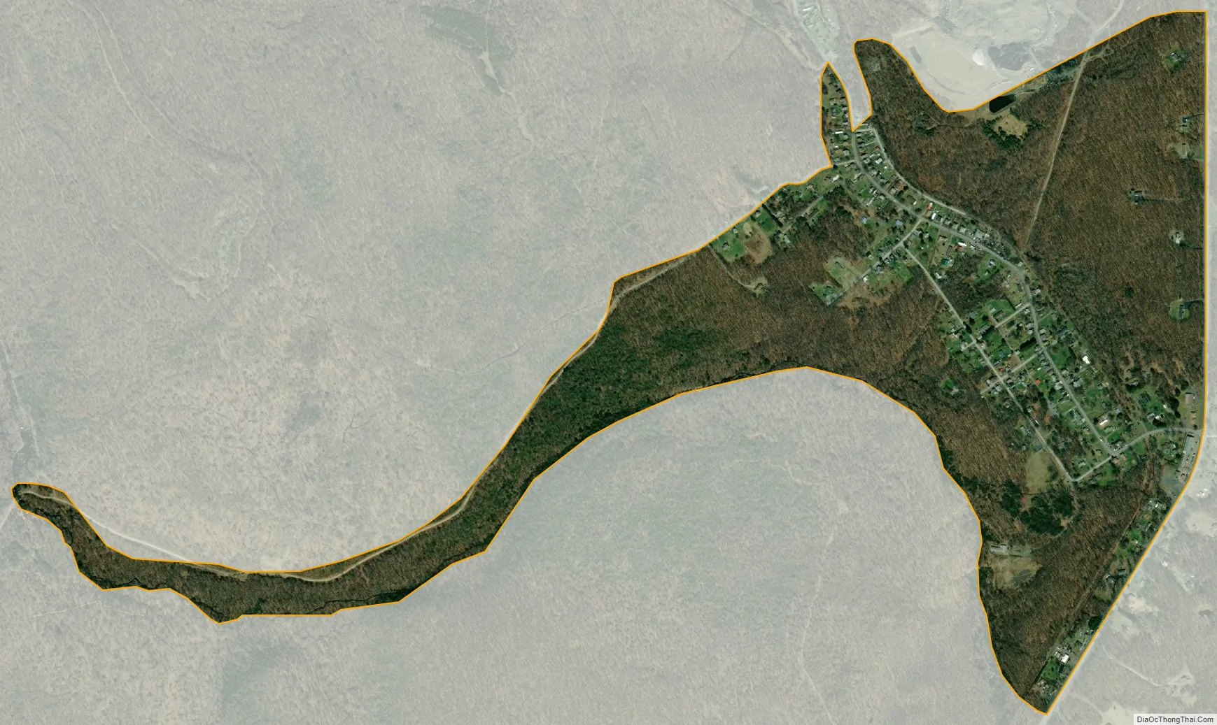
Sandy Ridge city Satellite Map
Geography
Sandy Ridge is located in Pennsylvania, at 40°48′43″N 78°13′56″W / 40.81194°N 78.23222°W / 40.81194; -78.23222 (40.811904, -78.232142), southwest of the center of Rush Township. It sits at an elevation of 1,800 to 1,950 feet (550 to 590 m), 3 miles (5 km) northwest of the physical Sandy Ridge, the 2,500-foot-high (760 m) local expression of the Allegheny Front.
Pennsylvania Route 970 passes through the community, leading northwest 4 miles (6 km) to Osceola Mills on Moshannon Creek in Clearfield County. Pennsylvania Route 350 forms the eastern edge of the community, leading north 6 miles (10 km) to Philipsburg (also on Moshannon Creek) and south over the Allegheny Front 9 miles (14 km) to Interstate 99 at Bald Eagle.
According to the United States Census Bureau, the Sandy Ridge CDP has a total area of 0.64 square miles (1.65 km), all of it land.
See also
Map of Pennsylvania State and its subdivision:- Adams
- Allegheny
- Armstrong
- Beaver
- Bedford
- Berks
- Blair
- Bradford
- Bucks
- Butler
- Cambria
- Cameron
- Carbon
- Centre
- Chester
- Clarion
- Clearfield
- Clinton
- Columbia
- Crawford
- Cumberland
- Dauphin
- Delaware
- Elk
- Erie
- Fayette
- Forest
- Franklin
- Fulton
- Greene
- Huntingdon
- Indiana
- Jefferson
- Juniata
- Lackawanna
- Lancaster
- Lawrence
- Lebanon
- Lehigh
- Luzerne
- Lycoming
- Mc Kean
- Mercer
- Mifflin
- Monroe
- Montgomery
- Montour
- Northampton
- Northumberland
- Perry
- Philadelphia
- Pike
- Potter
- Schuylkill
- Snyder
- Somerset
- Sullivan
- Susquehanna
- Tioga
- Union
- Venango
- Warren
- Washington
- Wayne
- Westmoreland
- Wyoming
- York
- Alabama
- Alaska
- Arizona
- Arkansas
- California
- Colorado
- Connecticut
- Delaware
- District of Columbia
- Florida
- Georgia
- Hawaii
- Idaho
- Illinois
- Indiana
- Iowa
- Kansas
- Kentucky
- Louisiana
- Maine
- Maryland
- Massachusetts
- Michigan
- Minnesota
- Mississippi
- Missouri
- Montana
- Nebraska
- Nevada
- New Hampshire
- New Jersey
- New Mexico
- New York
- North Carolina
- North Dakota
- Ohio
- Oklahoma
- Oregon
- Pennsylvania
- Rhode Island
- South Carolina
- South Dakota
- Tennessee
- Texas
- Utah
- Vermont
- Virginia
- Washington
- West Virginia
- Wisconsin
- Wyoming