Shirleysburg is a borough in Huntingdon County, Pennsylvania, United States. The population was 150 at the 2010 census.
| Name: | Shirleysburg borough |
|---|---|
| LSAD Code: | 21 |
| LSAD Description: | borough (suffix) |
| State: | Pennsylvania |
| County: | Huntingdon County |
| Total Area: | 0.16 sq mi (0.41 km²) |
| Land Area: | 0.16 sq mi (0.41 km²) |
| Water Area: | 0.00 sq mi (0.00 km²) |
| Total Population: | 150 |
| Population Density: | 868.75/sq mi (335.98/km²) |
| ZIP code: | 17260 |
| Area code: | 814 |
| FIPS code: | 4270408 |
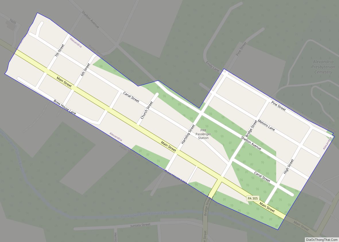
Online Interactive Map
Click on ![]() to view map in "full screen" mode.
to view map in "full screen" mode.
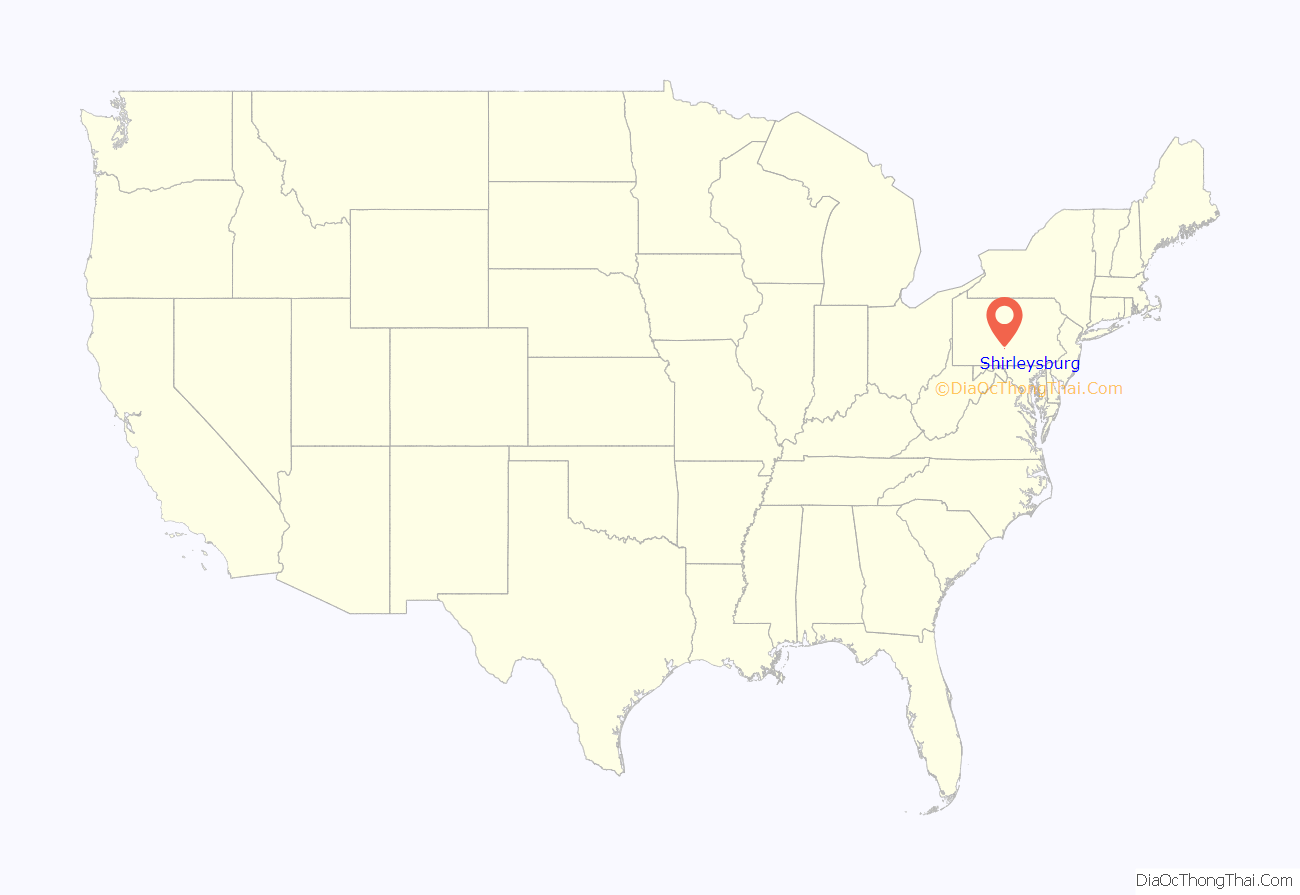
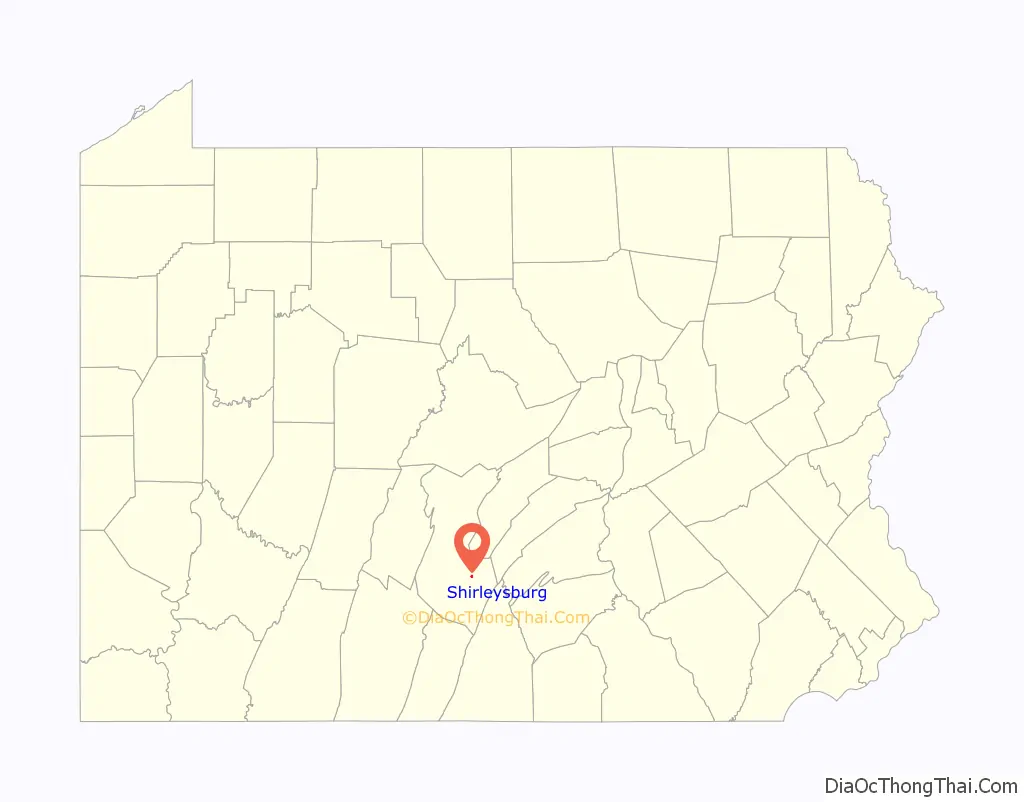
Shirleysburg location map. Where is Shirleysburg borough?
History
Shirleysburg was originally the site of, and takes its name from Fort Shirley, a French and Indian War fort. During this period, in 1754 Monacatoocha (Scarouady) led about 200 French-allied Native Americans: Iroquois, Lenape, and Shawnee from their village of Logstown on the western frontier to take refuge near here.
The narrow gauge East Broad Top Railroad (EBT) was constructed through Shirleysburg in 1873. It continued to serve the town for 83 years, until it ceased operations in 1956. Since 1960 EBT tourist trains have operated from Rockhill to Colgate Grove, just south of town, where a wye was constructed to turn trains. The inactive tracks pass through the community on their way to Mount Union.
The Benjamin B. Leas House was listed on the National Register of Historic Places in 1984.
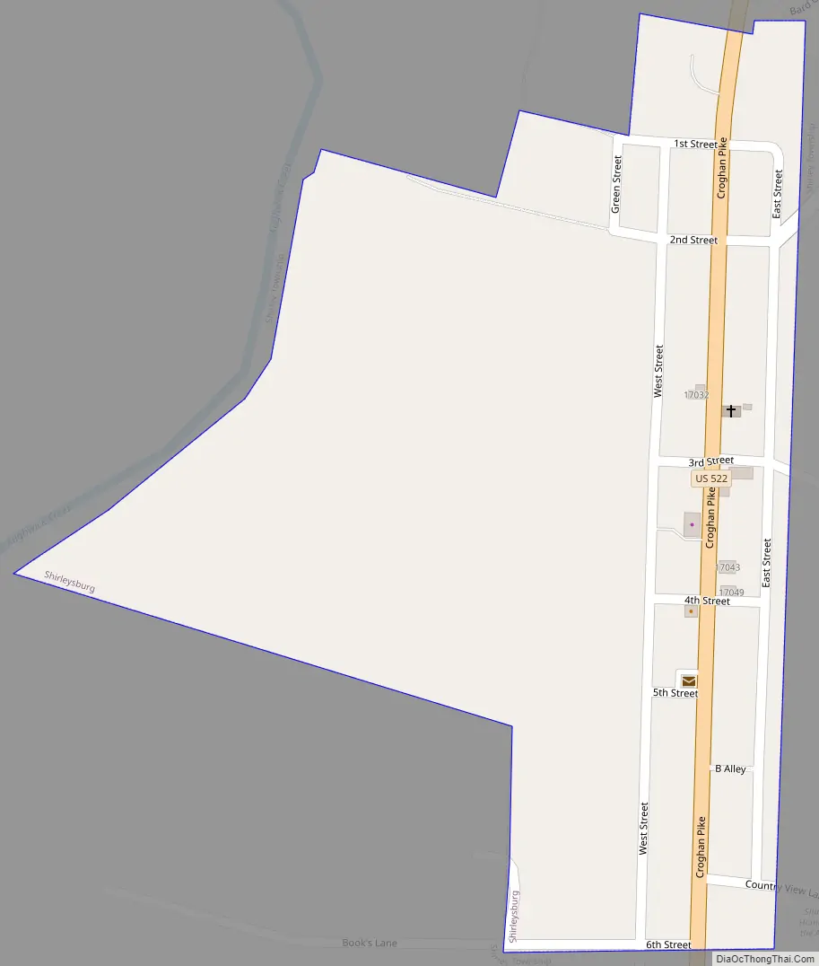
Shirleysburg Road Map
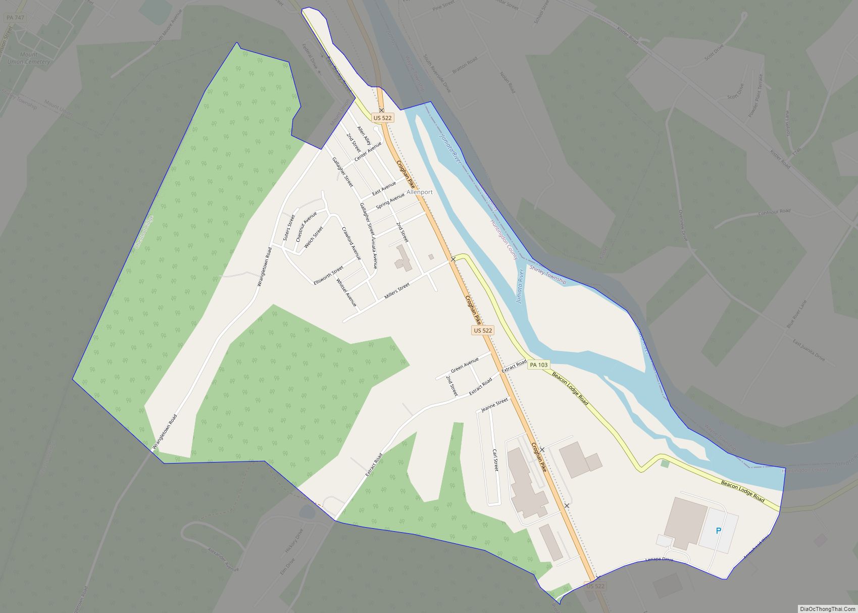
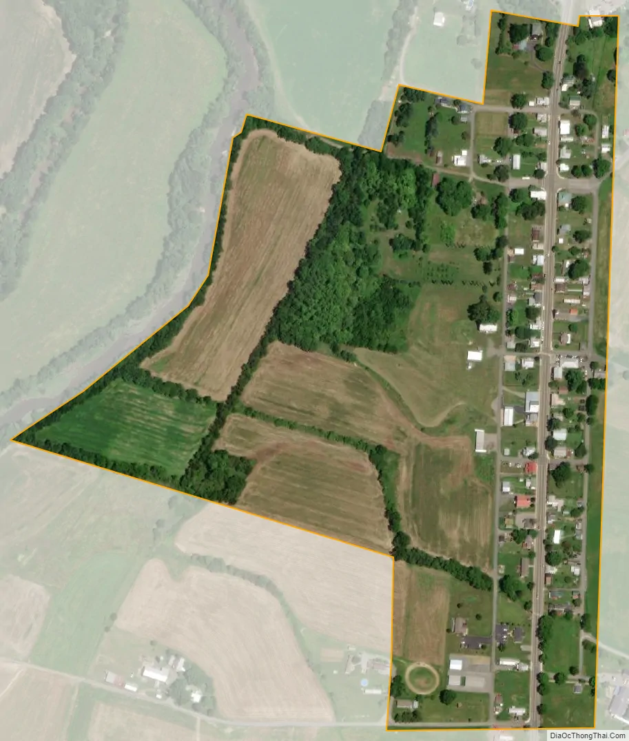
Shirleysburg city Satellite Map
Geography
Shirleysburg is located in southeastern Huntingdon County at 40°17′49″N 77°52′29″W / 40.29694°N 77.87472°W / 40.29694; -77.87472 (40.296892, -77.874652). It sits in the valley of Aughwick Creek, between Blacklog Mountain to the east and Jacks Mountain to the west. U.S. Route 522 passes through the borough, leading north 6 miles (10 km) to Mount Union and south 4 miles (6 km) to Orbisonia, next to Rockhill.
According to the United States Census Bureau, Shirleysburg has a total area of 0.4 square kilometres (0.2 sq mi), all land. The western border of the borough follows Aughwick Creek, a northward-flowing tributary of the Juniata River.
See also
Map of Pennsylvania State and its subdivision:- Adams
- Allegheny
- Armstrong
- Beaver
- Bedford
- Berks
- Blair
- Bradford
- Bucks
- Butler
- Cambria
- Cameron
- Carbon
- Centre
- Chester
- Clarion
- Clearfield
- Clinton
- Columbia
- Crawford
- Cumberland
- Dauphin
- Delaware
- Elk
- Erie
- Fayette
- Forest
- Franklin
- Fulton
- Greene
- Huntingdon
- Indiana
- Jefferson
- Juniata
- Lackawanna
- Lancaster
- Lawrence
- Lebanon
- Lehigh
- Luzerne
- Lycoming
- Mc Kean
- Mercer
- Mifflin
- Monroe
- Montgomery
- Montour
- Northampton
- Northumberland
- Perry
- Philadelphia
- Pike
- Potter
- Schuylkill
- Snyder
- Somerset
- Sullivan
- Susquehanna
- Tioga
- Union
- Venango
- Warren
- Washington
- Wayne
- Westmoreland
- Wyoming
- York
- Alabama
- Alaska
- Arizona
- Arkansas
- California
- Colorado
- Connecticut
- Delaware
- District of Columbia
- Florida
- Georgia
- Hawaii
- Idaho
- Illinois
- Indiana
- Iowa
- Kansas
- Kentucky
- Louisiana
- Maine
- Maryland
- Massachusetts
- Michigan
- Minnesota
- Mississippi
- Missouri
- Montana
- Nebraska
- Nevada
- New Hampshire
- New Jersey
- New Mexico
- New York
- North Carolina
- North Dakota
- Ohio
- Oklahoma
- Oregon
- Pennsylvania
- Rhode Island
- South Carolina
- South Dakota
- Tennessee
- Texas
- Utah
- Vermont
- Virginia
- Washington
- West Virginia
- Wisconsin
- Wyoming