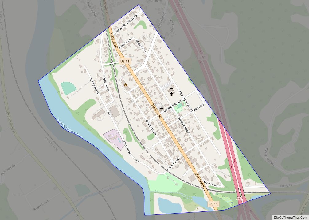
Susquehanna Depot, often referred to simply as Susquehanna, is a borough in Susquehanna County, Pennsylvania, United States, located on the Susquehanna River 23 miles (37 km) southeast of Binghamton, New York. In the past, railroad locomotives and railroad cars were made here. It is also known for its Pennsylvania Bluestone quarries.
The behavioral scientist B. F. Skinner was born in Susquehanna. The American writer John Gardner lived the last few years of his life in Susquehanna, where he died in a motorcycle accident in 1982.
The borough population was 1,365 as of the 2020 census.
| Name: | Susquehanna Depot borough |
|---|---|
| LSAD Code: | 21 |
| LSAD Description: | borough (suffix) |
| State: | Pennsylvania |
| County: | Susquehanna County |
| Incorporated: | 1853 |
| Total Area: | 0.79 sq mi (2.05 km²) |
| Land Area: | 0.74 sq mi (1.91 km²) |
| Water Area: | 0.05 sq mi (0.14 km²) |
| Total Population: | 1,365 |
| Population Density: | 1,852.10/sq mi (715.15/km²) |
| Area code: | 570 |
| FIPS code: | 4275568 |
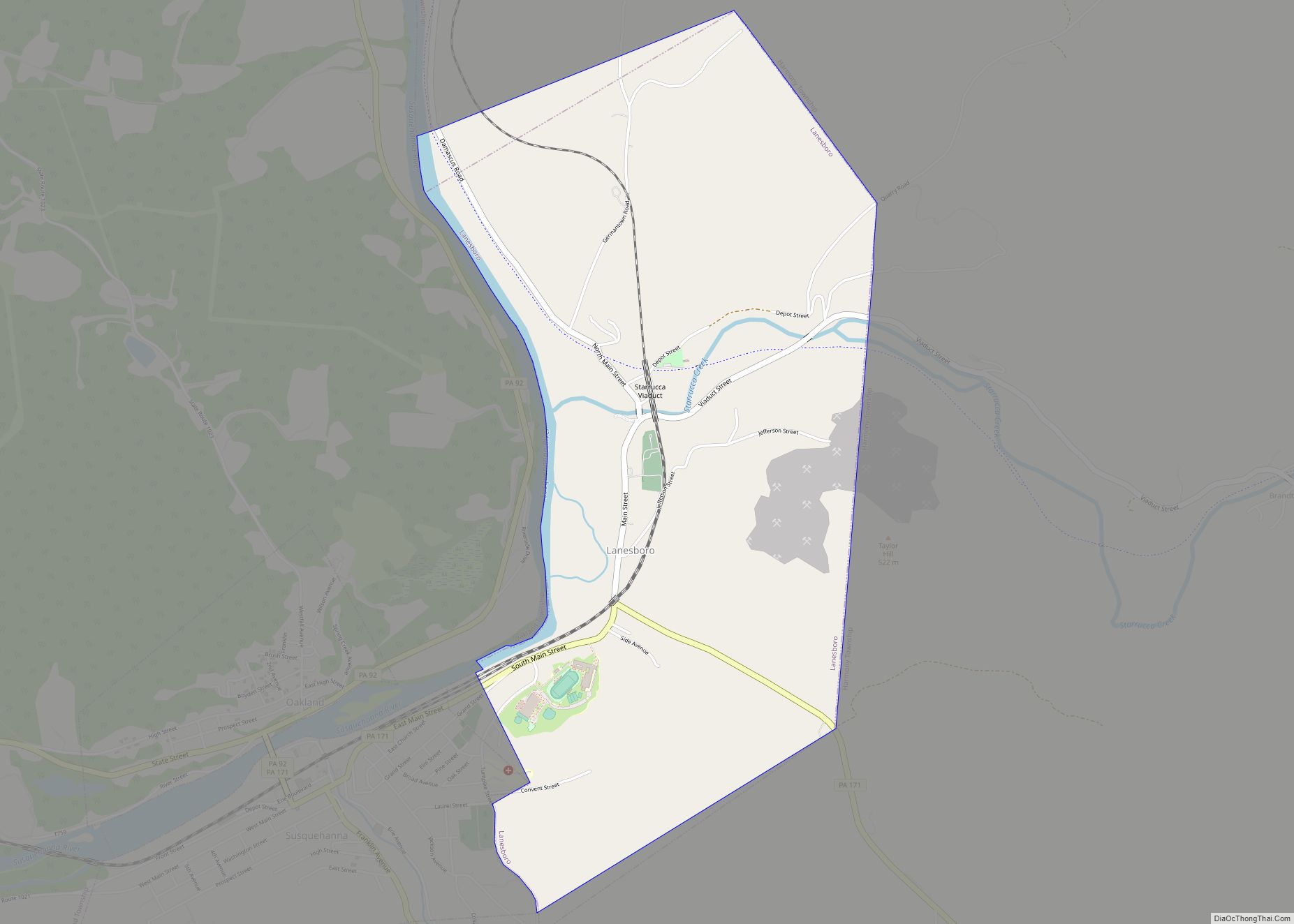
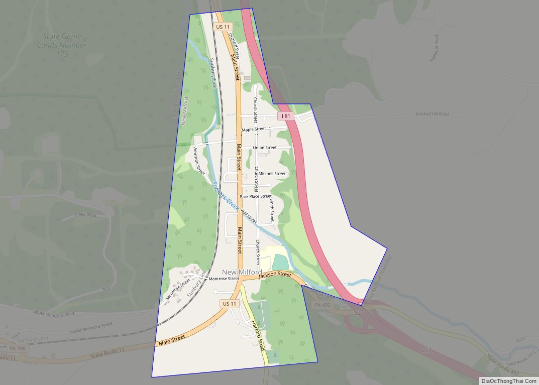
Online Interactive Map
Click on ![]() to view map in "full screen" mode.
to view map in "full screen" mode.
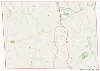
Susquehanna Depot location map. Where is Susquehanna Depot borough?


History
The New York and Erie Railroad (later reorganized as the Erie Railroad) built a rail line through the county in 1848, including the Starrucca Viaduct: a monumental stone structure spanning Starrucca Creek. Concurrently, the railroad established workshops in what would eventually be known as Susquehanna Depot. Initially, 350 workers were employed. The line opened for traffic in 1851.
The borough was incorporated on August 19, 1853, from part of Harmony Township. In 1863, the Erie shops were expanded to cover 8 acres (3.2 ha) and they employed 700 workers by 1865, and later over 1,000. The complex included a 33-stall roundhouse, a rail yard, a foundry, gas works, oil works and offices. By 1887, the shops were producing five locomotives per month. The Susquehanna railroad station, which included a large hotel called the Starrucca House, opened in 1865.
The railroad converted the Starrucca House to offices and staff housing c. 1903. A new roundhouse complex was constructed between 1904 and 1911, and other shop buildings were added through the 1920s. In 1928, the railroad relocated its locomotive shops to Hornell, New York, and moved other shops out of Susquehanna in 1929, but retained a coach shop with reduced staffing through the 1950s. In 1952, Erie closed the roundhouse as it converted its steam locomotive roster to diesel locomotives. By the end of the decade, Erie had moved all of its remaining shop operations to Meadville.
Erie merged into the Erie–Lackawanna Railroad (EL) in 1960, and the latter ended passenger train service through Susquehanna on November 27, 1966. EL went bankrupt in 1972 and was absorbed into Conrail in 1976. Most of the railroad shop buildings were demolished in 1980 and 1981.
With the demise of the local railroad industry, Susquehanna now has many small resident-owned businesses scattered along Main Street. Recent renovations to several Main Street buildings mark the first significant upturn in the local economy in several decades.
The Erie Railroad Station was added to the National Register of Historic Places in 1972.
Susquehanna Depot Road Map

Susquehanna Depot city Satellite Map

Geography
Susquehanna Depot is located at 41°56′41″N 75°36′14″W / 41.94472°N 75.60389°W / 41.94472; -75.60389 (41.944601, -75.604025).
According to the United States Census Bureau, the borough has a total area of 0.83 square miles (2.1 km), of which 0.77 square miles (2.0 km) is land and 0.06 square miles (0.16 km) (7.23%) is water.
See also
Map of Pennsylvania State and its subdivision:- Adams
- Allegheny
- Armstrong
- Beaver
- Bedford
- Berks
- Blair
- Bradford
- Bucks
- Butler
- Cambria
- Cameron
- Carbon
- Centre
- Chester
- Clarion
- Clearfield
- Clinton
- Columbia
- Crawford
- Cumberland
- Dauphin
- Delaware
- Elk
- Erie
- Fayette
- Forest
- Franklin
- Fulton
- Greene
- Huntingdon
- Indiana
- Jefferson
- Juniata
- Lackawanna
- Lancaster
- Lawrence
- Lebanon
- Lehigh
- Luzerne
- Lycoming
- Mc Kean
- Mercer
- Mifflin
- Monroe
- Montgomery
- Montour
- Northampton
- Northumberland
- Perry
- Philadelphia
- Pike
- Potter
- Schuylkill
- Snyder
- Somerset
- Sullivan
- Susquehanna
- Tioga
- Union
- Venango
- Warren
- Washington
- Wayne
- Westmoreland
- Wyoming
- York
- Alabama
- Alaska
- Arizona
- Arkansas
- California
- Colorado
- Connecticut
- Delaware
- District of Columbia
- Florida
- Georgia
- Hawaii
- Idaho
- Illinois
- Indiana
- Iowa
- Kansas
- Kentucky
- Louisiana
- Maine
- Maryland
- Massachusetts
- Michigan
- Minnesota
- Mississippi
- Missouri
- Montana
- Nebraska
- Nevada
- New Hampshire
- New Jersey
- New Mexico
- New York
- North Carolina
- North Dakota
- Ohio
- Oklahoma
- Oregon
- Pennsylvania
- Rhode Island
- South Carolina
- South Dakota
- Tennessee
- Texas
- Utah
- Vermont
- Virginia
- Washington
- West Virginia
- Wisconsin
- Wyoming