Three Springs is a borough in Huntingdon County, Pennsylvania, United States. The population was 444 at the 2010 census.
The borough takes its name from nearby Three Springs Creek.
| Name: | Three Springs borough |
|---|---|
| LSAD Code: | 21 |
| LSAD Description: | borough (suffix) |
| State: | Pennsylvania |
| County: | Huntingdon County |
| Total Area: | 1.23 sq mi (3.19 km²) |
| Land Area: | 1.23 sq mi (3.19 km²) |
| Water Area: | 0.00 sq mi (0.00 km²) |
| Total Population: | 444 |
| Population Density: | 351.18/sq mi (135.59/km²) |
| ZIP code: | 17264 |
| Area code: | 814 |
| FIPS code: | 4276632 |
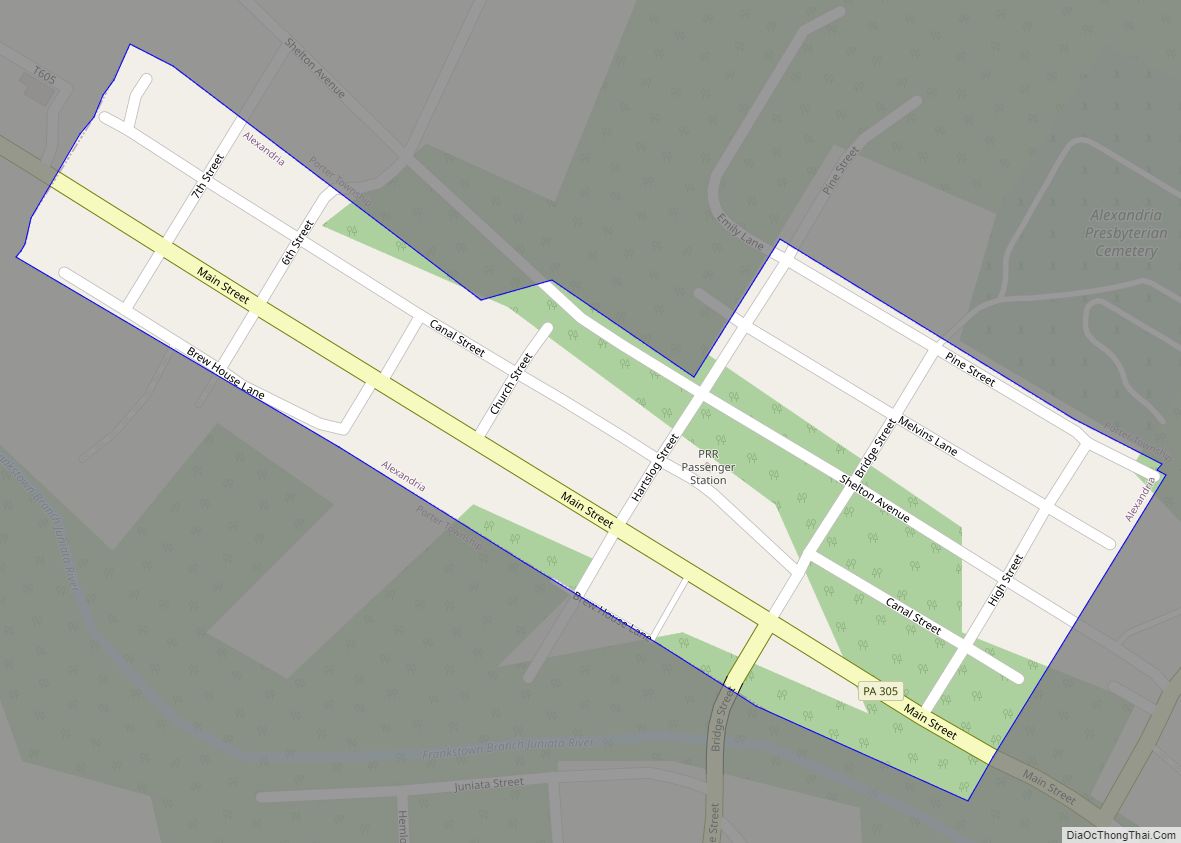
Online Interactive Map
Click on ![]() to view map in "full screen" mode.
to view map in "full screen" mode.
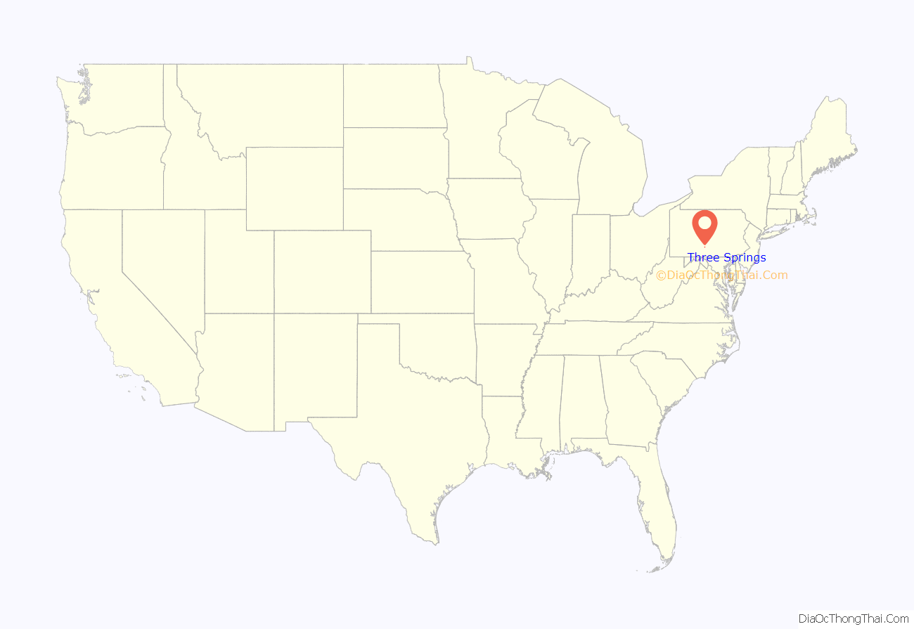
Three Springs location map. Where is Three Springs borough?
History
The narrow-gauge East Broad Top Railroad was constructed through the community in 1874. A small yard and station were located here, and a tank farm and scrap yard were serviced. The tracks have been out of service since 1956 but are still in place and owned by the railroad.
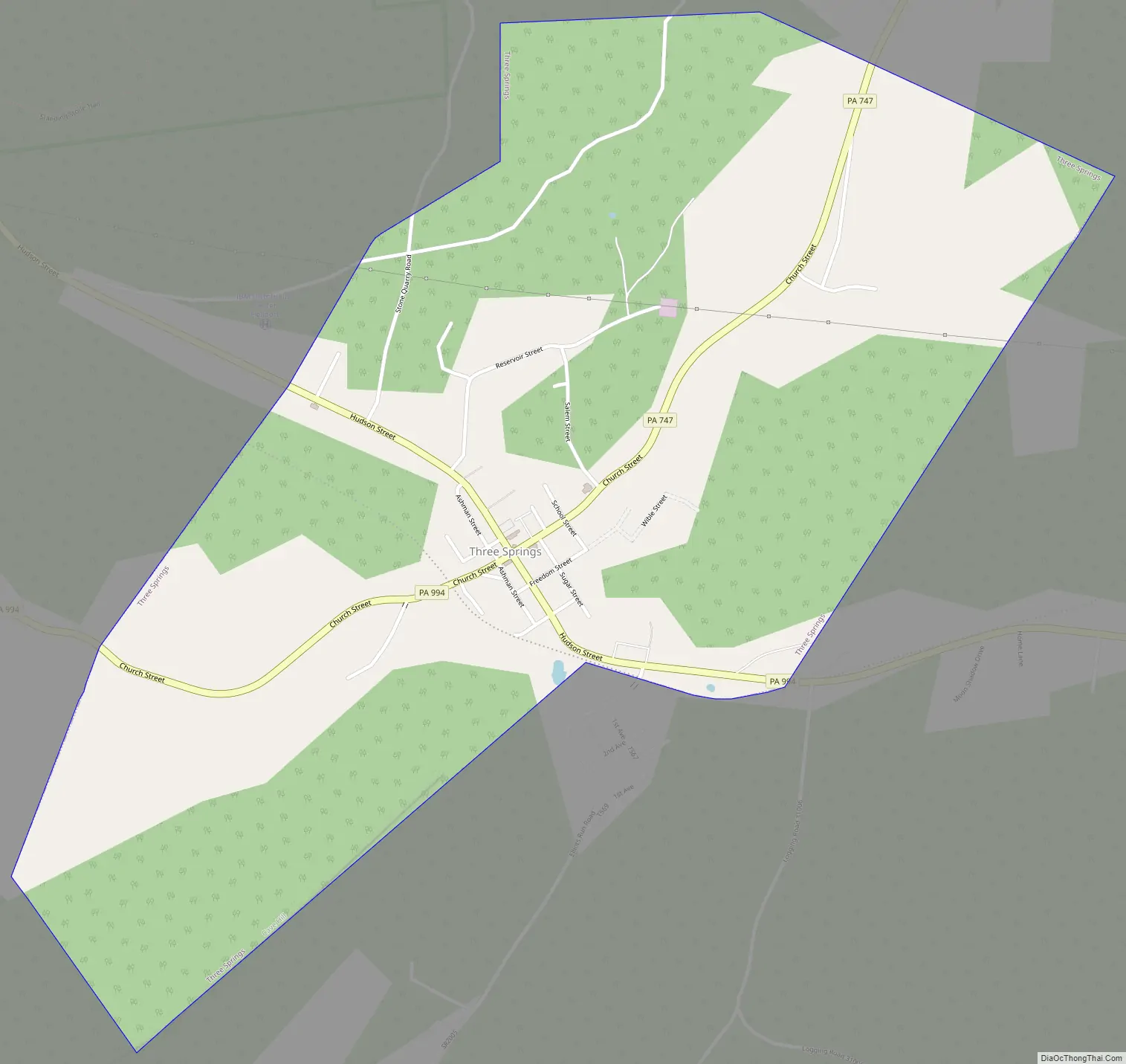
Three Springs Road Map
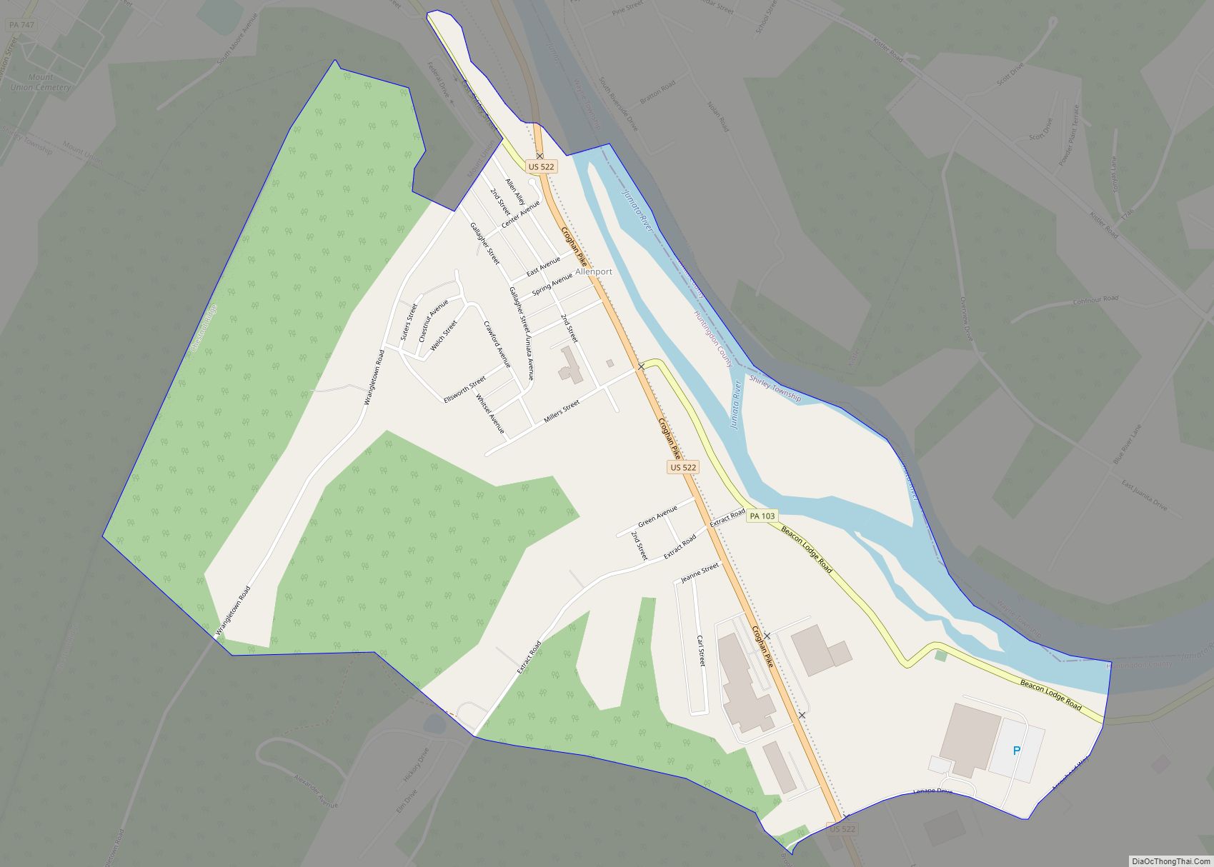
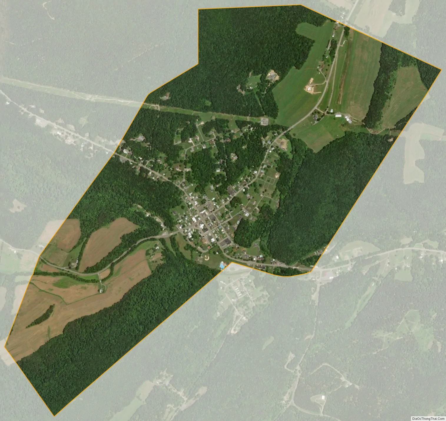
Three Springs city Satellite Map
Geography
Three Springs is in southern Huntingdon County, sitting at the base of the south end of Jacks Mountain. Spring Creek and North Spring Branch flow through the borough, joining just southeast of the borough limits to form Three Springs Creek, an east-flowing tributary of Aughwick Creek and part of the Juniata River watershed. Sinking Run, another tributary of Three Springs Creek, flows through the eastern part of the borough.
Pennsylvania Route 994 runs through the center of the borough, leading northeast 6 miles (10 km) to Rockhill and west-northwest 20 miles (32 km) to Entriken. Pennsylvania Route 829 leads from the center of Three Springs 2 miles (3 km) northwest to Saltillo, and Pennsylvania Route 747 leads north-northeast 14 miles (23 km) to Mount Union at the Juniata River.
According to the United States Census Bureau, the borough of Three Springs has a total area of 1.2 square miles (3.2 km), all land.
See also
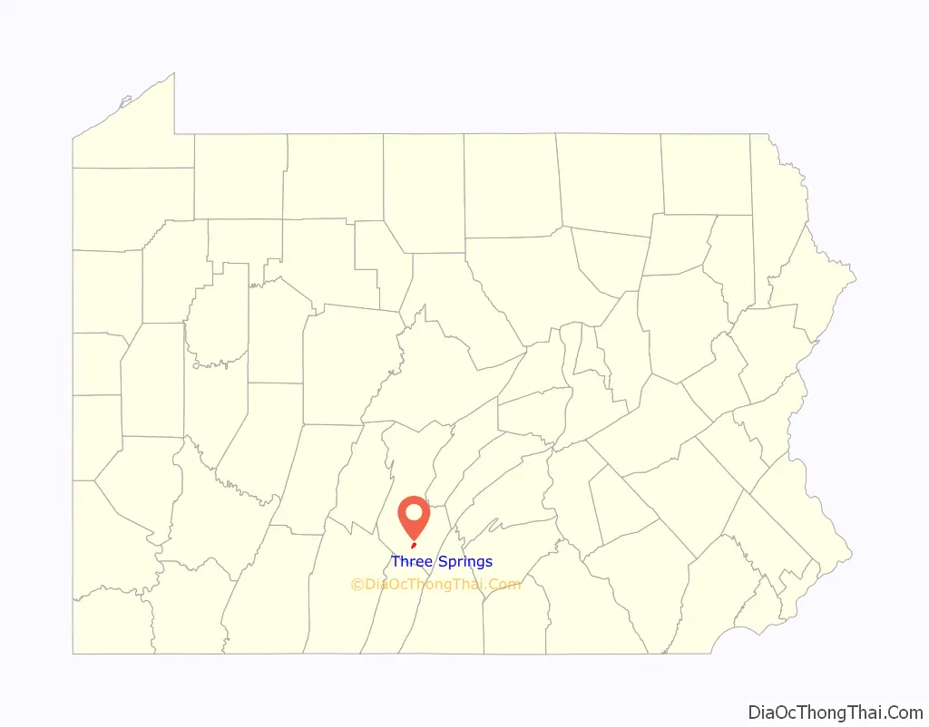
Map of Pennsylvania State and its subdivision:- Adams
- Allegheny
- Armstrong
- Beaver
- Bedford
- Berks
- Blair
- Bradford
- Bucks
- Butler
- Cambria
- Cameron
- Carbon
- Centre
- Chester
- Clarion
- Clearfield
- Clinton
- Columbia
- Crawford
- Cumberland
- Dauphin
- Delaware
- Elk
- Erie
- Fayette
- Forest
- Franklin
- Fulton
- Greene
- Huntingdon
- Indiana
- Jefferson
- Juniata
- Lackawanna
- Lancaster
- Lawrence
- Lebanon
- Lehigh
- Luzerne
- Lycoming
- Mc Kean
- Mercer
- Mifflin
- Monroe
- Montgomery
- Montour
- Northampton
- Northumberland
- Perry
- Philadelphia
- Pike
- Potter
- Schuylkill
- Snyder
- Somerset
- Sullivan
- Susquehanna
- Tioga
- Union
- Venango
- Warren
- Washington
- Wayne
- Westmoreland
- Wyoming
- York
- Alabama
- Alaska
- Arizona
- Arkansas
- California
- Colorado
- Connecticut
- Delaware
- District of Columbia
- Florida
- Georgia
- Hawaii
- Idaho
- Illinois
- Indiana
- Iowa
- Kansas
- Kentucky
- Louisiana
- Maine
- Maryland
- Massachusetts
- Michigan
- Minnesota
- Mississippi
- Missouri
- Montana
- Nebraska
- Nevada
- New Hampshire
- New Jersey
- New Mexico
- New York
- North Carolina
- North Dakota
- Ohio
- Oklahoma
- Oregon
- Pennsylvania
- Rhode Island
- South Carolina
- South Dakota
- Tennessee
- Texas
- Utah
- Vermont
- Virginia
- Washington
- West Virginia
- Wisconsin
- Wyoming