Volant is a borough in Lawrence County, Pennsylvania, United States. The population was 127 at the 2020 Census. Volant is surrounded by Old Order Amish farms of the New Wilmington settlement. It is part of the New Castle micropolitan area.
| Name: | Volant borough |
|---|---|
| LSAD Code: | 21 |
| LSAD Description: | borough (suffix) |
| State: | Pennsylvania |
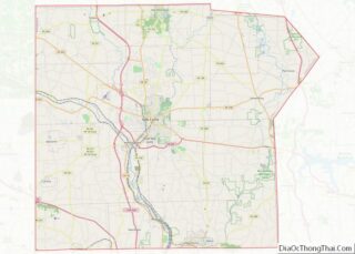
| County: | Lawrence County |
| Total Area: | 0.12 sq mi (0.31 km²) |
| Land Area: | 0.11 sq mi (0.29 km²) |
| Water Area: | 0.01 sq mi (0.02 km²) |
| Total Population: | 127 |
| Population Density: | 1,348.21/sq mi (518.98/km²) |
| Area code: | 724 |
| FIPS code: | 4280368 |
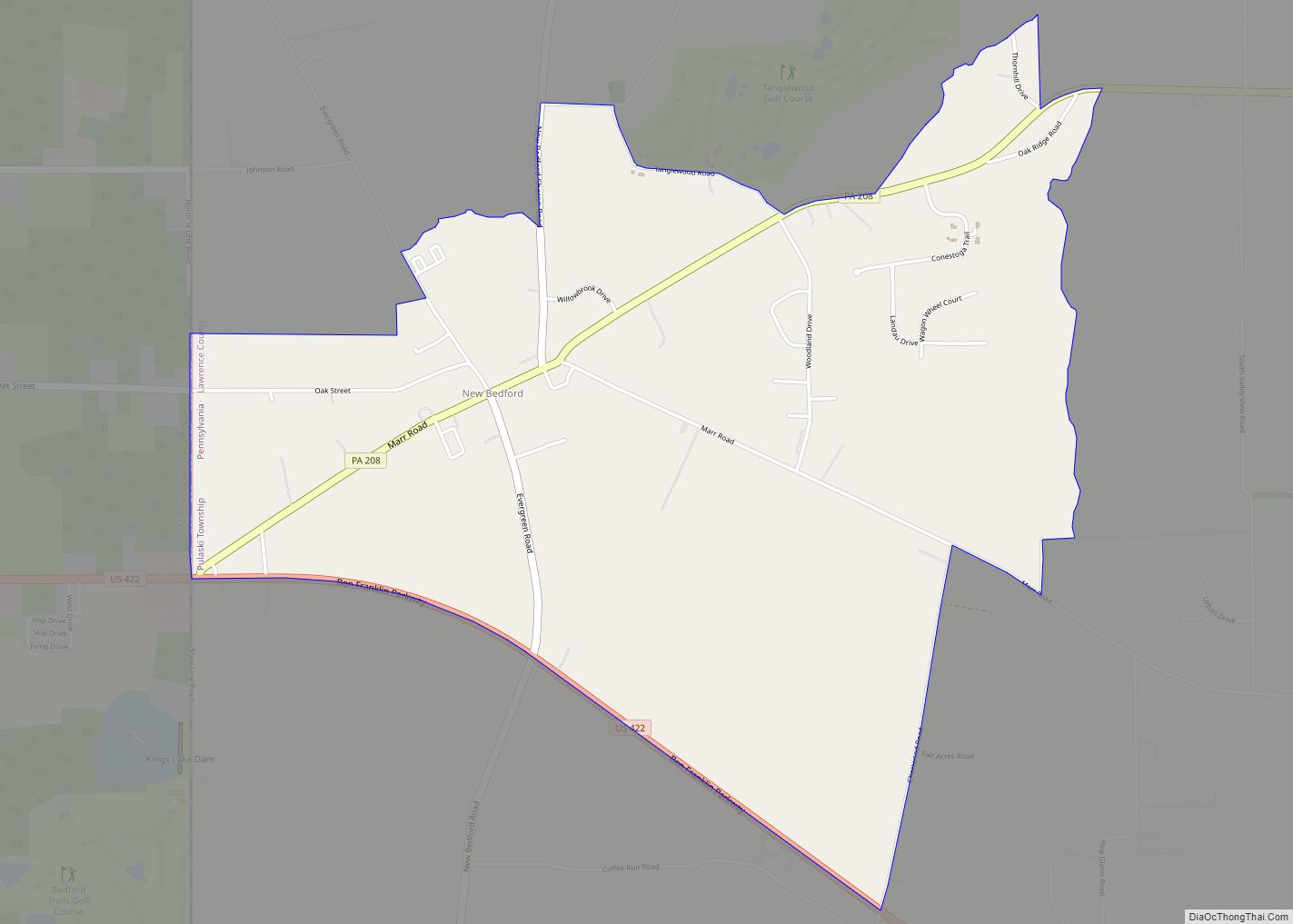
Online Interactive Map
Click on ![]() to view map in "full screen" mode.
to view map in "full screen" mode.
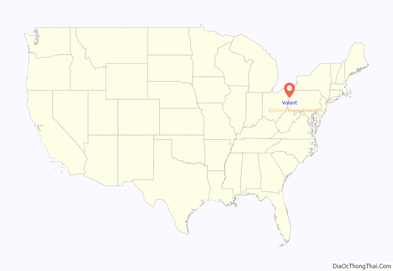
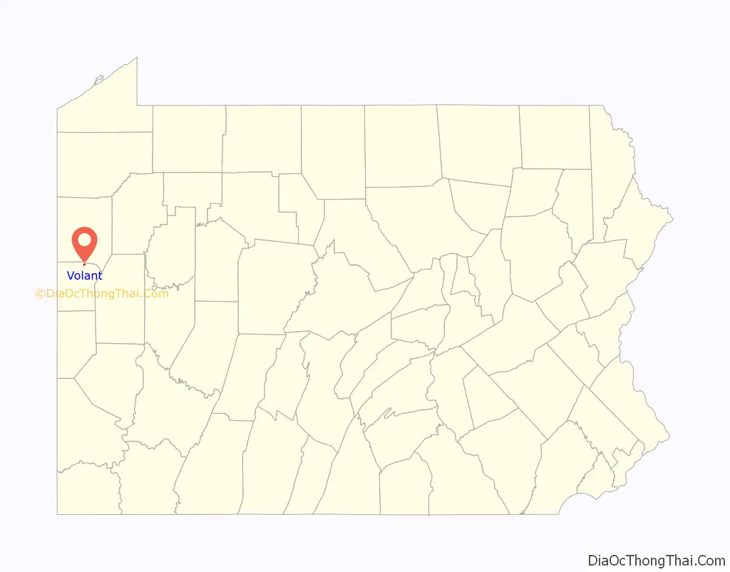
Volant location map. Where is Volant borough?
History
The land on which the borough of Volant is situated was bought from Native Americans in 1784. The first gristmill was built on Neshannock Creek in 1806, upstream from the current site. It was abandoned after a few years, and a new mill was built in 1812.
In 1847, an Amish settlement was established between New Wilmington and Volant. In 1868, J.P. Locke purchased the mill and 100 acres (0.40 km) of land and began laying out a settlement of 30 lots, which he called Lockeville. With the help of the railroad, his attempts to create a settlement were successful. In June 1893, the settlement changed its name to Volant and was incorporated as a self-governing unit.
The first store was built in 1877 by John and William Graham. By the turn of the 20th century the village turned into a commercial community. Thanks to the New Castle–Franklin railroad, Volant became a shopping district. The mill remained the nucleus of the town. Because of Volant’s rural location there was a livery stable, two harness shops, a blacksmith and a veterinarian. There was also a college which attracted students from the surrounding communities. As the town progressed toward establishing larger business ventures, a stone quarry was set up around 1900, along with a lumber mill and brick company. The growing need for petroleum spurred an oil boom north of Volant. The drilling continued until the beginning of World War I.
With the Great Depression came a gradual decline of the economy. The mill, which was the prime source of Volant’s economy, closed its doors in the early 1960s, and the trains stopped running through Volant in 1975.
In 1984 the mill reopened for the first time in over 20 years as a country gift and antique store. Encouraged by its success, other shops were opened on Main Street. There are over 50 shops and restaurants, turning Volant into one of western Pennsylvania’s tourist attractions.
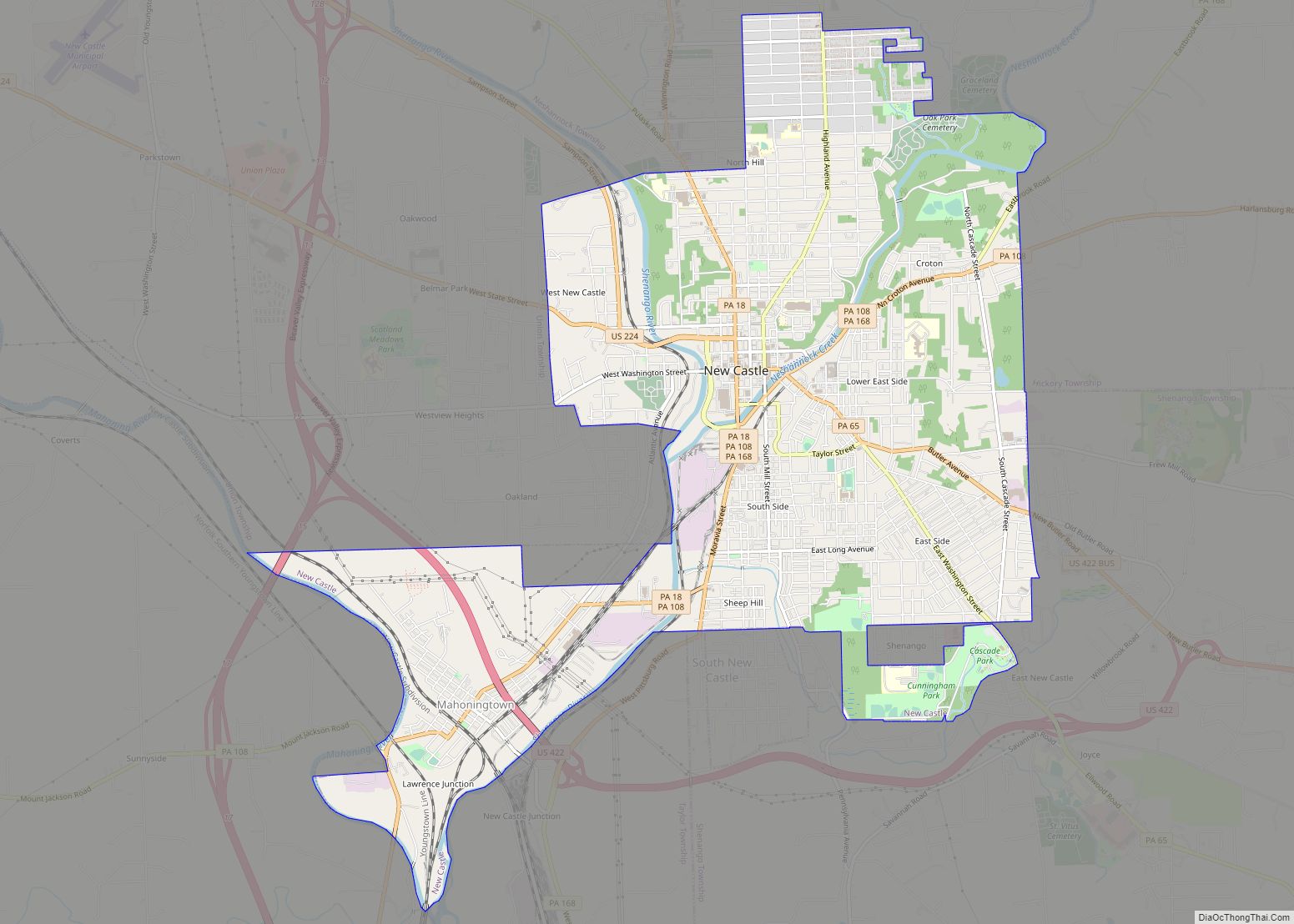
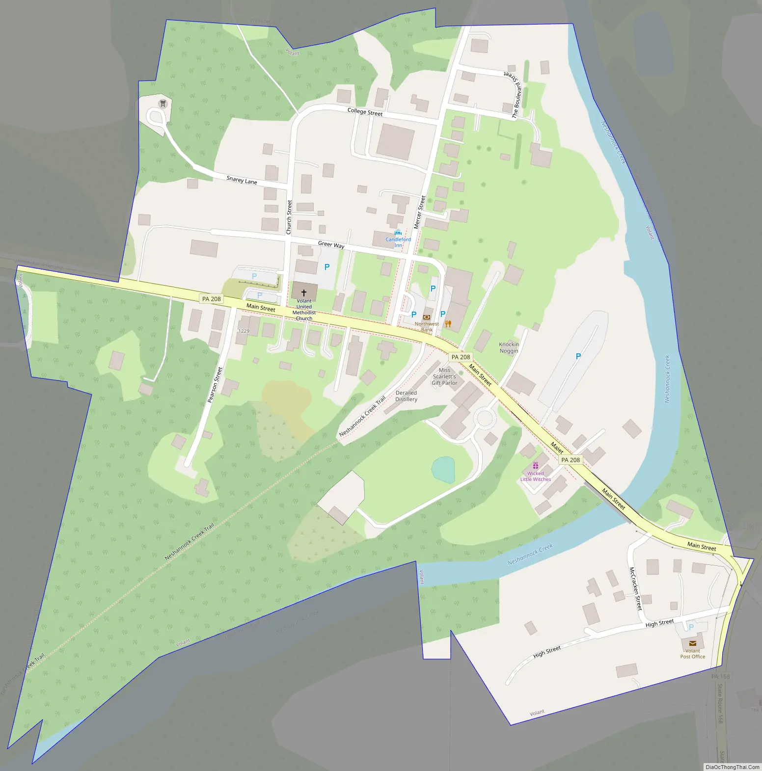
Volant Road Map
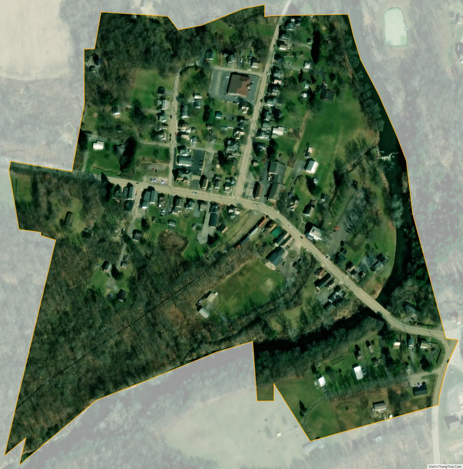
Volant city Satellite Map
Geography
Volant is located at 41°6′52″N 80°15′34″W / 41.11444°N 80.25944°W / 41.11444; -80.25944 (41.114489, -80.259463).
According to the United States Census Bureau, the borough has a total area of 0.1 square miles (0.26 km), all land.
Volant is located on Pennsylvania Route 208, 10 minutes from I-79 and I-80. It has an old-fashioned main street nestled in the hills of western Pennsylvania Amish country.
Volant shares its northern, southern and western borders with Wilmington Township and the eastern, northeastern and southeastern borders with Washington Township.
See also
Map of Pennsylvania State and its subdivision:- Adams
- Allegheny
- Armstrong
- Beaver
- Bedford
- Berks
- Blair
- Bradford
- Bucks
- Butler
- Cambria
- Cameron
- Carbon
- Centre
- Chester
- Clarion
- Clearfield
- Clinton
- Columbia
- Crawford
- Cumberland
- Dauphin
- Delaware
- Elk
- Erie
- Fayette
- Forest
- Franklin
- Fulton
- Greene
- Huntingdon
- Indiana
- Jefferson
- Juniata
- Lackawanna
- Lancaster
- Lawrence
- Lebanon
- Lehigh
- Luzerne
- Lycoming
- Mc Kean
- Mercer
- Mifflin
- Monroe
- Montgomery
- Montour
- Northampton
- Northumberland
- Perry
- Philadelphia
- Pike
- Potter
- Schuylkill
- Snyder
- Somerset
- Sullivan
- Susquehanna
- Tioga
- Union
- Venango
- Warren
- Washington
- Wayne
- Westmoreland
- Wyoming
- York
- Alabama
- Alaska
- Arizona
- Arkansas
- California
- Colorado
- Connecticut
- Delaware
- District of Columbia
- Florida
- Georgia
- Hawaii
- Idaho
- Illinois
- Indiana
- Iowa
- Kansas
- Kentucky
- Louisiana
- Maine
- Maryland
- Massachusetts
- Michigan
- Minnesota
- Mississippi
- Missouri
- Montana
- Nebraska
- Nevada
- New Hampshire
- New Jersey
- New Mexico
- New York
- North Carolina
- North Dakota
- Ohio
- Oklahoma
- Oregon
- Pennsylvania
- Rhode Island
- South Carolina
- South Dakota
- Tennessee
- Texas
- Utah
- Vermont
- Virginia
- Washington
- West Virginia
- Wisconsin
- Wyoming