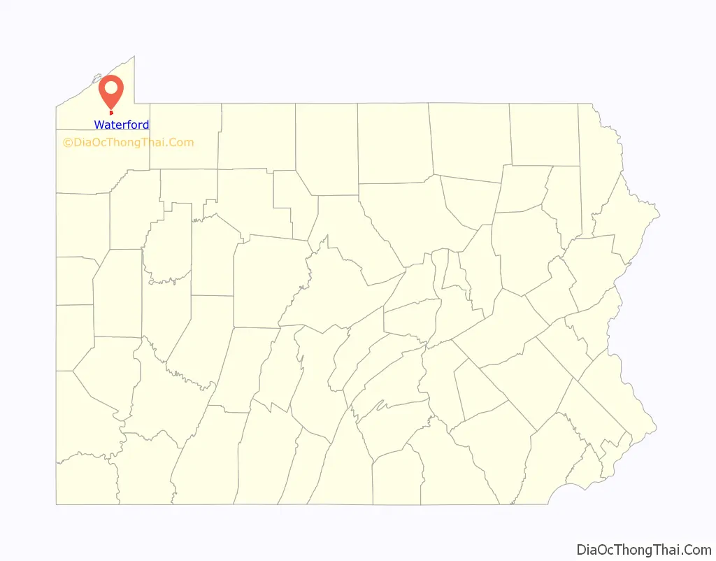
Waterford is a borough in Erie County, Pennsylvania, United States. The population was 1,475 at the 2020 census. It is part of the Erie Metropolitan Statistical Area.
Waterford is an independent municipality located entirely within (and surrounded by) Waterford Township and is located near the geographic center of the township.
| Name: | Waterford borough |
|---|---|
| LSAD Code: | 21 |
| LSAD Description: | borough (suffix) |
| State: | Pennsylvania |
| County: | Erie County |
| Total Area: | 1.24 sq mi (3.21 km²) |
| Land Area: | 1.23 sq mi (3.17 km²) |
| Water Area: | 0.01 sq mi (0.04 km²) |
| Total Population: | 1,475 |
| Population Density: | 1,219.41/sq mi (470.99/km²) |
| ZIP code: | 16441 |
| Area code: | 814 |
| FIPS code: | 4281456 |
| Website: | waterfordboro.net |
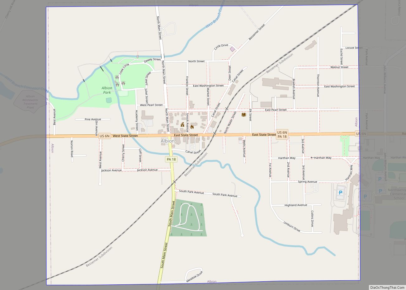
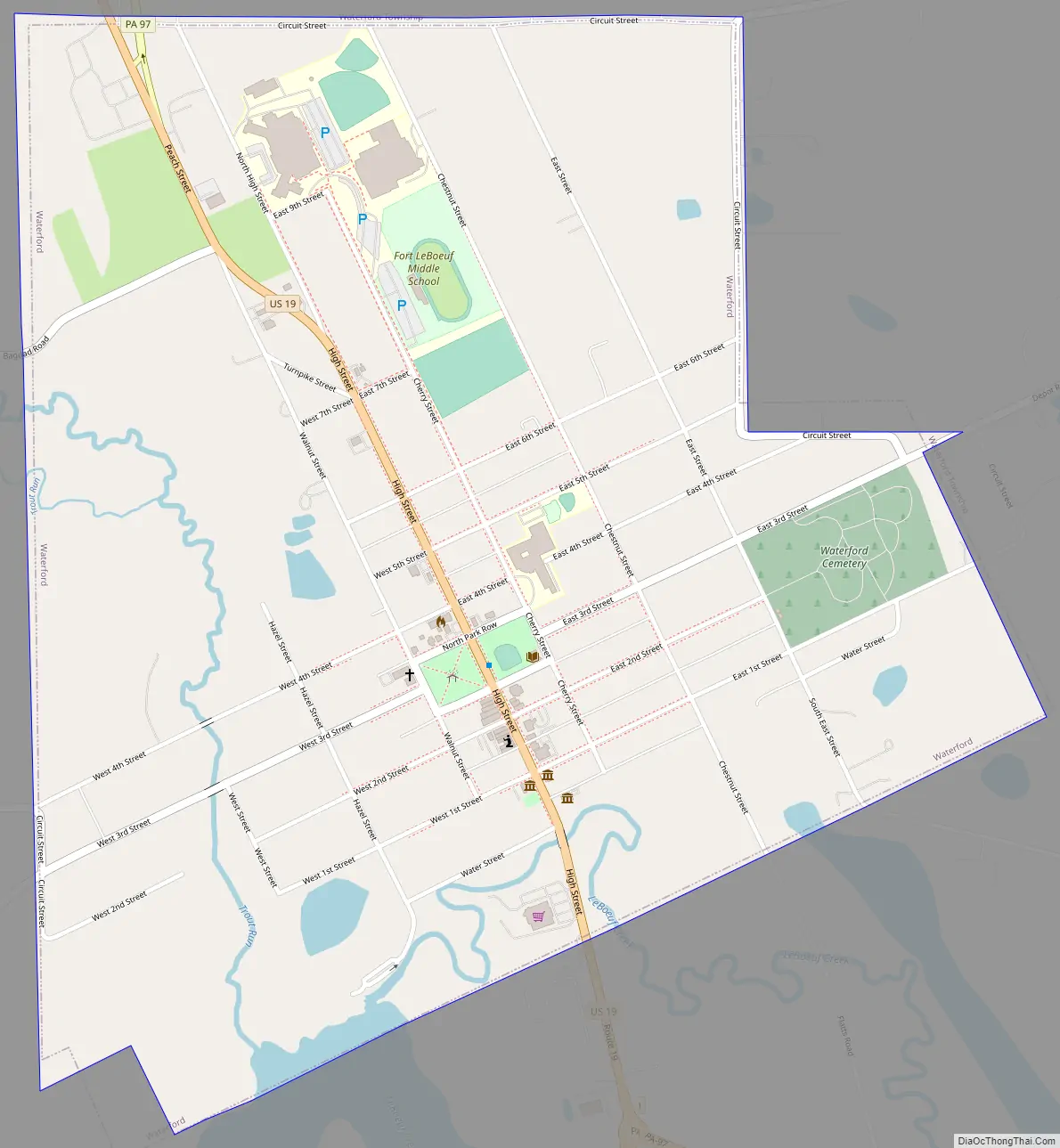
Online Interactive Map
Click on ![]() to view map in "full screen" mode.
to view map in "full screen" mode.
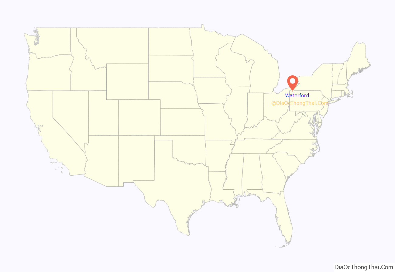
Waterford location map. Where is Waterford borough?
History
Waterford is said to contain the only statue of George Washington wearing a British uniform, but in reality, he had been sent by the Governor of Virginia and is wearing the uniform of an officer in the Virginia Militia. In December 1753, at age 21, Washington was asked by Governor Dinwiddie to carry a British ultimatum to the French on the Ohio frontier. Washington delivered the message at Fort Le Boeuf in present-day Waterford. The message, which went unheeded because he delivered it to the wrong person, called for the French to abandon their development of the Ohio Country to the south. The two colonial powers were heading toward worldwide conflict, the Seven Years’ War, known as the French and Indian War in North America.
The area roughly bounded by North Park Row, High Street, West First Street, and Walnut Street comprises the Waterford Borough Historic District. The Eagle Hotel and Waterford Covered Bridge, along with the Waterford Borough Historic District are all listed on the National Register of Historic Places.
Waterford Road Map
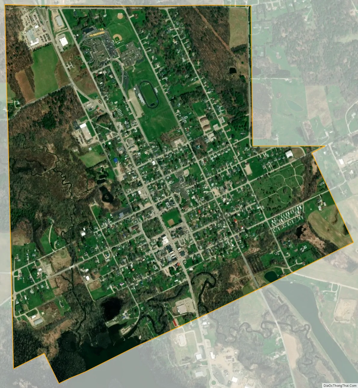
Waterford city Satellite Map
Geography
Waterford is located southeast of the center of Erie County at 41°56′37″N 79°59′2″W / 41.94361°N 79.98389°W / 41.94361; -79.98389 (41.943648, -79.984012). U.S. Route 19 and Pennsylvania Route 97 pass through the borough center as High Street. US 19 leads north 15 miles (24 km) to downtown Erie and south Meadville, while PA 97 leads north 14.5 miles (23.3 km) to Erie by a more easterly route and southeast 8 miles (13 km) to Union City.
According to the United States Census Bureau, Waterford borough has a total area of 1.2 square miles (3.2 km), of which 0.02 square miles (0.04 km), or 1.18%, is water. Lake LeBoeuf lies immediately south of the borough and is part of the French Creek watershed, draining south to the Allegheny River.
See also
Map of Pennsylvania State and its subdivision:- Adams
- Allegheny
- Armstrong
- Beaver
- Bedford
- Berks
- Blair
- Bradford
- Bucks
- Butler
- Cambria
- Cameron
- Carbon
- Centre
- Chester
- Clarion
- Clearfield
- Clinton
- Columbia
- Crawford
- Cumberland
- Dauphin
- Delaware
- Elk
- Erie
- Fayette
- Forest
- Franklin
- Fulton
- Greene
- Huntingdon
- Indiana
- Jefferson
- Juniata
- Lackawanna
- Lancaster
- Lawrence
- Lebanon
- Lehigh
- Luzerne
- Lycoming
- Mc Kean
- Mercer
- Mifflin
- Monroe
- Montgomery
- Montour
- Northampton
- Northumberland
- Perry
- Philadelphia
- Pike
- Potter
- Schuylkill
- Snyder
- Somerset
- Sullivan
- Susquehanna
- Tioga
- Union
- Venango
- Warren
- Washington
- Wayne
- Westmoreland
- Wyoming
- York
- Alabama
- Alaska
- Arizona
- Arkansas
- California
- Colorado
- Connecticut
- Delaware
- District of Columbia
- Florida
- Georgia
- Hawaii
- Idaho
- Illinois
- Indiana
- Iowa
- Kansas
- Kentucky
- Louisiana
- Maine
- Maryland
- Massachusetts
- Michigan
- Minnesota
- Mississippi
- Missouri
- Montana
- Nebraska
- Nevada
- New Hampshire
- New Jersey
- New Mexico
- New York
- North Carolina
- North Dakota
- Ohio
- Oklahoma
- Oregon
- Pennsylvania
- Rhode Island
- South Carolina
- South Dakota
- Tennessee
- Texas
- Utah
- Vermont
- Virginia
- Washington
- West Virginia
- Wisconsin
- Wyoming