Wescosville is a census-designated place located in Lehigh County, Pennsylvania. It is located between Allentown and Trexlertown in Lower Macungie Township. It is part of the Lehigh Valley, which had a population of 861,899 and was the 68th-most populous metropolitan area in the U.S. as of the 2020 census.
As of the 2010 census, the population of Wescosville was 5,872. Its ZIP Codes are split between the Allentown codes of 18103, 18104, and 18106.
| Name: | Wescosville CDP |
|---|---|
| LSAD Code: | 57 |
| LSAD Description: | CDP (suffix) |
| State: | Pennsylvania |
| County: | Lehigh County |
| Elevation: | 412 ft (126 m) |
| Land Area: | 2.72 sq mi (7.04 km²) |
| Water Area: | 0.004 sq mi (0.01 km²) |
| Population Density: | 2,160/sq mi (834.0/km²) |
| Area code: | 610 and 484 |
| FIPS code: | 4282320 |
| GNISfeature ID: | 1190850 |
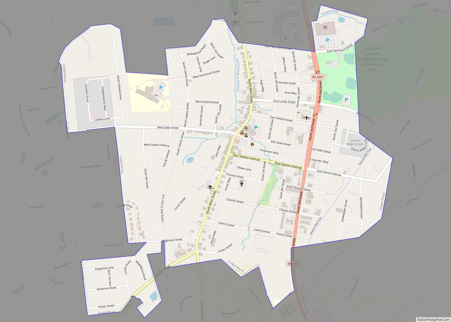
Online Interactive Map
Click on ![]() to view map in "full screen" mode.
to view map in "full screen" mode.
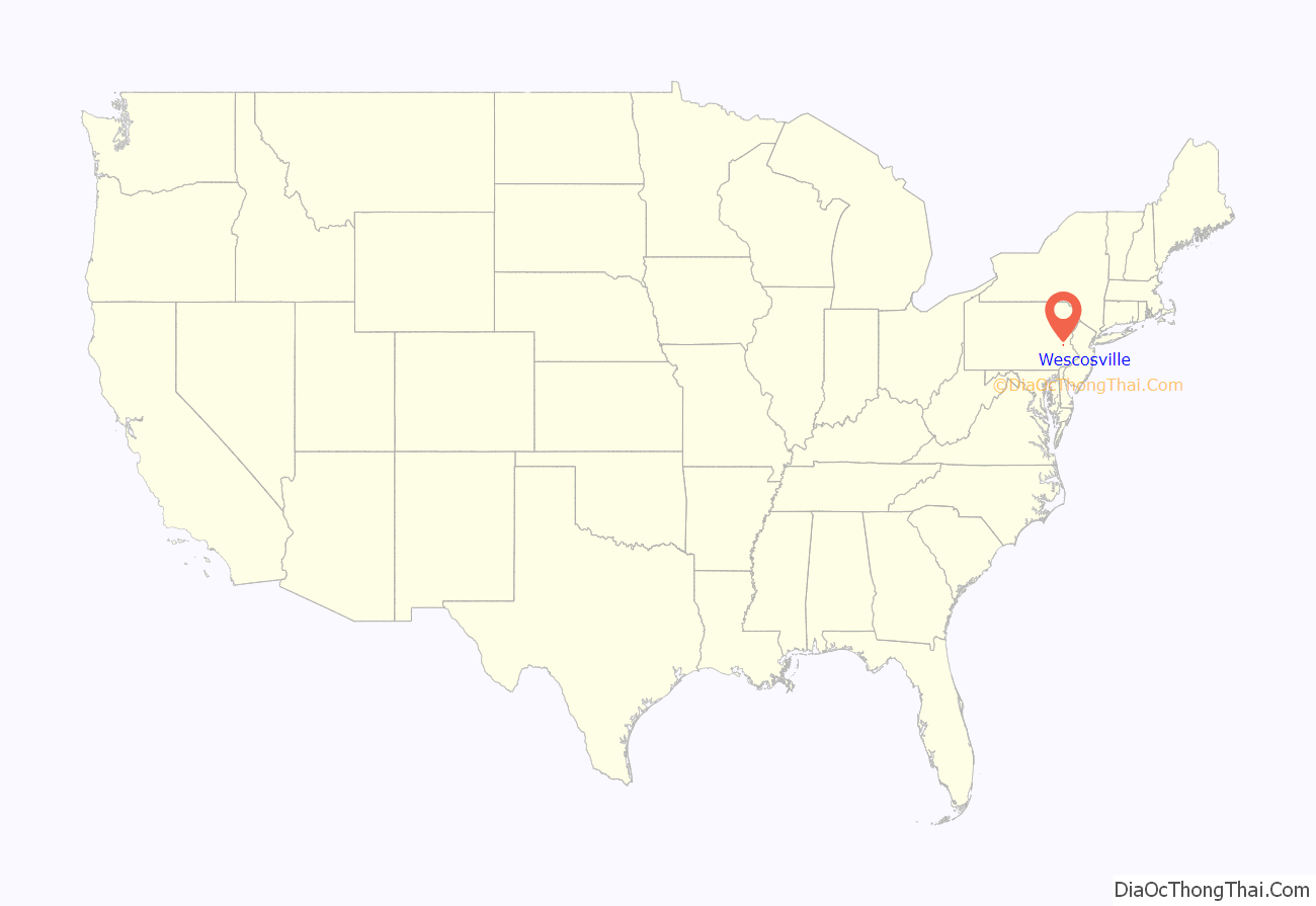
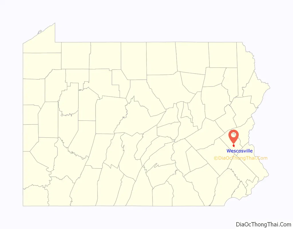
Wescosville location map. Where is Wescosville CDP?
History
Wescosville was named after Philip Wesco, who operated a local inn in the 1820s.
Wescosville Road Map
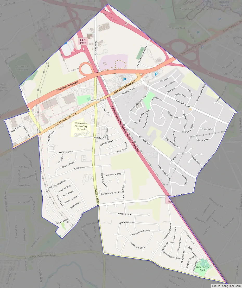
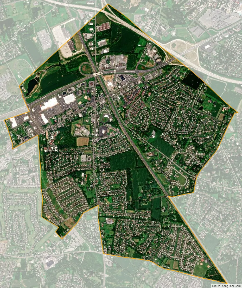
Wescosville city Satellite Map
Geography
Wescosville is located in south-central Lehigh County in the northern corner of Lower Macungie Township. It has a total area of 2.7 square miles (7.1 km) of which 0.004 square miles (0.01 km), or 0.15%, is water, according to the U.S. Census Bureau. The community drains south toward Little Lehigh Creek and north toward Cedar Creek, a tributary of the Little Lehigh. Wescosville is part of the Lehigh River watershed.
See also
Map of Pennsylvania State and its subdivision:- Adams
- Allegheny
- Armstrong
- Beaver
- Bedford
- Berks
- Blair
- Bradford
- Bucks
- Butler
- Cambria
- Cameron
- Carbon
- Centre
- Chester
- Clarion
- Clearfield
- Clinton
- Columbia
- Crawford
- Cumberland
- Dauphin
- Delaware
- Elk
- Erie
- Fayette
- Forest
- Franklin
- Fulton
- Greene
- Huntingdon
- Indiana
- Jefferson
- Juniata
- Lackawanna
- Lancaster
- Lawrence
- Lebanon
- Lehigh
- Luzerne
- Lycoming
- Mc Kean
- Mercer
- Mifflin
- Monroe
- Montgomery
- Montour
- Northampton
- Northumberland
- Perry
- Philadelphia
- Pike
- Potter
- Schuylkill
- Snyder
- Somerset
- Sullivan
- Susquehanna
- Tioga
- Union
- Venango
- Warren
- Washington
- Wayne
- Westmoreland
- Wyoming
- York
- Alabama
- Alaska
- Arizona
- Arkansas
- California
- Colorado
- Connecticut
- Delaware
- District of Columbia
- Florida
- Georgia
- Hawaii
- Idaho
- Illinois
- Indiana
- Iowa
- Kansas
- Kentucky
- Louisiana
- Maine
- Maryland
- Massachusetts
- Michigan
- Minnesota
- Mississippi
- Missouri
- Montana
- Nebraska
- Nevada
- New Hampshire
- New Jersey
- New Mexico
- New York
- North Carolina
- North Dakota
- Ohio
- Oklahoma
- Oregon
- Pennsylvania
- Rhode Island
- South Carolina
- South Dakota
- Tennessee
- Texas
- Utah
- Vermont
- Virginia
- Washington
- West Virginia
- Wisconsin
- Wyoming