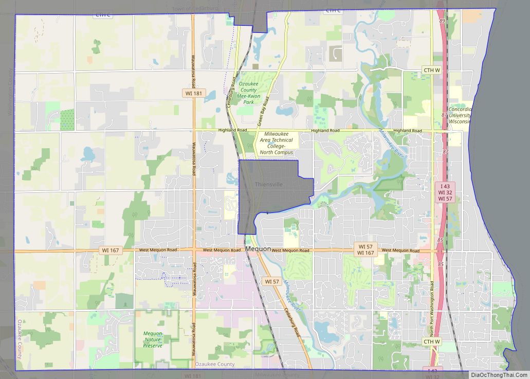
Thiensville is a village in Ozaukee County, Wisconsin, United States. Located on the west bank of a bend in the Milwaukee River, the community is bordered on all sides by the City of Mequon and is a suburb in the Milwaukee metropolitan area. The population was 3,235 at the 2010 census.
Thiensville was the site of a Potawatomi village in the early 19th century before white settlers began arriving in the 1830s and 1840s. Many of the community’s earliest settlers were German immigrants who were members of freethinker societies. One prominent freethinker was Joachim Heinrich Thien, for whom the village is named. Thien played a significant role in the Town of Mequon’s early politics and organized the Thiensville Volunteer Fire Department. The freethinkers were opposed to organized religion and actively prevented churches from being established in the community for the first eight decades of its history. Thiensville grew and prospered in the late 1800s when it became a railway stop; the community became more urban with stores, mills and services for farmers in the rural Town of Mequon. The Village of Thiensville formally incorporated in 1910.
Both Mequon and Thiensville experienced significant development during the suburbanization that followed World War II, with Mequon incorporating as a city in 1957. The two communities have close ties, with a shared chamber of commerce, library, and school district. In July 2005, CNNMoney.com ranked Thiensville and Mequon 19th on its list of the 100 Best Places to Live in the United States.
| Name: | Thiensville village |
|---|---|
| LSAD Code: | 47 |
| LSAD Description: | village (suffix) |
| State: | Wisconsin |
| County: | Ozaukee County |
| Incorporated: | 1910; 113 years ago (1910) |
| Elevation: | 676 ft (206 m) |
| Total Area: | 1.08 sq mi (2.79 km²) |
| Land Area: | 1.04 sq mi (2.69 km²) |
| Water Area: | 0.04 sq mi (0.10 km²) |
| Total Population: | 3,235 |
| Population Density: | 3,010.60/sq mi (1,162.67/km²) |
| Area code: | 262 |
| FIPS code: | 5579475 |
| GNISfeature ID: | 1575351 |
| Website: | village.thiensville.wi.us |
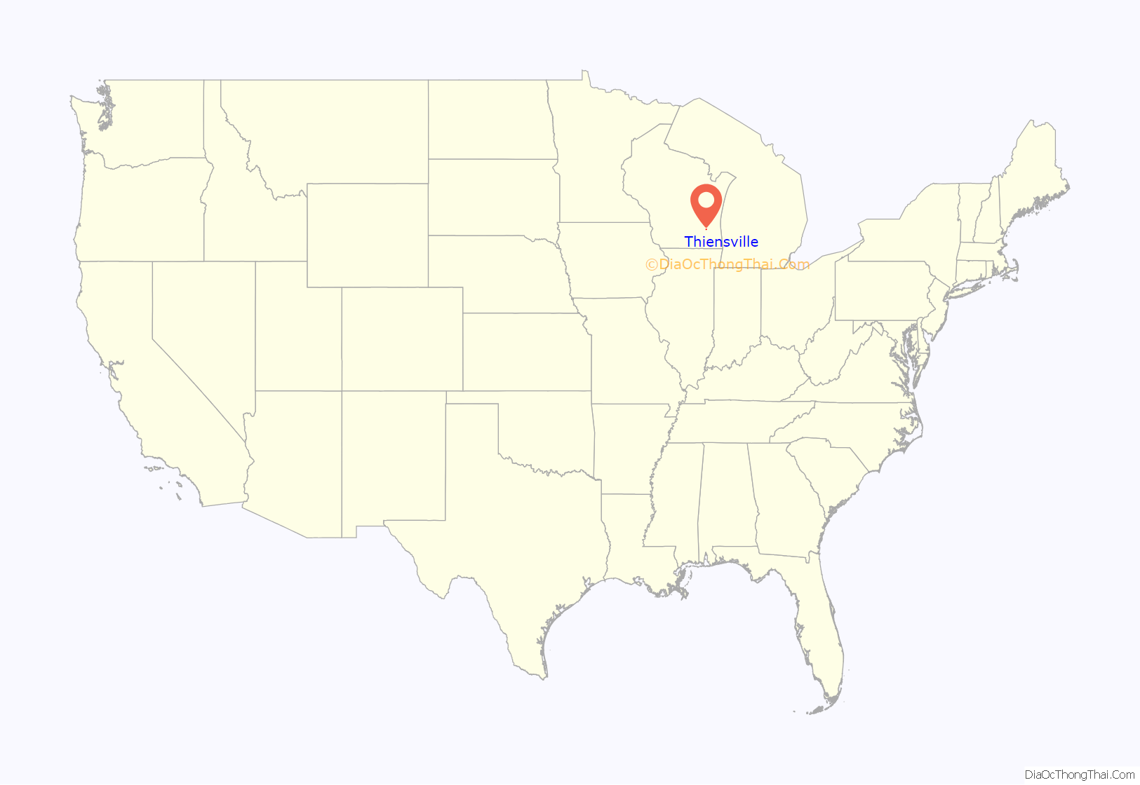
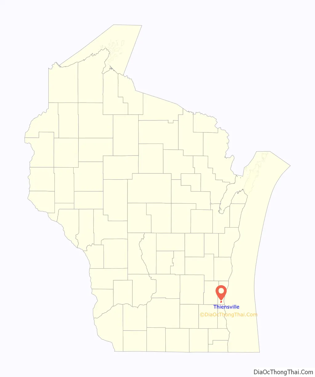
Online Interactive Map
Click on ![]() to view map in "full screen" mode.
to view map in "full screen" mode.
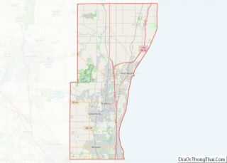
Thiensville location map. Where is Thiensville village?
History
In the early 19th century, the Potawatomi lived on the west bank of the Milwaukee River and had a village in present-day Thiensville, located on Pigeon Creek, north of Freistadt Road. They surrendered their land to the United States federal government in 1833 through the 1833 Treaty of Chicago, which (after being ratified in 1835) required them to leave the area by 1838.
The first permanent white settlers arrived in the mid-1830s from New York, England, and Ireland. One of the first settlers was John Weston, who settled near present-day Thiensville in 1837 and served as the first postmaster of the Town of Mequon. The first Germans arrived in 1839, and in the 1840s Germans became the largest ethnic group in Thiensville, the Town of Mequon, and Ozaukee County.
Joachim Heinrich Thien moved to the area in 1842 from Oldenburg, Prussia, and helped design a plan for the settlement that would become Thiensville. A year later he employed a group of Native American laborers to construct a dam and a canal on the Milwaukee River. He then built a sawmill and a store. Thien hosted the first town meeting for the Town of Mequon in 1846, and in 1857 he established the volunteer fire department and served as its first captain.
Thien was a freethinker, as were many of the early German settlers. The influence of the freethinker societies kept formal churches out of the village until 1919, when St. Cecilia Catholic Church was built.
Thiensville grew in part because of its location on the Chicago, Milwaukee & St. Paul Railway, which was constructed in the early 1870s. In the late 19th and early 20th centuries, Thiensville was one of the most concentrated communities in the Town of Mequon. While most of Mequon was quite rural, Theinsville functioned as a downtown area with stores, mills, and professional services. The Village of Theinsville incorporated in 1910 with a population of 289.
In 1945, eighty German prisoners of war from Camp Fredonia in Little Kohler, Wisconsin were contracted to work at the Herbert A. Nieman Canning Company in the village to make up for the loss of labor due to local men fighting in World War II. German prisoners from Camp Rockfield in Rockfield, Wisconsin, (located in present-day Germantown) also worked at the Fromm Bros., Nieman & Co. Fox Ranch in northern Mequon.
In the 20th century, Mequon and the village of Theinsville developed a close relationship, with a shared school district, chamber of commerce, and library.
Thiensville Road Map
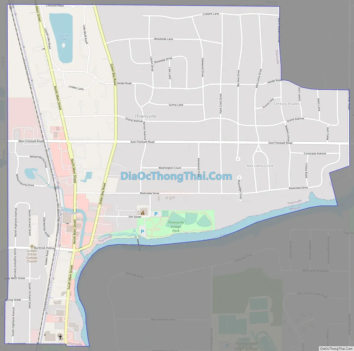
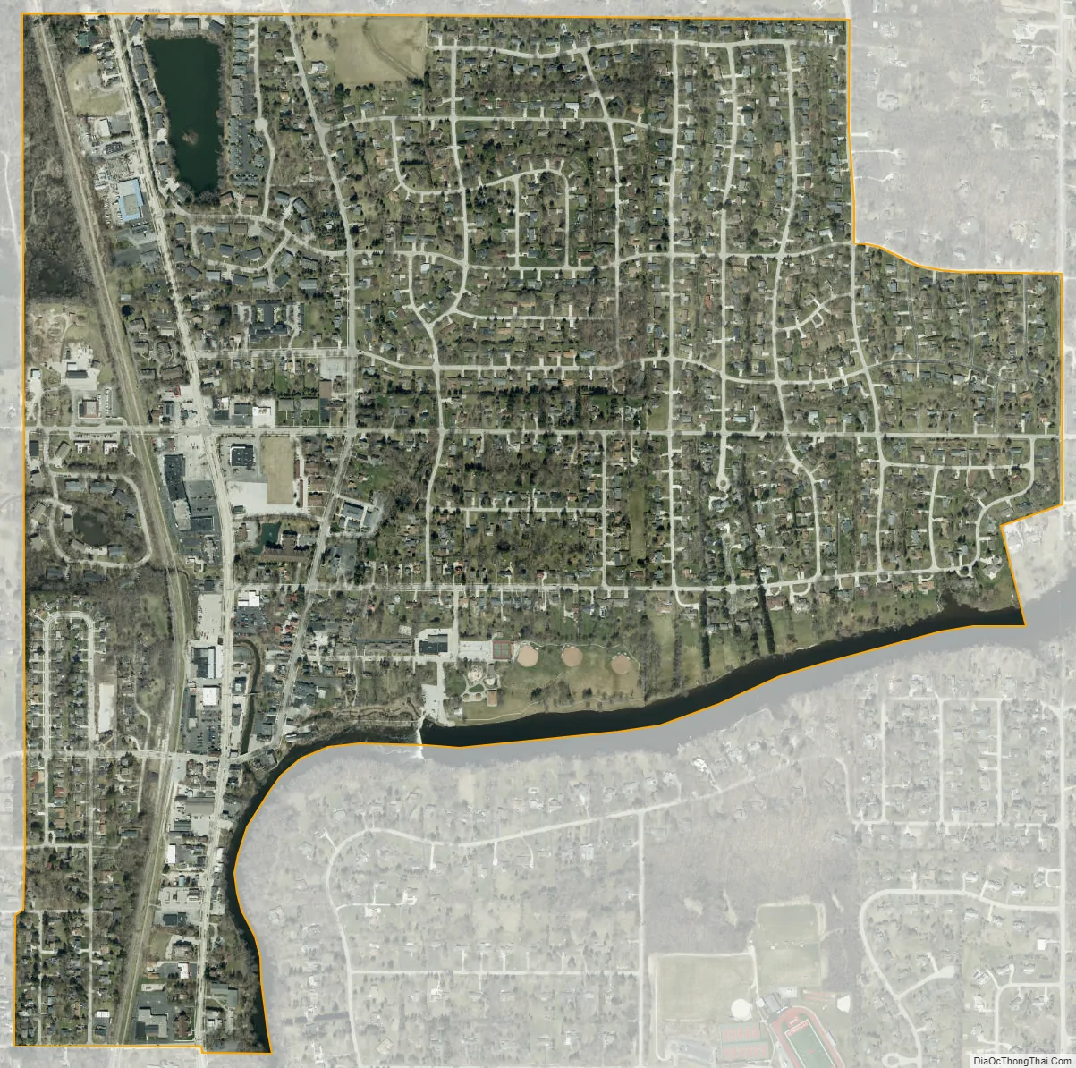
Thiensville city Satellite Map
Geography
Thiensville is located at 43°14′13″N 87°58′48″W / 43.23694°N 87.98000°W / 43.23694; -87.98000 (43.236806, -87.979951). According to the United States Census Bureau, the village has a total area of 1.10 square miles (2.85 km), of which, 1.09 square miles (2.82 km) of it is land and 0.01 square miles (0.03 km) is water.
The Village of Thiensville is an enclave, surrounded by the City of Mequon on all sides. The village is located on the north and west bank of a bend in the Milwaukee River. Pigeon Creek also flows through downtown Thiensville into the river, with the confluence near the old village hall at the intersection of Main Street and Green Bay Road. There is a dam on the Milwaukee River, upstream from the confluence of the river and the creek.
The village is located in the Southeastern Wisconsin glacial till plains that were created by the Wisconsin glaciation during the most recent ice age. The village is south of the Devonian Thiensville formation, a large limestone deposit lying mostly below the soil with the exception of an exposed rock face at the Cedarburg Road cut in northern Mequon. The Wisconsin Department of Natural Resources considers the eastern part of Thiensville to be in the Central Lake Michigan Coastal ecological landscape, while the western part of the village is in the Southern Lake Michigan Coastal ecological landscape. Before white settlers arrived in the area, the area was an upland forest dominated by American beech and sugar maple trees. While some areas of Mequon have remained undeveloped, most of Thiensville has been developed and little-to-none of the old growth forest remains.
The region struggles with many invasive species, including the emerald ash borer, common carp, reed canary grass, the common reed, purple loosestrife, garlic mustard, Eurasian buckthorns, and honeysuckles.
See also
Map of Wisconsin State and its subdivision:- Adams
- Ashland
- Barron
- Bayfield
- Brown
- Buffalo
- Burnett
- Calumet
- Chippewa
- Clark
- Columbia
- Crawford
- Dane
- Dodge
- Door
- Douglas
- Dunn
- Eau Claire
- Florence
- Fond du Lac
- Forest
- Grant
- Green
- Green Lake
- Iowa
- Iron
- Jackson
- Jefferson
- Juneau
- Kenosha
- Kewaunee
- La Crosse
- Lafayette
- Lake Michigan
- Lake Superior
- Langlade
- Lincoln
- Manitowoc
- Marathon
- Marinette
- Marquette
- Menominee
- Milwaukee
- Monroe
- Oconto
- Oneida
- Outagamie
- Ozaukee
- Pepin
- Pierce
- Polk
- Portage
- Price
- Racine
- Richland
- Rock
- Rusk
- Saint Croix
- Sauk
- Sawyer
- Shawano
- Sheboygan
- Taylor
- Trempealeau
- Vernon
- Vilas
- Walworth
- Washburn
- Washington
- Waukesha
- Waupaca
- Waushara
- Winnebago
- Wood
- Alabama
- Alaska
- Arizona
- Arkansas
- California
- Colorado
- Connecticut
- Delaware
- District of Columbia
- Florida
- Georgia
- Hawaii
- Idaho
- Illinois
- Indiana
- Iowa
- Kansas
- Kentucky
- Louisiana
- Maine
- Maryland
- Massachusetts
- Michigan
- Minnesota
- Mississippi
- Missouri
- Montana
- Nebraska
- Nevada
- New Hampshire
- New Jersey
- New Mexico
- New York
- North Carolina
- North Dakota
- Ohio
- Oklahoma
- Oregon
- Pennsylvania
- Rhode Island
- South Carolina
- South Dakota
- Tennessee
- Texas
- Utah
- Vermont
- Virginia
- Washington
- West Virginia
- Wisconsin
- Wyoming