Benicia (/bəˈniːʃə/ bə-NEE-shə, Spanish: [beˈnisja]) is a waterside city in Solano County, California, located in the North Bay region of the San Francisco Bay Area. It served as the capital of California for nearly thirteen months from 1853 to 1854. The population was 26,997 at the 2010 United States Census. The city is located along the north bank of the Carquinez Strait. Benicia is just east of Vallejo and across the strait from Martinez. Steve Young, elected in November 2020, is the mayor.
| Name: | Benicia city |
|---|---|
| LSAD Code: | 25 |
| LSAD Description: | city (suffix) |
| State: | California |
| County: | Solano County |
| Incorporated: | March 27, 1850 |
| Elevation: | 26 ft (8 m) |
| Total Area: | 14.12 sq mi (36.57 km²) |
| Land Area: | 12.81 sq mi (33.19 km²) |
| Water Area: | 1.31 sq mi (3.39 km²) 17.75% |
| Total Population: | 27,131 |
| Population Density: | 2,117.46/sq mi (817.56/km²) |
| ZIP code: | 94510 |
| Area code: | 707 |
| FIPS code: | 0605290 |
| Website: | www.ci.benicia.ca.us |
Online Interactive Map
Click on ![]() to view map in "full screen" mode.
to view map in "full screen" mode.
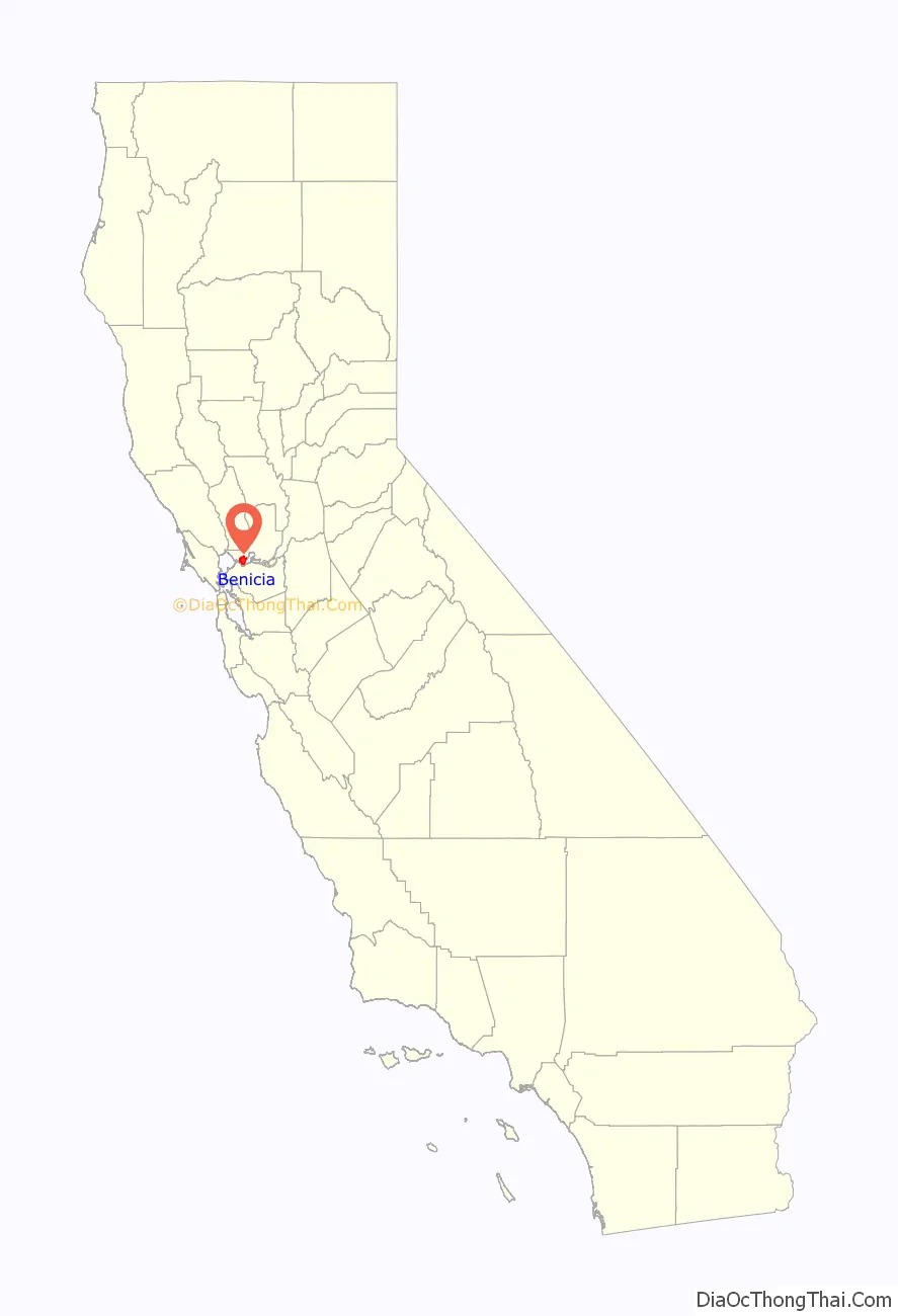
Benicia location map. Where is Benicia city?
History
The City of Benicia was founded on May 19, 1847, by Dr. Robert Semple, Thomas O. Larkin, and Comandante General Mariano Guadalupe Vallejo, on land sold to them by General Vallejo in December 1846. It was named for the General’s wife, Francisca Benicia Carillo de Vallejo, a member of the Carrillo family of California, a prominent Californio dynasty. The General intended that the city be named “Francisca” after his wife, but this name was dropped when the former city of “Yerba Buena” changed its name to “San Francisco,” so her second given name was used instead. In his memoirs, William Tecumseh Sherman contended that Benicia was “the best natural site for a commercial city” in the region.
In February 1848, first word of gold found at Sutter’s Mill was leaked at a Benicia Tavern, thus starting the California Gold Rush. Benicia became a way station on the way to the Sierras.
In March 1850, Benicia became one of the first incorporated cities in California, a month after Sacramento. Benicia was the original county seat of Solano County. The lower floor of the Benicia Masonic Hall, built in 1850 with lumber donated by Benicia founder Robert Semple on land donated by Alexander Riddell, was used as the County court room and offices prior to the completion of Benicia’s city hall. In 1858, the county seat was moved to Fairfield.
In 1853, Benicia became the third site selected to serve as the California State capital, after San Jose and nearby Vallejo, and its newly constructed city hall was California’s capitol from February 11, 1853, to February 25, 1854. Soon after, the legislature was moved to the courthouse in Sacramento, which has remained the State capital ever since. The restored capitol is part of the Benicia Capitol State Historic Park, and is the only building remaining of the State’s pre-Sacramento capitols.
The original campus of Mills College was founded in Benicia in 1852 as the Young Ladies Seminary, and was the first women’s college west of the Rocky Mountains. Before moving to Oakland in 1871, it was located on West I Street, just north of First Street.
From 1860 to 1861, Benicia was indirectly involved in the Pony Express. When riders missed their connection with a steamer in Sacramento, they would continue on to Benicia and cross over to Martinez via the ferry. One of the earliest companies in California, the Pacific Mail Steamship Company, established a major shipyard in Benicia in the 19th century. The prolific shipbuilder Matthew Turner formed the Matthew Turner Shipyard at Benicia in 1883. Benicia became an important wheat storage and shipping site. It was also the site of the United States Army’s Benicia Arsenal.
On December 1, 1879, the Central Pacific Railroad rerouted the Sacramento-Oakland portion of its transcontinental line to Benicia and established a major railroad ferry across the Carquinez Strait from Benicia to Port Costa. The world’s largest ferry, the Solano, later joined by the even larger Contra Costa, carried entire trains across the Carquinez Strait from Benicia to Port Costa, from whence they continued on to the Oakland Pier.
On June 5, 1889, the legendary prize fight between James J. Corbett and Joe Choynski was held on a barge off the coast of Benicia. The match lasted 28 rounds, and is now commemorated by a plaque near Southampton Bay.
Modern era
In 1901, the world’s first long-distance powerline crossing over Carquinez Strait was built. After California’s wheat output dropped in the early 20th century and especially after the Southern Pacific (which took over the operations of the Central Pacific) opened a railroad bridge to Martinez on October 15, 1930, eliminating the ferry crossing and the Benicia station, Benicia declined until the economic boom of World War II, in which the population doubled to about 7,000 residents.
A major fire on March 22, 1945, destroyed a half-block of businesses, including the nearly-century-old “old brewery”, and the Solano Hotel, with flames briefly threatening the old state capitol, now a historical landmark. A roof fire was quickly extinguished and the structure was not badly damaged. Losses were estimated at $125,000.
Two developments in the early 1960s would completely change Benicia: The closing of the Benicia Arsenal in 1960–64, and the completion of the Benicia–Martinez Bridge in 1962. The closing of the Arsenal removed Benicia’s traditional economic base, but allowed city leaders to create an industrial park on Arsenal land which eventually provided more revenue for the city than the Army had. The completion of the Benicia-Martinez Bridge made it possible for the city to become a suburb of San Francisco and Oakland, and suburban development in the Benicia hills began in the late 1960s.
On December 20, 1968, near the Benicia water pumping station on Lake Herman Road, the Zodiac Killer made his debut by killing Vallejo natives David Faraday and Betty Lou Jensen as they rested or “necked” in Faraday’s car. Near the same area on July 4 of the following year, the killer struck again, killing Darlene Elizabeth Ferrin and injuring Michael Mageau at the Blue Rock Springs Park in Vallejo, immediately next to Benicia.
Northeast of the town’s residential areas an oil refinery was built and completed in 1969 by Humble Oil (later Exxon Corporation). The refinery was later bought by Valero Energy Corporation, a San Antonio-based oil company, in 2000.
Between 1970 and 1995, the population of Benicia grew steadily at a rate of about 1,000 people per year, and the city changed from a poor, blue-collar town of 7,000 to a white-collar bedroom suburb of 27,000.
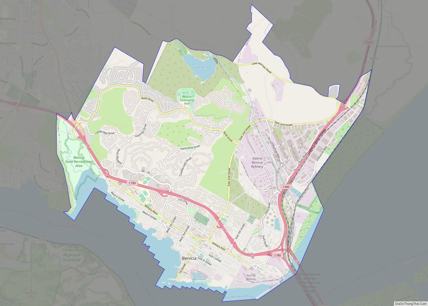
Benicia Road Map
Benicia city Satellite Map
Geography
According to the United States Census Bureau, the city has a total area of 15.7 square miles (41 km), of which 12.9 square miles (33 km) are land and 2.8 square miles (7.3 km), comprising 17.75%, are water. Benicia is located on the north side of the Carquinez Strait.
See also
Map of California State and its subdivision:- Alameda
- Alpine
- Amador
- Butte
- Calaveras
- Colusa
- Contra Costa
- Del Norte
- El Dorado
- Fresno
- Glenn
- Humboldt
- Imperial
- Inyo
- Kern
- Kings
- Lake
- Lassen
- Los Angeles
- Madera
- Marin
- Mariposa
- Mendocino
- Merced
- Modoc
- Mono
- Monterey
- Napa
- Nevada
- Orange
- Placer
- Plumas
- Riverside
- Sacramento
- San Benito
- San Bernardino
- San Diego
- San Francisco
- San Joaquin
- San Luis Obispo
- San Mateo
- Santa Barbara
- Santa Clara
- Santa Cruz
- Shasta
- Sierra
- Siskiyou
- Solano
- Sonoma
- Stanislaus
- Sutter
- Tehama
- Trinity
- Tulare
- Tuolumne
- Ventura
- Yolo
- Yuba
- Alabama
- Alaska
- Arizona
- Arkansas
- California
- Colorado
- Connecticut
- Delaware
- District of Columbia
- Florida
- Georgia
- Hawaii
- Idaho
- Illinois
- Indiana
- Iowa
- Kansas
- Kentucky
- Louisiana
- Maine
- Maryland
- Massachusetts
- Michigan
- Minnesota
- Mississippi
- Missouri
- Montana
- Nebraska
- Nevada
- New Hampshire
- New Jersey
- New Mexico
- New York
- North Carolina
- North Dakota
- Ohio
- Oklahoma
- Oregon
- Pennsylvania
- Rhode Island
- South Carolina
- South Dakota
- Tennessee
- Texas
- Utah
- Vermont
- Virginia
- Washington
- West Virginia
- Wisconsin
- Wyoming

