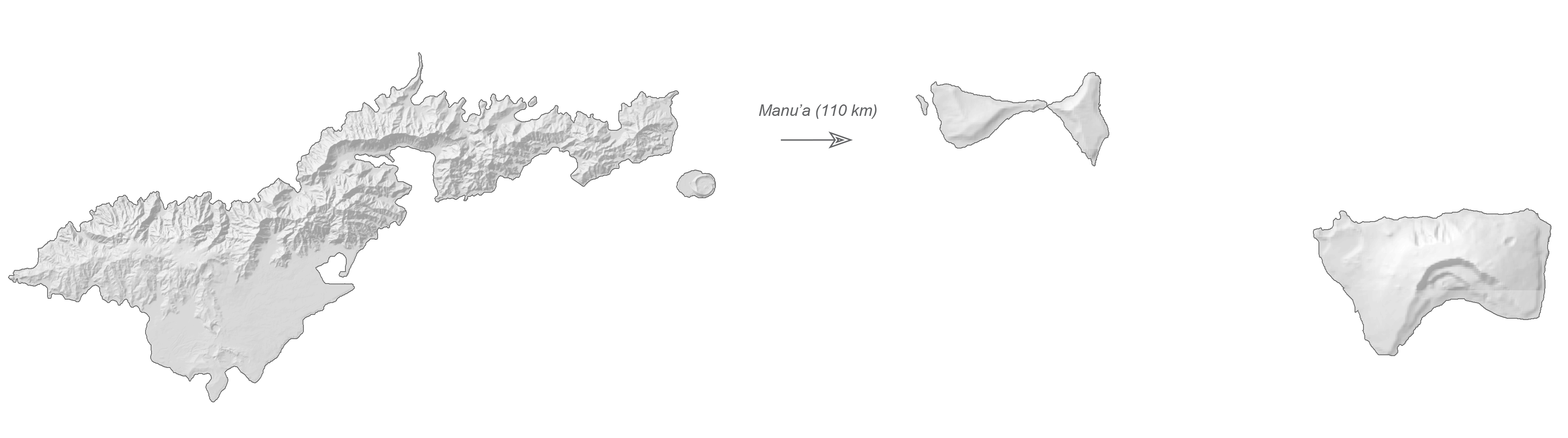
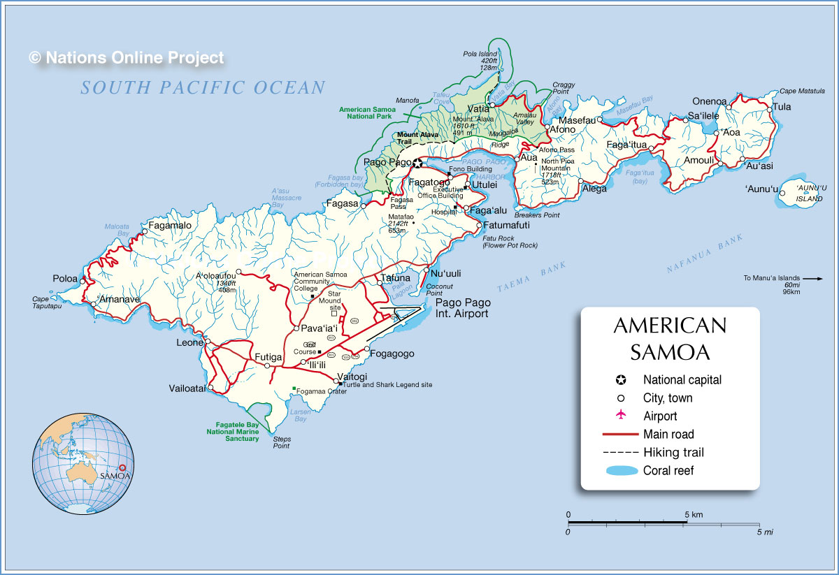
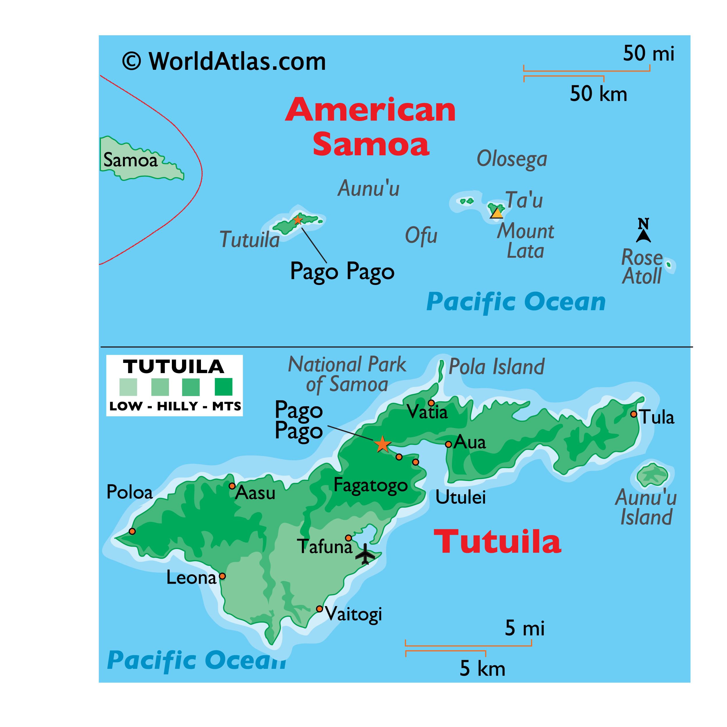
Covering a total land area of 199 sq.km, American Samoa is composed of 5 principal islands (Tutuila, Ta’u, Olosega, Ofu and Aunuu) and 2 coral atolls. It is the southernmost unincorporated overseas territory of the United States, located in the South Pacific Ocean. Out of the 5 principal islands and 2 coral atolls, the Rose Atoll is uninhabited and is a Marine National Monument. Tutuila island is the largest island in American Samoa.
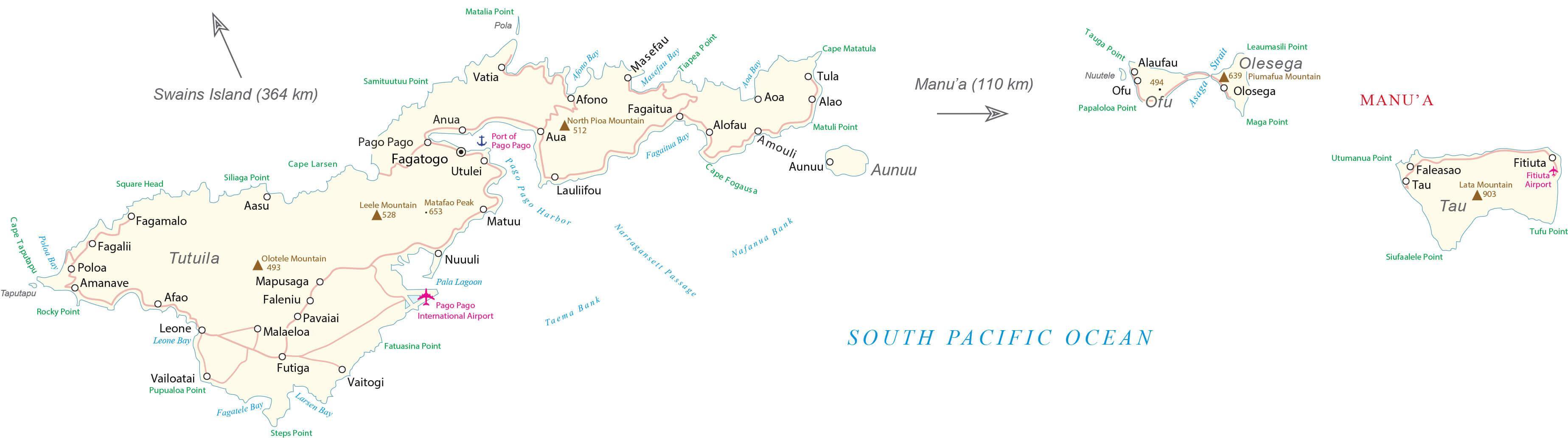
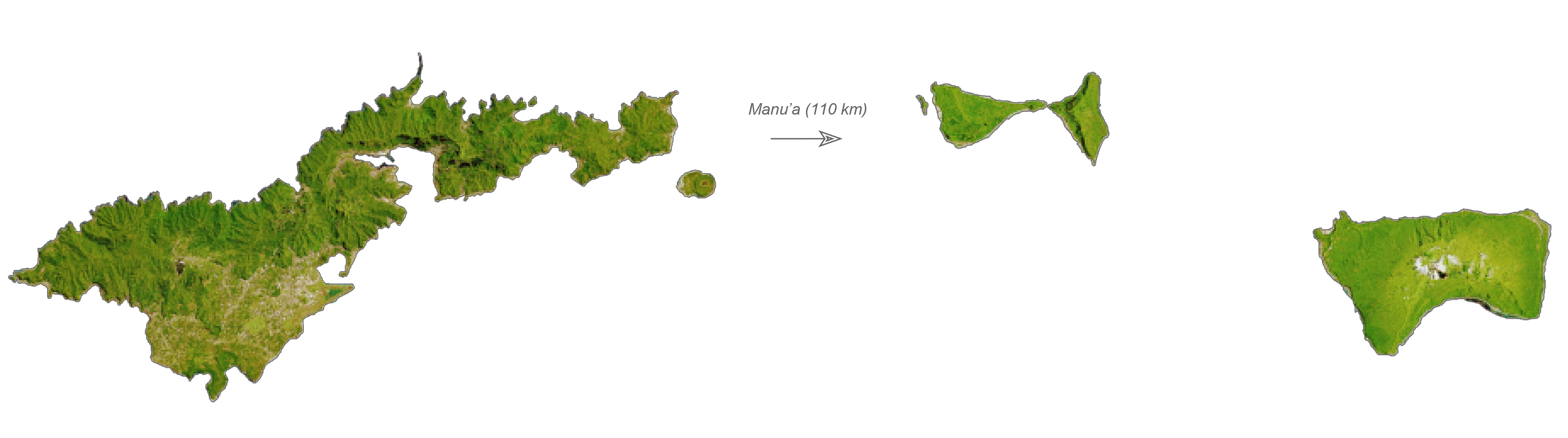
As observed on the physical map of American Samoa above, the islands are largely mountainous due to their volcanic origin. These rugged islands also have narrow coastal plains. Matafao’s Peak is the highest point in Tutuila, at 2142ft (653m). The Tau, Olosega and Ofu islands form the Manu’a island group at the east of Tutuila, constituting the 2nd largest island area.
Located in the Manu’a islands, on the island of Ta’u is, Lata Mountain – the highest point of American Samoa marked on the physical map above by a yellow triangle. It is 966 m (3,169 ft) tall. The lowest point is the Pacific Ocean (0m). At the extremities of the islands, coral reefs are common.
| Flag: |  |
|---|---|
| Legal Name: | American Samoa |
| Capital Value: | Pago Pago |
| Official languages: |
|
| Demonym(s): | American Samoan |
| Government: | Devolved presidential constitutional dependency |
| Legislature: | Fono |
| Total Area: | 224 km² |
| Land Area: | 224 km² |
| Population: | 55,312 |
| Density: | 670.8/sq mi (259.0/km) |
| GDP: | $636.00 Million |
| GDP Per Capita: | $11,466.69 |
| Currency Value: | US Dollar (USD) |
| Driving side: | right |
| Calling code: | +1-684 |
| Internet TLD: | .as |
Explore the beauty and diversity of American Samoa with this detailed map. Discover the cities, villages, roads, and highways that make up this US territory, as well as its volcanic islands and mountainous regions. With this map, you can get a better understanding and appreciation of the area’s unique landscape.
Online Interactive Political Map
Click on ![]() to view map in "full screen" mode.
to view map in "full screen" mode.
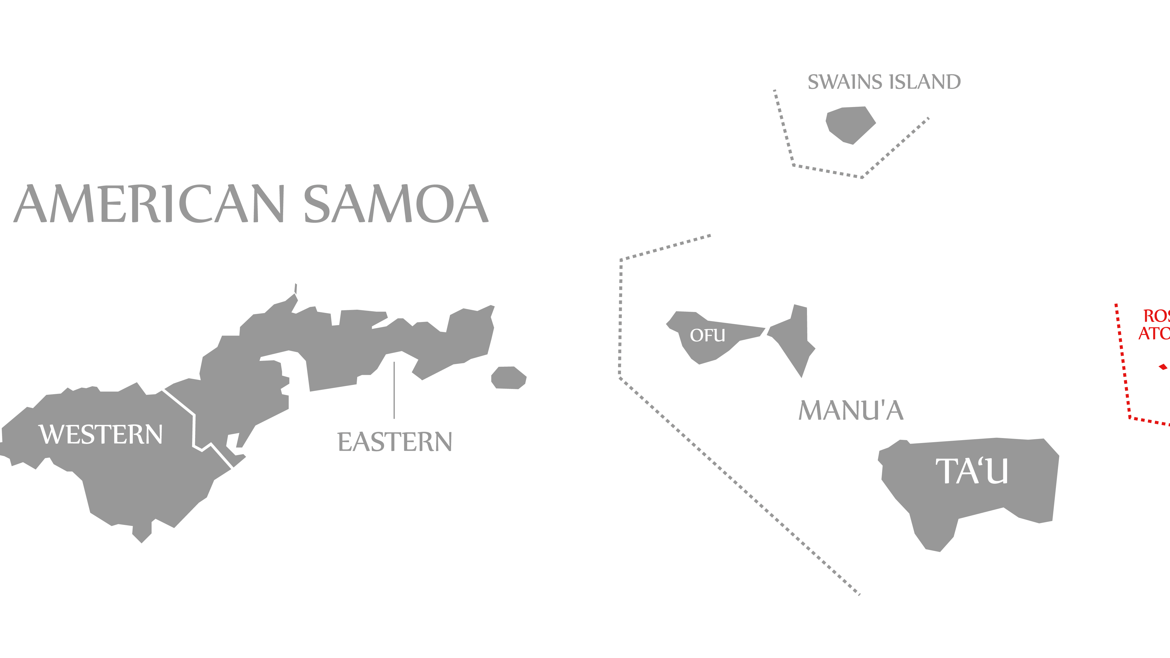
American Samoa is administratively divided into 3 districts and 2 islands (unorganized atolls). Eastern District, Western District and Manu’a District are the 3 districts; Rose Island and Swains Island are the 2 islands. These districts are further subdivided into 15 counties. These counties further comprise of 76 villages.
Covering a total land area of 199 sq.km, American Samoa is composed of 5 principal islands (Tutuila, Tau, Olosega, Ofu and Aunuu) and 2 coral atolls. It is the southernmost unincorporated overseas territory of the United States and one of the two territories located in the Southern hemisphere.
Located on the eastern shore of the Tutuila Island (main island of American Samoa) is, Pago Pago – the territorial capital of American Samoa. It is one of the deepest natural harbors in the South Pacific region. Pago Pago is also the industrial, commercial and the only modern urban center in the island territory. Situated within the Pago Pago harbor is, Fagatogo village – the official seat of government of American Samoa. Tafuna is the largest and the most populous village in the island territory.
Location Maps
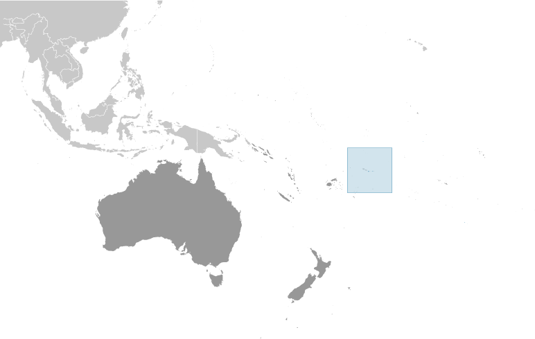
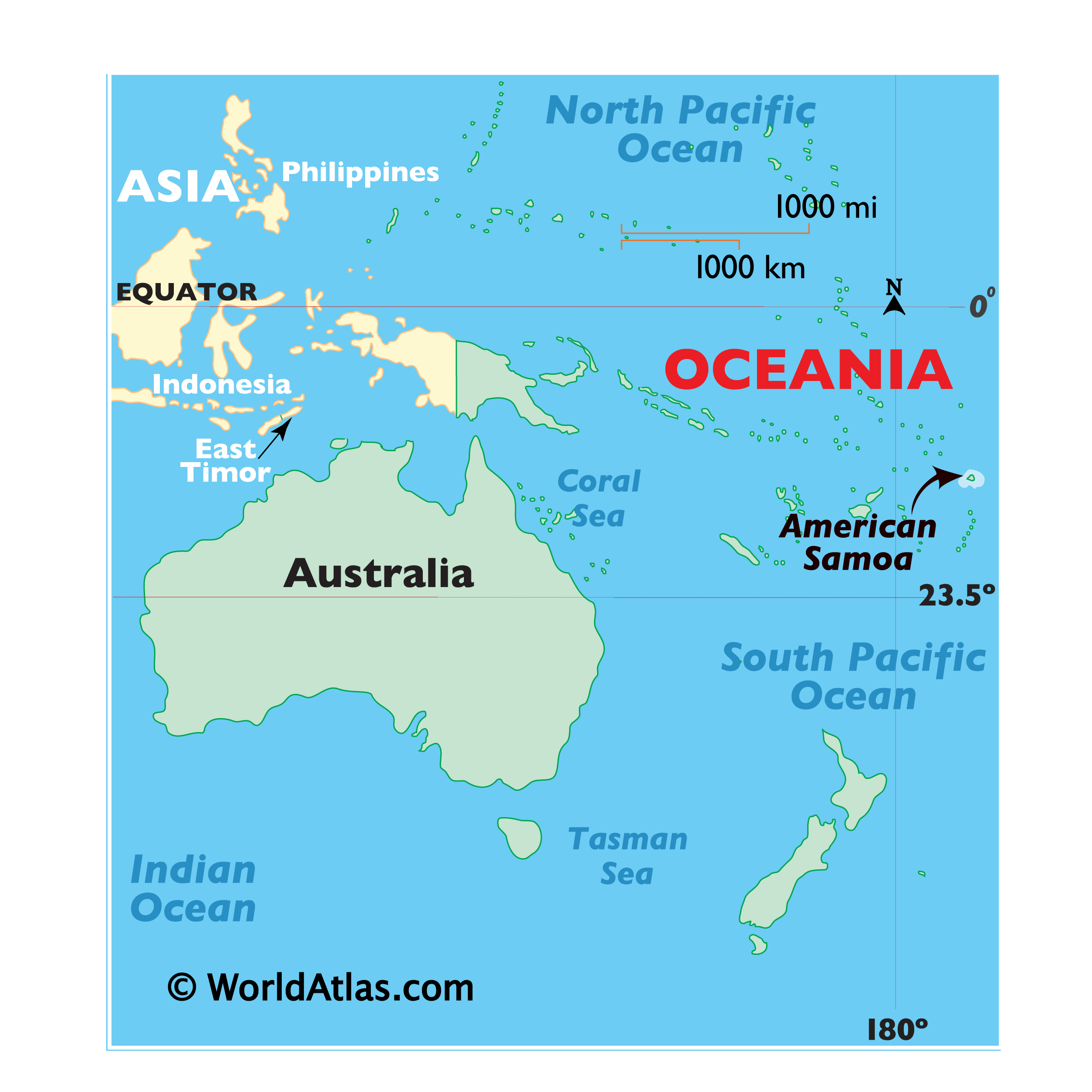
Where is American Samoa?
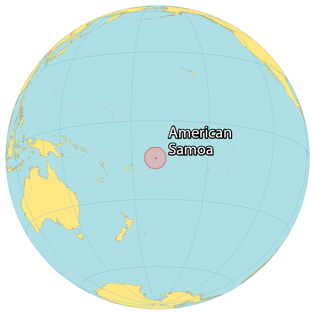
American Samoa is an unincorporated territory of the United States that consists of 7 islands and atolls in the South Pacific Ocean. It’s part of Polynesia and Oceania near the country of Samoa, just 73 kilometers (46 mi) away to the west. Additionally, the Tonga Islands are situated to the southwest, and the Cook Islands are to the east.
The country is recognized for its pristine beaches, reefs, culture, traditions, nature, and military bases. It’s the only US territory that is inhabited in the southern hemisphere, other than Jarvis Island. Pago Pago is the capital city located in the center of the main island of Tutuila. But its largest village is Tafuna.
High Definition Political Map of American Samoa
History
Traditional oral literature of Samoa and Manuʻa talks of a widespread Polynesian network or confederacy (or “empire”) that was prehistorically ruled by the successive Tui Manuʻa dynasties. Manuan genealogies and religious oral literature also suggest that the Tui Manuʻa had long been one of the most prestigious and powerful paramounts of Samoa. Oral history suggests that the Tui Manuʻa kings governed a confederacy of far-flung islands which included Fiji, Tonga as well as smaller western Pacific chiefdoms and Polynesian outliers such as Uvea, Futuna, Tokelau, and Tuvalu. Commerce and exchange routes between the western Polynesian societies are well documented and it is speculated that the Tui Manuʻa dynasty grew through its success in obtaining control over the oceanic trade of currency goods such as finely woven ceremonial mats, whale ivory “tabua”, obsidian and basalt tools, chiefly red feathers, and seashells reserved for royalty (such as polished nautilus and the egg cowry).
18th century: First Western contact
Contact with Europeans began in the early 18th century. Dutchman Jacob Roggeveen was the first known European to sight the Samoan Islands in 1722, calling them the “Baumann Islands” after one of his captains. The next explorer to visit the islands was Louis-Antoine de Bougainville, who named them the “Îles des Navigateurs” in 1768. British explorer James Cook recorded the island names in 1773, but never visited.
The 1789 visit by La Pérouse ended in an attack, on a Tutuila water collection expedition, resulting in the death of his second in command Capt. de Langle and several of his crew. La Pérouse named the island “Massacre Island”, and the bay near Aasu is still called “Massacre Bay”.
HMS Pandora, under the command of Admiral Edward Edwards (Royal Navy officer), visited the island in 1791 during its search for the H.M.S. Bounty mutineers. Von Kotzebue visited in 1824.
19th century
Mission work in the Samoas had begun in late 1830 when John Williams of the London Missionary Society arrived from the Cook Islands and Tahiti. By the late nineteenth century, French, British, German, and American vessels routinely stopped at Samoa, as they valued Pago Pago Harbor as a refueling station for coal-fired shipping and whaling.
The United States Exploring Expedition visited the islands in 1839.
In March 1889, an Imperial German naval force entered a village in Samoa, and in doing so destroyed some American property. Three American warships then entered the Apia harbor and prepared to engage the three German warships found there. Before any shots were fired, a typhoon wrecked both the American and German ships. A compulsory armistice was then called because of the lack of any warships.
20th century
At the turn of the 20th century, international rivalries in the latter half of the century were settled by the 1899 Tripartite Convention in which Germany and the United States partitioned the Samoan Islands into two: the eastern island group became a territory of the United States (Tutuila in 1900 and officially Manuʻa in 1904) and is today known as American Samoa; the western islands, by far the greater landmass, became known as German Samoa, after Britain gave up all claims to Samoa and in return accepted the termination of German rights in Tonga and certain areas in the Solomon Islands and West Africa. Forerunners to the Tripartite Convention of 1899 were the Washington Conference of 1887, the Treaty of Berlin of 1889 and the Anglo-German Agreement on Samoa of 1899.
The following year, the U.S. formally annexed its portion, a smaller group of eastern islands, one of which contains the noted harbor of Pago Pago. After the United States Navy took possession of eastern Samoa for the United States government, the existing coaling station at Pago Pago Bay was expanded into a full naval station, known as United States Naval Station Tutuila and commanded by a commandant. The Navy secured a Deed of Cession of Tutuila in 1900 and a Deed of Cession of Manuʻa in 1904 on behalf of the U.S. government. The last sovereign of Manuʻa, the Tui Manuʻa Elisala, signed a Deed of Cession of Manuʻa following a series of U.S. naval trials, known as the “Trial of the Ipu”, in Pago Pago, Taʻu, and aboard a Pacific Squadron gunboat. The territory became known as the U.S. Naval Station Tutuila.
On July 17, 1911, the U.S. Naval Station Tutuila, which was composed of Tutuila, Aunuʻu and Manuʻa, was officially renamed American Samoa. People of Manuʻa had been unhappy since they were left out of the name “Naval Station Tutuila”. In May 1911, Governor William Michael Crose authored a letter to the Secretary of the Navy conveying the sentiments of Manuʻa. The department responded that the people should choose a name for their new territory. The traditional leaders chose “American Samoa”, and, on July 7, 1911, the solicitor general of the Navy authorized the governor to proclaim it as the name for the new territory.
In 1918, during the final stages of World War I, the Great Influenza epidemic had taken its toll, spreading rapidly from country to country. American Samoa became one of the only places in the world (the others being New Caledonia and Marajó island in Brazil) to have proactively prevented any deaths during the pandemic through the quick response from Governor John Martin Poyer after hearing news reports of the outbreak on the radio and requesting quarantine ships from the U.S. mainland. The result of Poyer’s quick actions earned him the Navy Cross from the U.S. Navy. With this distinction, American Samoans regarded Poyer as their hero for what he had done to prevent the deadly disease. The neighboring New Zealand territory at the time, Western Samoa, suffered the most of all Pacific islands, with 90% of the population infected; 30% of adult men, 22% of adult women and 10% of children died. Poyer offered assistance to help his New Zealand counterparts but was refused by the administrator of Western Samoa, Robert Logan, who became outraged after witnessing the number of quarantine ships surrounding American Samoa. Angered by this, Logan cut off communications with his American counterparts.
After World War I, during the time of the Mau movement in Western Samoa (then a League of Nations mandate governed by New Zealand), there was a corresponding American Samoa Mau movement led by Samuelu Ripley, a World War I veteran who was from Leone village, Tutuila. After meetings on the United States mainland, he was prevented from disembarking from the ship that brought him home to American Samoa and was not allowed to return because the American Samoa Mau movement was suppressed by the U.S. Navy. In 1930 the U.S. Congress sent a committee to investigate the status of American Samoa, led by Americans who had a part in the overthrow of the Kingdom of Hawaii.
Swains Island, which had been included in the list of guano islands appertaining to the United States and bonded under the Guano Islands Act, was annexed in 1925 by Pub. Res. 68–75, following the dissolution of the Gilbert and Ellice Islands Colony by the United Kingdom.
During World War II, U.S. Marines stationed in Samoa outnumbered the local population and had a huge cultural influence. Young Samoan men from age 14 and above were combat trained by U.S. military personnel. Samoans served in various capacities during World War II, including as combatants, medical personnel, code personnel, and ship repairmen.
In 1949, Organic Act 4500, a U.S. Department of Interior–sponsored attempt to incorporate American Samoa, was introduced in Congress. It was ultimately defeated, primarily through the efforts of Samoan chiefs, led by Tuiasosopo Mariota. The efforts of these chiefs led to the creation of a territorial legislature, the American Samoa Fono, which meets in the village of Fagatogo. In 1950 the Department of the Interior began to administer the American Samoa.
By 1956, the U.S. Navy-appointed governor was replaced by Peter Tali Coleman, who was locally elected. Although technically considered “unorganized” since the U.S. Congress has not passed an Organic Act for the territory, American Samoa is self-governing under a constitution that became effective on July 1, 1967. The U.S. Territory of American Samoa is on the United Nations list of non-self-governing territories, a listing which is disputed by the territorial government officials, who do consider themselves to be self-governing.
American Samoa and Pago Pago International Airport had historic significance with the Apollo Program. The astronaut crews of Apollo 10, 12, 13, 14, and 17 were retrieved a few hundred miles from Pago Pago and transported by helicopter to the airport prior to being flown to Honolulu on C-141 Starlifter military aircraft.
While the two Samoas share language and ethnicity, their cultures have recently followed different paths, with American Samoans often emigrating to Hawaiʻi and the U.S. mainland, and adopting many U.S. customs, such as the playing of American football and baseball. Samoans have tended to emigrate instead to New Zealand, whose influence has made the sports of rugby and cricket more popular in the western Samoan islands. Travel writer Paul Theroux noted that there were marked differences between the societies in Samoa and American Samoa.
21st century
American Samoans have a high rate of service in the U.S. Armed Forces. Because of economic hardship, military service has been seen as an opportunity in American Samoa and other U.S. Overseas territories.
Physical Map of American Samoa
Geography
American Samoa, located within the geographical region of Oceania, is one of only two possessions of the United States in the Southern Hemisphere, the other being Jarvis Island. Its total land area is 76.1 square miles (197.1 km)—slightly larger than Washington, D.C.—consisting of five rugged, volcanic islands and two coral atolls.
The five volcanic islands are Tutuila, Aunuʻu, Ofu, Olosega, and Taʻū. The coral atolls are Swains and Rose Atoll. Of the seven islands, Rose Atoll is the only uninhabited one; it is a Marine National Monument. American Samoa is the southernmost reach of the United States at fourteen degrees below the equator.
Due to its positioning in the South Pacific Ocean, it is frequently hit by tropical cyclones between November and April. Rose Atoll is the easternmost point of the territory. American Samoa’s Rose Atoll is the southernmost point of the United States. American Samoa is home to the National Park of American Samoa.
The highest mountains are: Lata Mountain (Taʻū), 3,170 ft (970 m); Matafao Peak, 2,141 ft (653 m); Piumafua (Olosega), 2,095 ft (639 m); and Tumutumu (Ofu), 1,621 ft (494 m). Mount Pioa, nicknamed the Rainmaker, is 1,718 ft (524 m). American Samoa is also home to some of the world’s highest sea cliffs at 3,000 ft (910 m).
The Vailuluʻu seamount, an active submerged volcano, lies 28 miles (45 km) east of Taʻū in American Samoa. It was discovered in 1975 and has since been studied by an international team of scientists, contributing towards understanding of the Earth’s fundamental processes. Growing inside the summit crater of Vailuluʻu is an active underwater volcanic cone, named after Samoa’s goddess of war, Nafanua.
American Samoa lies within two terrestrial ecoregions: Samoan tropical moist forests and Western Polynesian tropical moist forests.
American Samoa Satellite Map
Elevation Map