Corning is a city in Quincy Township, Adams County, Iowa, United States. The population was 1,564 at the 2020 census. It is the county seat of Adams County. Corning is located just north of the intersection of U.S. Route 34 and Iowa Highway 148. Corning is perhaps best known as the birthplace of Johnny Carson. Daniel Webster Turner, who was governor of Iowa from 1931 to 1933, was born in Corning on March 17, 1877.
The town is named for Erastus Corning who owned stock in the Burlington and Missouri River Railroad which reached Corning on August 23, 1869. (resulting in the local depot moving from nearby Queen City to Corning). Corning donated a church bell to the Methodist Church. Corning also owned sizeable shares of the Chicago, Burlington and Quincy Railroad and other towns on the railroad including Corning, Missouri.
| Name: | Corning city |
|---|---|
| LSAD Code: | 25 |
| LSAD Description: | city (suffix) |
| State: | Iowa |
| County: | Adams County |
| Elevation: | 1,194 ft (364 m) |
| Total Area: | 1.56 sq mi (4.05 km²) |
| Land Area: | 1.56 sq mi (4.04 km²) |
| Water Area: | 0.01 sq mi (0.01 km²) |
| Total Population: | 1,564 |
| Population Density: | 1,003.85/sq mi (387.54/km²) |
| ZIP code: | 50841 |
| Area code: | 641 |
| FIPS code: | 1916500 |
| GNISfeature ID: | 0455634 |
| Website: | http://www.cityofcorningia.com/ |
Online Interactive Map
Click on ![]() to view map in "full screen" mode.
to view map in "full screen" mode.
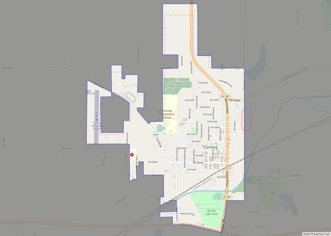
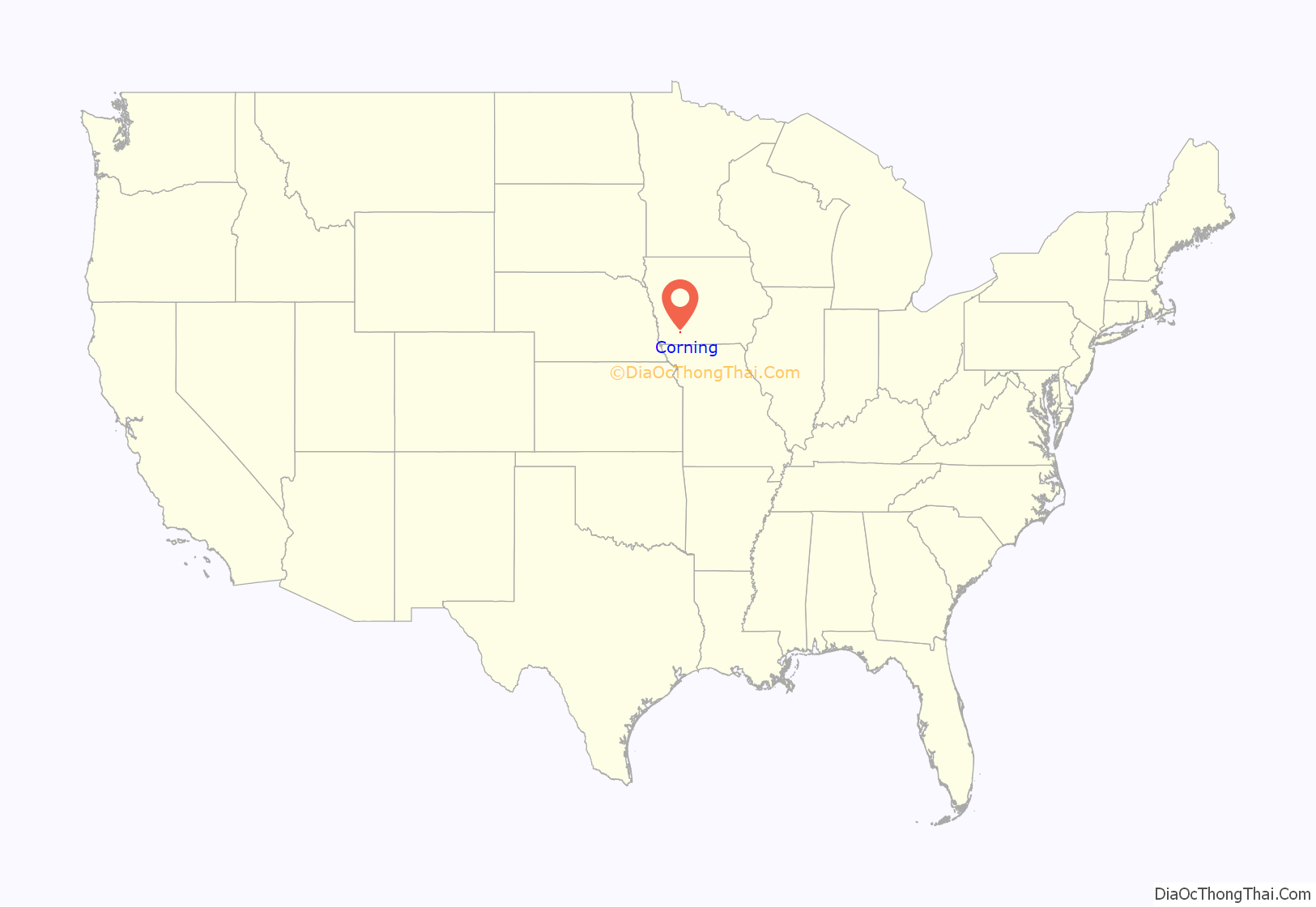
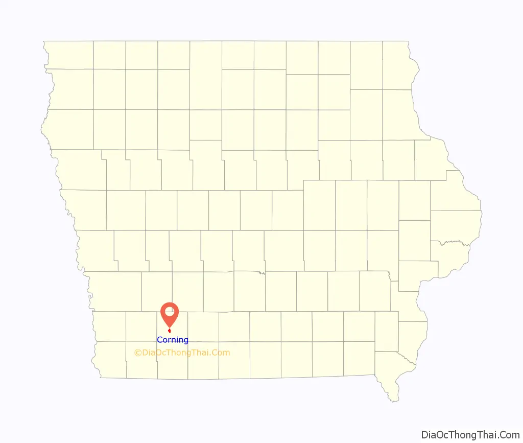
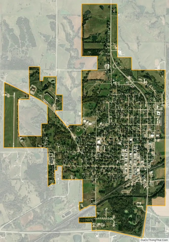
Corning location map. Where is Corning city?
History
French Icarian settlement
The first European settlers here were a group of French Icarians who came from Nauvoo, Illinois in 1852; they established a community near Lake Icaria, north of Corning in 1854. The new state of Iowa gave the town of “Icaria” a corporate charter in 1860. This community was dedicated to the utopian principles of Etienne Cabet and the democratic principles of the American Revolution and the French Revolution; this small French-speaking community considered themselves to be very patriotic Americans. In the 1860s, the community split between “traditionalists” and “progressives” (the latter favored women’s right to vote). The “progressives” left the original site and moved to a new location about three miles (5 km) east of Corning’s current location. Although the corporation formally dissolved in 1878, some continued to live in the communal dwellings until 1898, making this the longest-lasting Icarian colony in the United States. Eventually the community disbanded and merged into the general population. Displays and documents about the Icarian community can be found at the Icarian History Foundation office and in the Adams County offices, both in Corning. The former colony east of Corning is slowly being restored with the help of state and federal grants, and it will become a historical site; as of 2006, only a couple of partially restored buildings and a very small cemetery (with grave markers inscribed in French) remain. Around the first weekend of June each year, Corning celebrates “Le Festival De L’Heritage Francais” in the French market.
American settlement
Nearby Queen City had been established circa 1854. Surveyors came to the current location of Corning in 1857, though the area was largely uninhabited (except by the Icarians) until 1869.
The first Adams County seat was established by act of the Iowa Legislature on January 12, 1853, at Quincy. The building was later used as a schoolhouse and in 1932, it was torn down. In November 1872, the people voted to remove the courthouse from Quincy and locate the county seat in Corning.
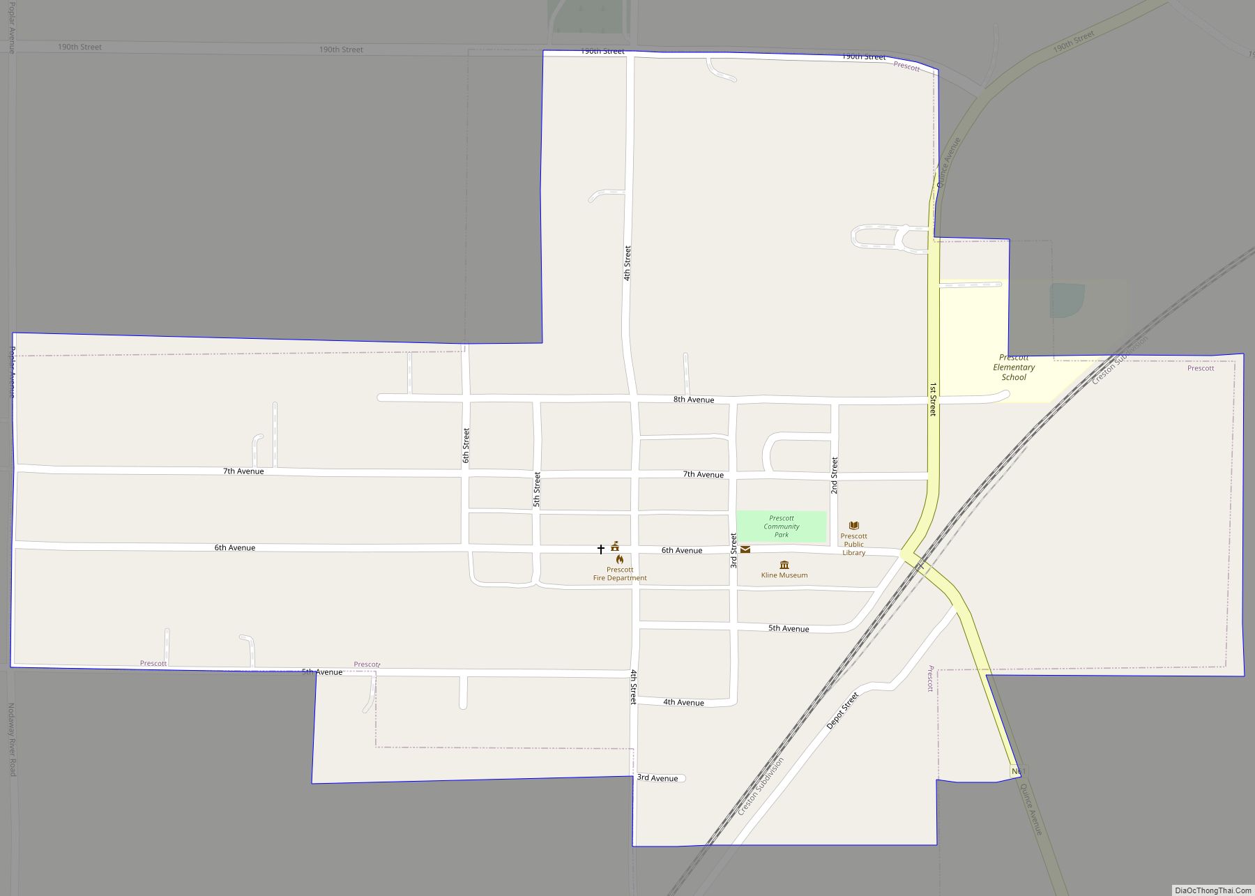
Corning Road Map
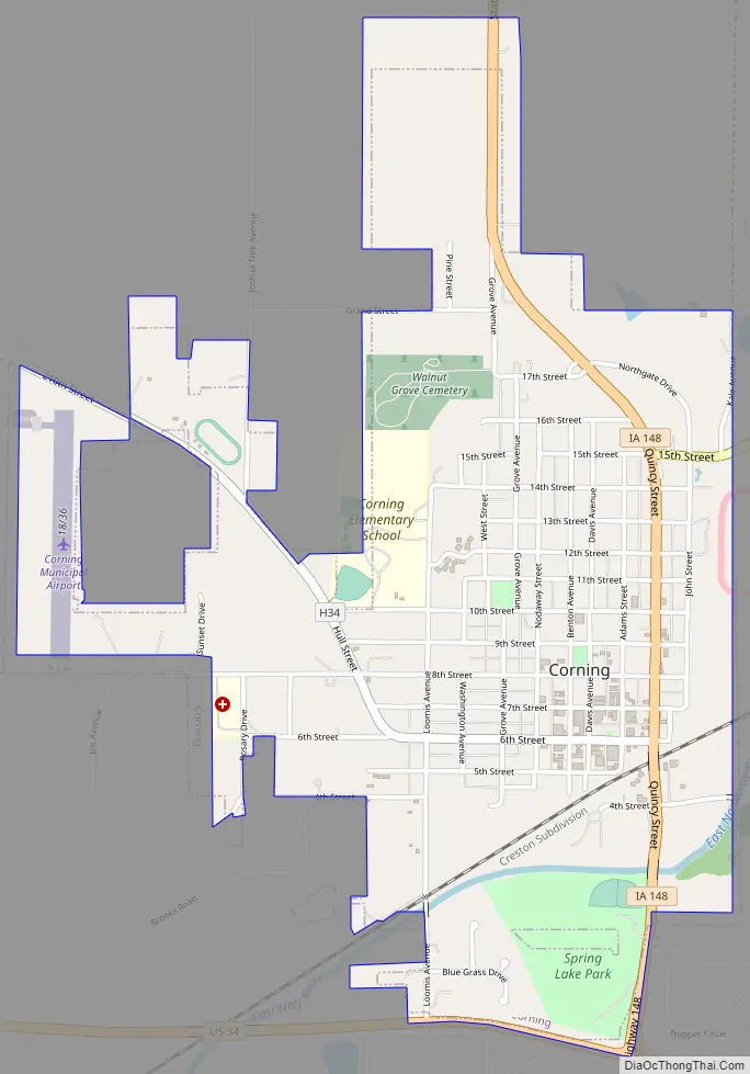
Corning city Satellite Map
Geography
Corning is located at 40°59′29″N 94°44′13″W / 40.99139°N 94.73694°W / 40.99139; -94.73694 (40.991340, −94.737028).
According to the United States Census Bureau, the city has a total area of 1.58 square miles (4.09 km), all land.
See also
Map of Iowa State and its subdivision:- Adair
- Adams
- Allamakee
- Appanoose
- Audubon
- Benton
- Black Hawk
- Boone
- Bremer
- Buchanan
- Buena Vista
- Butler
- Calhoun
- Carroll
- Cass
- Cedar
- Cerro Gordo
- Cherokee
- Chickasaw
- Clarke
- Clay
- Clayton
- Clinton
- Crawford
- Dallas
- Davis
- Decatur
- Delaware
- Des Moines
- Dickinson
- Dubuque
- Emmet
- Fayette
- Floyd
- Franklin
- Fremont
- Greene
- Grundy
- Guthrie
- Hamilton
- Hancock
- Hardin
- Harrison
- Henry
- Howard
- Humboldt
- Ida
- Iowa
- Jackson
- Jasper
- Jefferson
- Johnson
- Jones
- Keokuk
- Kossuth
- Lee
- Linn
- Louisa
- Lucas
- Lyon
- Madison
- Mahaska
- Marion
- Marshall
- Mills
- Mitchell
- Monona
- Monroe
- Montgomery
- Muscatine
- O'Brien
- Osceola
- Page
- Palo Alto
- Plymouth
- Pocahontas
- Polk
- Pottawattamie
- Poweshiek
- Ringgold
- Sac
- Scott
- Shelby
- Sioux
- Story
- Tama
- Taylor
- Union
- Van Buren
- Wapello
- Warren
- Washington
- Wayne
- Webster
- Winnebago
- Winneshiek
- Woodbury
- Worth
- Wright
- Alabama
- Alaska
- Arizona
- Arkansas
- California
- Colorado
- Connecticut
- Delaware
- District of Columbia
- Florida
- Georgia
- Hawaii
- Idaho
- Illinois
- Indiana
- Iowa
- Kansas
- Kentucky
- Louisiana
- Maine
- Maryland
- Massachusetts
- Michigan
- Minnesota
- Mississippi
- Missouri
- Montana
- Nebraska
- Nevada
- New Hampshire
- New Jersey
- New Mexico
- New York
- North Carolina
- North Dakota
- Ohio
- Oklahoma
- Oregon
- Pennsylvania
- Rhode Island
- South Carolina
- South Dakota
- Tennessee
- Texas
- Utah
- Vermont
- Virginia
- Washington
- West Virginia
- Wisconsin
- Wyoming