Eldridge is a city in Scott County, Iowa, United States. The population was 6,726 in the 2020 Census; Eldridge is a suburb and part of the Quad Cities metropolitan area.
| Name: | Eldridge city |
|---|---|
| LSAD Code: | 25 |
| LSAD Description: | city (suffix) |
| State: | Iowa |
| County: | Scott County |
| Elevation: | 797 ft (243 m) |
| Land Area: | 9.76 sq mi (25.27 km²) |
| Water Area: | 0.00 sq mi (0.00 km²) |
| Population Density: | 689.28/sq mi (266.12/km²) |
| ZIP code: | 52748 |
| Area code: | 563 |
| FIPS code: | 1924600 |
| GNISfeature ID: | 0465072 |
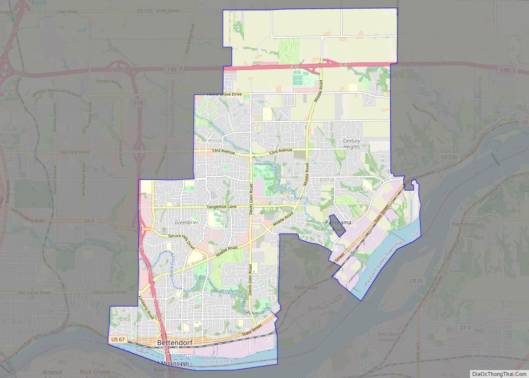
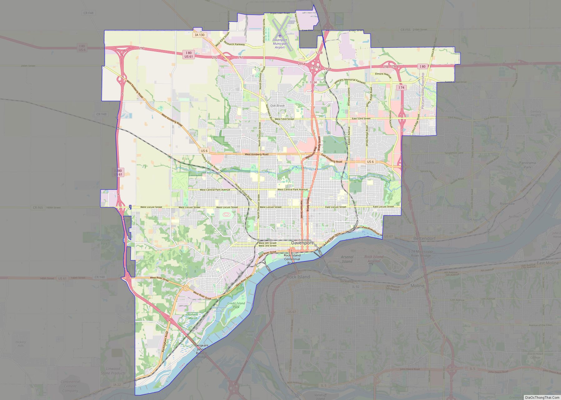
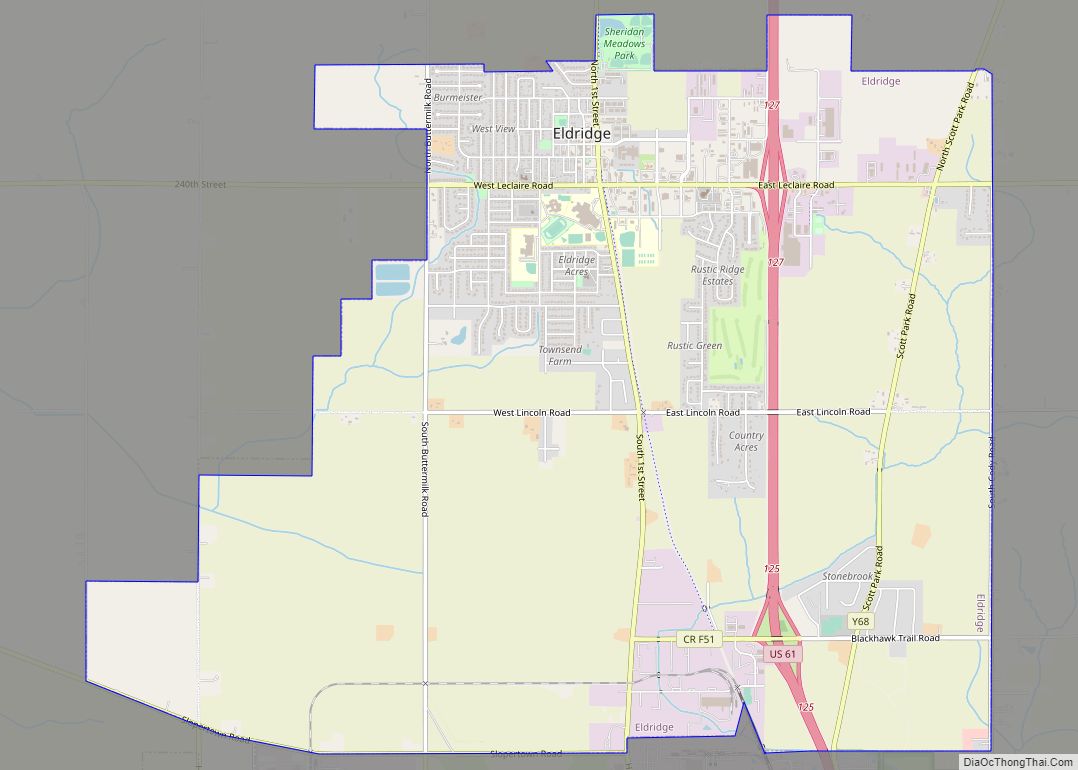
Online Interactive Map
Click on ![]() to view map in "full screen" mode.
to view map in "full screen" mode.
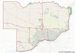
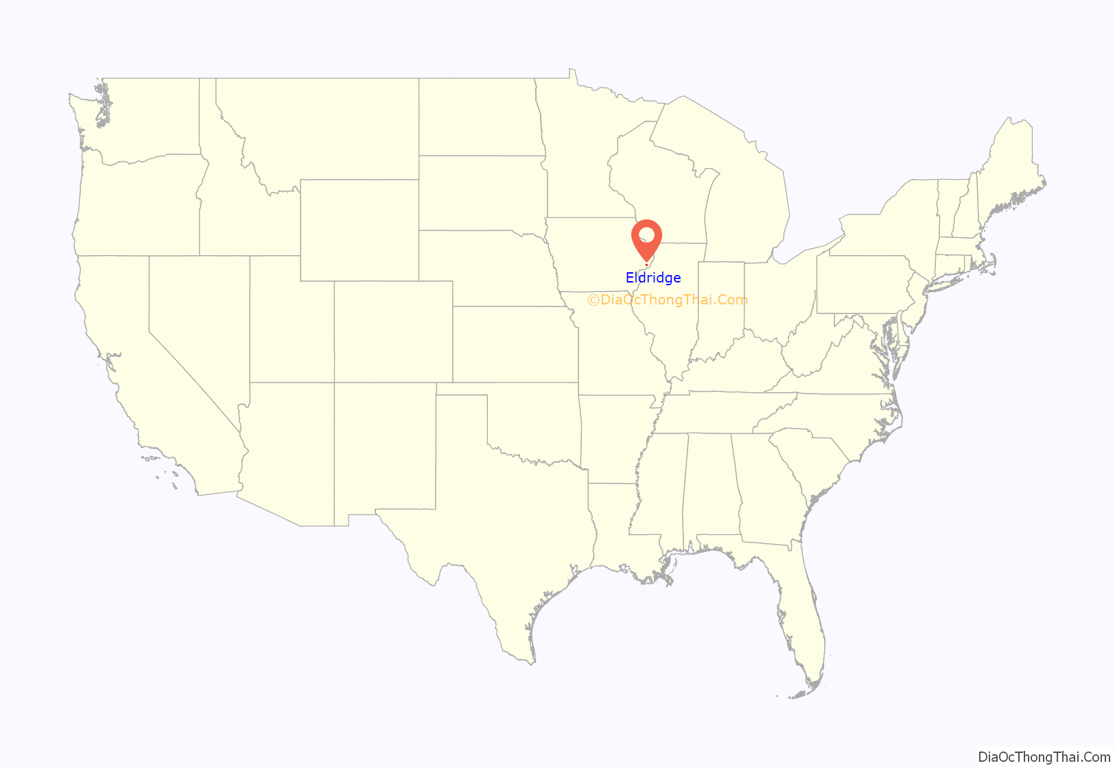
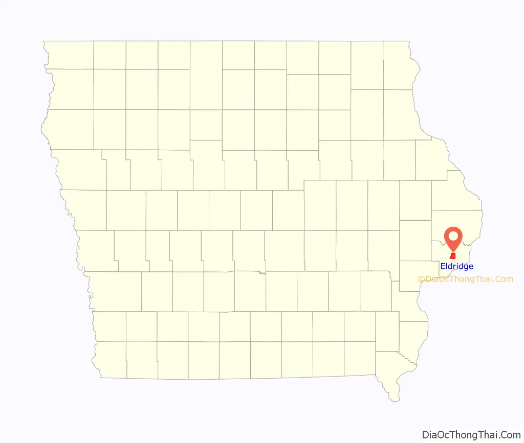
Eldridge location map. Where is Eldridge city?
History
Jacob M. Eldridge, the city’s namesake, arrived in central Scott County in 1846, having purchased land for $1.25 per acre. Immigrants from Germany soon followed, and northern Scott County slowly began to develop. Railroads were developed during the 1860s, bringing more settlers. Eldridge Junction, built on land donated by Jacob Eldridge, was incorporated on July 2, 1871. A post office and a Presbyterian church were soon built.
Eldridge faced several challenges during its early years. The railroad faltered financially during the 1880s and was re-located to Oxford Junction, while a smallpox epidemic several years later was said to have totally isolated the city. A fire heavily damaged the city’s business district in 1904, and in 1918 a tornado of unknown strength heavily damaged or destroyed several residences and the church, and killed three people. Each time, the city recovered, and the farming community maintained its status as a grain and livestock shipping center.
The city began growing in population during the 1950s, starting with the formation of the Scott County Library System (a countywide network of libraries serving smaller communities in the area) in 1950, and the North Scott Community School District in 1956. By the late 1960s, the population had grown to more than 1,000 residents, and with the creation of several industrial parks to encourage new business development, the city continued to grow.
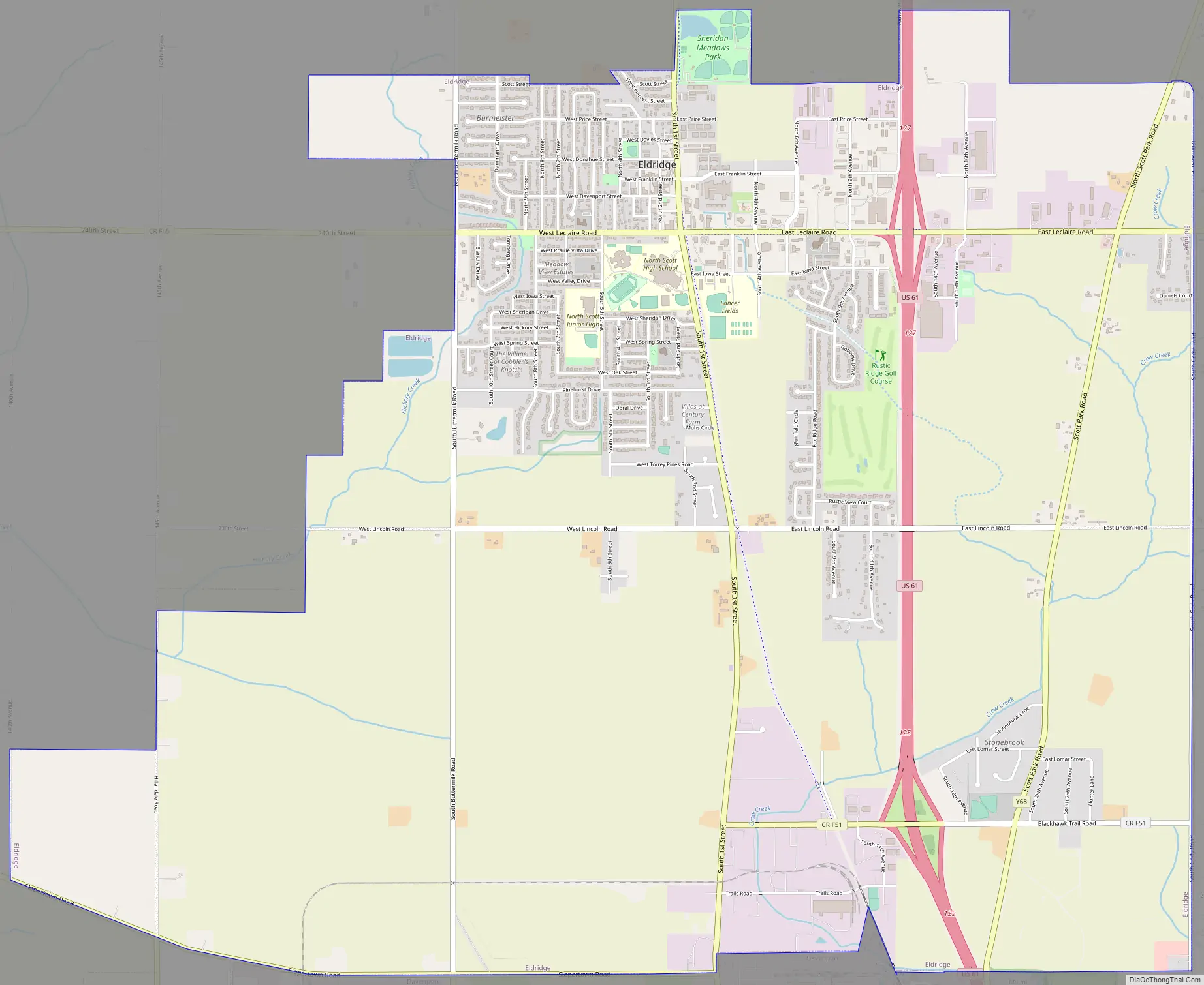
Eldridge Road Map
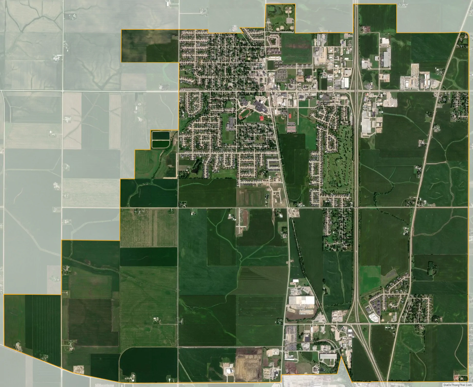
Eldridge city Satellite Map
Geography
Eldridge is located at 41°38′55″N 90°34′53″W / 41.64861°N 90.58139°W / 41.64861; -90.58139 (41.648697, −90.581492). It is located north of Davenport along U.S. Route 61.
According to the United States Census Bureau, the city has a total area of 9.48 square miles (24.55 km), all land.
See also
Map of Iowa State and its subdivision:- Adair
- Adams
- Allamakee
- Appanoose
- Audubon
- Benton
- Black Hawk
- Boone
- Bremer
- Buchanan
- Buena Vista
- Butler
- Calhoun
- Carroll
- Cass
- Cedar
- Cerro Gordo
- Cherokee
- Chickasaw
- Clarke
- Clay
- Clayton
- Clinton
- Crawford
- Dallas
- Davis
- Decatur
- Delaware
- Des Moines
- Dickinson
- Dubuque
- Emmet
- Fayette
- Floyd
- Franklin
- Fremont
- Greene
- Grundy
- Guthrie
- Hamilton
- Hancock
- Hardin
- Harrison
- Henry
- Howard
- Humboldt
- Ida
- Iowa
- Jackson
- Jasper
- Jefferson
- Johnson
- Jones
- Keokuk
- Kossuth
- Lee
- Linn
- Louisa
- Lucas
- Lyon
- Madison
- Mahaska
- Marion
- Marshall
- Mills
- Mitchell
- Monona
- Monroe
- Montgomery
- Muscatine
- O'Brien
- Osceola
- Page
- Palo Alto
- Plymouth
- Pocahontas
- Polk
- Pottawattamie
- Poweshiek
- Ringgold
- Sac
- Scott
- Shelby
- Sioux
- Story
- Tama
- Taylor
- Union
- Van Buren
- Wapello
- Warren
- Washington
- Wayne
- Webster
- Winnebago
- Winneshiek
- Woodbury
- Worth
- Wright
- Alabama
- Alaska
- Arizona
- Arkansas
- California
- Colorado
- Connecticut
- Delaware
- District of Columbia
- Florida
- Georgia
- Hawaii
- Idaho
- Illinois
- Indiana
- Iowa
- Kansas
- Kentucky
- Louisiana
- Maine
- Maryland
- Massachusetts
- Michigan
- Minnesota
- Mississippi
- Missouri
- Montana
- Nebraska
- Nevada
- New Hampshire
- New Jersey
- New Mexico
- New York
- North Carolina
- North Dakota
- Ohio
- Oklahoma
- Oregon
- Pennsylvania
- Rhode Island
- South Carolina
- South Dakota
- Tennessee
- Texas
- Utah
- Vermont
- Virginia
- Washington
- West Virginia
- Wisconsin
- Wyoming