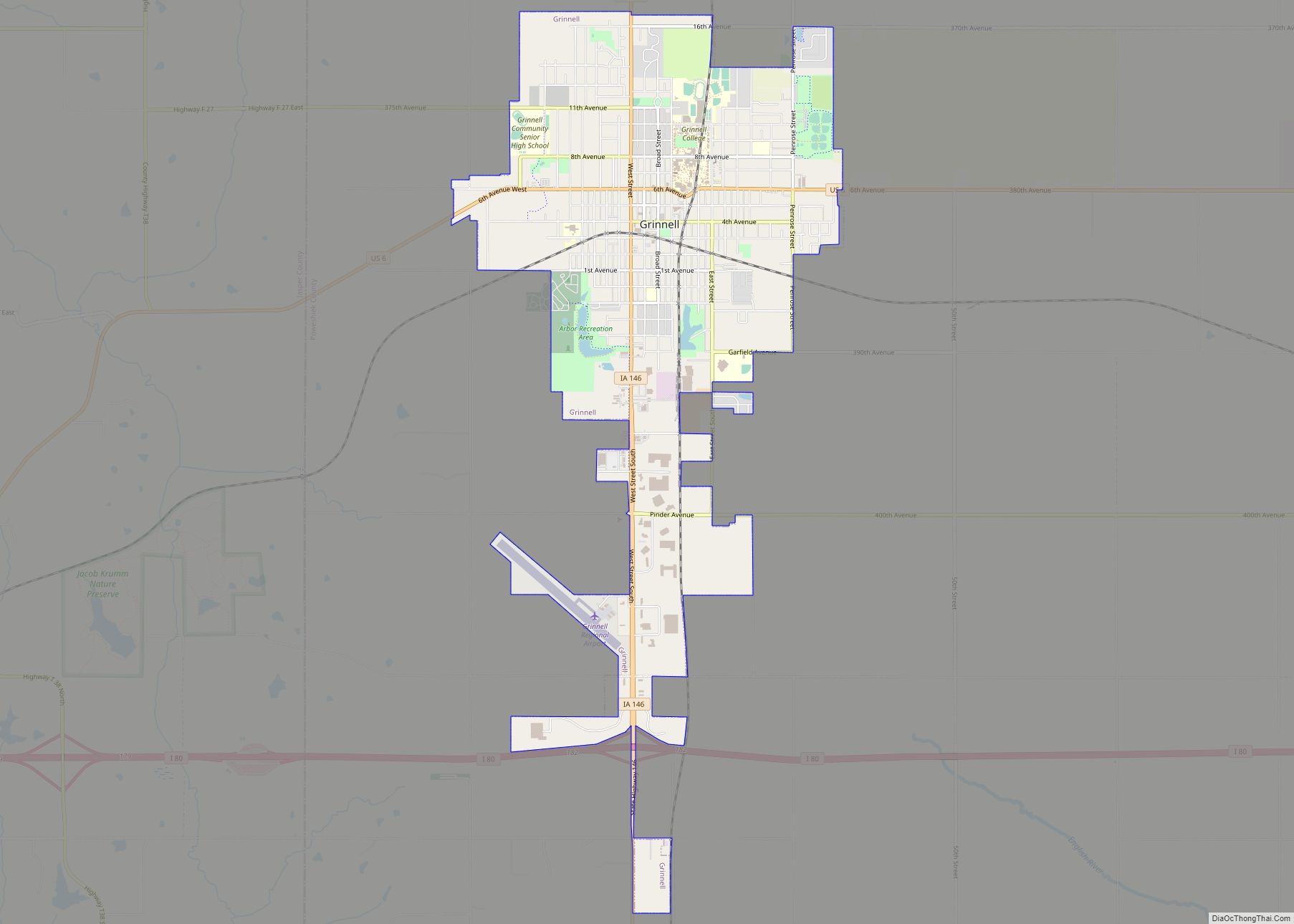
Grinnell (/ɡrɪˈnɛl/ GRIN-el) is a city in Poweshiek County, Iowa, United States. The population was 9,564 at the time of the 2020 census. It is best known for being the home of Grinnell College.
| Name: | Grinnell city |
|---|---|
| LSAD Code: | 25 |
| LSAD Description: | city (suffix) |
| State: | Iowa |
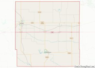
| County: | Poweshiek County |
| Elevation: | 1,014 ft (309 m) |
| Total Area: | 5.73 sq mi (14.84 km²) |
| Land Area: | 5.69 sq mi (14.74 km²) |
| Water Area: | 0.04 sq mi (0.11 km²) |
| Total Population: | 9,564 |
| Population Density: | 1,681.14/sq mi (649.06/km²) |
| Area code: | 641 |
| FIPS code: | 1933105 |
| GNISfeature ID: | 0457150 |
| Website: | grinnelliowa.gov |
Online Interactive Map
Click on ![]() to view map in "full screen" mode.
to view map in "full screen" mode.
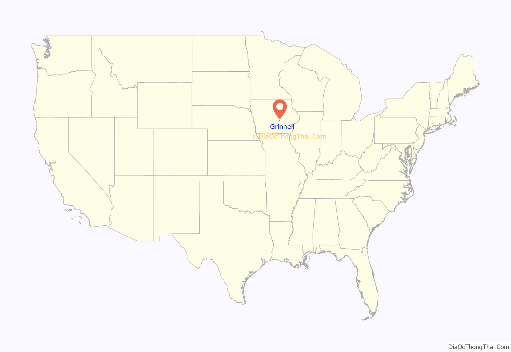
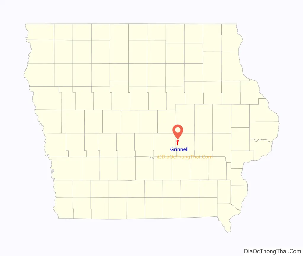
Grinnell location map. Where is Grinnell city?
History
Grinnell was founded by settlers from New England who were descended from English Puritans of the 1600s. Grinnell was founded in 1854 by four men: Josiah B. Grinnell, a Congregationalist from Vermont; Homer Hamlin, a minister; Henry Hamilton, a surveyor; and Dr. Thomas Holyoke. The city was to be named “Stella,” but J. B. Grinnell convinced the others to adopt his name, describing it as rare and concise. Grinnell was incorporated on April 28, 1865, and by 1880 Grinnell had a population of around 2000. Located at the junction of two railway lines (east–west line of the Rock Island Railroad and the north–south Minneapolis and St. Louis Railway), it is the largest community in Poweshiek County.
Grinnell was a stop on the Underground Railroad from its founding. One of the most famous events occurred in February 1859, when abolitionist John Brown, and 12 slaves he was helping escape to freedom, were hosted by J. B. Grinnell and several other community residents. Because of J. B. Grinnell’s efforts to help slaves and end slavery, in 2013 the National Park Service included his gravesite at Hazelwood Cemetery on the National Underground Railroad Network to Freedom listings.
The Mormon Trail ran along the southern edge of Grinnell. The trail was traveled by an estimated 100,000 plus travelers from 1846 to 1869, including some 70,000 Mormons escaping religious persecution. The Pioneer Company of 1846–1847 established the first route; from Nauvoo, Illinois, to Salt Lake City. A stone marker memorializes the Mormon Handcart Trail and the grave of a child who died along the trail near Grinnell.
Grinnell is home to Grinnell College, a highly rated private liberal arts college established in 1846. Grinnell College is now nationally recognized as a leading undergraduate institution. In July 2006, The New York Times included Grinnell in its profile of the 20 colleges and universities of “established or rising scholarship” which are fast becoming viable alternatives to Ivy League institutions, and is considered one of the 30 Hidden Ivies. While Grinnell athletics has had success in different sports over the years, one early victory is especially notable. On November 19, 1889, Grinnell College and the University of Iowa played each other at Grinnell in the first football game played west of the Mississippi River. Grinnell was victorious with a score of 24–0.
Two major events marked the early years of the community. On June 17, 1882, a violent, estimated, F5 tornado destroyed most of the college campus and much of the community with a death toll of 68, causing up to $1.3 million in total damages (in 1882 USD). In June, 1889, fire destroyed most of the downtown area.
Grinnell was home to the Spaulding Manufacturing Company. H. W. Spaulding began making carriages and spring wagons in Grinnell in 1876. In 1909, Spaulding Manufacturing added automobiles to its production line. At one time, the factory was the largest employer in the county. Automobile production ceased at the Spaulding factory in 1916 when it could no longer compete with the cheaper Ford automobile. The Spaulding factory site became home to the Spaulding Center for Transportation/Iowa Transportation Museum, as well as a 77 unit loft apartment complex which opened in 2017.
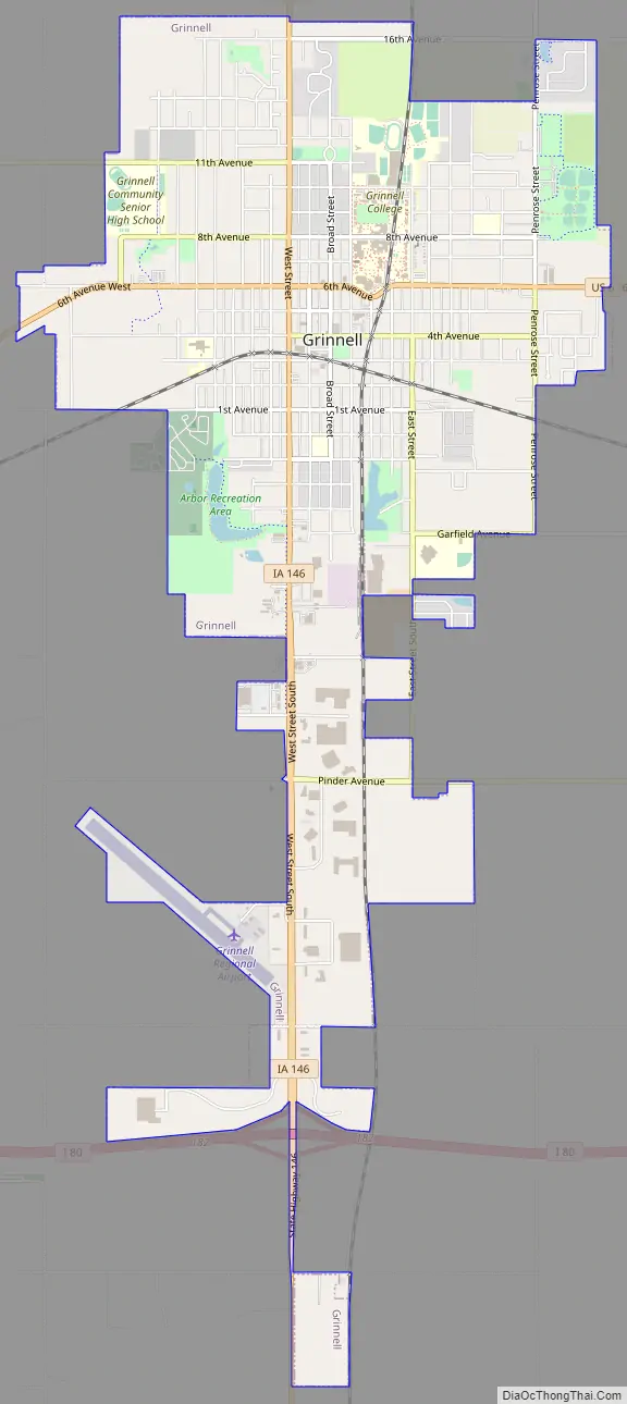
Grinnell Road Map
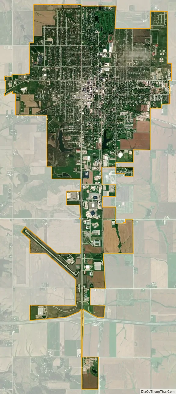
Grinnell city Satellite Map
Geography
According to the United States Census Bureau, the city has a total area of 5.64 square miles (14.61 km), of which 5.60 square miles (14.50 km) is land and 0.04 square miles (0.10 km) is water.
Climate
Grinnell has a humid continental climate with hot humid summers, and cold snowy winters. The precipitation averages 38.19 in (970 mm) yearly. Summers are the rainiest times of year, with over two thirds of the precipitation falling between April and September in an average year.
See also
Map of Iowa State and its subdivision:- Adair
- Adams
- Allamakee
- Appanoose
- Audubon
- Benton
- Black Hawk
- Boone
- Bremer
- Buchanan
- Buena Vista
- Butler
- Calhoun
- Carroll
- Cass
- Cedar
- Cerro Gordo
- Cherokee
- Chickasaw
- Clarke
- Clay
- Clayton
- Clinton
- Crawford
- Dallas
- Davis
- Decatur
- Delaware
- Des Moines
- Dickinson
- Dubuque
- Emmet
- Fayette
- Floyd
- Franklin
- Fremont
- Greene
- Grundy
- Guthrie
- Hamilton
- Hancock
- Hardin
- Harrison
- Henry
- Howard
- Humboldt
- Ida
- Iowa
- Jackson
- Jasper
- Jefferson
- Johnson
- Jones
- Keokuk
- Kossuth
- Lee
- Linn
- Louisa
- Lucas
- Lyon
- Madison
- Mahaska
- Marion
- Marshall
- Mills
- Mitchell
- Monona
- Monroe
- Montgomery
- Muscatine
- O'Brien
- Osceola
- Page
- Palo Alto
- Plymouth
- Pocahontas
- Polk
- Pottawattamie
- Poweshiek
- Ringgold
- Sac
- Scott
- Shelby
- Sioux
- Story
- Tama
- Taylor
- Union
- Van Buren
- Wapello
- Warren
- Washington
- Wayne
- Webster
- Winnebago
- Winneshiek
- Woodbury
- Worth
- Wright
- Alabama
- Alaska
- Arizona
- Arkansas
- California
- Colorado
- Connecticut
- Delaware
- District of Columbia
- Florida
- Georgia
- Hawaii
- Idaho
- Illinois
- Indiana
- Iowa
- Kansas
- Kentucky
- Louisiana
- Maine
- Maryland
- Massachusetts
- Michigan
- Minnesota
- Mississippi
- Missouri
- Montana
- Nebraska
- Nevada
- New Hampshire
- New Jersey
- New Mexico
- New York
- North Carolina
- North Dakota
- Ohio
- Oklahoma
- Oregon
- Pennsylvania
- Rhode Island
- South Carolina
- South Dakota
- Tennessee
- Texas
- Utah
- Vermont
- Virginia
- Washington
- West Virginia
- Wisconsin
- Wyoming