Hamburg is a city in Fremont County, Iowa, United States, that is the most southwestern city in Iowa, hugging the borders of Missouri to the south and Nebraska to the west. It is situated between the Nishnabotna and Missouri rivers. The population was 890 at the time of the 2020 census. It derives its name from the German city of Hamburg.
| Name: | Hamburg city |
|---|---|
| LSAD Code: | 25 |
| LSAD Description: | city (suffix) |
| State: | Iowa |
| County: | Fremont County |
| Elevation: | 919 ft (280 m) |
| Total Area: | 1.12 sq mi (2.91 km²) |
| Land Area: | 1.12 sq mi (2.91 km²) |
| Water Area: | 0.00 sq mi (0.00 km²) |
| Total Population: | 890 |
| Population Density: | 793.23/sq mi (306.19/km²) |
| ZIP code: | 51640 |
| Area code: | 712 |
| FIPS code: | 1933780 |
| GNISfeature ID: | 0457215 |
| Website: | hamburgiowa.org |
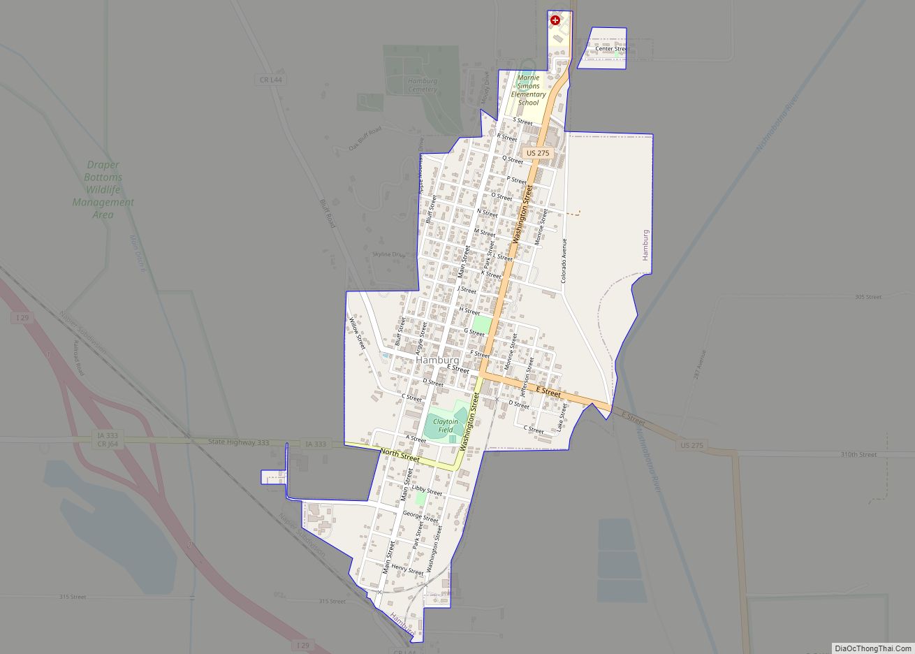
Online Interactive Map
Click on ![]() to view map in "full screen" mode.
to view map in "full screen" mode.
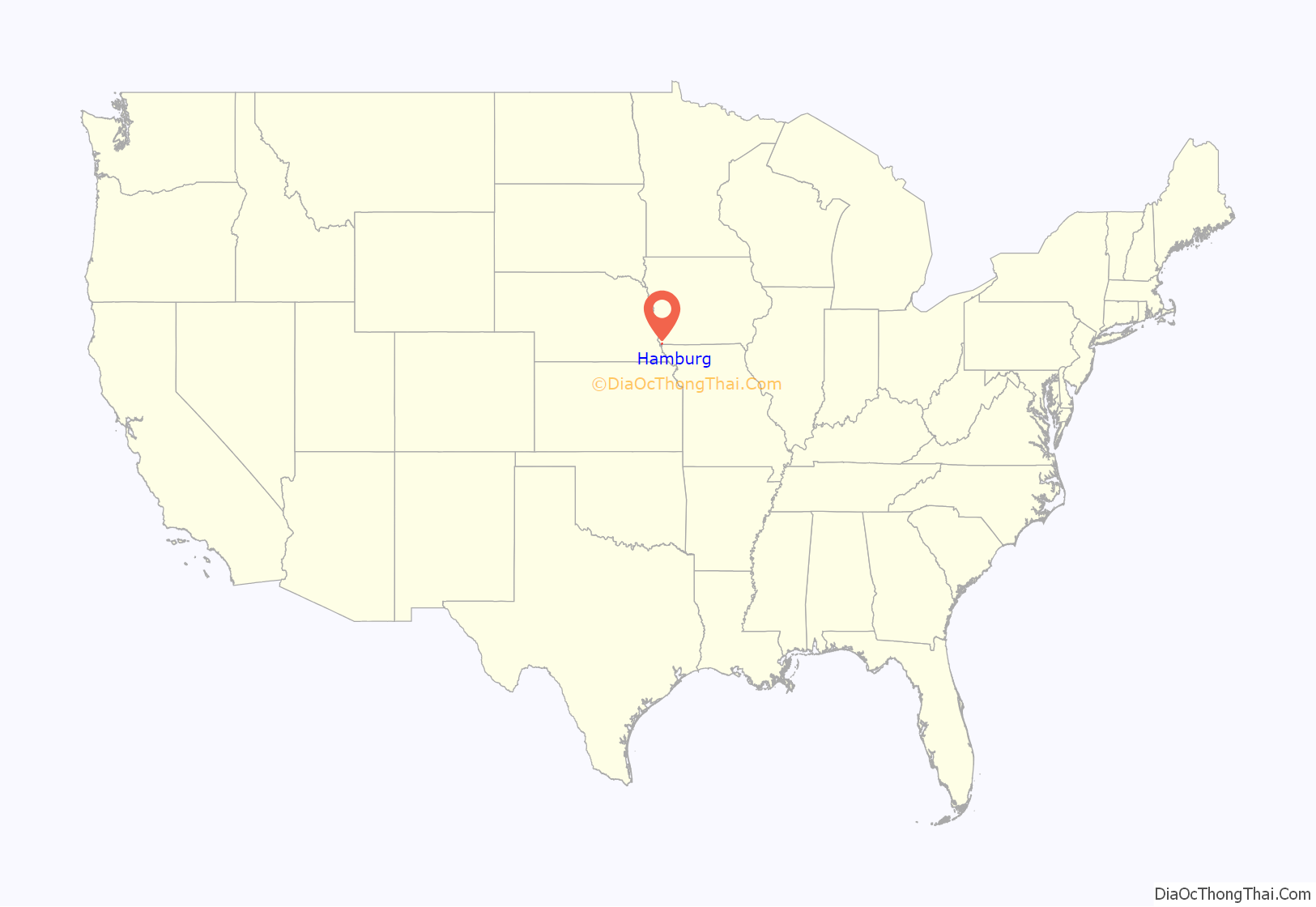
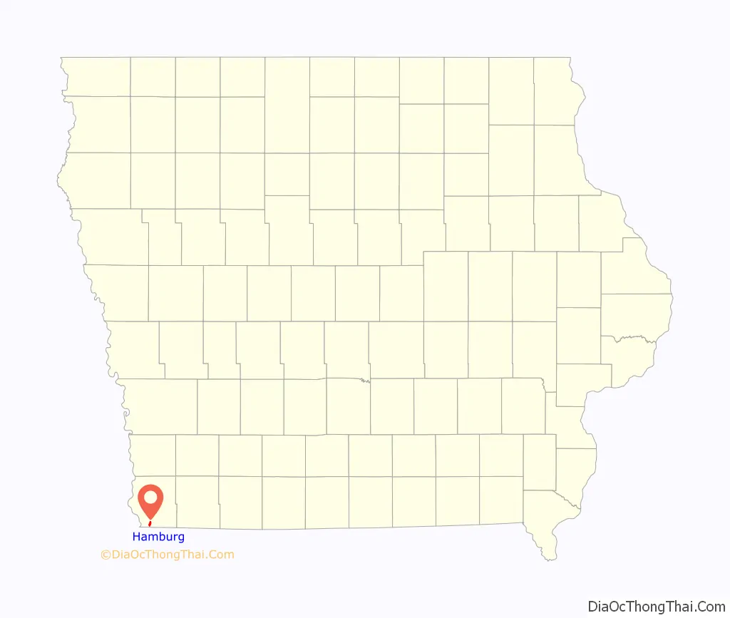
Hamburg location map. Where is Hamburg city?
History
The city is less than a quarter mile from the Missouri state line. The first settlers in the community were people who actually thought they were settling in Missouri following the Platte Purchase of former Indian territory there across the state line opened up settlement. The first formal settlement in the Hamburg vicinity were by the brothers James McKissick, Cornelius McKissick, Daniel McKissick who established McKissick’s Grove. A survey was made when Iowa entered the union in 1846, and only then did the settlers discover that they were in Iowa and not Missouri.
The brothers were also involved in another border irregularity when they bought McKissick Island a mile south of Hamburg. They thought at the time the island in the Missouri River was attached to Nebraska territory. The river changed course in 1867 resulting in the island becoming physically attached by dry land to Missouri and cut off from Nebraska by the main channel. Missouri and Nebraska both claimed the island and it was decided in 1904 by the U.S. Supreme Court that it belonged to Nebraska, although the states did not formally agree to the arrangement until 1999. In the meantime students from the Nebraska island passed through Missouri en route to being educated in Hamburg in Iowa.
Hamburg was formally laid out in 1857 at the behest of Augustus Borchers (August Heinrich B., August 26, 1817, Harburg near Hamburg, Germany – November 23, 1885, Hamburg (Ia.)) who named for the German city and was formally incorporated on April 1, 1867 at about the same time as it was reached by the Council Bluffs and St. Joseph Railroad. A second railroad Nebraska City Branch of the Burlington and Missouri River Railroad (which came from Red Oak, Iowa) came through in 1870.
Alex and Arthur Vogel started Vogel and Son Popcorn Company in 1948. The company grew to the point where he bought the city’s old water tower and train station to store his popcorn – the two structures hold a million pounds of popcorn. In 1960 the city started its Popcorn Days festival (replacing an earlier named peony festival). Vogel Popcorn is now owned by ConAgra Foods but remains headquartered in the city. Its popcorn is used in Act II and Orville Redenbacher’s.
The city gets considerable publicity during periods of Missouri River flooding, including most recently the 2019 Midwestern U.S. floods, which left the city without sewage, water or gas. In 2012, residents sought to raise funds for repairs to the city’s flood control levee with a flash mob dance video of “Proud Mary,” but did not receive the $5 million needed.
An aerial view of the breach at levee L-575 near Hamburg, which occurred June 13, 2011 and increased to nearly 300 feet in size.
Natural-colour satellite image of muddy flood water near Hamburg after the levee breach.
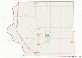
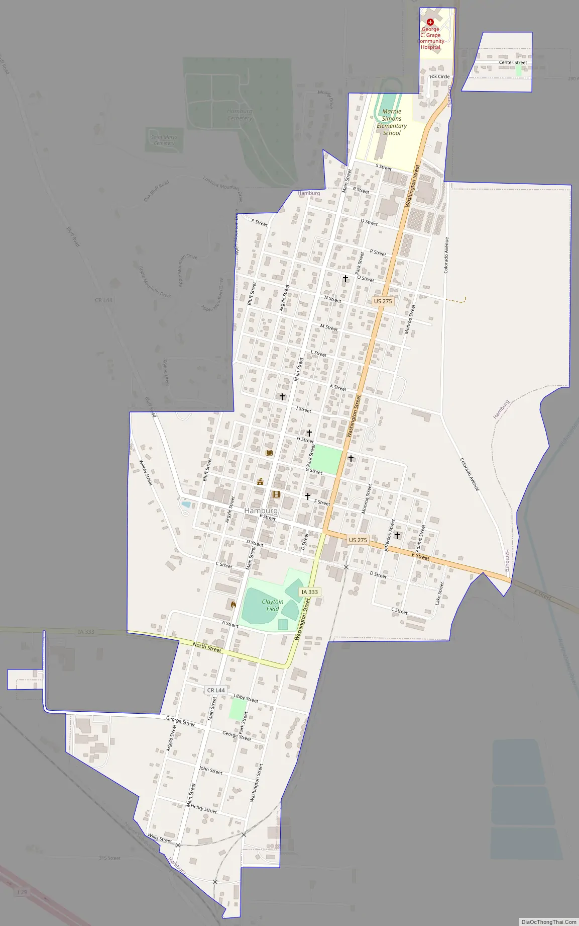
Hamburg Road Map
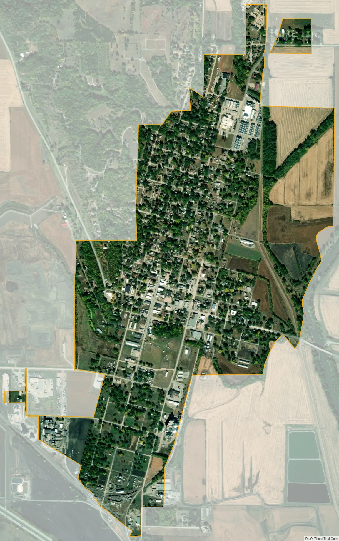
Hamburg city Satellite Map
Geography
According to the United States Census Bureau, the city has a total area of 1.10 square miles (2.85 km), all land.
Climate
The hottest temperature ever recorded in Hamburg was 109 °F on July 21, 1974, and the lowest temperature was −25 °F on December 23, 1989. On average, the hottest month is July, and the coldest is January.
See also
Map of Iowa State and its subdivision:- Adair
- Adams
- Allamakee
- Appanoose
- Audubon
- Benton
- Black Hawk
- Boone
- Bremer
- Buchanan
- Buena Vista
- Butler
- Calhoun
- Carroll
- Cass
- Cedar
- Cerro Gordo
- Cherokee
- Chickasaw
- Clarke
- Clay
- Clayton
- Clinton
- Crawford
- Dallas
- Davis
- Decatur
- Delaware
- Des Moines
- Dickinson
- Dubuque
- Emmet
- Fayette
- Floyd
- Franklin
- Fremont
- Greene
- Grundy
- Guthrie
- Hamilton
- Hancock
- Hardin
- Harrison
- Henry
- Howard
- Humboldt
- Ida
- Iowa
- Jackson
- Jasper
- Jefferson
- Johnson
- Jones
- Keokuk
- Kossuth
- Lee
- Linn
- Louisa
- Lucas
- Lyon
- Madison
- Mahaska
- Marion
- Marshall
- Mills
- Mitchell
- Monona
- Monroe
- Montgomery
- Muscatine
- O'Brien
- Osceola
- Page
- Palo Alto
- Plymouth
- Pocahontas
- Polk
- Pottawattamie
- Poweshiek
- Ringgold
- Sac
- Scott
- Shelby
- Sioux
- Story
- Tama
- Taylor
- Union
- Van Buren
- Wapello
- Warren
- Washington
- Wayne
- Webster
- Winnebago
- Winneshiek
- Woodbury
- Worth
- Wright
- Alabama
- Alaska
- Arizona
- Arkansas
- California
- Colorado
- Connecticut
- Delaware
- District of Columbia
- Florida
- Georgia
- Hawaii
- Idaho
- Illinois
- Indiana
- Iowa
- Kansas
- Kentucky
- Louisiana
- Maine
- Maryland
- Massachusetts
- Michigan
- Minnesota
- Mississippi
- Missouri
- Montana
- Nebraska
- Nevada
- New Hampshire
- New Jersey
- New Mexico
- New York
- North Carolina
- North Dakota
- Ohio
- Oklahoma
- Oregon
- Pennsylvania
- Rhode Island
- South Carolina
- South Dakota
- Tennessee
- Texas
- Utah
- Vermont
- Virginia
- Washington
- West Virginia
- Wisconsin
- Wyoming