Red Oak is a city in, and the county seat of, Montgomery County, Iowa, United States, located along the East Nishnabotna River. The population was 5,362 in the 2020 census, a decline from the 6,197 population in 2000.
| Name: | Red Oak city |
|---|---|
| LSAD Code: | 25 |
| LSAD Description: | city (suffix) |
| State: | Iowa |
| County: | Montgomery County |
| Elevation: | 1,050 ft (320 m) |
| Total Area: | 3.98 sq mi (10.31 km²) |
| Land Area: | 3.93 sq mi (10.17 km²) |
| Water Area: | 0.06 sq mi (0.15 km²) |
| Total Population: | 5,596 |
| Population Density: | 1,425.37/sq mi (550.37/km²) |
| ZIP code: | 51566, 51591 |
| Area code: | 712 |
| FIPS code: | 1966135 |
| GNISfeature ID: | 0460554 |
| Website: | city.redoakiowa.com |
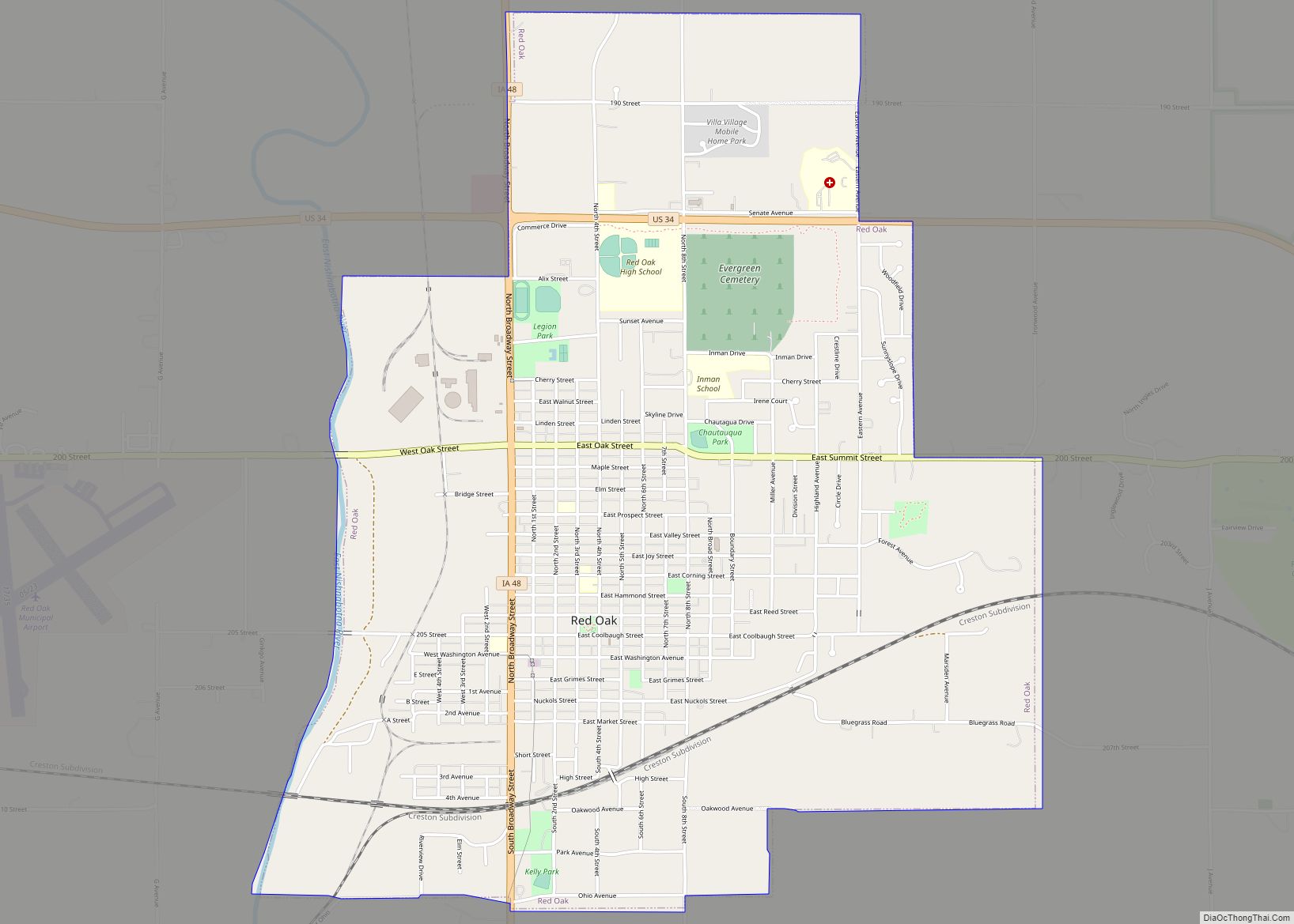
Online Interactive Map
Click on ![]() to view map in "full screen" mode.
to view map in "full screen" mode.
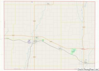
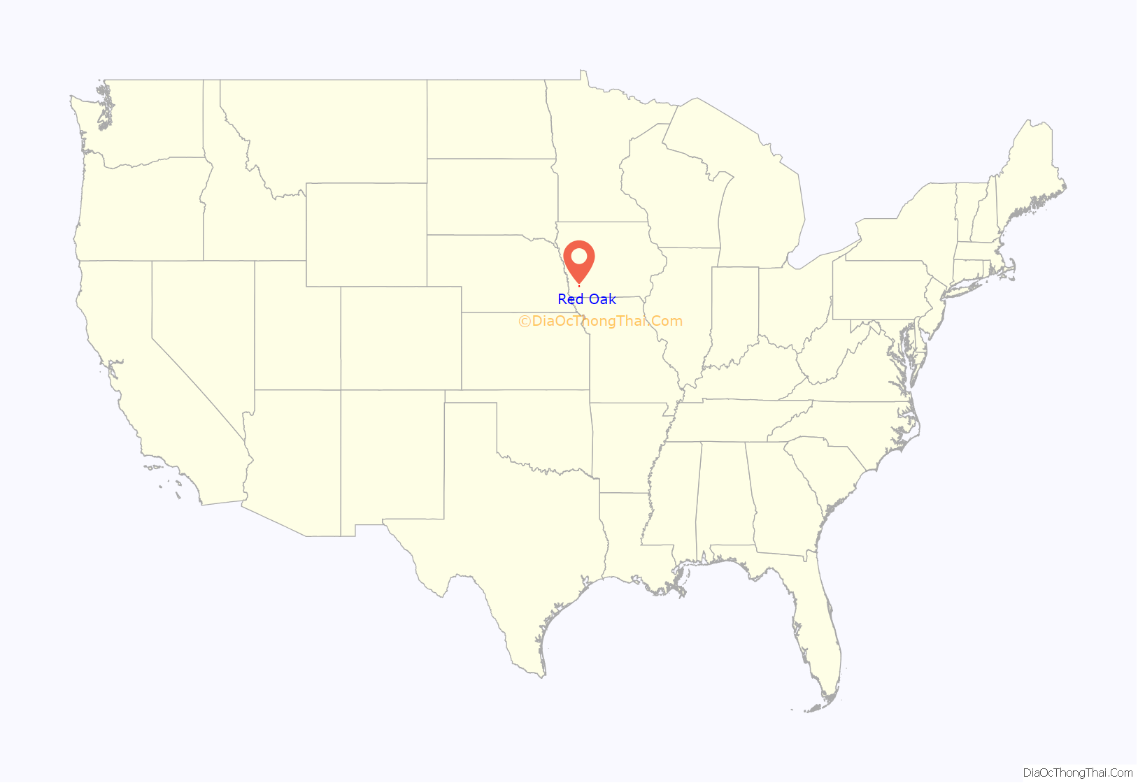
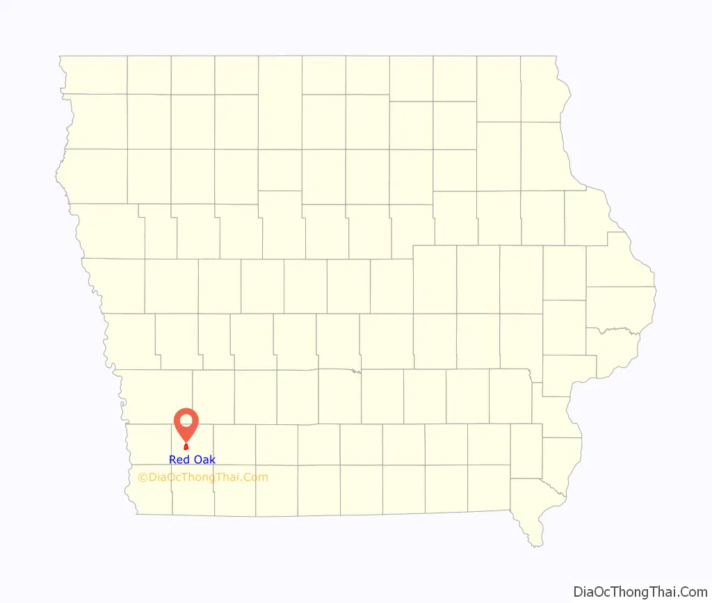
Red Oak location map. Where is Red Oak city?
History
Red Oak derives its name from Red Oak Creek which flows through the community and was noted for the red oaks on its banks. The first settlers arrived there in the 1850s. In 1865 it became the official county seat of Montgomery County and the courthouse which had been in the middle of the county seven miles northeast in Frankfort, Iowa was towed to the community during a snow storm. That courthouse remained in place until the current Montgomery County Courthouse was built in 1891. It is on the National Register of Historic Places.
In 1869 the community was officially founded when the Chicago, Burlington and Quincy Railroad (called the Burlington and Missouri River Railroad at the time) arrived. The community was named Red Oak Junction by the railroad on March 20, 1876. The junction was a line off the main Chicago to Council Bluffs, Iowa line that went to Nebraska City, Nebraska and on to Lincoln, Nebraska. The Junction name was dropped in 1901 although the community continues to celebrate its history each summer in Junction Days. In 1903 a depot was opened by the railroad. Preservation efforts for the depot have been enacted since 1993. Today it is the Restored BN and World War II Museum celebrating the community’s disproportionate casualties during World War II and other wars, significant military heritage and community pride in service to country. The depot is one of nine places in Montgomery County on the National Register of Historic Places listings in Montgomery County, Iowa.
Darwin R. Merritt, born in Red Oak on April 12, 1872, graduated third in his class from the United States Naval Academy in Annapolis, Maryland on July 1, 1897. On February 15, 1898, he perished in the explosion that sank the USS Maine (ACR-1) in the harbor of Havana, Cuba. His body was later recovered and interred in Evergreen Cemetery in Red Oak.
The community suffered, in a national per capita comparison, a disproportionate number of casualties in the Civil War and World War II.
In the American Civil War, the area provided more Union troops per capita than any other in the state. Company M (which also included residents from Montgomery County) had 160 casualties among its 250 members; 52 men were killed in action.
Early World War II battles claimed a disproportionate number of soldiers from Red Oak, although the final casualty statistics tend to disprove the oft-repeated statement that Red Oak suffered more losses per capita than any other American community. In the Battle of Kasserine Pass in February 1943, forty-five soldiers from Red Oak alone were captured or killed; more than 100 telegrams arrived in Red Oak saying that its soldiers were missing in action. In recognition of Red Oak’s casualties, the city’s name was given to a “victory ship”. The SS Red Oak Victory has become a floating museum in the shipyard where it was built, in Richmond, California.
The old Burlington Northern depot has been transformed into the Restored BN Depot and World War II Museum telling this history.
The Red Oak School District was established in 1870, while Webster Eaton first published the Red Oak Express newspaper in 1868.
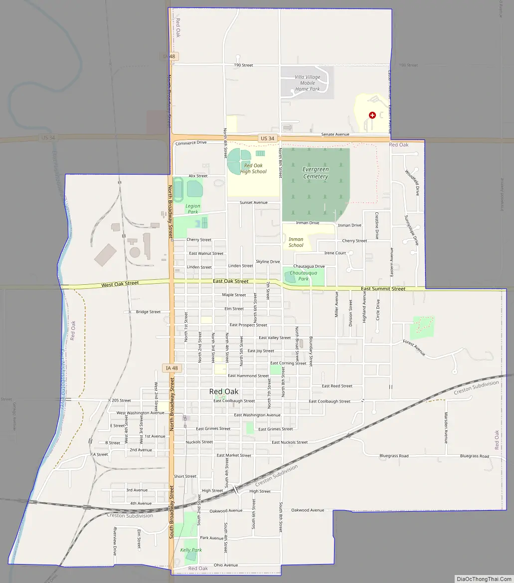
Red Oak Road Map
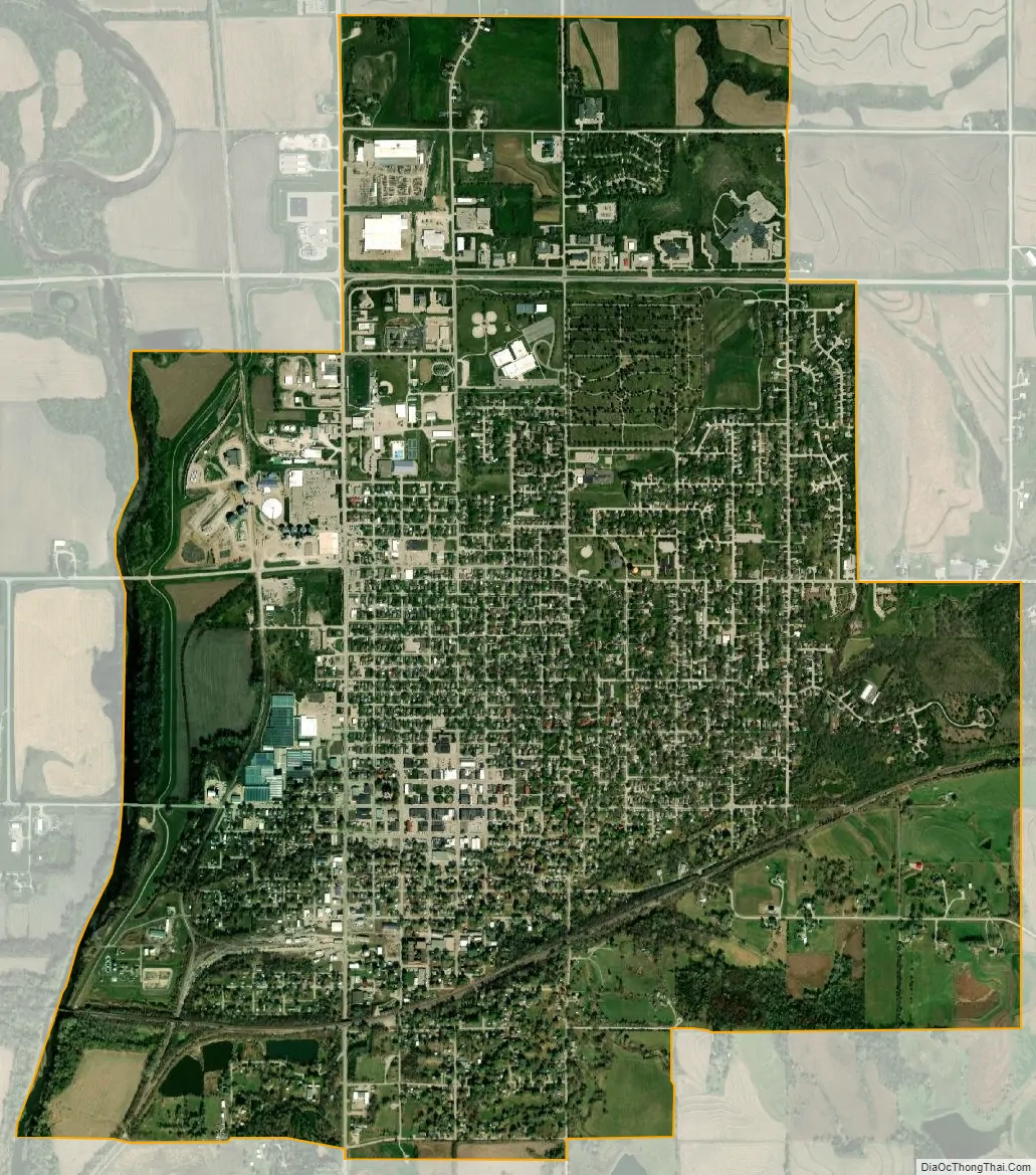
Red Oak city Satellite Map
Geography
Red Oak is located at 41°0′42″N 95°13′38″W / 41.01167°N 95.22722°W / 41.01167; -95.22722 (41.011681, -95.227227).
According to the United States Census Bureau, the city has a total area of 4.01 square miles (10.39 km), of which 3.95 square miles (10.23 km) is land and 0.06 square miles (0.16 km) is water.
Climate
See also
Map of Iowa State and its subdivision:- Adair
- Adams
- Allamakee
- Appanoose
- Audubon
- Benton
- Black Hawk
- Boone
- Bremer
- Buchanan
- Buena Vista
- Butler
- Calhoun
- Carroll
- Cass
- Cedar
- Cerro Gordo
- Cherokee
- Chickasaw
- Clarke
- Clay
- Clayton
- Clinton
- Crawford
- Dallas
- Davis
- Decatur
- Delaware
- Des Moines
- Dickinson
- Dubuque
- Emmet
- Fayette
- Floyd
- Franklin
- Fremont
- Greene
- Grundy
- Guthrie
- Hamilton
- Hancock
- Hardin
- Harrison
- Henry
- Howard
- Humboldt
- Ida
- Iowa
- Jackson
- Jasper
- Jefferson
- Johnson
- Jones
- Keokuk
- Kossuth
- Lee
- Linn
- Louisa
- Lucas
- Lyon
- Madison
- Mahaska
- Marion
- Marshall
- Mills
- Mitchell
- Monona
- Monroe
- Montgomery
- Muscatine
- O'Brien
- Osceola
- Page
- Palo Alto
- Plymouth
- Pocahontas
- Polk
- Pottawattamie
- Poweshiek
- Ringgold
- Sac
- Scott
- Shelby
- Sioux
- Story
- Tama
- Taylor
- Union
- Van Buren
- Wapello
- Warren
- Washington
- Wayne
- Webster
- Winnebago
- Winneshiek
- Woodbury
- Worth
- Wright
- Alabama
- Alaska
- Arizona
- Arkansas
- California
- Colorado
- Connecticut
- Delaware
- District of Columbia
- Florida
- Georgia
- Hawaii
- Idaho
- Illinois
- Indiana
- Iowa
- Kansas
- Kentucky
- Louisiana
- Maine
- Maryland
- Massachusetts
- Michigan
- Minnesota
- Mississippi
- Missouri
- Montana
- Nebraska
- Nevada
- New Hampshire
- New Jersey
- New Mexico
- New York
- North Carolina
- North Dakota
- Ohio
- Oklahoma
- Oregon
- Pennsylvania
- Rhode Island
- South Carolina
- South Dakota
- Tennessee
- Texas
- Utah
- Vermont
- Virginia
- Washington
- West Virginia
- Wisconsin
- Wyoming