Hiawatha is a city in Linn County, Iowa, United States. It is a suburb located in the northwestern side of Cedar Rapids and is part of the Cedar Rapids Metropolitan Statistical Area. The population was 7,183 at the time of the 2020 census, an increase from 6,480 in 2000.
| Name: | Hiawatha city |
|---|---|
| LSAD Code: | 25 |
| LSAD Description: | city (suffix) |
| State: | Iowa |
| County: | Linn County |
| Incorporated: | June 12, 1950 |
| Elevation: | 850 ft (260 m) |
| Total Area: | 4.77 sq mi (12.36 km²) |
| Land Area: | 4.76 sq mi (12.34 km²) |
| Water Area: | 0.01 sq mi (0.01 km²) |
| Total Population: | 7,183 |
| Population Density: | 1,507.45/sq mi (582.01/km²) |
| ZIP code: | 52233 |
| Area code: | 319 |
| FIPS code: | 1935940 |
| GNISfeature ID: | 0457418 |
| Website: | www.hiawatha-iowa.com |
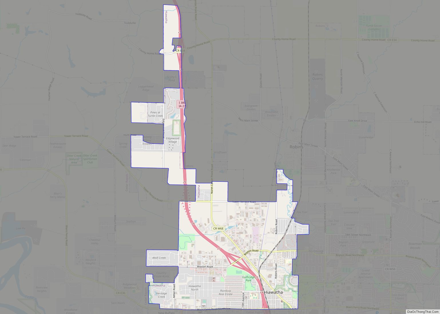
Online Interactive Map
Click on ![]() to view map in "full screen" mode.
to view map in "full screen" mode.
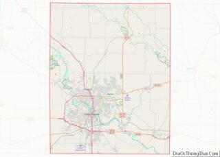
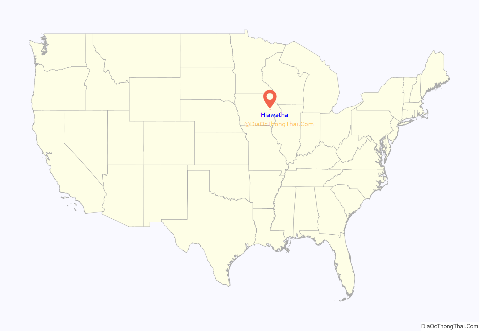
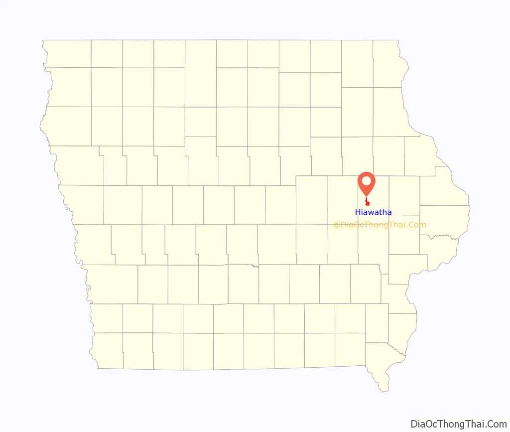
Hiawatha location map. Where is Hiawatha city?
History
In 1946, Fay Clark, an entrepreneur of several ventures located in Linn County north of Cedar Rapids, Iowa, had a vision of houses and a highway running through a new city. In 1950 Clark and another 45 residents signed a petition seeking to become the 17th incorporated town in Linn County. The town would be named after Clark’s trailer company. That same year he and Henry Katz of Marion established the Linn County Fire Association to help provide fire protection to rural communities. Clark served as mayor of Hiawatha from 1950 to 1958, and again from 1961 to 1963. Clark died in 1991 at the age of 84.
Hiawatha residents celebrated the dedication of their new City Hall on May 17, 2008.
Hiawatha celebrated its 60th anniversary in May 2010.
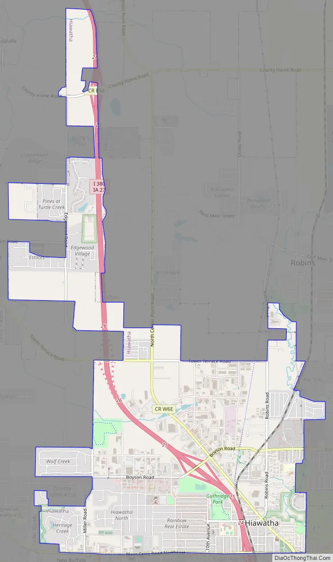
Hiawatha Road Map
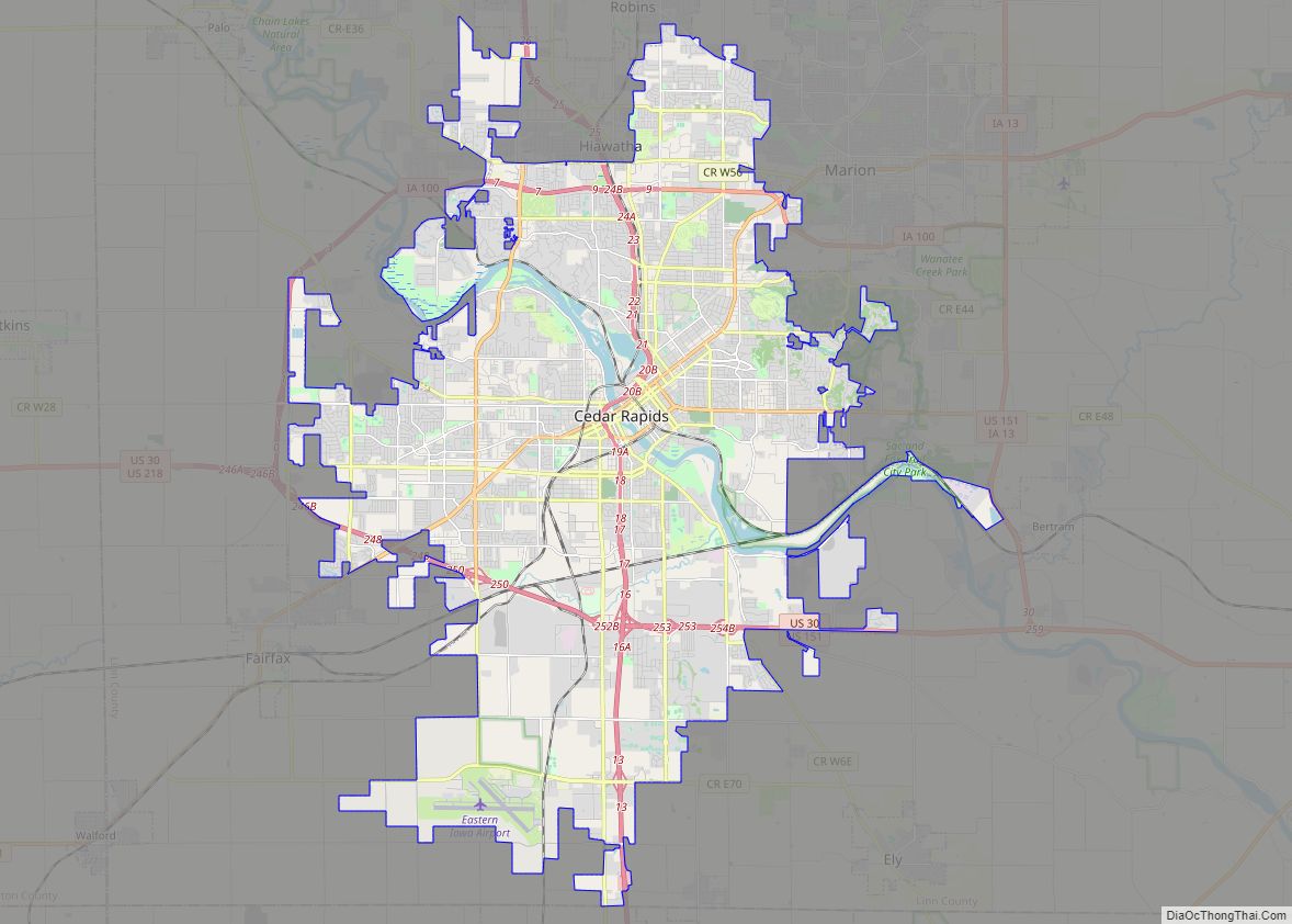
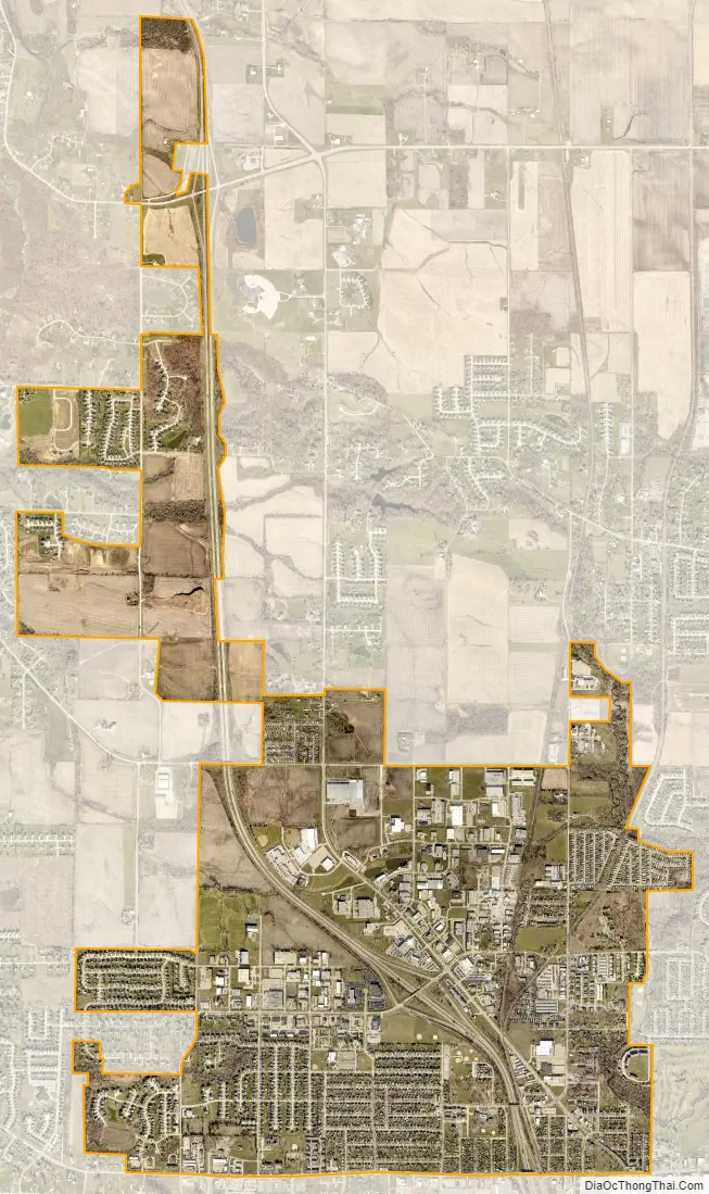
Hiawatha city Satellite Map
Geography
Hiawatha’s longitude and latitude coordinates in decimal form are 42.044409, -91.681025.
According to the United States Census Bureau, the city has a total area of 4.23 square miles (10.96 km), all land.
The elevation of Hiawatha is 850 feet (260 m) above sea level.
Hiawatha’s population density is estimated at 1884 people per square mile which is considered low for urban areas.
Climate
See also
Map of Iowa State and its subdivision:- Adair
- Adams
- Allamakee
- Appanoose
- Audubon
- Benton
- Black Hawk
- Boone
- Bremer
- Buchanan
- Buena Vista
- Butler
- Calhoun
- Carroll
- Cass
- Cedar
- Cerro Gordo
- Cherokee
- Chickasaw
- Clarke
- Clay
- Clayton
- Clinton
- Crawford
- Dallas
- Davis
- Decatur
- Delaware
- Des Moines
- Dickinson
- Dubuque
- Emmet
- Fayette
- Floyd
- Franklin
- Fremont
- Greene
- Grundy
- Guthrie
- Hamilton
- Hancock
- Hardin
- Harrison
- Henry
- Howard
- Humboldt
- Ida
- Iowa
- Jackson
- Jasper
- Jefferson
- Johnson
- Jones
- Keokuk
- Kossuth
- Lee
- Linn
- Louisa
- Lucas
- Lyon
- Madison
- Mahaska
- Marion
- Marshall
- Mills
- Mitchell
- Monona
- Monroe
- Montgomery
- Muscatine
- O'Brien
- Osceola
- Page
- Palo Alto
- Plymouth
- Pocahontas
- Polk
- Pottawattamie
- Poweshiek
- Ringgold
- Sac
- Scott
- Shelby
- Sioux
- Story
- Tama
- Taylor
- Union
- Van Buren
- Wapello
- Warren
- Washington
- Wayne
- Webster
- Winnebago
- Winneshiek
- Woodbury
- Worth
- Wright
- Alabama
- Alaska
- Arizona
- Arkansas
- California
- Colorado
- Connecticut
- Delaware
- District of Columbia
- Florida
- Georgia
- Hawaii
- Idaho
- Illinois
- Indiana
- Iowa
- Kansas
- Kentucky
- Louisiana
- Maine
- Maryland
- Massachusetts
- Michigan
- Minnesota
- Mississippi
- Missouri
- Montana
- Nebraska
- Nevada
- New Hampshire
- New Jersey
- New Mexico
- New York
- North Carolina
- North Dakota
- Ohio
- Oklahoma
- Oregon
- Pennsylvania
- Rhode Island
- South Carolina
- South Dakota
- Tennessee
- Texas
- Utah
- Vermont
- Virginia
- Washington
- West Virginia
- Wisconsin
- Wyoming